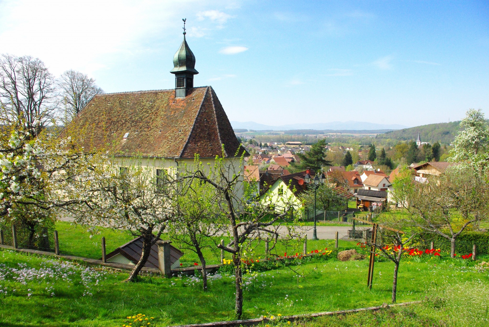
Located between the Plain of Alsace, the Rhine River, the Vosges and the Jura mountains, the Sundgau region has its own distinctive geographic character. The hilly region is covered with pine, beech and oak woods, orchards, pastures, fields and ponds filled with carp, dotted with a multitude of wealthy villages. Like the rest of France, only the spire of the parish church signals the presence of colourful and elegant villages between two hills.
The Sundgau
Most of the Sundgau is within reach of the neighbouring cities of Basel, Mulhouse, Belfort and Montbéliard and is easily accessible by car and bicycle. The little city of Altkirch (also known as the Sundgau’s capital) is the starting point of a variety of drives through the picturesque region in Southern Alsace. We have chosen to take you on a tour that will lead us to Ferrette, the Alsatian Jura and the flower-decked houses of Grentzingen.
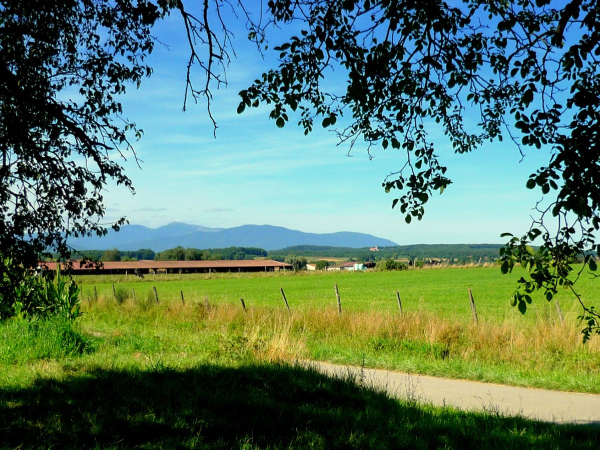
- The landscape of the Sundgau in the vicinity of Dannemarie © French Moments
“The Sundgau is a land apart, a rural but prosperous little distinct area in the South of Alsace. It proves that there is not only one Alsace, as it is commonly thought, but several. The Sundgau has kept hidden an Austrian feel to it, heritage of a long history when the Kingdom of France was perceived as a distant threat. Celebrated as the Land’s End of the Habsburg empire, the Sundgau is a vital and cultural link between northern and southern Europe, between eastern and western Europe by virtue of its position at the Porte de Bourgogne, locally known as Trouée de Belfort.”
Altkirch: Capital of the Sundgau
Halle au Blé and Place Xavier Jourdain
The large square at the top of the town and its corn hall (“Halle au blé”) are the main entrance to the small town centre with its typical narrow streets.
The 19th-century building of the Halle au Blé is also named “Kornhaus” in Alsatian dialect. The Halle au Blé recalls the prosperity of the Sundgau in the trade of cereals, particularly red wheat. It is used today as one of the town’s largest function venues and houses a village hall on the first floor (salle des fêtes). On its façade, the coats of arms of Altkirch and the Sundgau can be seen.
On the opposite side of the square, located out of the square to the right, stands the Bloch Tower (Tour Bloch). This interesting part of the medieval rampart used to protect the steep side of the town. It has been restored since to integrate apartments.
Place de la République and the Town-Hall
Place de la République is located halfway between the Halle au Blé and the Church, on the main road axis of Altkirch’s centre.
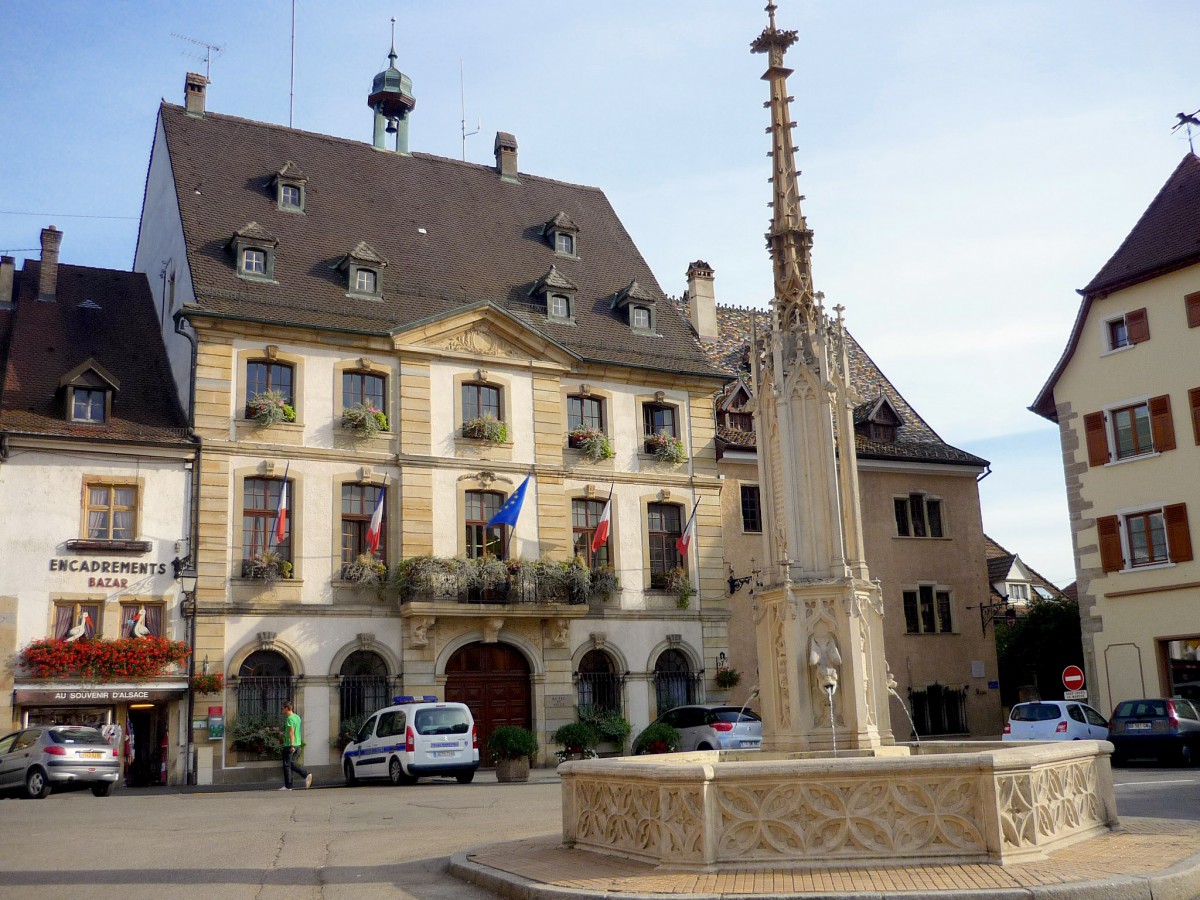
- Place de la République and Altkirch town-hall © French Moments
The Town-Hall
The main building bordering the square is the town hall, called “Mairie”. The actual house was built in 1778 under the supervision of Meinrad Stroltz from Belfort. The building was believed by local historians to be commissioned from French general Jean-Baptiste Kléber until a more recent account brushed this theory aside. Notice the woman’s head with blindfolded eyes sculpted on the pediment: it symbolises justice and evokes the time when the building was used as the local tribunal until 1850. The roof is very steep, with many small “sitting dog” or “training” (“Schleppganten”) windows. It shelters several storeys of attics, which are pierced by small dormer windows, just as in Strasbourg’s old town.
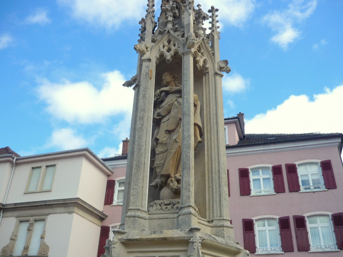
- Altkirch, the fountain of the Virgin © French Moments
The Statue of the Virgin
In the centre of the square lies the fountain of the Virgin. It stands on the site of the former Church Notre-Dame of Altkirch. This Gothic sanctuary was commissioned in 1254 by Berthold de Ferrette, Bishop of Basel, and was the priory church of the town. As the building threatened to fall into ruins, the authorities decided on its dismantlement in 1844. The space left vacant was used to create the actual square.
The statue of the Virgin and a Child placed in the niche of the fountain and the little steeple that surmounts it are the only parts that were saved from the church. They were sculpted in the 14th century by the Laurent brothers, from Nancy, in commemoration of an event locally called the “miracle of Altkirch”.
In 1376, Lord Enguerrand de Coucy besieged the little town with his army of mercenaries called “les Anglais” (the English). While a few men vainly attempted to push back the enemies, the rest of the population took refuge in the church to pray. When Enguerrand de Coucy was nearing victory, a glowing light appeared in the sky, blinding the enemy and reviving the fervour of the people of Altkirch who eventually won the battle. Many attributed this victory to a special act of the Virgin Mary, and the statue that stands today in the fountain on Place de la République became an object of devotion.
The Sundgau museum
The Renaissance mansion adjoining the Town-Hall is home to the Sundgau museum (Musée Sundgauvien). The bailiff of Altkirch used to reside in this building, locally known as “Maison Rothéa”. The bailiff’s function was to deal out justice and to supervise the administration of the town of Altkirch, which was a seigneury belonging to the Habsburgs from 1324 to 1648. The angle turret and the colourful roof give a noble appearance to the building. The museum of the Sundgau displays panels explaining the history of the Sundgau, a collection of old rural items as well as scale models of Altkirch throughout history.
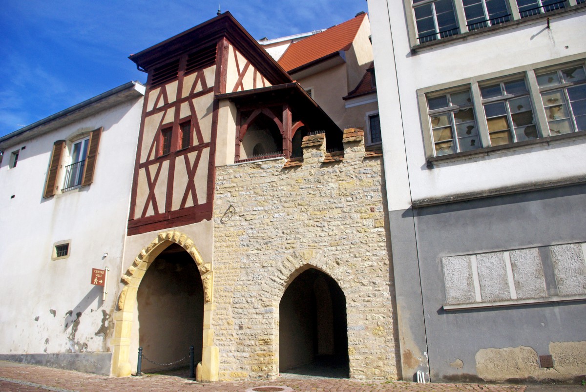
On the West side of the square is the Belfort gate, the last remaining fortified gate of three that were part of the medieval ramparts. Also locally named “Vieille Porte” (old gate), its construction was spread from 1215 to 1339. Between 1730 and 1776, a second opening was made for pedestrians and another floor was added. Notice the pigeon loft set on top of the gate.
The Apple House
Built at a crossroad of several narrow streets in what could be Altkirch’s most picturesque part, the Apple House (“Maison de la Pomme”) stands as one of the town’s most interesting buildings.
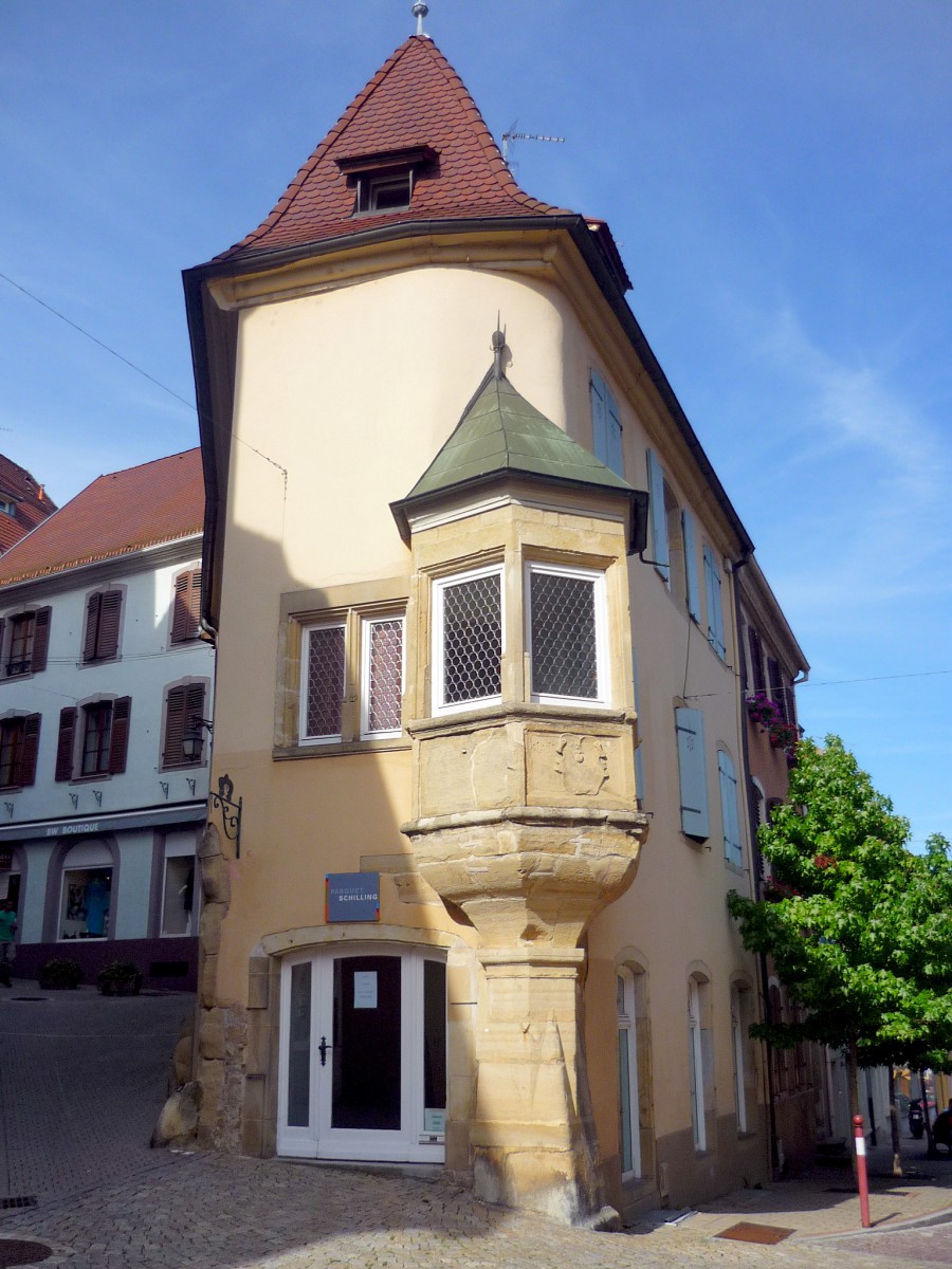
The house was built in 1586 and features several types of Renaissance architecture in Alsace: a beautiful bay window sculpted in stone, dormer windows, and a soaring gable. The Apple House is called as such because of the apple engraved in relief on the side of the bay window. Today, it houses the tourist office of Altkirch.
Altkirch’s Catholic Church
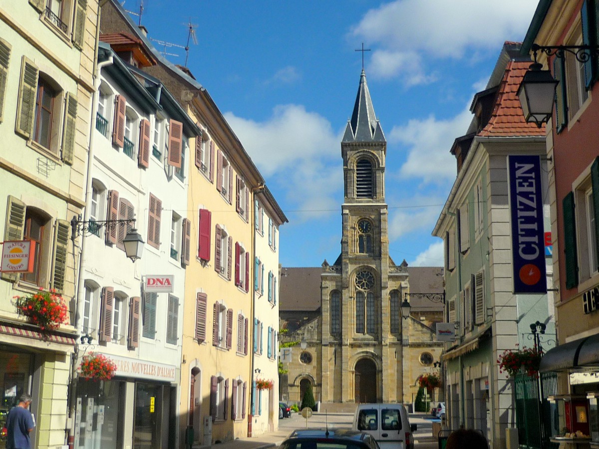
- Altkirch’s church © French Moments
The Church of Notre-Dame de l’Assomption is located at the extremity of the rocky spur of the town. It replaces a former Gothic church that was dismantled in 1844. It was built on the site of the castle of Altkirch, which was locally famous for having the region’s highest keep. Built in Neo-Romanesque style, the church does not seem to compete well with other famous Alsatian sanctuaries such as the Strasbourg Cathedral and Colmar and Thann collegiate churches. Its bell tower is unfortunately disproportioned compared to the rest of the building (two taller spires would have made a better impression!). The inside of the church is rather well decorated with many items saved from the former Gothic church.

- Altkirch from afar © French Moments
The little town of Altkirch, unfortunately, got rid of two buildings (a ruined castle and a Gothic church) which could have granted it a much higher touristic status in Alsace if the town had kept them in the 19th century. For amateurs of medieval ruins, a visit to the Sundgau should include the discovery of the little town of Ferrette with its two ruined castles, which we will describe later.
From Altkirch, take the D462 to the direction of Hirsingue and Ferrette. Turn right at Carspach to enter the centre of the village.
Carspach
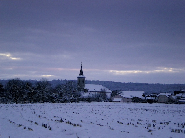
- The village of Carspach, Alsace © French Moments
The charming and typical village of Carspach is home to a handful of dynamic small and medium sized businesses, as well as some locally reputed restaurants which serve Sundgauvian dishes such as fried carp.
With its church, town hall (la mairie), flowered half-timbered houses and little picturesque canals crossing its centre, Carspach is worth passing through by car.
The Saint Georges parish church of Carspach is not particularly interesting as it was rebuilt in 1922 after the original building was destroyed during the First World War. However, as for many sites in the region, it is its history that makes it fascinating. The first mention of the church dates back from 1280. In 1338, Jeanne de Ferrette donated the sanctuary to the Bishop of Basel.
The Sonnenberg Institute
When leaving the village by the D25 in the direction of Hirtzbach, you can catch sight of the Sonnenberg Institute behind the trees. Before the First World War, it was a reputed spa institution (hence the architecture reminiscent of the Deauville mansions in Normandy) that was destroyed during the war. Entirely rebuilt, it was successively affected to a vocational education centre under the management of a Catholic order from Ribeauvillé.
Drive along the D25 road to Hirtzbach.
Hirtzbach
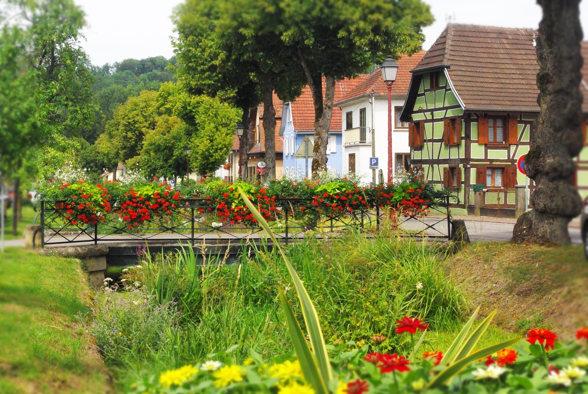
- The village of Hirtzbach in Alsace © French Moments
Some 4km away to the South of Altkirch lies the village of Hirtzbach. A beautiful stream (the Hirtz) crosses the entire village in all its length. The Hirtz stream is crossed by twelve little bridges, adding to the charm of the old village. They link many remarkable half-timbered houses aligned on both sides of the stream. Hirtzbach was first mentioned in 1274 and families of Austrian nobility used to live there until the 17th century (See History of the Sundgau).
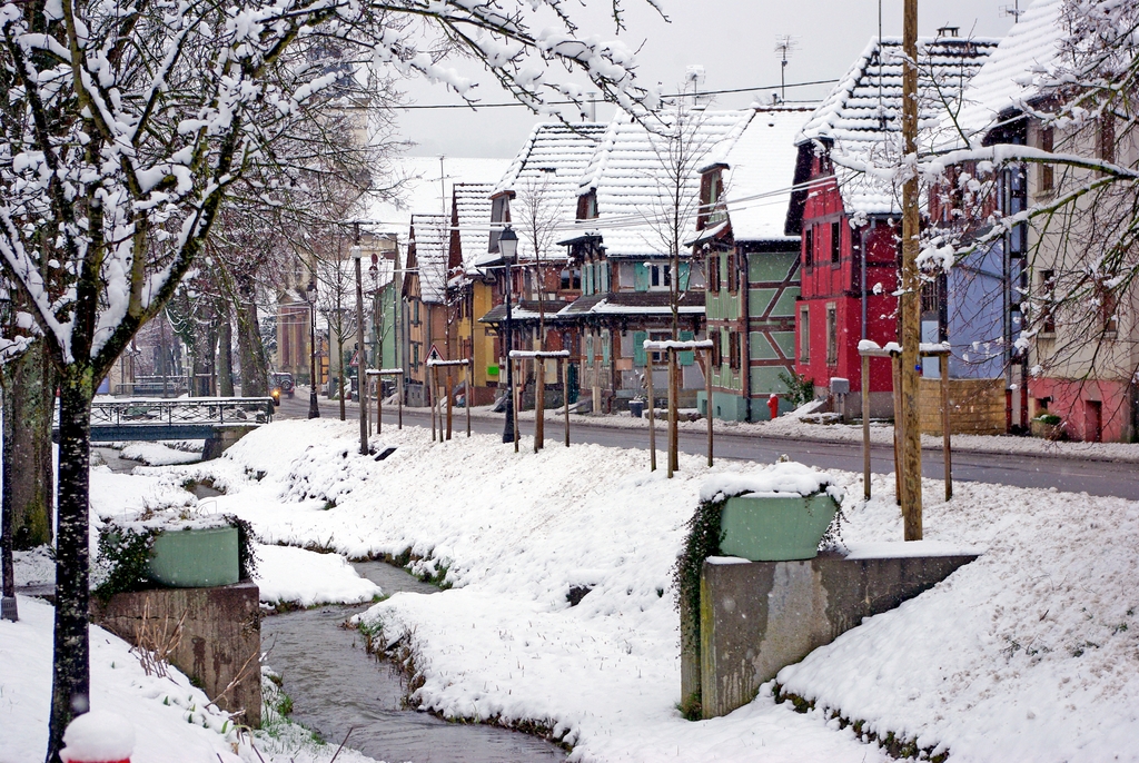
- Half-timbered houses in Hirtzbach © French Moments
No visit to the Sundgau would be complete with a stroll along the Hirtz stream. Indeed, Hirtzbach owes its local and regional fame to an extravagant floral decoration that attracts visitors and curious alike to the Sundgau. Over the last 30 years, Hirtzbach has won several floral prizes.
Awarded the Grand Prix of floral decoration!
In 1981, the Sundgauvian village was awarded the Grand Prix of floral decoration and gained ‘4 flowers’, the maximum level of excellence of floral decoration in France. Both the municipality and the local population participate in making Hirtzbach one of Alsace‘s most beautiful villages. Floral decoration is not considered as a duty: it is more understood there as a shared passion.
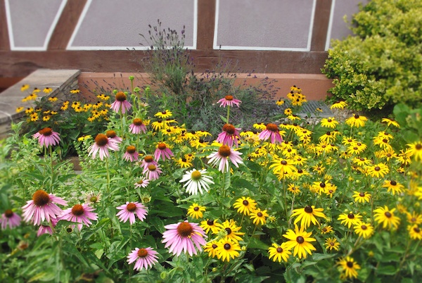
- Hirtzbach © French Moments
The Charles de Reinach Park
The Charles de Reinach Park located near the chateau is a peaceful and restful place.
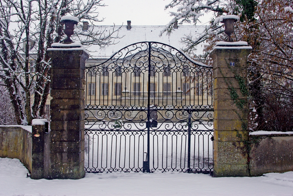
- The chateau of Reinach, Hirtzbach © French Moments
On Saturdays, it is not rare to see couples all dressed up coming to this enchanting park to take their official wedding photos! Initially a private garden, it was opened to the public in 1982. The Park features a romantic English garden, some interesting old buildings, ponds and is very well maintained.
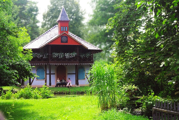
- Hirtzbach, Reinach Park © French Moments
The lushness of Hirtzbach’s forest is a true invitation to go hiking or cycling. It is easy to walk in the municipal territory of Hirtzbach which is essentially covered with forest. On the edge of the wood coming from the village stands the Chapel St Léger on the site of the vanished village of Sankt-Glückern. Since the 15th century, several legends and mysterious tales grew up about the disappeared village. It is said that the village was destroyed by English mercenaries during the Hundred Years War. Others mentioned the Black Death which would have decimated the whole population… except for 3 surviving families who abandoned their village to establish themselves in Altkirch, Carspach and Hirtzbach. Read more about Hirtzbach.
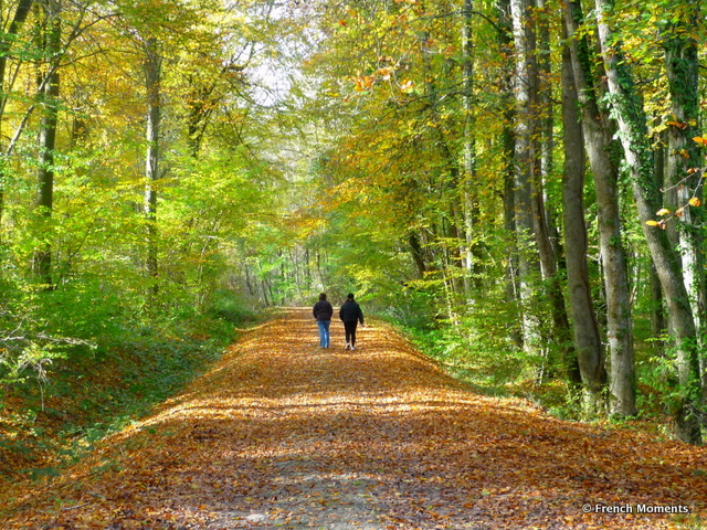
- A walk in the forest of Hirtzbach © French Moments
Continue on the D25 to Hirsingue. Shortly after entering the little town, turn right and follow the banks of the Ill River.
Hirsingue
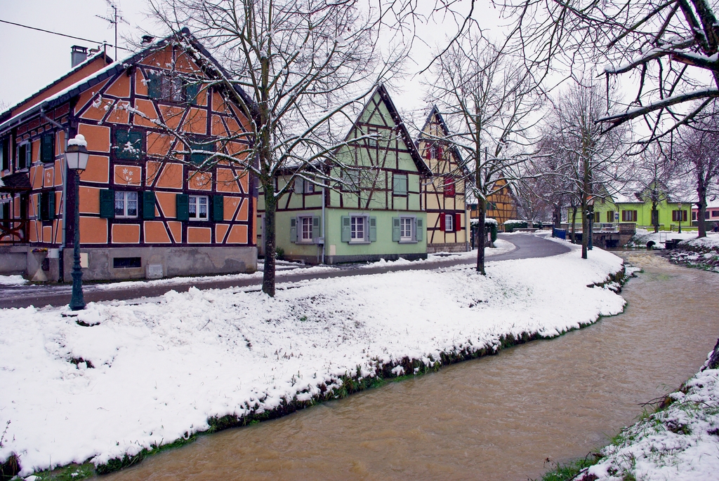
- The banks of the River Ill at Hirsingue © French Moments
The little town of Hirsingue owes its charm to the little narrow streets bordered with old half-timbered houses that follow the banks of the Ill River. Not as picturesque as Hirtzbach, this is nevertheless a very old town that was first mentioned as early as 708 by St. Odile, the Patron Saint of Alsace. In 1239, the village was sold by the abbey of Niedermunster to the Bishop of Basel who later gave Hirsingue to the Habsburgs in exchange for the town of Laufen in Switzerland. In 1633, Hirsingue shared the fate of the rest of the Sundgau by being destroyed by the raids of the Swedish army during the Thirty Years War. In 1648, Hirsingue became French and its castle was finally dismantled in 1789 when the local nobility took refuge in Basel, Switzerland.
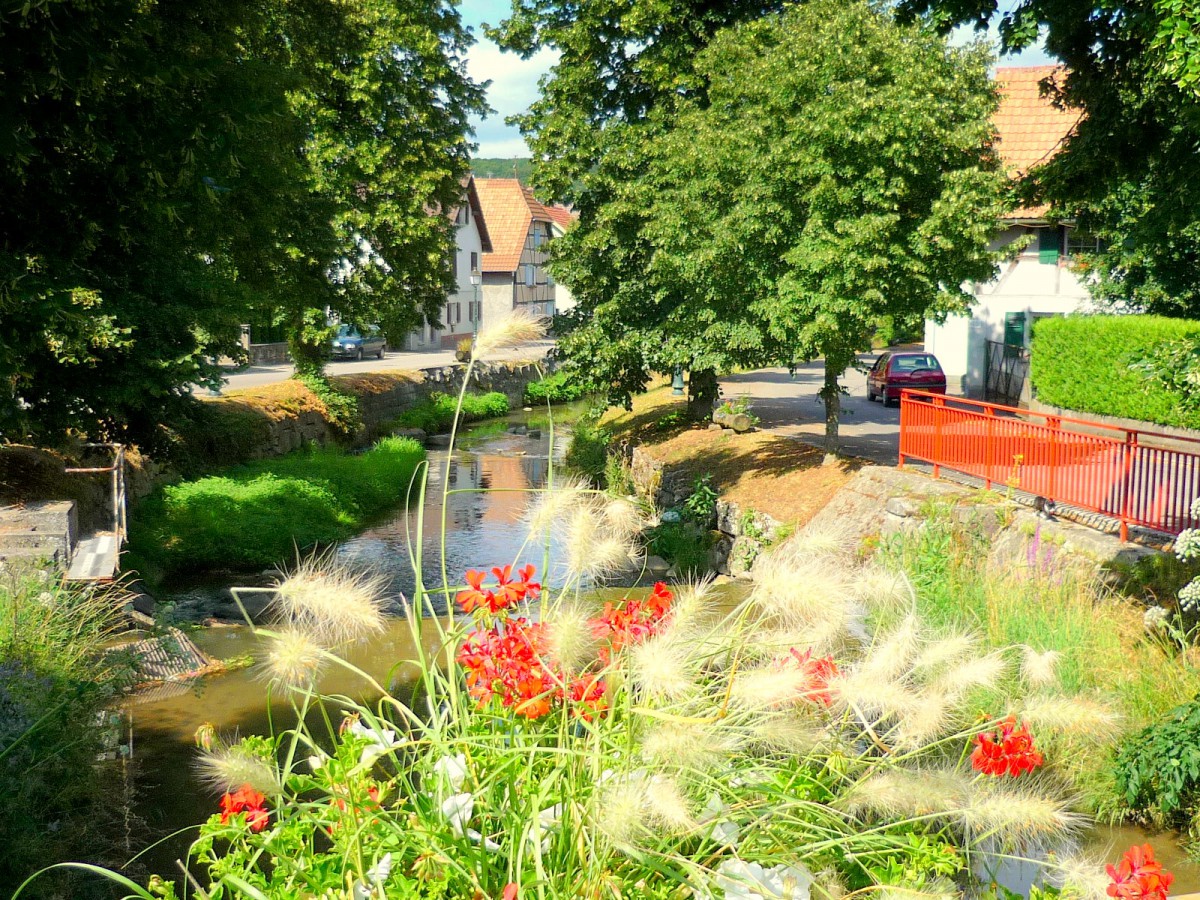
- Hirsingue © French Moments
Continue your journey along the D432 road in the direction of Ferrette. Cross the village of Heimersdorf with its beautiful half-timbered house. The road then leads you through a 4 km drive through a small valley with ponds where monks used to raise carp. Fried carp (carpe frite) remains a local speciality typical of the Sundgau. Stop at the next village: Feldbach.
Feldbach: the Romanesque church
In 1144, the Count of Ferrette, Frédéric I, founded a Benedictine convent in Feldbach headed by the powerful abbey of Cluny. Until the 14th century, the monastery was one of the most populated of the Cluny institution in Alsace. When the Sundgau came under the authority of the Habsburgs in 1324, the importance of Feldbach decreased. Many times, the convent suffered from the wars between the Swiss Confederates and the Habsburgs.
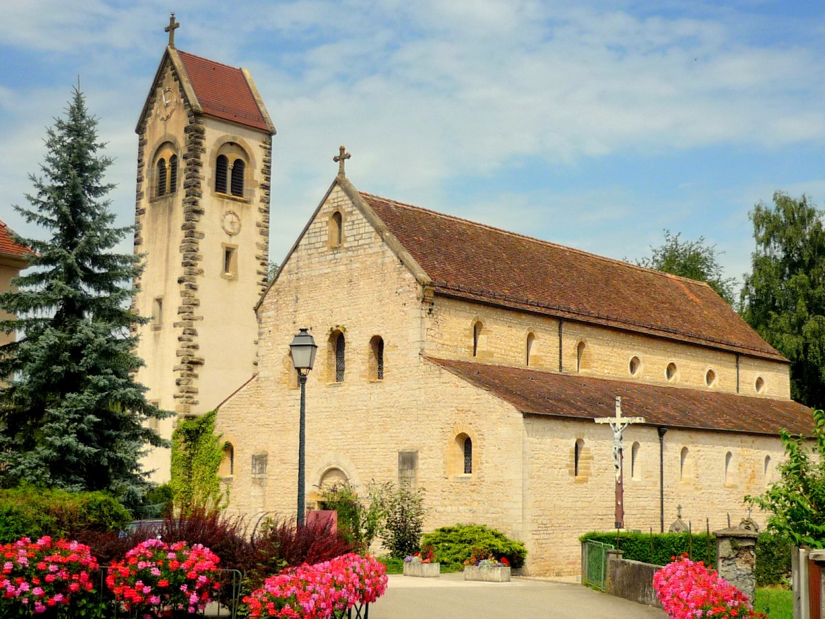
- The Romanesque church of Feldbach © French Moments
During the French Revolution, the priory was closed and the function of the church was later restricted to that of a parish church.
The jewel of the little village is its 12th-century parish church. Although the bell tower looks ancient, it was only built in 1910; before that, a little steeple was used to surmount the western façade of the church.
Inside the sanctuary, the recent restoration undertaken in 1975-77 gave back to the church its initial aspect of the 12th century while keeping elements from the 15th century. It is an interesting church as its nave is divided into two parts: one for the nuns and one for the congregation.
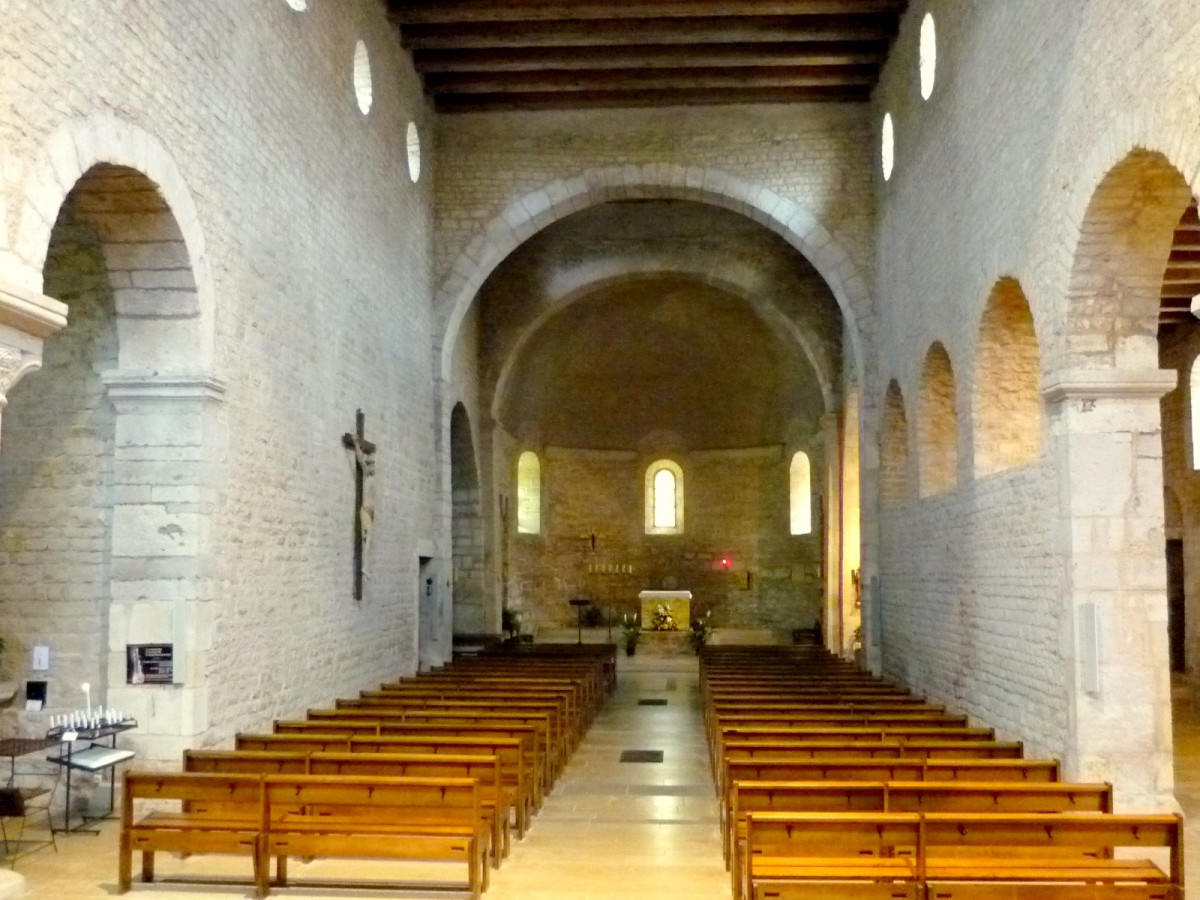
- Inside the Romanesque church of Feldbach © French Moments
The Romanesque church is now located along the touristic “Route Romane d’Alsace” (Alsace Romanesque Route).
Continue on the D432 road for another 6 km before entering Ferrette. Park your car in the carpark located at the foot of the church.
Ferrette: the capital of the counts
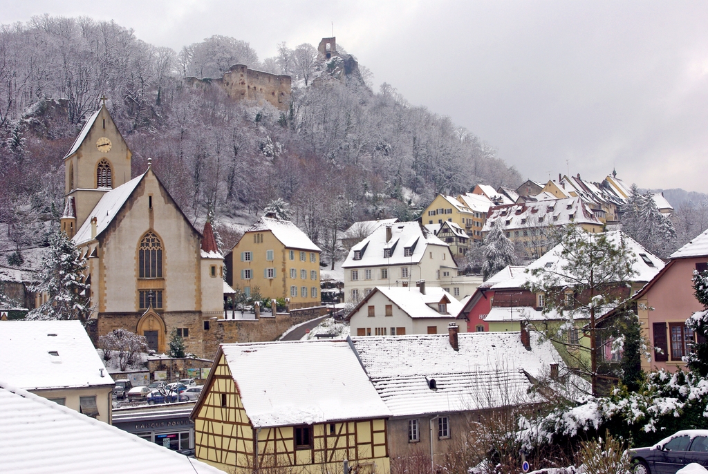
- The little town of Ferrette under the snow © French Moments
Guarding the entrance to the green mountains of Jura and located at only 12 km from the Swiss border, the former capital of the Counts of Ferrette is arguably the jewel of the Sundgau. Its site is picturesque: situated in the forest covered foothills of the Alsatian Jura Mountains, the pleasant little town has attracted more and more visitors over the last decades.
The little town
The little town of Ferrette itself is a modest place barely evoking the important fortified settlement founded by the Counts of Ferrette. The dynasty – as well as the town – were locally known through their Germanic name: Pfirt, francized by Ferrette.
The visit of Ferrette starts at the bottom of the hill, where the church dedicated to St. Bernard de Menton stands. The original bell tower from the 12th century is listed as a historic monument.
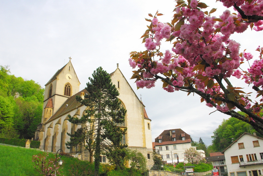
- The church © French Moments
When starting to climb the steep street to the top of the town, you can observe a curious statue of Mary with three arms as well as a Calvary depicting Jesus on the cross which is sheltered from the rain by an awning!
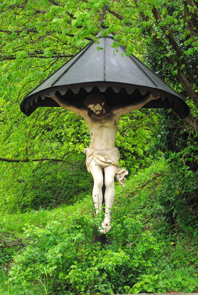
- Ferrette in the spring © French Moments
Many of the houses of Ferrette that are built along the narrow street which climbs up to the top of the town have been entirely restored in recent years.
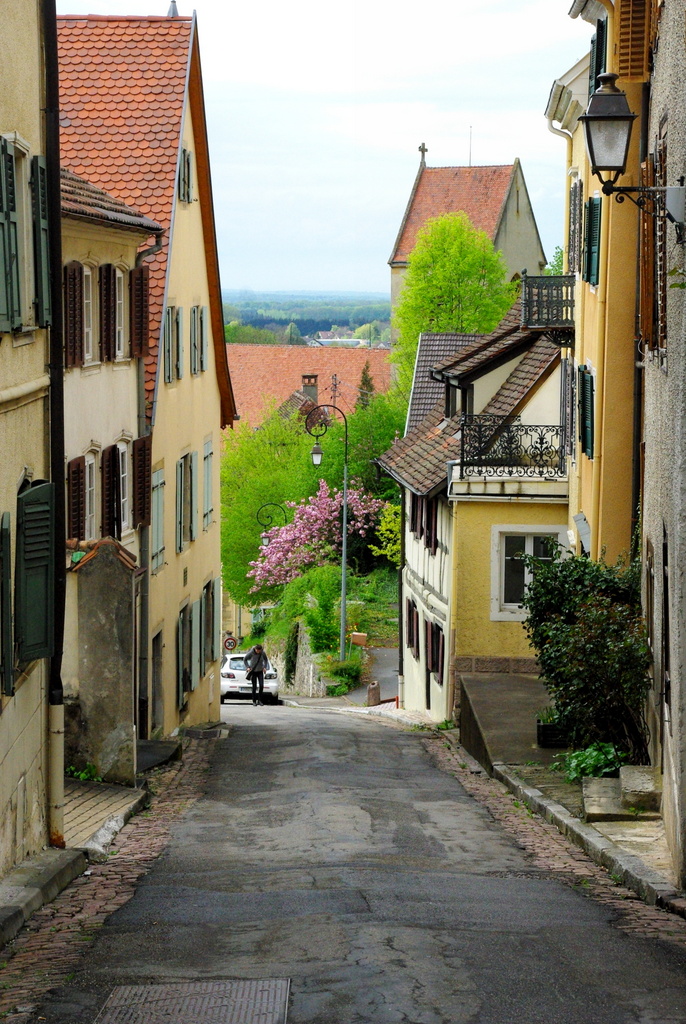
- In the main street of Ferrette © French Moments
The Town-Hall
The Town Hall with its red-coloured facade, its Renaissance-style windows and its steep roof, stands above the neighbouring houses.
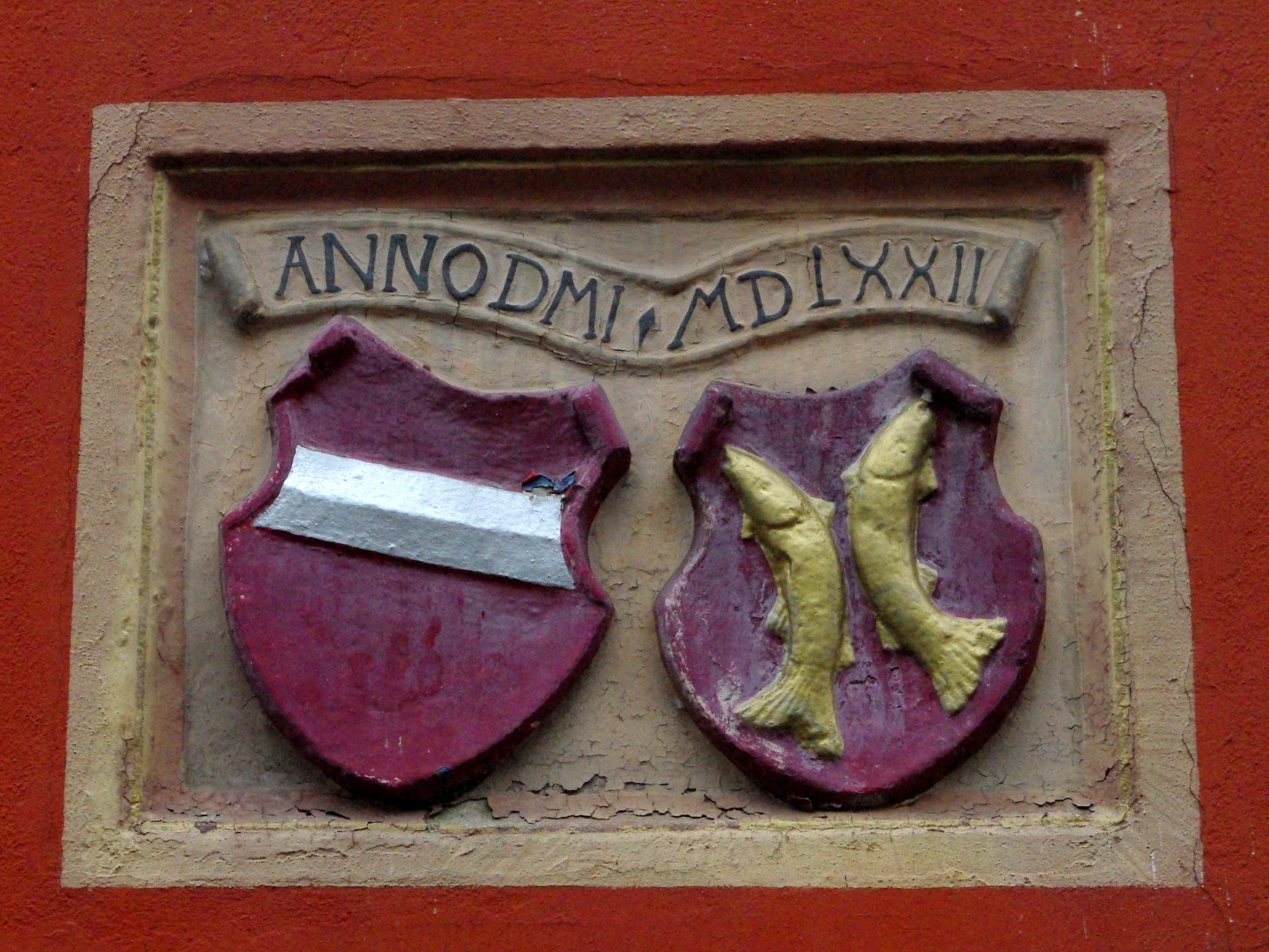
- Coat of arms of the Habsburgs and the Counts of Ferrette © French Moments
The castles of Ferrette
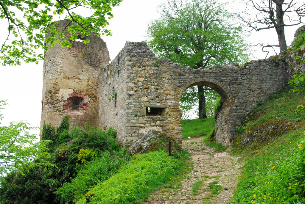
- The castle of Ferrette © French Moments
Thrust upon a rock above the little town, and guarding the Alsatian Jura, the ruins of two feudal castles are still an imposing testimony to the Sundgau’s History. They belonged to the Counts of Ferrette who used to live up there. The formidable fortress was ruined during the Thirty Years’ War (1618-1648). A delightful steep path leads to the upper platform of the keep which, at 612 meters, commands remarkable views of the Sundgau hills, the Vosges and the Black Forest mountain range in Germany. The view over rolling and lush fields of the Sundgau reminds us that this is a land of plenty.
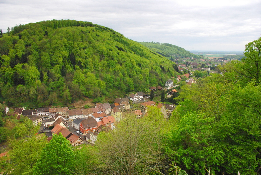
- Ferrette viewed from the castle © French Moments
The medieval character of Ferrette is ideal for the organisation of popular events such as the “Fête mediévale” which takes place at the end of June with sound and light shows.
Today, the title of Count of Ferrette is held by Albert II, Prince of Monaco, from the House of Grimaldi.
From Ferrette, you can opt to drive through the Alsatian Jura and later reach the village of Werentzhouse on the D9B road.
The Alsatian Jura
The Alsatian Jura (Jura Alsacien) is one of the most picturesque parts of the Sundgau. It comprises the first elevation of the Jura massif, which runs in a “banana-shape” between Basel, Switzerland and Chambéry, France. The slopes of the Alsatian Jura are recognisable with their clayey hills, caves and cliffs.
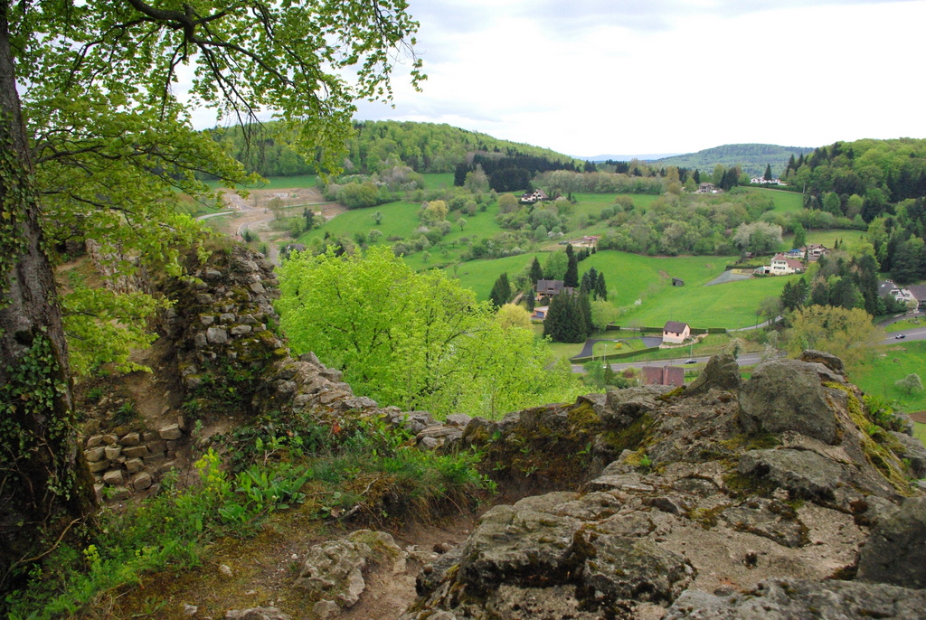
- The Alsatian Jura from the Ferrette castle © French Moments
There, the Ill River, the iconic river of Alsace, has its source at Winkel before crossing Alsace from south to north and flowing into the Rhine North of Strasbourg.
Lucelle, at the Franco-Swiss border, is the most southern village of Alsace, and one of the least populated (less than 50 inhabitants). Lucelle was known for its 12th century Cistercian abbey, which spread its influence to Bavaria, Burgundy and Switzerland. The monastery was dismantled during the French Revolution and never rebuilt.
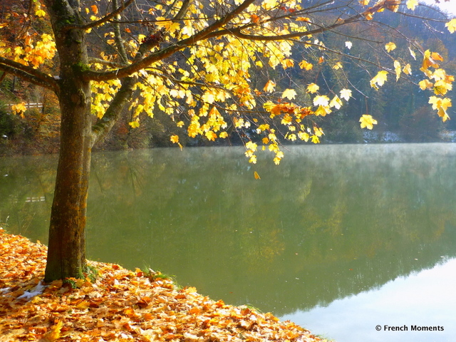
- The small lake of Lucelle © French Moments
There are three important ruined castles in the Alsatian Jura: Ferrette, Morimont and Landskron.
Château de Morimont
The Morimont castle (to the West of Winkel) is built on a rocky crest.
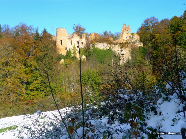
- Morimont Castle © French Moments
Built with the distinctive white colour of Jurassic limestone, the ruins give the place a certain romantic eerie atmosphere. Morimont castle was first mentioned in 1271 and took its name from the Morimont dynasty, which was vassals of the Ferrettes and later the Habsburgs. It was destroyed by the French in 1637.
Château de Landskron
The Landskron castle is located at a stone’s throw from Basel, at the border between France and Switzerland in the commune of Leymen. It is locally recognisable for its big rectangular keep.
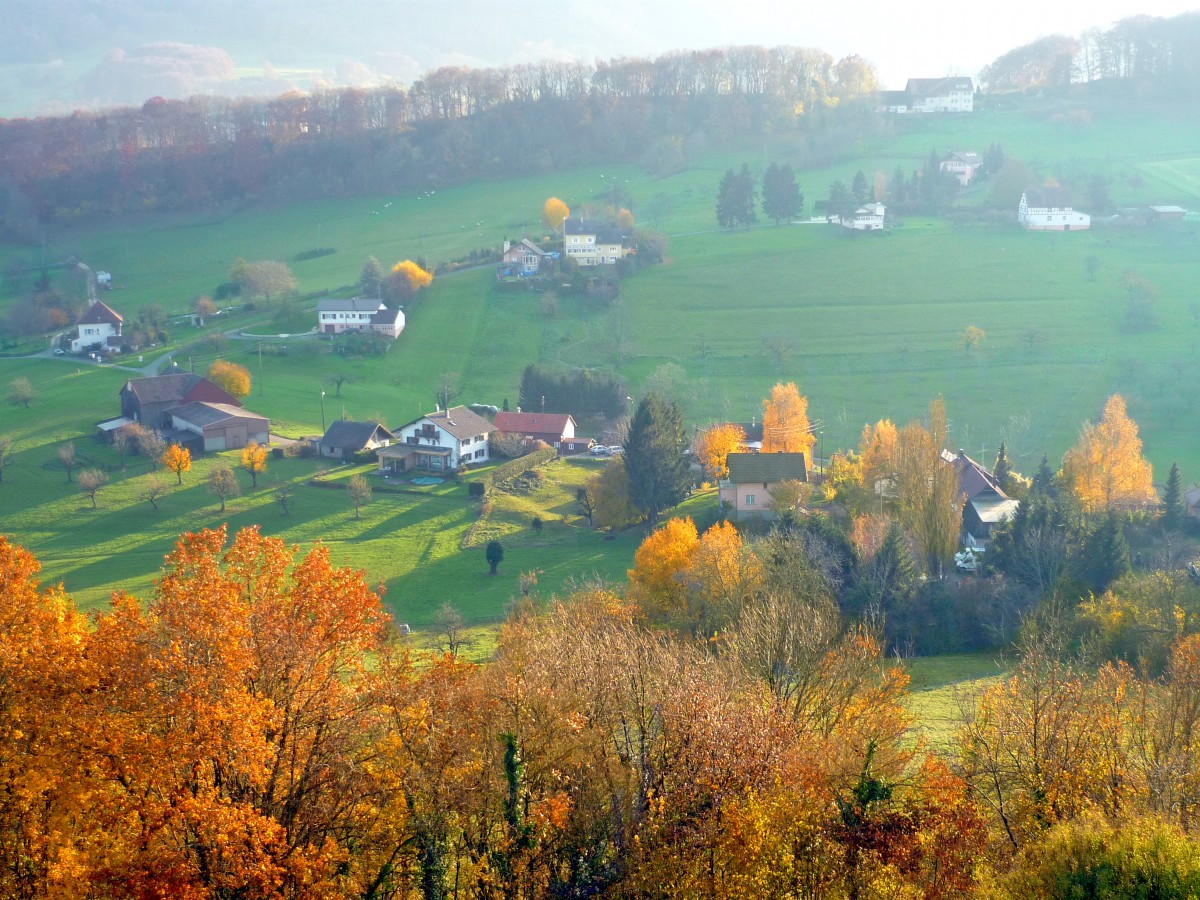
- The view from the Landskron Castle in Autumn © French Moments
Built from 1297, it is another monument that testifies to the unending wars that were fought in the region between the Habsburgs, the Bishop of Basel and the Swiss Confederates, followed by the French. A few decades after Louis XIV entered into its possession, Vauban rebuilt the fortress and it was later used as a jail for political prisoners. The Landskron castle was eventually dismantled by the Austrian and Bavarian armies who were waging war against Napoleon.
Reach Waldighoffen by the D9B road through Werentzhouse where you can admire an old watermill beautiful decorated with flowers, and follow the direction marked Altkirch through the villages of Oberdorf and Grentzingen.
Oberdorf and Grentzingen
From Waldighoffen, the D9B road is bordered with houses for the next 3 kilometres through the communes of Oberdorf and Grentzingen.
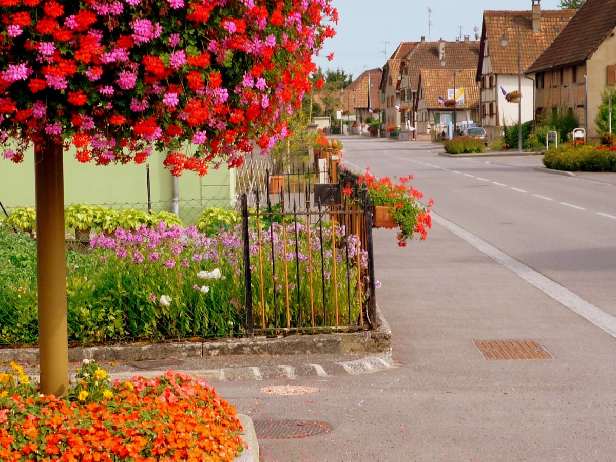
- Grentzingen, Sundgau © French Moments
The two villages are perfect examples of “village-rue”, where houses are lined up at right angles to the main and only street.
“Village-rue” is typical of the Lorraine region, but in the Sundgau, Oberdorf and Grentzingen are known for their amazing display of floral decoration from spring to autumn. Great half-timbered houses in keeping with the Sundgau outrival each other with their window-boxes full of flowers in bloom, their windows sparkling and their doorways swept.
The traditional house in the Sundgau is made up of wooden galleries and roofs that go down very close to the ground. Each house stands positioned next to each other in a single block and has open courtyards.
These perfectly kept half-timbered houses feature here and there symbolic shapes on their house fronts: Saint-Andrew’s crosses, curule chairs, diamonds, old inscriptions, adding to the charm of the decorative villages.
From Grentzingen, you can opt to go back to Altkirch through the rural village of Willer (on the site of an ancient Roman route), before reaching the D16 at Hundsbach where you will turn left in the direction of Wittersdorf.
How to get to the Sundgau
The Sundgau region is easily accessible by car from Paris, Lyon, Strasbourg, Switzerland and Germany through the network of reliable motorways crossing Southern Alsace from North to South.
From Paris, take the A5 motorway to Langres and then the single carriage-way route départementale which runs through Vesoul and Belfort. Switzerland and Germany are just on the borders.
If you travel from Australia or America, you could take a flight to Paris Charles de Gaulle or Frankfurt airports and rent a car from there, or if you prefer, fly to Zurich, only 100 km away from Basle by motorway.
The TGV from Paris-Gare de l’Est takes just over 2 hours to Strasbourg and 3h15 to Mulhouse.
More info!
- Read this article on our French blog Mon Grand-Est!
- Visit the website of the Sundgau Tourist Board

