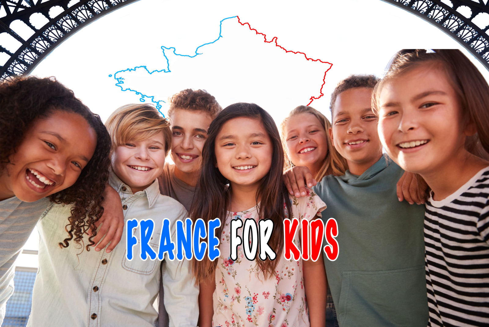
Welcome to the France for kids page!
This page is still under work as we are working on publishing additional resource about France... In the meantime, enjoy!
The Geography of France for kids
The location of France
France is situated in Western Europe and is a founding member of the European Union.

This position between the north and the south of Europe has made France important throughout history as a crossroads of international trade and cultures. That is why France is sometimes referred to as the "crossroads of Europe".
France is one of Europe’s largest countries, after Russia and the Ukraine.
The country consists of:
- Metropolitan France (la Métropole) which covers 551,500 square kilometres (212,935 sq mi), and
- The French overseas regions (départements et territoires d'Outre-Mer) which are located across the world (French Guiana, Guadeloupe, Martinique, Reunion Island, New Caledonia, Wallis and Futuna…)
France's total land area covers 643,801 km2 (248,573 sq mi), that is 0.45% of the total land area on Earth.
The borders of France
France is shaped like a hexagon, that is a six-sided figure.
- Three of these six sides border the sea.
- The other three sides border on land.
Due to its hexagonal shape, Metropolitan France is often referred to as l'Hexagone.

France shares borders with five countries and two micro-states:
- Spain,
- Andorra,
- Monaco,
- Italy,
- Switzerland,
- Germany,
- Luxembourg, and
- Belgium.

The English Channel separates France from the United Kingdom.
The seas around France
France is surrounded by one ocean and three seas:
- the Atlantic Ocean (l'Océan Atlantique)
- the English Channel (la Manche)
- the North Sea (la Mer du Nord)
- the Mediterranean Sea (la Mer Méditerranée)

The rivers of France
France is criss-crossed by an important water system that includes 5 main rivers.

- la Garonne (575 km / 357 mi). It empties into the Atlantic Ocean.
- la Loire (1012 km / 628 mi). It empties into the Atlantic Ocean.
- le Rhône (813 km / 505 mi). It empties into the Mediterranean Sea.
- le Rhin [Rhine] (1230 km / 764 mi). It empties into the North Sea.
- la Seine (776 km / 482 mi). It empties into the English Channel.

The River Loire from above

The Seine near La Défense

The Garonne in Bordeaux

The Rhône in Lyon
![The Rhine in Basel © Norbert Aepli - licence [CC BY 2.5] from Wikimedia Commons](https://frenchmoments.eu/wp-content/uploads/2020/06/Rhine-in-Basel-©-Norbert-Aepli-licence-CC-BY-2.5-from-Wikimedia-Commons.jpg "Rhine in Basel © Norbert Aepli - licence [CC BY 2.5] from Wikimedia Commons")
The Rhine in Basel
The French make a distinction between ‘un fleuve’ (a river that flows into the sea) and ‘une rivière’ (a river that flows into another river).
There are many other rivers in France, many of them rising in mountainous regions (Alps, Massif Central, Vosges, Jura and Pyrenees).
(click on the toggle for more info!)
- l'Ariège
- la Dordogne (although some refer to it as a ‘fleuve’)
- le Lot
- le Gers
- le Tarn

The view of the Dordogne River from the castle of Beynac
- l'Aube
- l'Essonne
- l'Eure
- la Marne
- l'Oise
- l'Yonne

River Marne in Noisiel
- l'Allier
- le Cher
- la Creuse
- l'Indre
- le Loir
- la Mayenne
- la Sarthe
- la Vienne

Remparts of Vendôme following the banks of the Loir River
- l'Aar (Switzerland)
- l'Ill (France)
- le Main (Germany)
- la Moselle (France, Luxembourg, Germany)
- le Neckar (Germany)
- la Ruhr (Germany)

Pont-à-Mousson on the banks of the Moselle
- l'Ain
- l'Arc
- le Doubs
- la Drôme
- la Durance
- le Gard
- l'Isère
- la Saône

The Isère River at Bourg-Saint-Maurice
- l'Adour
- l'Aude
- la Charente
- l'Escaut
- la Meuse
- l'Orne
- la Somme
- le Var
- la Vilaine

The Meuse River in Saint-Mihiel, Lorraine
Free Worksheets to Download!


The relief of France
France is known for its wide variety of natural landscapes:
- cliffs with sandy coastlines,
- plains (Parisian Basin, Aquitaine Basin),
- rolling hills,
- plateaus, and
- mountain ranges.

The French countryside of Lorraine

The French countryside of Périgord
France covers several mountain ranges:
- the Alps (culminate at Mont Blanc: 4809 m / 15,777 ft)
- the Ardennes (Signal de Botrange*: 694 m / 2277 ft)
- the Jura (Crêt de la Neige: 1720 m / 5643 ft)
- the Massif Central (Puy de Sancy: 1885 m / 6184 ft)
- the Pyrenees (Aneto**: 3404 m / 11168 ft)
- the Vosges (Grand Ballon: 1424 m / 4672 ft)
- and the mountainous island of Corsica (Monte Cinto: 2706 m / 8878 ft)
* in Belgium - ** in Spain


The French Alps

The Vosges
Free Worksheets to Download!


The climate of France
Did you know that Paris is situated as far north as Newfoundland and Vancouver? However the climate of France is rather mild as the European country does not have the extremes of temperature characteristic of some parts of North America. This is largely due to the long Atlantic seacoasts that are warmed by the Gulf Stream, and the Mediterranean sea, a large body of warm water.
France is located in a land area with a temperate climate. However, the country's territory is largely open to the seas and the ocean to the west, while to the east it is linked to the European continent.
The French climate is subject to oceanic, continental and Mediterranean influences.
- The west of the country is dominated by an oceanic climate (heavy rainfall, cool summers and mild winters).
- Inland, the climate is semi-oceanic and semi-continental. Rainfall decreases, the summer is hot and the winter cold.
- In the south-east and in Corsica, the Mediterranean climate prevails. It is characterised by mild temperatures in winter and a very hot summer. Precipitation can be very heavy in autumn, but is almost non-existent in summer.
- Finally, the French Mountains are subject to a climate dictated by altitude. Rainfall increases and temperatures decrease according to the degree of exposure to the winds.

Spring in the French Alps
Thus, in summer, the sunny south-east attracts millions of holidaymakers, while in winter, they go skiing in the snowy mountains.
On a map, the five climatic nuances of France can be delineated. They are:
- the oceanic climate,
- the semi-oceanic climate,
- the semi-continental climate,
- the Mediterranean climate, and
- the mountain climate

The population of France
The French population is 67.8 million which makes it the second most populous country of the EU after Germany.
The capital of France is Paris.
The population of Greater Paris is about 10,734,000.


Other main cities are:
- Lyon - Pop. 1,652,000
- Marseille - Pop. 1,588,000
- Lille - Pop. 1,041,000
- Toulouse - Pop. 958,000
- Nice - Pop. 944,000
- Bordeaux - 917,000
- Nantes - 642,000
- Toulon - 573,000
- Grenoble - 510,000
(population including the suburbs)


LYON

BORDEAUX
![Lille © Velvet - licence [CC BY-SA 3.0] from Wikimedia Commons](https://frenchmoments.eu/wp-content/uploads/2021/01/Lille-LR-copyright-Velvet-licence-CC-BY-SA-3.0-from-Wikimedia-Commons.jpg "Lille-LR-copyright-Velvet---licence-[CC-BY-SA-3.0]-from-Wikimedia-Commons")
LILLE
![Toulon from Mount Faron © David.Monniaux - licence [CC BY-SA 3.0] from Wikimedia Commons](https://frenchmoments.eu/wp-content/uploads/2021/01/Toulon-from-Mount-Faron-LR-copyright-David.Monniaux-licence-CC-BY-SA-3.0-from-Wikimedia-Commons.jpg "Toulon-from-Mount-Faron-LR-copyright-David.Monniaux---licence-[CC-BY-SA-3.0]-from-Wikimedia-Commons")
TOULON

TOULOUSE

MARSEILLE

NICE
![Nantes from Tour Bretagne © Adam Bishop - licence [CC BY-SA 3.0] from Wikimedia Commons](https://frenchmoments.eu/wp-content/uploads/2021/01/Nantes-from-Tour-Bretagne-LR-copyright-Adam-Bishop-licence-CC-BY-SA-3.0-from-Wikimedia-Commons.jpg "Nantes-from-Tour-Bretagne-LR-copyright-Adam-Bishop---licence-[CC-BY-SA-3.0]-from-Wikimedia-Commons")
NANTES

GRENOBLE
Free Worksheets to Download!


The administration of France
For administrative purposes, Metropolitan France is divided into 13 régions, 97 départements and 34,839 communes.
The regions of France
Metropolitan France is divided into 13 administrative regions.
(click on the toggle for more info!)

Capital City:
Population:
7,877,698
Area:
69 711 km2 / 26,916 sq mi
Landmarks:
Mont Blanc, Lake Annecy, Volcanoes of Auvergne, Chauvet Cave, Vanoise and Ecrins National Parks, villages of Bonneval-sur-Arc, Pérouges and Yvoire, Lake Bourget, Lake Aiguebelette, Lake Geneva
Traditional Dish/Food:
salade lyonnaise, rosette de Lyon, quenelles, crozets, diots, Auvergne ham, raclette, beaufort cheese, reblochon, tomme de Savoie, cantal cheese, coussins lyonnais, pralines de Lyon, gâteau de Savoie, Nougat from Montélimar
Tourist Board:

Name in English:
Burgundy-Franche-Comté
Capital City:
Dijon
Population:
2,807,807
Area:
47 784 km2 / 18 449 sq mi
Landmarks:
Old town of Dijon, Semur-en-Auxois, Vézelay, Cluny, Citadel of Besançon, Côtes de Nuits, Côtes de Beaune, Joux Castle, Baume-les-Messieurs, Lion of Belfort, Fontenay abbey, Royal saltworks at Arc-et-Senans, Hospices de Beaune, Guédelon Castle, Alesia
Traditional Dish/Food:
beef bourguignon, Morteau and Montbéliard sausages, Bresse chickens, époisses, chaource, comté cheese, morbier cheese, cancoillotte, anis de Flavigny, cassis of Dijon, Dijon gingerbread
Tourist Board:

Name in English:
Brittany
Capital City:
Rennes
Population:
3,335,414
Area:
27 209 km2 / 10 505 sq mi
Landmarks:
Saint-Malo, Dinard, La Baule, Quiberon, Quimper, La Trinité-sur-Mer, Vannes, Carnac stones, Locronan, Rennes, castles of Fougères and Josselin, Tréguier, Concarneau, Pointe du Raz, Morbihan gulf
Traditional Dish/Food:
galette de sarrasin, kouign patatez, oysters, moules marinières (mussels), salted butter, cider, far breton, kouign aman, galette bretonne, crêpes bretonnes, quatre-quarts, niniches from Quiberon, palet breton
Tourist Board:

Capital City:
Orléans
Population:
2,572,853
Area:
39 151 km2 / 15 116 sq mi
Landmarks:
Gothic cathedrals of Bourges, Chartres, Orléans and Tours, castles of the Loire (Amboise, Azay-le-Rideau, Blois, Chambord, Chenonceau, Cheverny, Langeais, Ussé, Valençay), gardens of Villandry, Vendôme, Châteaudun, Sologne Forest
Traditional Dish/Food:
Valençay cheese, Sainte-Maure de Touraine, Tarte Tatin, Pithiviers cake, Montargis pralines
Tourist Board:

Name in English:
Corsica
Capital City:
Ajaccio
Population:
338,554
Area:
8 722 km2 / 3 368 sq mi
Landmarks:
Bastia, Calanques of Piana, Citadel of Calvi, Bonifacio, old town of Corte, Palombaggia beach, Monte Cinto, Aiguilles de Bavella, Archipel des Sanguinaires, Agriates desert, Genese towers around the island
Traditional Dish/Food:
chestnuts, fleur du maquis cheese, clementines, coppa, tomme corse, brocciu, canistrelli, caccavellu, falculelle
Tourist Board:

Capital City:
Population:
3,335,414
Area:
57 433 km2 / 22 175 sq mi
Landmarks:
Strasbourg Cathedral and Petite France district, Colmar, Alsace Wine Route, Vosges mountains, Nancy, Metz, Moselle Valley, Verdun, Domrémy, Reims cathedral, Montagne de Reims, Troyes
Traditional Dish/Food:
Alsatian sauerkraut, Strasbourg sausages, pretzels, Flammenkueche, quiche lorraine, mirabelles, madeleines of Commercy and Liverdun, bergamotes, macarons from Nancy and Boulay, biscuit rose from Reims, Kugelhopf, bredeles
Tourist Board:

Capital City:
Population:
3,335,414
Area:
27 209 km2 / 10 505 sq mi
Landmarks:
Bay of Somme, Cape Blanc-Nez, Cape Gris-Nez, Compiègne Forest, Gothic cathedrals of Amiens, Beauvais and Laon, Arras squares, Lille old town, spoil tips of Lens, citadel city of Montreuil, Chantilly castle, Pierrefonds Castle, Coucy Castle
Traditional Dish/Food:
fricadelle, French fries, maroilles, mimolette, ficelle picarde, bêtises from Cambrai, waffles
Tourist Board:

Name in English:
Capital City:
Population:
12,213,447
Area:
12 011 km2 / 4 638 sq mi
Landmarks:
Eiffel Tower, Notre-Dame cathedral, Sacré-Cœur, Arc de Triomphe, Louvre, Pompidou Centre, Panthéon, La Défense, Vincennes castle, Disneyland Paris, Meaux, Provins, Fontainebleau castle and forest, Park of Sceaux, Park of Saint-Cloud, Mont-Valérien, Saint-Denis basilica, Saint-Germain-en-Laye, Versailles, Montfort-l'Amaury, Rambouillet
Traditional Dish/Food:
Paris ham, agaricus (Paris mushrooms), brie de Meaux, coulommiers, baguette, croissant, Paris-Brest, saint-honoré, opéra, macarons, financier
Tourist Board:

Name in English:
Capital Cities:
Rouen (prefecture of the region)
Caen (seat of the regional council)
Population:
3,327,477
Area:
29 906 km2 / 11 546 sq mi
Landmarks:
Old town of Rouen, Le Havre, gardens of Giverny, cliffs of Etretat, Honfleur, Deauville-Trouville, D-Day beaches, Caen, Bayeux, Mont-Saint-Michel, Grandville, Cherbourg-Octeville, Barfleur
Traditional Dish/Food:
tripes à la mode de Caen, andouilles, scallops, Boursin, Brillat-Savarin, Camembert, Livarot, Pont l’évêque, Isigny cream and butter, apples, teurgoule, Falaise berlingots, Isigny caramels
Tourist Board:

Capital City:
Population:
5,979,778
Area:
84 036 km2 / 32 446 sq mi
Landmarks:
Old town of Bordeaux, Lascaux Caves, Poitiers, La Rochelle, Ré island, Oléron island, Angoulême, Limoges, Sarlat, Dordogne Valley, Pau, Biarritz, Bayonne, Dune of Pilat, Bay of Arcachon, Futuroscope
Traditional Dish/Food:
Bayonne ham, magret de canard, foie gras, oysters, poule au pot, black walnut and truffle from Périgord, ossau-iraty, sainte-maure caprifeuille, soignon, gâteau basque, broyé poitevin, canelés
Tourist Board:

Name in English:
Occitania or Occitany
Capital City:
Population:
5,885,496
Area:
72 724 km2 / 28 079 sq mi
Landmarks:
Pont du Gard, Aigues-Mortes, Nîmes, Alès, Narbonne, Montpellier, Perpignan, Cathar castles, Carcassonne, Mount Canigou, Toulouse old town, Foix, Lourdes, Cirque de Gavarnie, Albi, Najac, Saint-Cirq-Lapopie, Cahors, Rocadamour, Pech Merle cave
Traditional Dish/Food:
Collioure anchovies, cassoulet, Roquefort, Rocamadour cheese, bleu des Causses, tomme des Pyrénées, gâteau à la broche from the Pyrenees
Tourist Board:

Capital City:
Population:
3,781,423
Area:
32 082 km2 / 12 387 sq mi
Landmarks:
Castles of the Loire (Angers, Saumur, Nantes, Brissac, Plessis-Bourré and Montreuil-Bellay), Gothic cathedrals (Angers, Nantes, Le Mans), Les Sables d’Olonne, Le Puy-du-Fou
Traditional Dish/Food:
Guérande salt, Rillettes du Mans, Petit Beurre from Nantes, sablé from Sablé-sur-Sarthe, brioche from Vendée
Tourist Board:

Capital City:
Marseille
Population:
5,052,832
Area:
31 400 km2 / 12 123 sq mi
Landmarks:
Old harbour of Marseille, Pope's Palace of Avignon, Aix-en-Provence, Montagne Sainte-Victoire, Luberon, Saint-Rémy-de-Provence, Alpilles, Arles, Camargue, Les Baux-de-Provence, Calanques, Iles d'Hyères, Verdon Gorges, Saint-Tropez, Maures, Estérel, French Riviera (from Cannes to Nice and Menton), Serre-Ponçon Lake, Ecrins National Park, Briançon
Traditional Dish/Food:
pastis, olive oil, herbes de Provence, rice from Camargue, fougasse, salade niçoise, pissaladière, pistou, aïoli, tapenade, ratatouille, bouillabaisse from Marseille, Nice socca, Carpentras strawberries, Cavaillon melons, fruits confits from Apt, calissons, mendiants, Carpentras berlingots, tarte tropézienne
Tourist Board:

These regions should not be confused with the historic provinces such as:
Free Worksheets to Download!


The French départements
The 13 administrative regions of France are in turn divided into 96 départements (excluding the overseas territories).
The departments were created in 1790 during the French Revolution to replace the old provinces of the kingdom of France. In an attempt to forget historical or cultural names attached to the former provinces, most of them were named after physical geographical features such as:
- rivers: Ain, Drôme, Gers, Meuse, Oise, Tarn, Yonne
- mount or mountains: Ardennes, Cantal, Jura, Vosges
- coasts, gulfs or seas: Côtes d’Armor, Manche, Morbihan
- islands: Corse du Sud, Haute-Corse, Guadeloupe, Martinique, Réunion
- forests: Landes, Yvelines
- geographic situation: Finistère, Nord
- cities: Paris, Pas-de-Calais, Territoire de Belfort, Seine-Saint-Denis
- poetry: Côte d'Or
Some départements were added after the French Revolution and bear old provinces names: Alpes de Haute-Provence, Savoie, Haute-Savoie.

The départements are sorted in alphabetical number. Each département have its own number which is widely used to designate locations.
The first two figures are used in French postcode. For example:
- 01000 is the postcode for Bourg-en-Bresse, the préfecture (head city) of the Ain département [01]
- 88000 is the postcode for Epinal, the préfecture (head city) of the Vosges département [88].
The numbers of the départements are featured on vehicle registration plates which reveals to anyone where they originate.
Some département numbers are well-known by the French, such as:
- 13 - Bouches-du-Rhône (Marseille, Aix-en-Provence)
- 2A and 2B - respectively Corse du Sud and Haute-Corse (Ajaccio, Bastia)
- 59 - Nord (Lille)
- 69 - Rhône (Lyon)
- 75 - Paris
- 78 - Yvelines (Versailles)
Each département has a préfecture or capital. For instance, the préfecture of Loiret [45] is Orléans.
The communes
The départements are divided into communes.
Created at the French Revolution, they replace the old parishes (la paroisse).
On the 1st January 2020, France totalled 34,839 communes.
The commune is the basic unit of local administration. It elects its own municipal council (le conseil municipal) and mayor (le/la maire) for a 6-year term. The mayor acts as the principal administrator of the commune. The mayor and its staff work at the municipal hall (la mairie).
The communes vary widely in population and area :
- The most populous commune of France is Paris (2,206,388 inhabitants).
- There are 7 communes with zero resident which are all located near Verdun in the Meuse. These villages were destroyed during the Battle of Verdun in WWI.
- The commune with the largest area is Arles (Bouches-du-Rhône) with 758,93 km2 (293 sq mi).
- The commune with the smallest area is Castelmoron-d’Albret (Gironde) with 0,0376 km2 (8.75 acres).
To sum up!

Do you know the answer?


