For me, the hike to the Col de la Vanoise from Pralognan-la-Vanoise is the most beautiful walk in the Alps. Of course, this bold statement relates to my childhood memories. It was in Pralognan that we used to spend our family holidays. As a child, I was reluctant to follow my parents on excursions. This is the haute-montagne and the hikes can be demanding (and lengthy!). However, as we grew up, the mountains of Pralognan became a natural playground of discovery. From the village, we climbed up to the mountain pastures to find a paradise on earth. For someone like me who loves mountains, the Vanoise National Park is definitely a place to explore. Here is one of my favourite hikes in the region with photos to inspire mountain lovers! I bet you’ll love walking in the Vanoise!
The history of a Vanoise pass
The Vanoise pass (in French: Col de la Vanoise) is one of the oldest passages used (since the Bronze Age (1000 BC). This is due to its location: a junction point between the Tarentaise and the Haute-Maurienne.
Then, the Romans abandoned the pass in favour of the Petit Saint-Bernard pass (2188 m) to link Rome to Lyon. Later, the passage was considered unsafe following the barbarian invasions.
Why this deviation?
According to the information panel at the chalet des Barmettes, the route over the Vanoise Pass was revived in the 8th century as a link between Chambéry and Turin, the two main cities of the Duchy of Savoy.
I have not (yet) understood how this route had to pass through this pass at 2517 metres when it was so simple to go up the valleys of the Tarentaise (through the Petit Saint-Bernard pass) or the Maurienne (Mont Cenis pass). The question is asked, if you have some information, I am interested! (share your answer in the comments below)
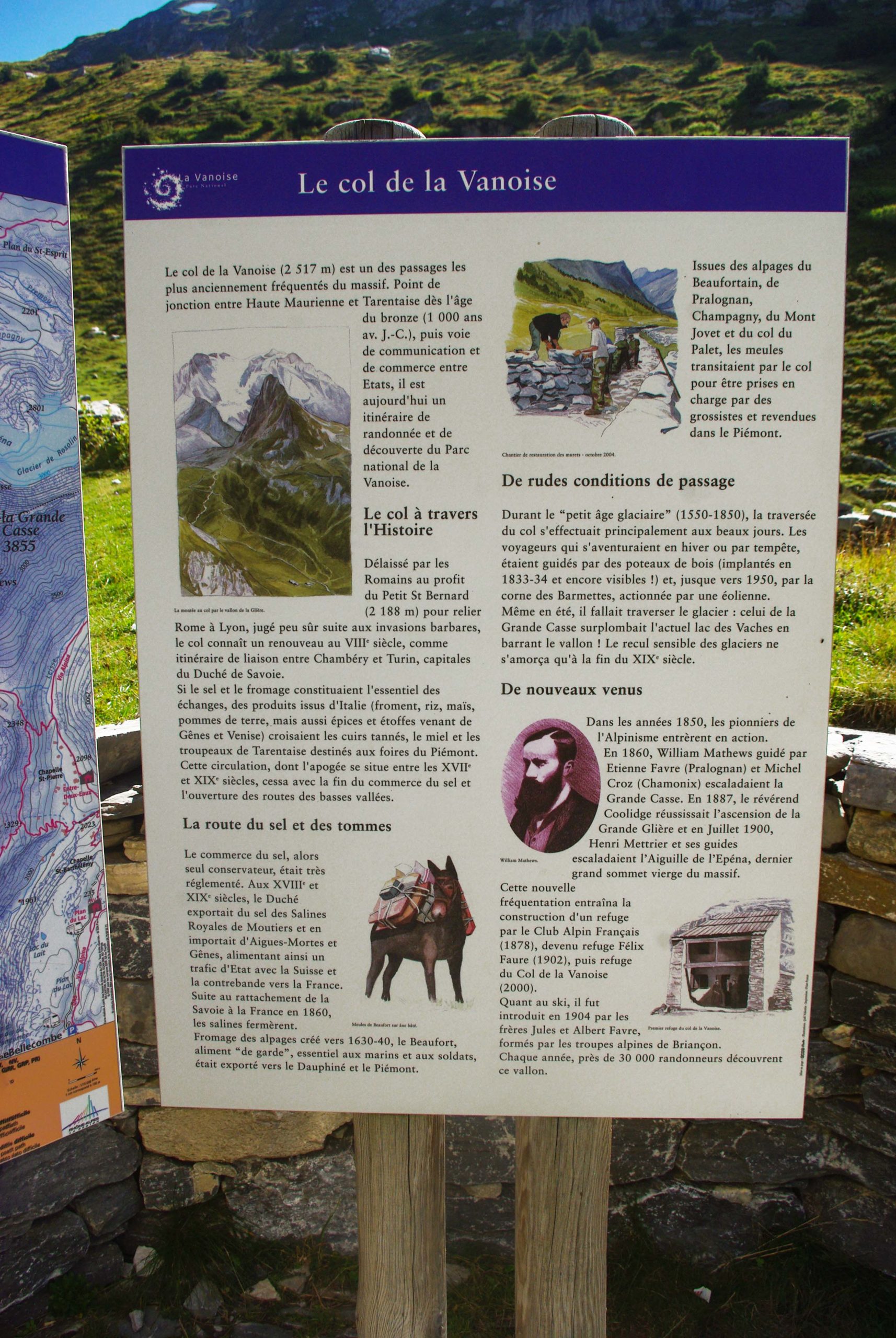
Exchanges between Savoie and Italy
If salt and cheese constituted the central part of the exchanges, Italian products were also transported (wheat, rice, spices and fabrics from Genoa and Venice). Products from Tarentaise (tanned hides, honey and herds) were sent to the fairs in the Italian Piedmont.
The peak of this traffic was between the 17th and 19th centuries. It ceased with the end of the salt trade and the opening of the low valley roads.
The salt and cheese route
In the past, salt was the only known preservative. Its trade was highly regulated. In the 18th and 19th centuries, the Duchy of Savoy exported salt from the Royal Salt Works in Moûtiers and imported it from Aigues-Mortes and Genoa. This traffic fuelled smuggling into France.
However, the Moûtiers salt works closed when Savoy became part of France in 1860.
The Beaufort cheese trade
The cheese from the mountain pastures – Beaufort – was used by sailors and soldiers. It was exported to the Dauphiné and Piedmont via the Vanoise Pass. The wheels of Beaufort cheese came from the mountain pastures of Beaufortain, Pralognan, Champagny and La Plagne.

A road to avoid in winter
During the “little ice age” (1550-1850), the crossing of the pass was only done after the snow melted, in summer.
Travellers who ventured out in winter (or in stormy weather) were guided by wooden posts. These were erected in 1833-34 and are still visible today!
However, crossing the Grande Casse glacier was necessary even in summer, which overhung the current Lac des Vaches.
And the English landed!
But things were to change in the middle of the 19th century with the arrival in Pralognan of mountaineering pioneers. In 1860, the Englishman William Matthews, guided by Etienne Favre (from Pralognan) and Michel Croz (from Chamonix), achieved a historic feat: the climb of the Grande Casse.
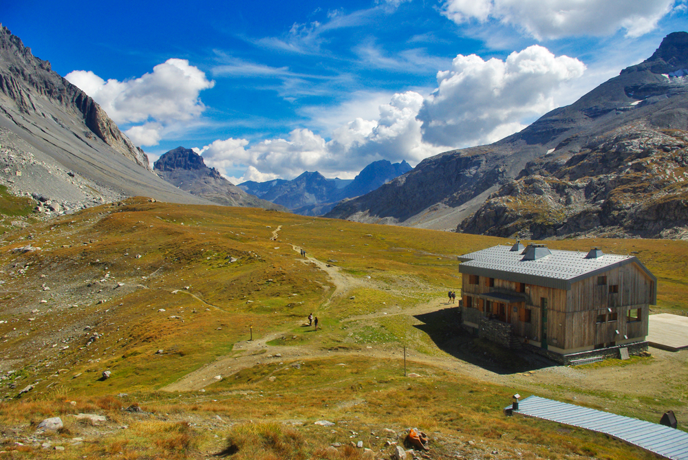
To cope with this new influx of visitors, the French Alpine Club built a refuge in 1878.
Every year, an estimated 30,000 hikers follow the old salt and cheese route to reach the Lac des Vaches and the Col de la Vanoise.
Itinerary to the Col de la Vanoise
It takes 3 hours to reach the pass of Col de la Vanoise (alt. 2,517m).
The excursion starts at Pralognan-la-Vanoise at 1,420m. But to make things a little bit easier, I recommend taking the Mont Bochor cable car (alt. 2,023 m).
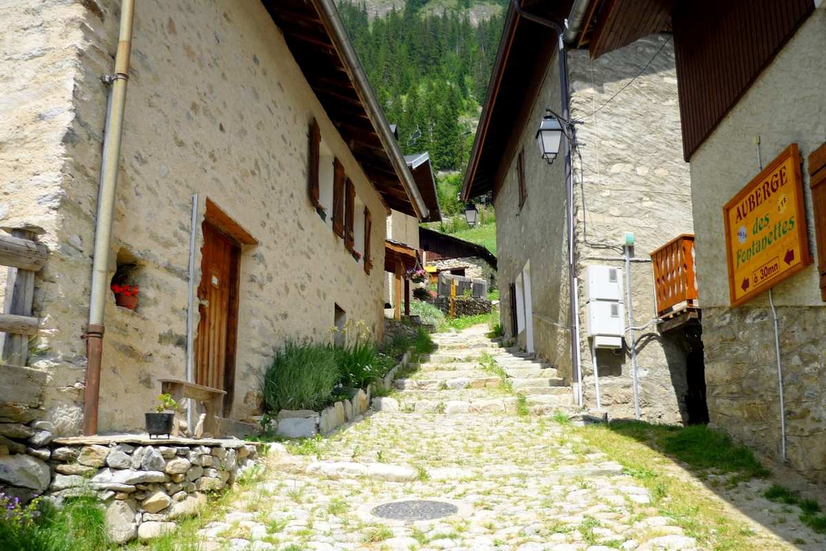
If the cable car is not in service, you can park your car at the hamlet of Les Fontanettes. (You can also take the Barmettes chairlift if it is in service; it will take you to the gates of the Vanoise National Park).
Walking in the Vanoise to the mountain pass
First, take a ride on the Mont-Bochor cable car.
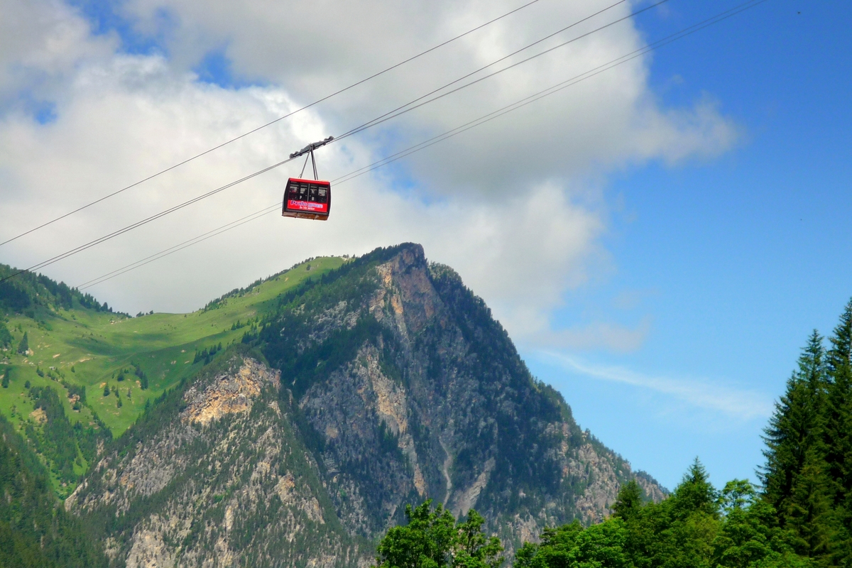
When you arrive at the top of the Mont Bochor (2,023m) from the cable car, the view of the village and the Vanoise peaks catches the eye.

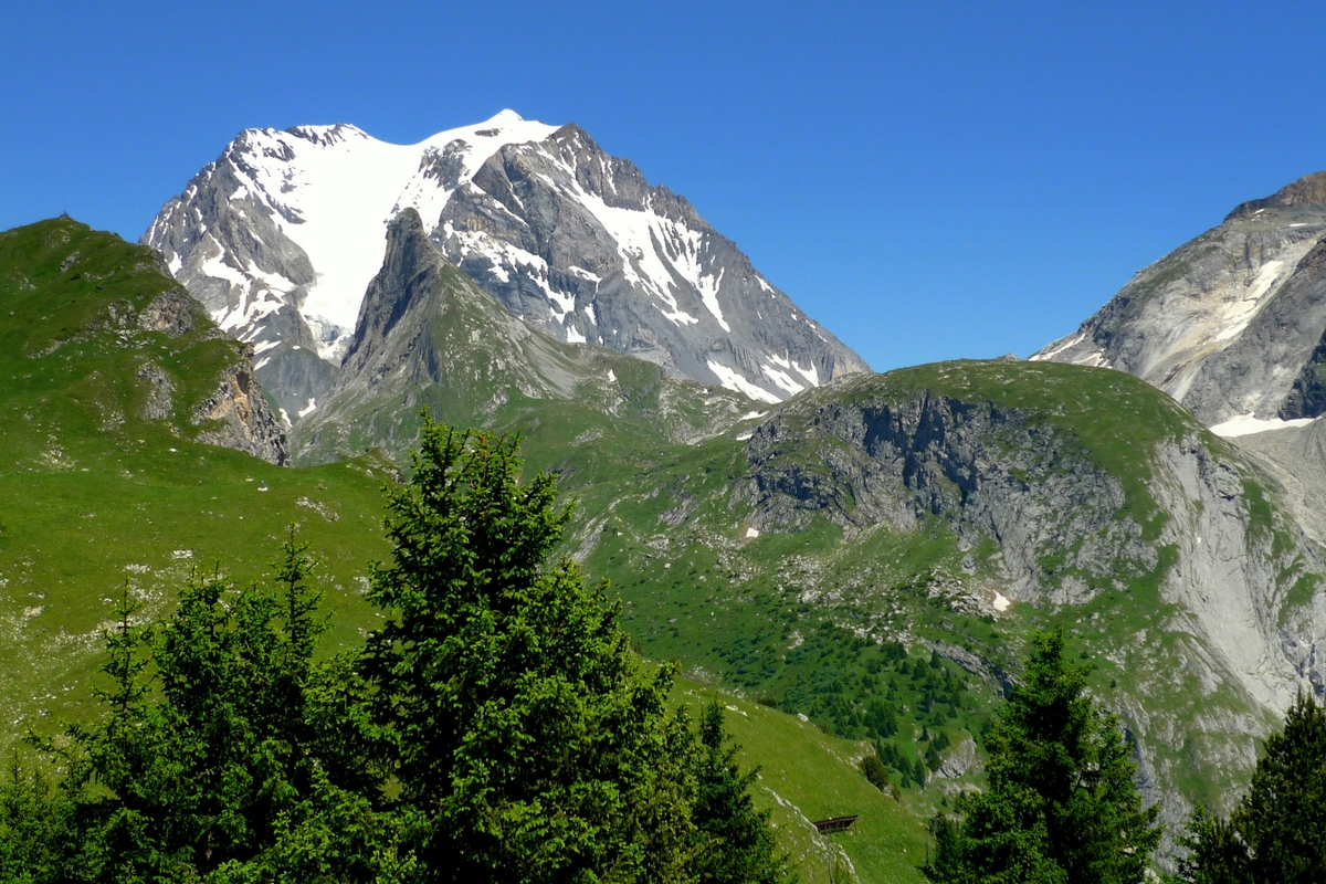
At the orientation table, you can see the three iconic summits of Pralognan: the Moriond, the Aiguille de la Vanoise and the Grande Casse. When walking in the Vanoise, you’ll often spot them in the distance…
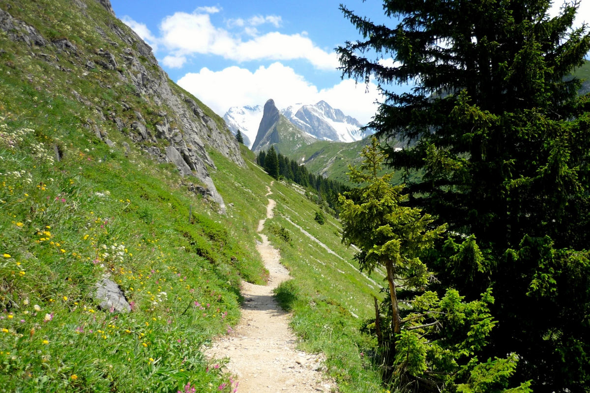
The walk to the Col de la Vanoise already follows a narrow track to the Baumettes Refuge (2,057m). In the Alps, this type of path is called “chemin en balcon” because it borders a very steep slope.
From the Baumettes to Lac des Vaches
At the chalet of Les Baumettes, the narrow path joins the main track from the village to the Col de la Vanoise, which, although steep at some points, is wider, so families with children can walk it, a reason for its success!

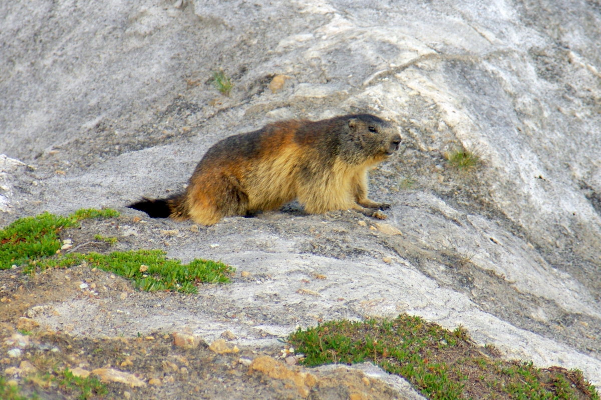
It crosses vast alpine landscapes interspaced by some beautiful waterfalls. This is where the marmots are the easiest to see.
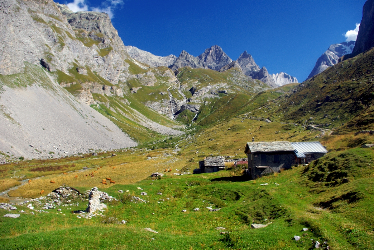
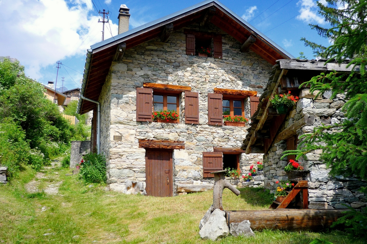
The old chalets that can be seen on the left side of the track used to serve as ‘bergeries’ (shepherd’s huts).
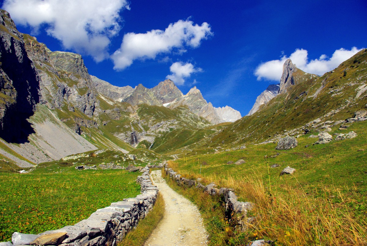
Walking in the Vanoise on this track is a great moment when you know that it used to be taken by thousands of travellers throughout the ages… especially by salt and Beaufort traders en route to Italy.
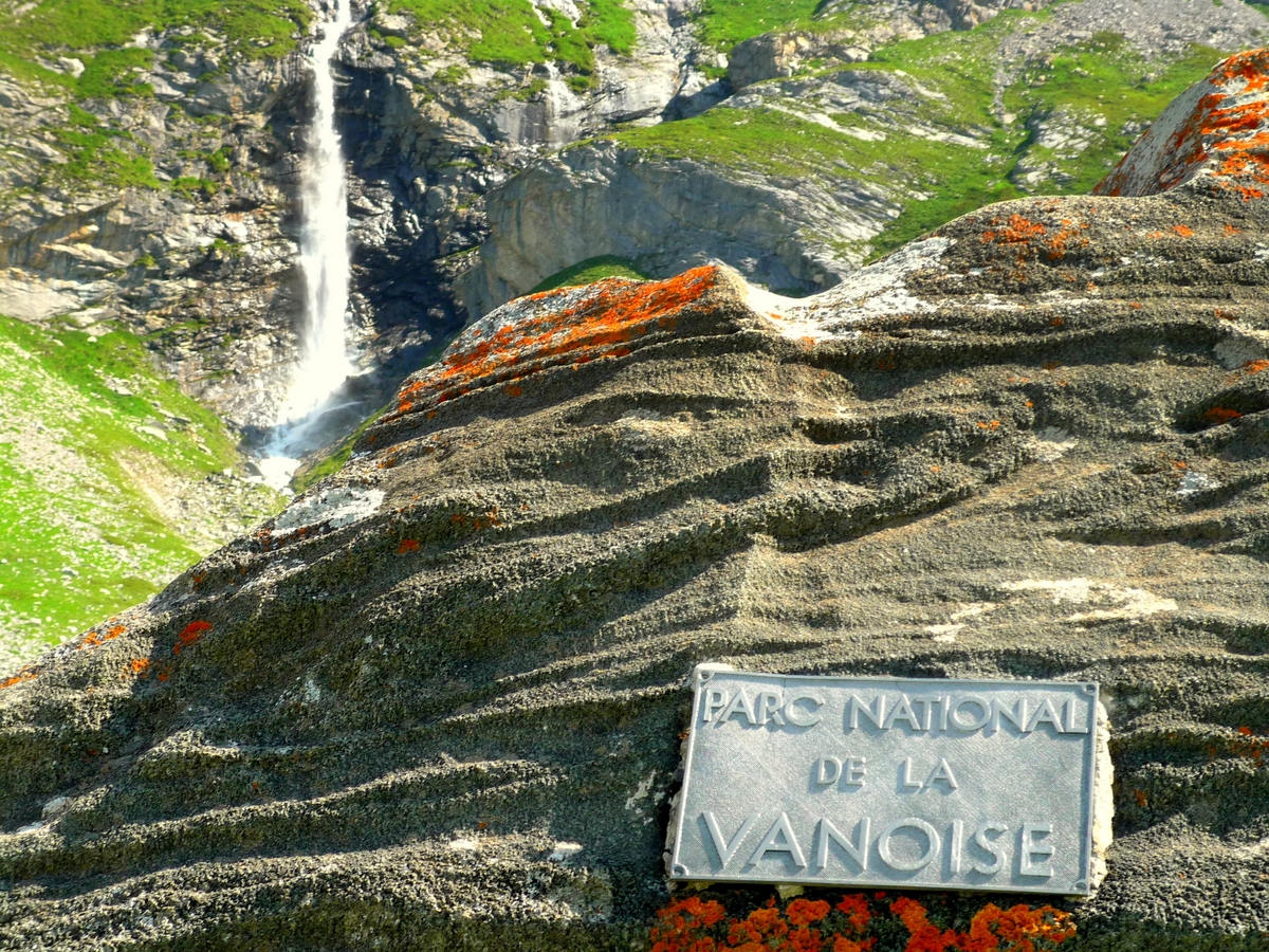
Near a beautiful waterfall, a time-worn plate indicates the entrance to the Vanoise National Park.
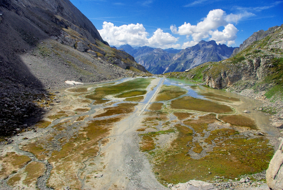
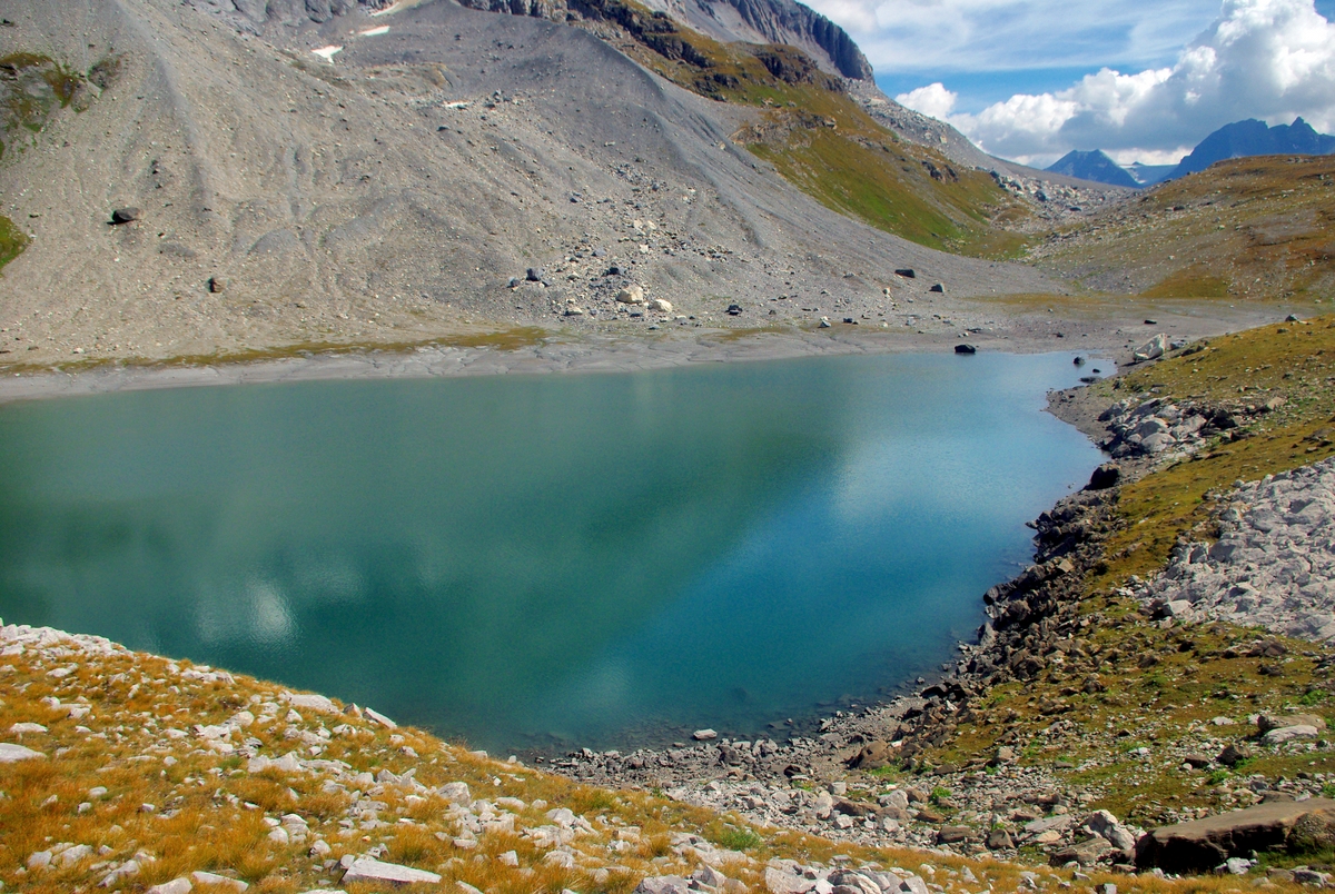
The Lac des Vaches is the boundary between the green grass and the rocky landscapes. The intimidating Grande Casse mountain (3,855m) looks nearer than ever.
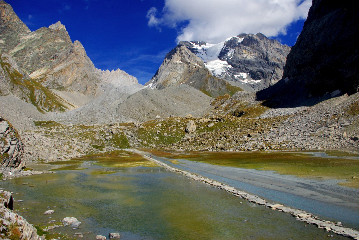
The Lac des Vaches is probably the most awkward lake in the Vanoise. The hiker has to cross a stone ford which in a hot summer can be almost dry if it hasn’t rained for several days. There are also the Tarine cows who lay down on the grass chewing their last supper whilst gazing at the passers-by.
From the Lac des Vaches to the pass
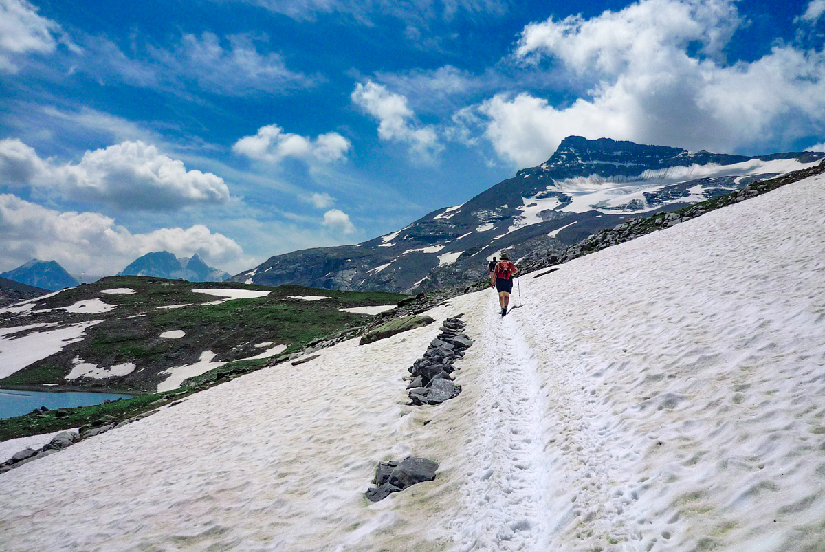
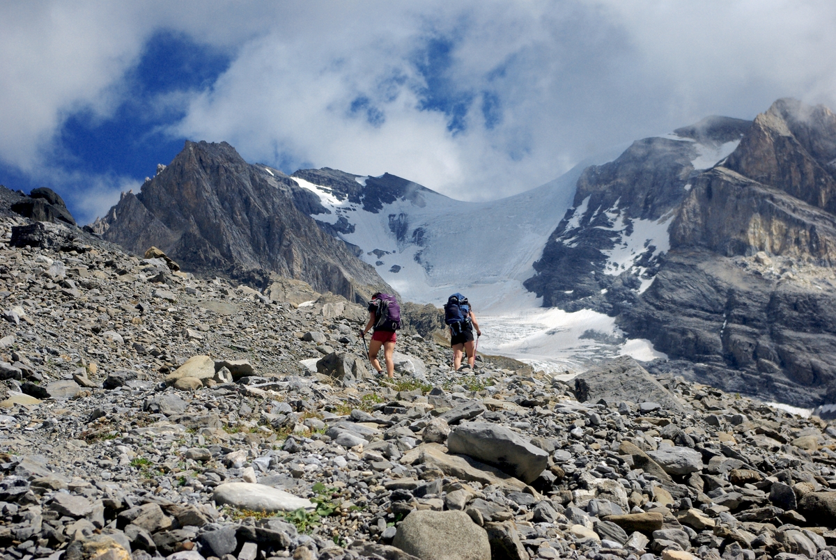
After the Lac des Vaches, the track continues with its last ascent in what could be a lunar setting.
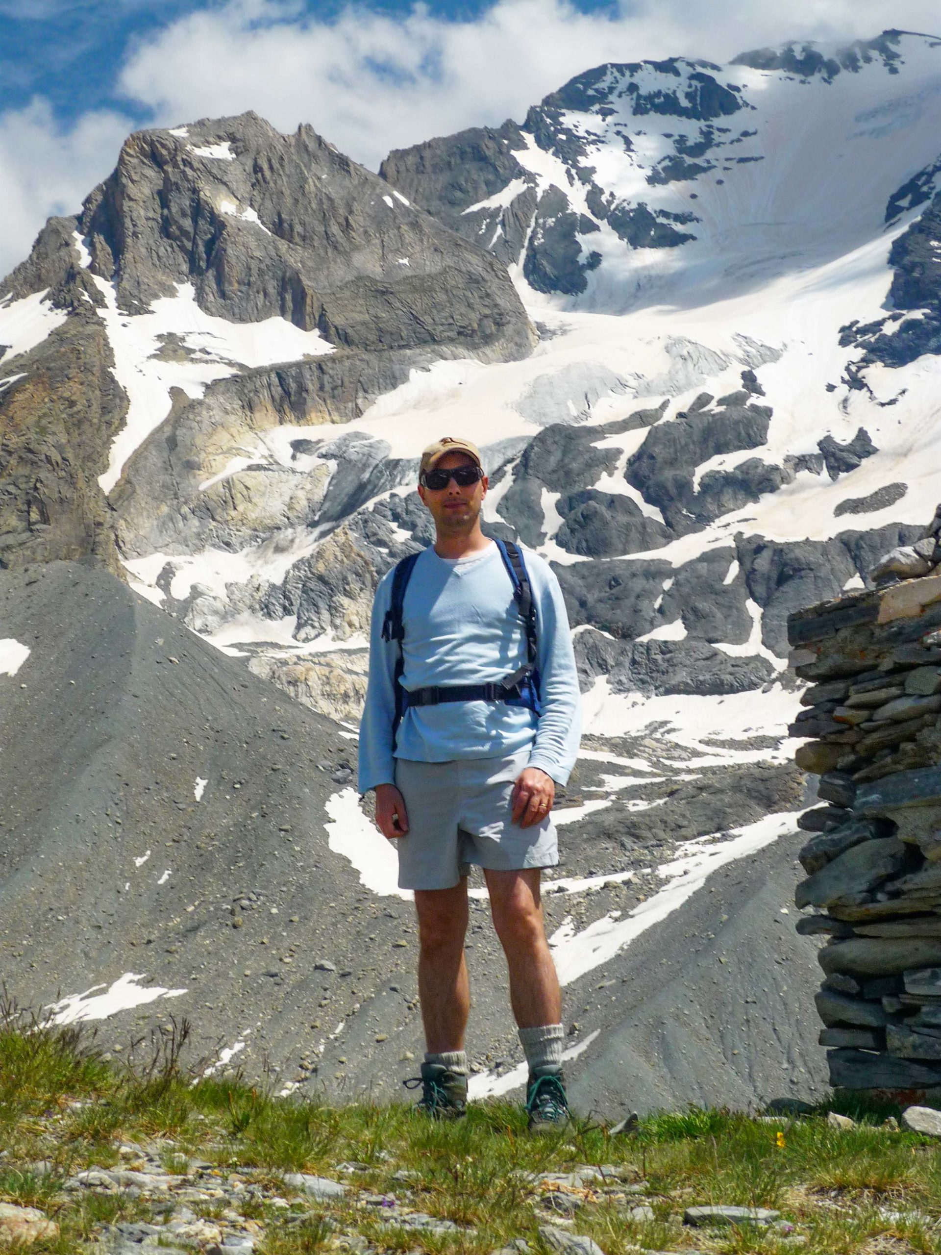
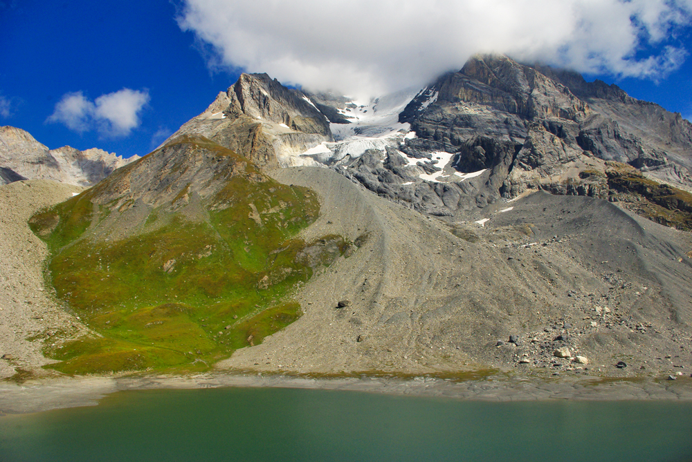
The last lake, the Lac Long, marks the approach of the Col de la Vanoise (2,517m) with a great view of the Aiguille de la Vanoise on the right.
The natural lake lies at the foot of the Grande Casse, the highest mountain in the département of Savoie.
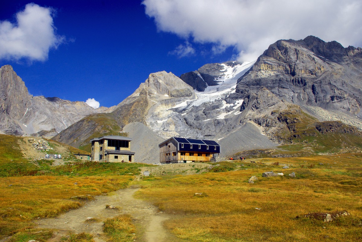
Arriving at the Col de la Vanoise
At the pass, a refuge for experienced hikers was built more than a century ago. It was named for a while after the French President Félix Faure, who had lunch there in 1897.
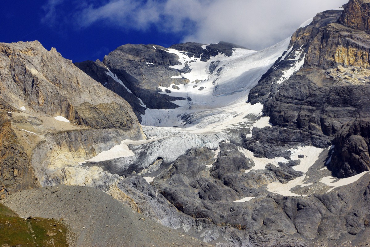
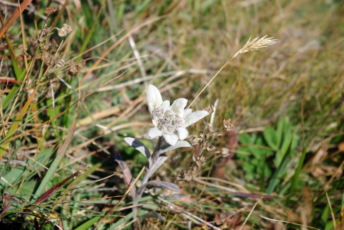
Impressive glaciers surround the pass. This could explain the presence of edelweiss (in French: étoile d’argent) in the meadow near the refuge. These flowers are visible from June-July. The ones I photographed were from early September.
The immediate surroundings of the pass are remarkable to visit and are at the very heart of the Vanoise National Park.
In fact, there are many mountain lakes with pure waters worth a visit: the Lac des Assiettes, the Lac Rond or the Lac du Col de la Vanoise. Marmots, ibex or chamois are easily visible, for this is their homeland.
The main hiking track of the old “Salt Route” continues towards Tignes with magnificent views of La Grande Motte (3,653 m), the Maurienne Valley and further on to Italy.
On the way back to Pralognan
On the way back, it is possible to take an alternative route that goes down to the left side of the Aiguille de la Vanoise. It reaches the hamlet of Les Fontanettes through the Cirque de l’Arcelin.
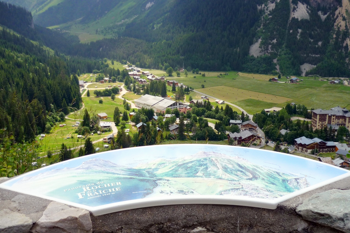
From Les Fontanettes, it is possible to go down to Pralognan-la-Vanoise via several paths. One of them passes by the remarkable waterfall locally known of “Cascade de la Fraîche”.

Nearby, at Rocher de la Fraîche is an orientation table. It gives an understanding of the site of Pralognan.
The walk ends with the crossing of the hamlet of Les Bieux. The centre of Pralognan is only 5 minutes away.
How to get to Pralognan-la-Vanoise
Pralognan-la-Vanoise is easily reached by car thanks to France’s excellent system of motorways and expressways.
From Paris, Lyon, Strasbourg or Marseille, all the roads lead to Albertville, where the dual carriage-way to Moutiers brings you closer to the village. From Moutiers, it will take you only 30-45 minutes to reach the village at an altitude of 1,400 metres.
If you travel from overseas, take a flight to Lyon or the Swiss airport of Zurich or Geneva, and rent a car from there! Geneva is actually one of the closest airports to the Savoie region.
If you wish to visit this village from Paris on a 4-5 nights stay, take a TGV train to Moutiers and a coach from the little town’s station (www.altibus.com) that will take you directly to the resort.
Walking in the Vanoise: more info!
- The Vanoise National Park on the blog
- The village of Pralognan on the blog
- The Tourist Board of Pralognan-la-Vanoise
- Find your accommodation in the Vanoise massif with our partner
- The Vanoise National Park website [in French only]
Have you been to the Vanoise? If so, share with us the highlights of your visit by commenting below!
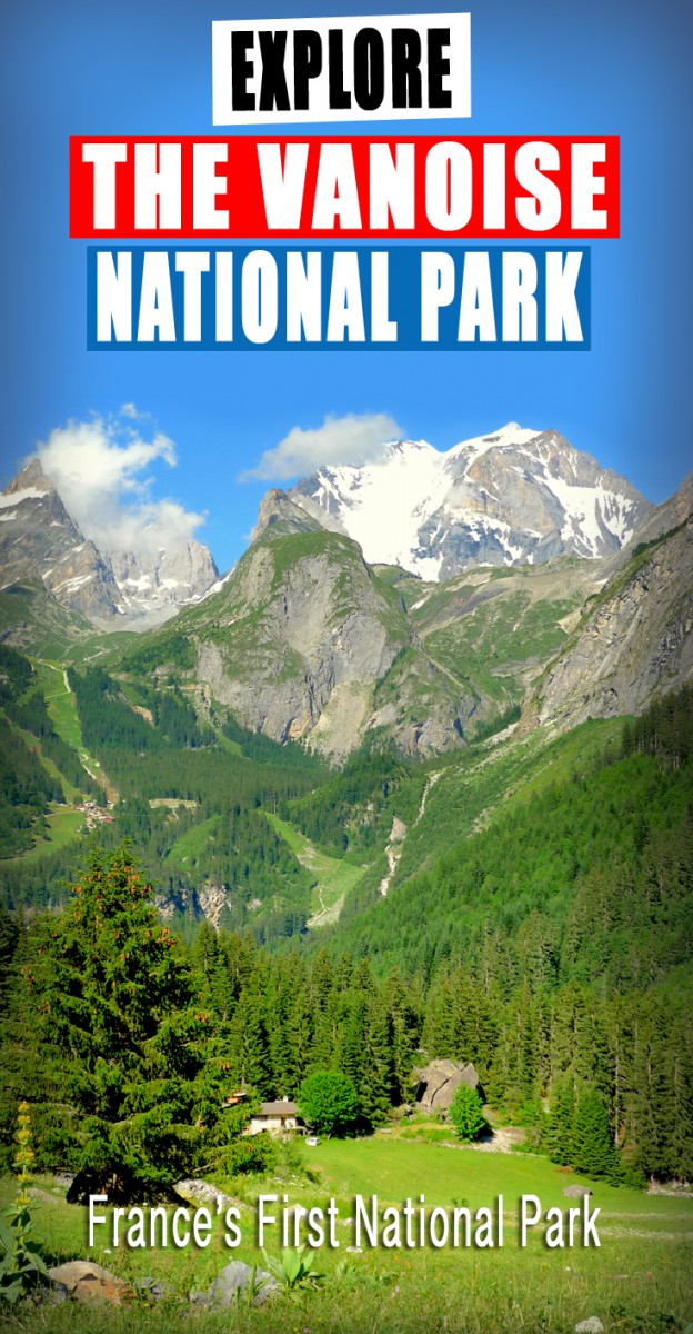
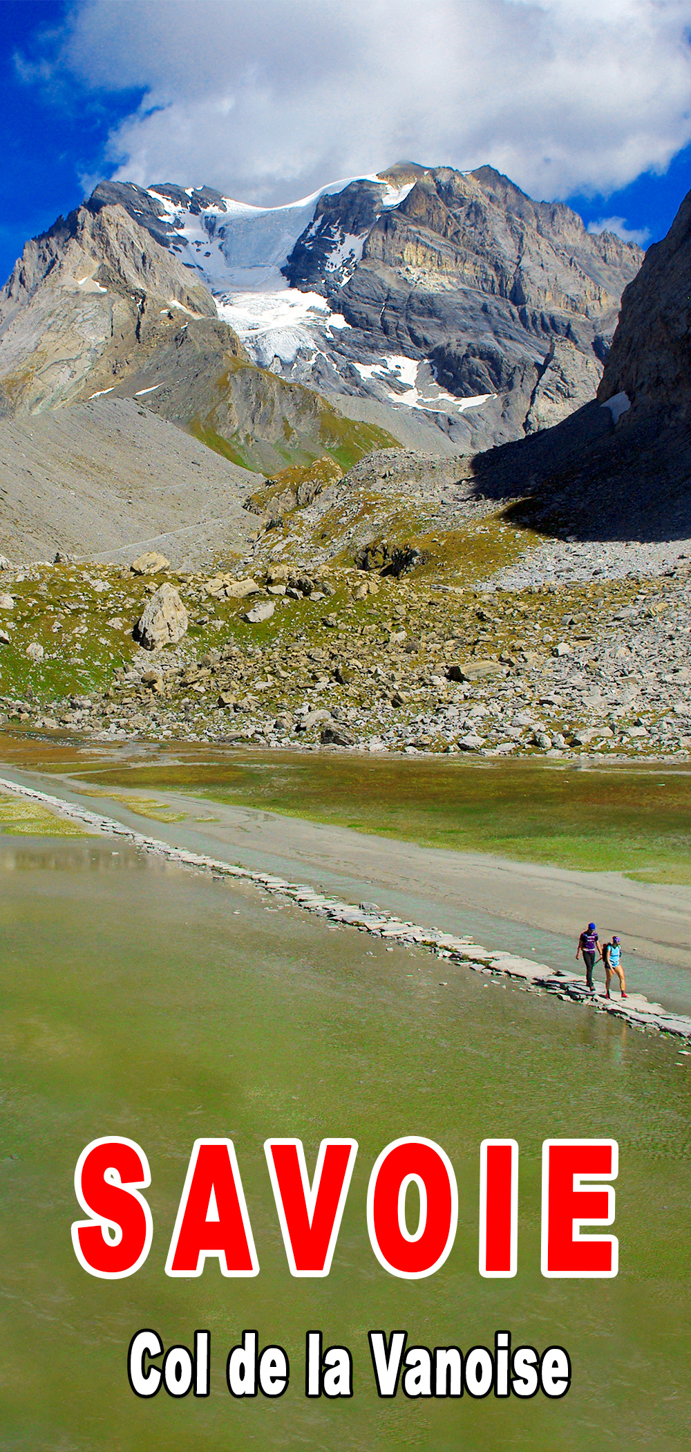
Pin it for later!
Did you like reading about walking in the Vanoise? If so, share this article on Facebook or Twitter, and pin it on Pinterest: