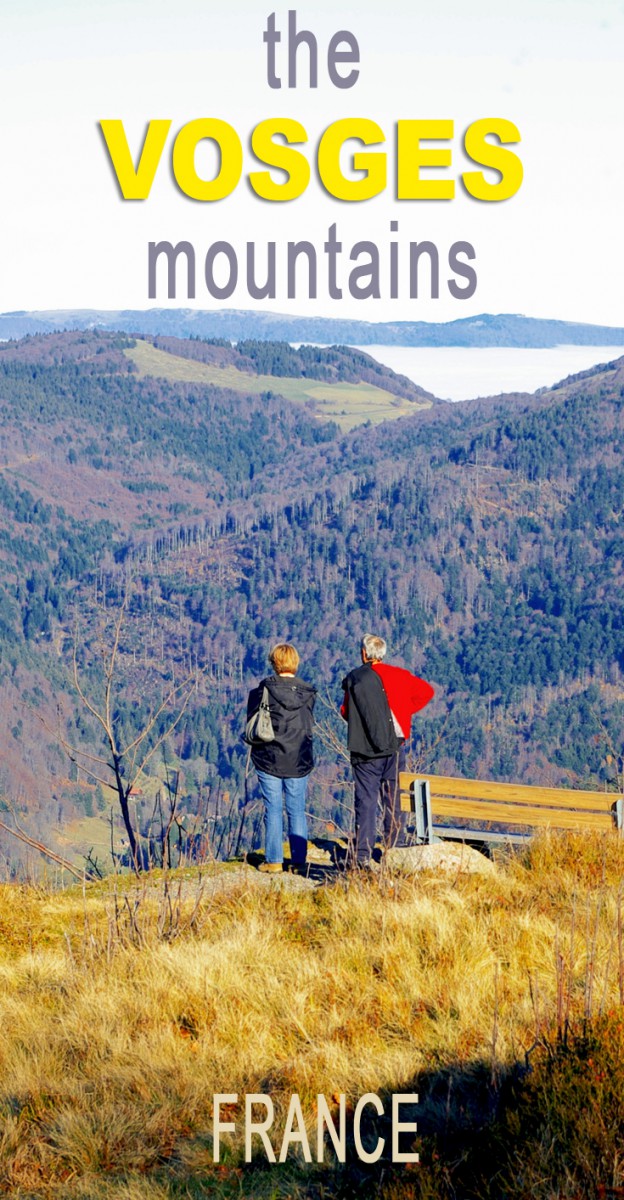
Unlike the Alps and the Pyrenees, the Vosges mountains are synonymous with softness thanks to the rounded shape of their peaks, the “ballons” (rounded summits).
The immense forest covers 60% of the mountain range’s surface area and features mostly conifers (firs, pines, spruces) and beech.
Yet this mountainous mass still offers a variety of landscapes, including glacial lakes, wet and high-altitude meadows, deep valleys, waterfalls, cliffs and rocks.
Description of the Vosges mountains
The expression “the blue line of the Vosges” is attributed to Jules Ferry (late 19th century) in the context of the post-war period of 1870, when it served as a reminder to the French that, on the other side of the mountains, Alsace was under German power.
Since then, this romantic name has evoked images of the Vosges Mountains with their rounded summits, pine forests, blueberry-covered meadows, and its Munster cheese.

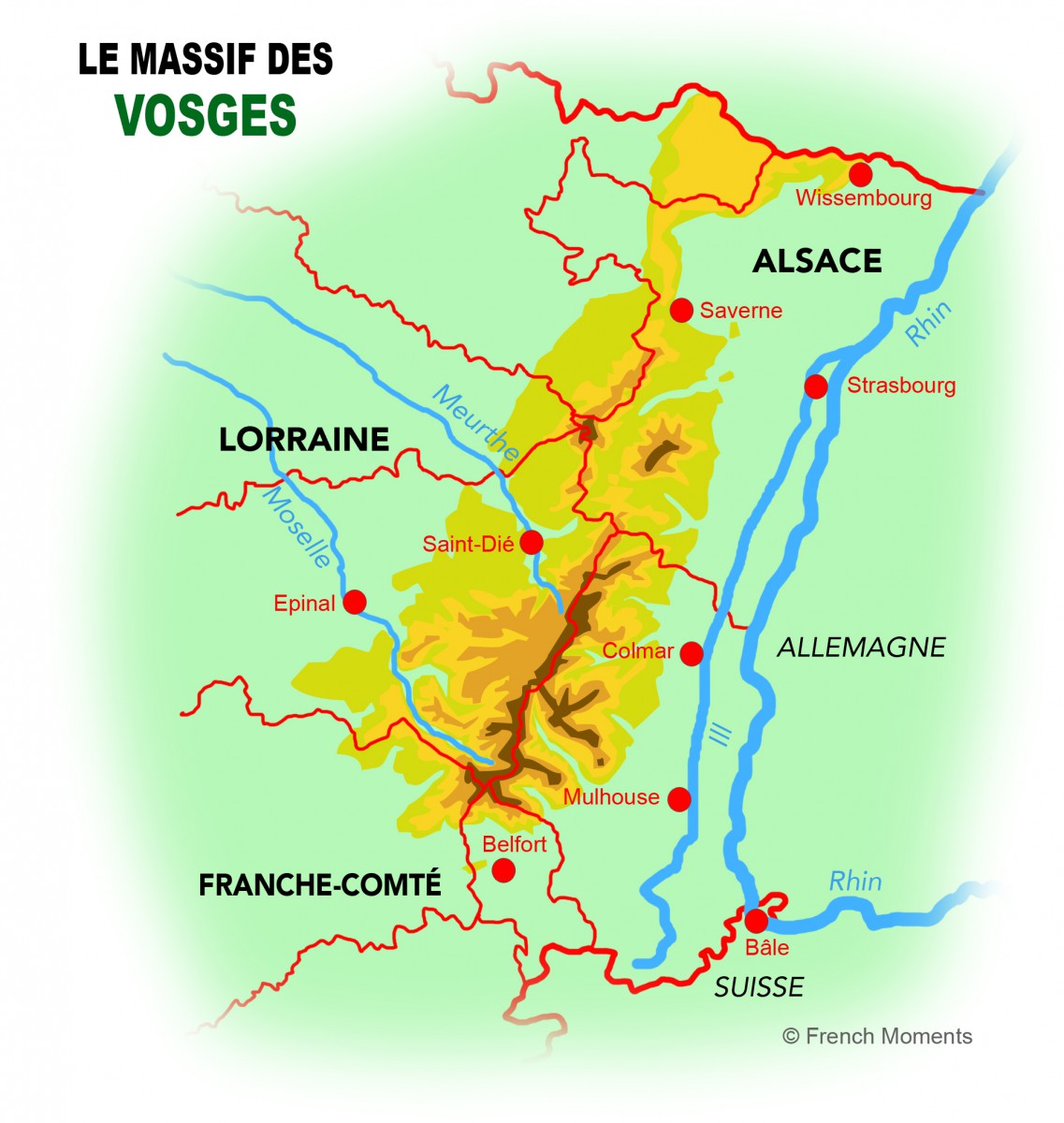
From Wissembourg to Belfort
The range of the Vosges Mountains extends across 180km from the German border near Wissembourg in the north to Belfort in the south.
The mountain range is shared by three historic regions: Alsace to the east, Lorraine to the west, and Franche-Comté to the south.
The crest line was a real linguistic and cultural barrier between Alsace and Lorraine.
As such, the term “Alsace-Lorraine” refers not to a homogeneous region, but rather the contrary; it was used to describe the geographic entity corresponding to the annexation of Alsace and of the Lorraine département of Moselle by Prussia.
The rest of the French territory is still known in Alsace by the name of “inner France” (la France intérieure) or “beyond the Vosges”.
There are two large geological formations that are easily distinguishable from each other and which are protected by the creation of two regional nature parks: the Northern Vosges and the Higher Vosges.
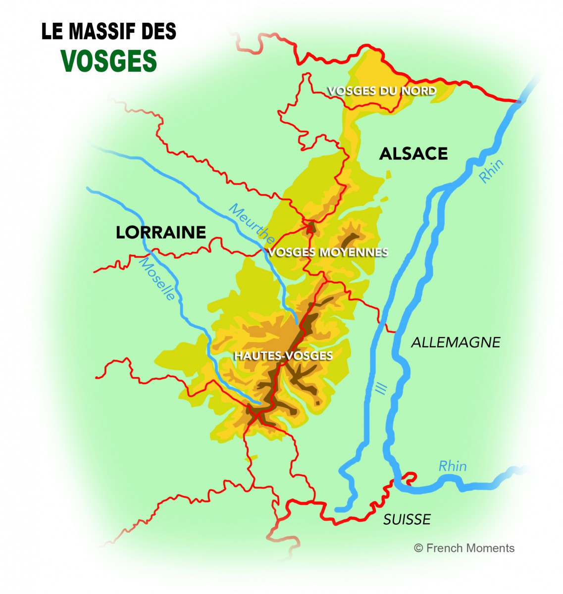
The Northern Vosges (Vosges du Nord)
The Northern Vosges, known as “Vosges gréseuses” (the sandstone Vosges), begin in the north of Donon and are made up mostly of red sandstone.
They extend beyond the Franco-German border and into the nature park of the German Palatinate (Naturpark Pfälzerwald).
The two parks were given the prestigious title of International Biosphere Reserve by UNESCO in 1991, a title which is only shared by some 320 sites worldwide.
The Higher Vosges (Hautes-Vosges)
The Higher Vosges, known as “the cristallines Vosges” (in reference to the granite cover of the mountains), feature the mountain range’s highest peaks, which often mark the border between Lorraine and Alsace.
Of these peaks, the Grand Ballon (1,424 metres) is the culminating point of the Vosges.
Other major summits include:
- the Hohneck (1,363m),
- the Ballon d’Alsace (1,247m),
- the Ventron (1,204m),
- the Drumont (1,200m),
- the Champ du Feu (1,099m),
- and the Donon (1,009m).
Much of this geological formation lies within the Ballons des Vosges Regional Nature Park, which was created in 1989.
The unique climate of the Vosges
The climate of the Vosges mountains is semi-continental, dry and hot in the summer, and often cold and snowy in the winter.
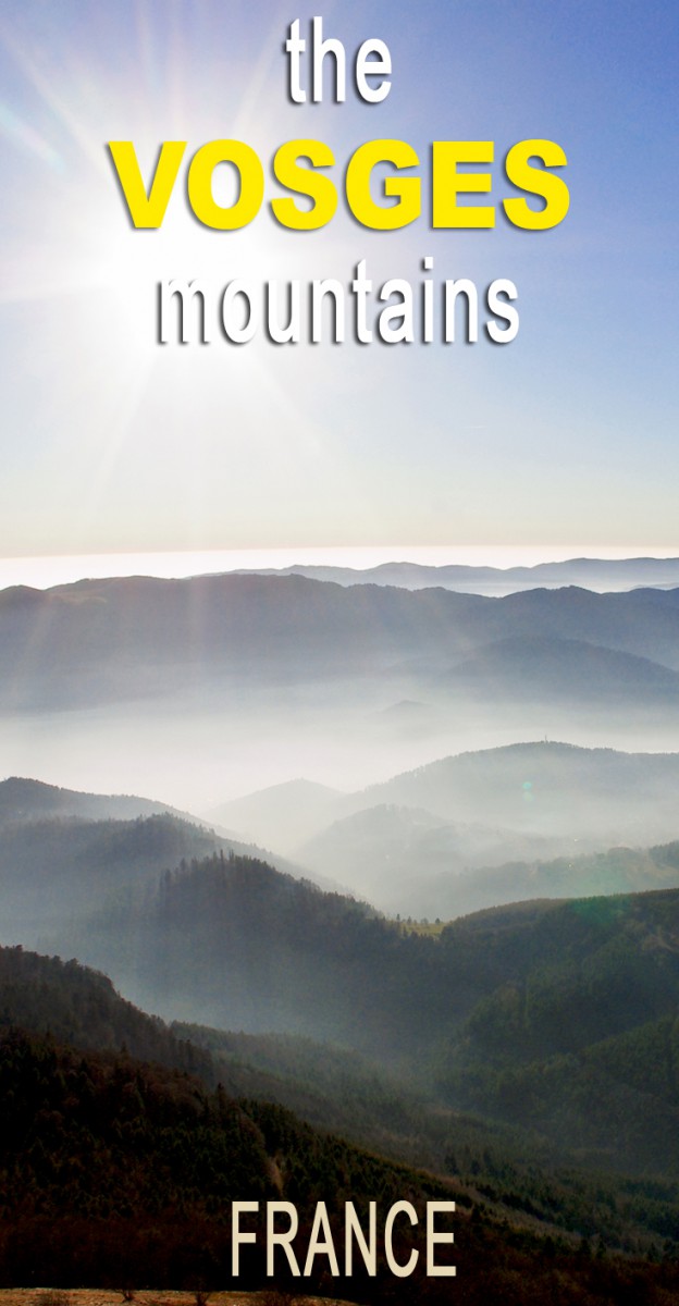
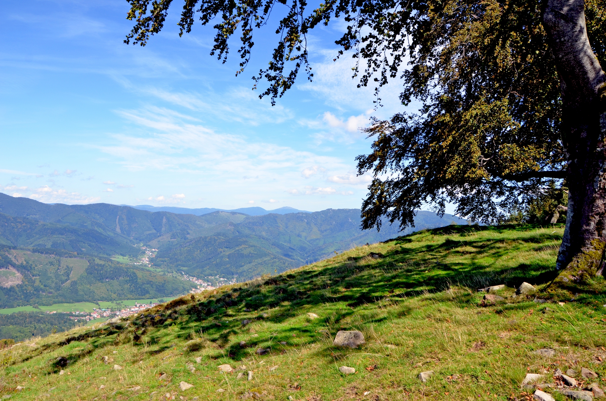
The magic moment comes when the fog sweeps through the valley below, and the Rhine Plain and its heights are covered in a thick blanket of clouds, while the clear view continues all the way to the Black Forest in Germany, the Jura in Switzerland and from the Tyrolean Alps to Mont-Blanc.
The Vosges act as a natural barrier against the oceanic disturbances coming from the west. The winters are cold and the summers cool (an average of 11°C compared to 20°C in the Alsace Plain).
The crest experiences significant rainfall, with sometimes more than 2 metres of rain per year.
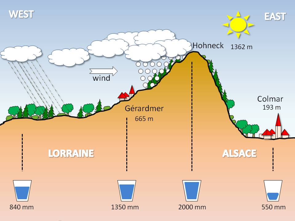
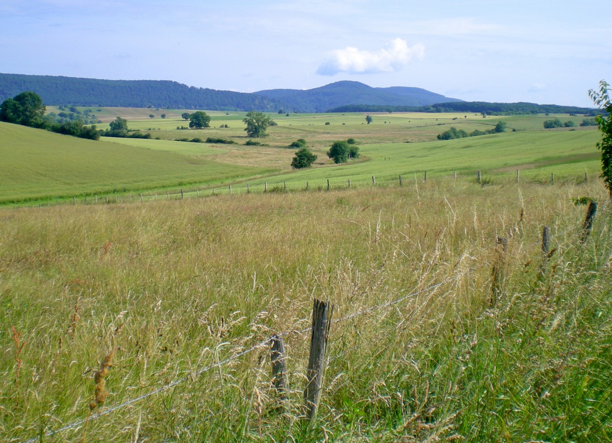
The uniqueness of the Vosges mountains lies in the slope of its two sides: it is steep on the Alsatian side and falls gently from the Lorraine and Franche-Comté side to merge with the Paris Basin.
This can be best described as the Foehn effect and explains a lot about the microclimate, which is favourable for the towns located along the Alsace Wine Route and especially the region surrounding Colmar.
The Higher Vosges also act as an obstacle to the bad Atlantic weather that crosses through France, as clouds and rain collide with the mountains and protect Colmar from precipitation.
The Fauna and Flora of the Vosges
The Vosges fauna
The mountains are home to a variety of fauna, including deer, roe, wild boars, badgers, foxes, marten, stoats and chamois.
Wild cats (lynx) have haunted the forests since the end of the 20th century, but they are very hard to spot, and a beaver colony has been established in the Doller Valley for almost thirty years.
The capercaillie (or great grouse) became an emblematic figure of the Vosges mountain range, and several birds of prey glide across the Vosges sky, along with 130 other species of bird.
As for the legendary bears, they have been extinct since 1760 when the last animal was killed over the Munster Valley.
The Vosges flora
While blueberry and daffodil are considered to be the symbols of the Vosges’ vegetation, we must not forget the many other flowering plant species on the sides of the ballons.
The digitalis and arnica are also worth a mention, as are martagon lilies and orchids, lichens and fungi.
The alpine flora is magnificent on the crests of the Vosges, where the temperatures are harsh.
Along with the arnica, Alpine anemone, yellow gentians, and martagon lilies stain the heights with splashes of vibrant colours.
The Hautes-Chaumes of the Vosges
The Hautes-Chaumes (high pastures where cows graze in summer) appear above 1,000 metres and cover approximately 4,500 hectares along the crests of the Vosges.
The extreme climate conditions are due to the natural history of the Vosges mountains as well as thousands of years of human and pastoral occupation, which have given rise to a series of low moors which accommodate blueberries, Calluna, alpine pasqueflower, arnica, scraggly trees, red fescue grass, Alpine fennel and pastures that crown the summits.
These pastures are the result of a succession of clearings of beech groves or more or fewer woody heaths by the monks who colonised the valleys during the 7th and 8th centuries.
Human occupation of the Vosges
The Vosges mountains lie at the natural border between the Germanic and Latin language worlds and have shared in the history of both Alsace and Lorraine.
It comes as no surprise then that they have known an eventful past, as confirmed by the multitude of fortified medieval castles in ruin or the remains of trenches of the First World War.
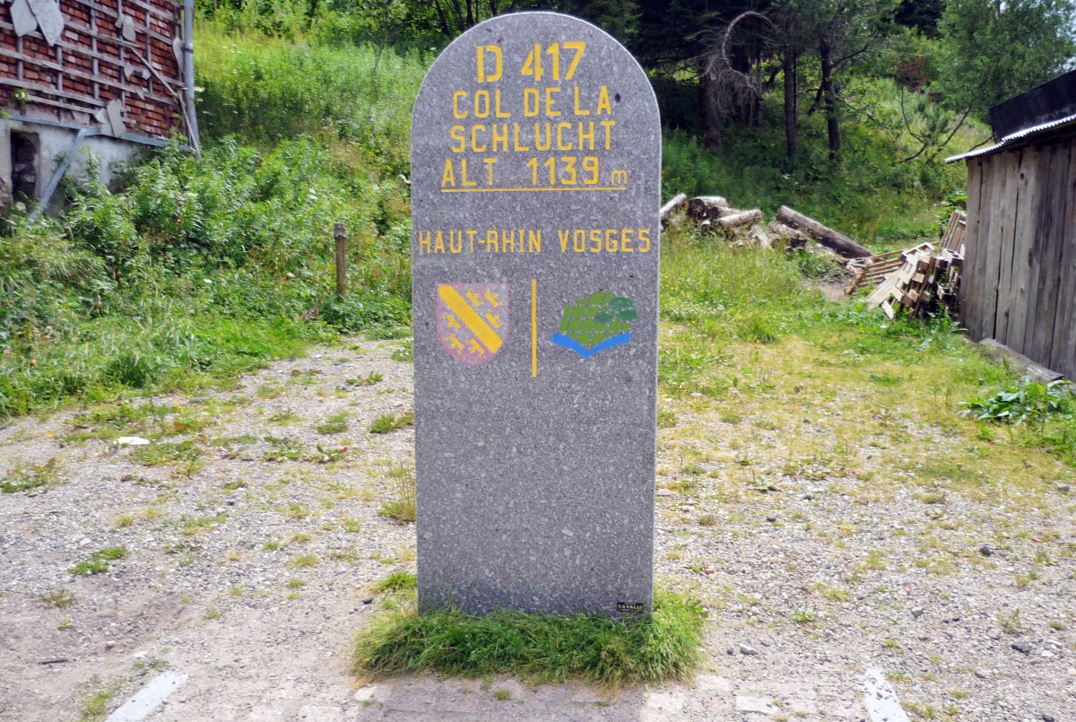
The mountain passes of the Vosges have always been the link for communication between the Latin and Germanic worlds, the most significant among them being: Col de Bussang (727m), Col de la Schlucht (1135 m), Col du Bonhomme (949 m) and Col de Saverne (410 m), which link the Alsatian cities of Mulhouse, Colmar and Strasbourg, and the Swiss town of Basle to Paris and the cities of Nancy and Metz in Lorraine.
The Vosges: two different cultures
The Vosges mountains are indeed a land of contrast, and this becomes apparent when you cross the Col de Bussang from the Thur Valley in Alsace to reach the Moselle Valley in Lorraine.
The architecture of the houses between the two places is radically different, as is the dialect.
Legends continue to haunt isolated natural sites (isolated rocks, glacial lakes, localities…) on both the Lorraine and Alsatian sides.
Traditions and customs still live on, such as the celebrations of the Bonfires of Saint John at the end of June, which are of Celtic origin.
Religious heritage found in the Vosges
The newfound prosperity following the end of the barbarian invasions favoured the rise of Christianity.
The abbeys (by monk master-builders) contributed to the exploitation of the mountain chain, as did the clearing of valleys, especially those of Doller, Thur, Moselle and Bruche.
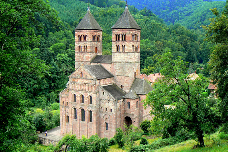
Large monastic communities, such as Luxeuil-les-Bains, Munster, Remiremont, Pairis and Mont-Saint-Odile were founded here.
Murbach Abbey, near Guebwiller, governed vast territories in Alsace and the church ruins are a masterpiece of Romanesque art in the Vosges.
Religious heritage is still present in the Vosges mountains; you can find witnesses of it all along the roads where you can see evidence of stone evoking an intense Christian fervour (crosses, Calvary landmarks, remote chapels), while in the small towns the churches were built to conform with the architectural trend of their time.
For instance Romanesque art in Marmoutier Abbey, gothic art in the Saint-Thiébaut church in Thann, and baroque art in Moyenmoutier.
In 1955, Famous Swiss-French architect Le Corbusier completed a chapel with lines equally modest and bold, on an ancient site of the Ronchamp pilgrimage in Franche-Comté.
Human activities in the Vosges
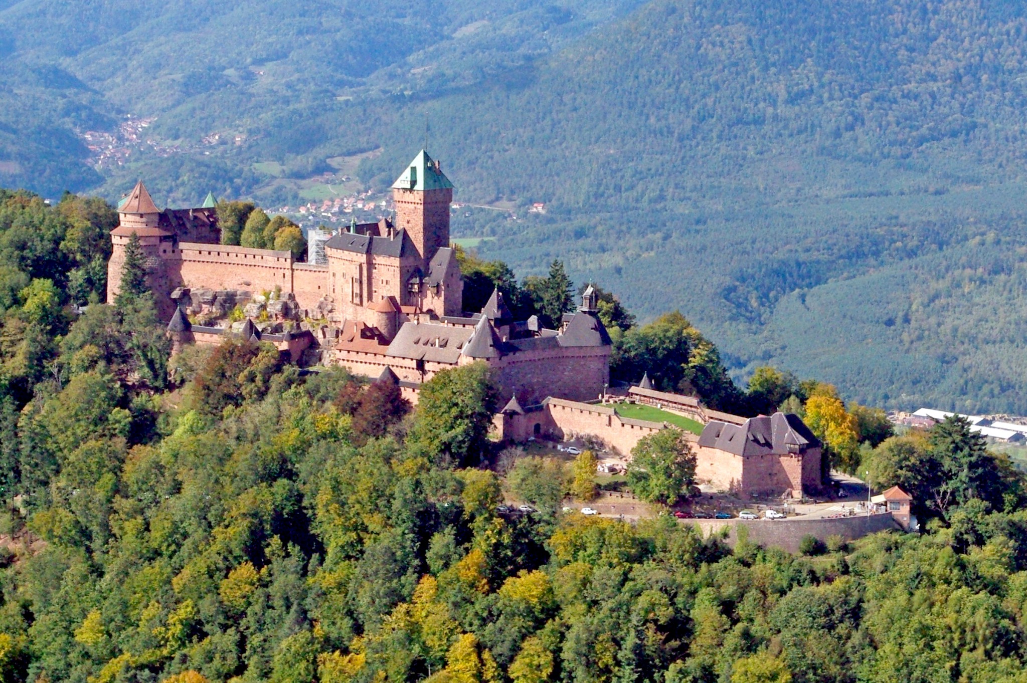
During the Middle Ages, several fortified castles were built on strategic sites of main commercial and military roads.
Many of these castles stand nestled at the foothills of the Vosges, along what is now the Alsace Wine Route, like those of Haut-Kœnigsbourg, Kaysersberg and Thann.
The Vosges mountains are exploited for their wood, and breeding has long been practised here, thanks to the clearing of the summits by the monks.
The cows of the Vosges (les Vosgiennes) are a reputable breed that can still be seen grazing freely in the Hautes-Chaumes.
Mining extraction and forging were then developed in the region from the 15th century (iron and copper mines in the Bruche Valley and Doller Valley, silver mines in the Lièpvrette Valley).
The valleys of the Vosges enjoyed prosperity from the 18th century onwards, thanks to the textile industry.
Competition with foreign labour throughout the 20th century led to their closures, one by one, forcing the people of the Vosges to look to other financial resources such as ecotourism.
The craft industry of the Vosges
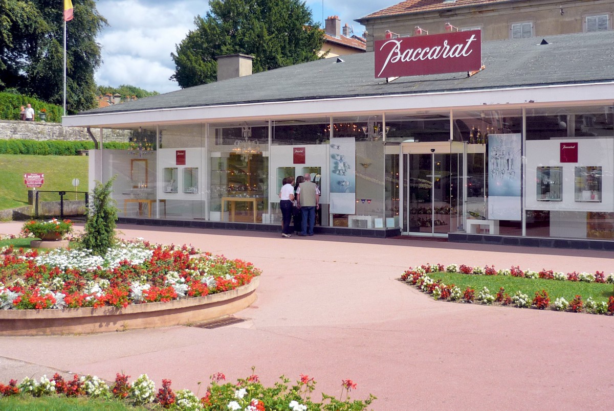
While many English-speakers may not be familiar with the Vosges mountains, the same certainly cannot be said for some of the names and brands that come from the region.
In fact, it is difficult to talk about the Vosges without mentioning the mineral waters (Contrexéville and Vittel), the Épinal prints, the Mirecourt stringed instrument making, as well as the luminous purity and unrivalled finesse of Baccarat crystal.
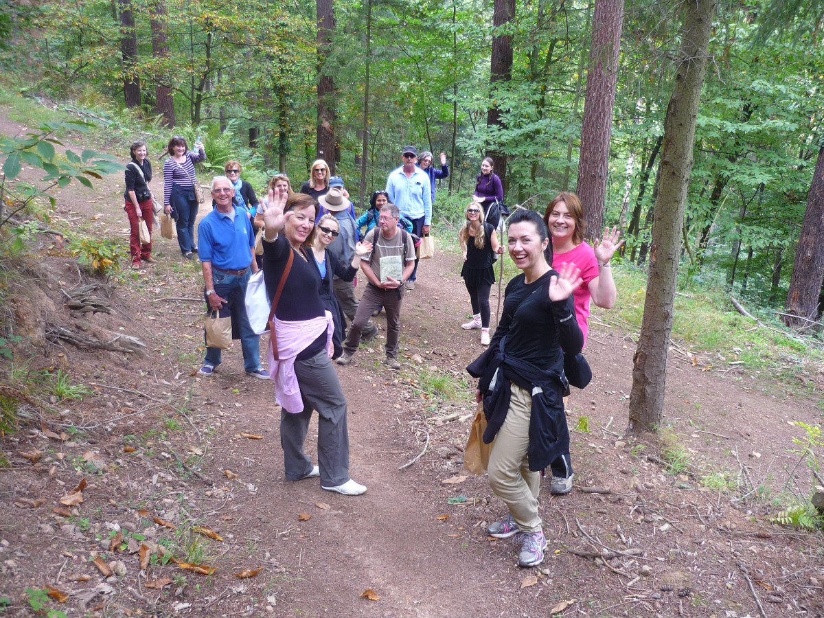
The Club Vosgien and hiking in the Vosges
The Club Vosgien (Vogesenclub) was created in 1872 in Saverne by Richard Stieve.
This genuine local institution is the oldest hikers’ association in France.
It was designed to encourage hikers in the mountain range through the meticulous marking of trails. Several thousands of kilometres of marked trails were thus created and maintained, some of which – the G.R. (Grandes Randonnées) allow visitors to travel across the entire mountain range on foot from Wissembourg in the north to Belfort in the south, over nearly 300 kilometres.
In December 2009, the Federation of the Vosges Club counted an assembly of 113 different associations, which boasts 34,000 members and maintains and signposts 20,000 km of tracks.
You can still see the marks of history along some tracks, such as the border markers that used to mark the boundary between France and the German Empire from 1871 to 1918.
Smugglers of tobacco, alcohol and matches learned to know the mountain by heart and did not need signposts to figure out where they were!
The peaceful side of the Vosges did not hide the fact that the peoples, especially France and Germany, were fighting against each other in numerous combats.
The ruined castles that can be seen are proof of this, as are the battlefields of Hartmannswillerkopf (Vieil-Armand), the Belfort fortifications, and the famous “Maginot Line” in the northern Vosges.
When you are hiking in the Vosges mountains, handheld GPS units can become very handy and decrease the chances of getting lost. Globosurfer.com will give you a comprehensive guide on how to choose a hiking GPS.
The Fermes-Auberges and the local gastronomy
When you’re tired and worn out from walking to the top of the Vosges mountains, an authentic traditional farm meal in one of the many farmhouses in the Vosges is just what you need.
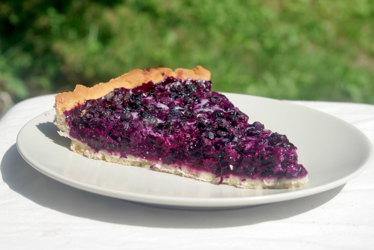
This “marcaire” meal is typical in the Vosges and features pie as a first course and roïgabrageldi (potatoes with smoked pork shoulder) as a main.
This is of course followed by Munster cheese and a delicious blueberry tart (in summer).
The farm inns of the Vosges house people, animals and crops under the same roof.
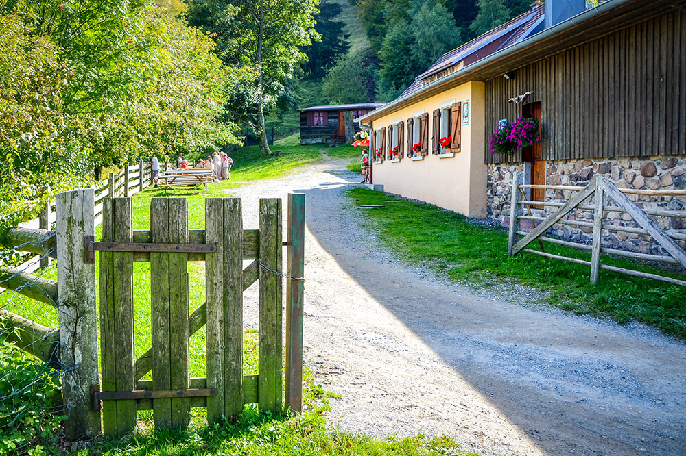
They are partly buried and are built from granite balls found in the fields and topped with a wooden roof.
The most exposed façade is protected by cladding made of small wooden boards laid out in a fish scale pattern, known as the “essis”, while the hay in the attic guards against the cold.
The peculiar, potbelly bread ovens can often be seen on and around these isolated and established farms.
Learn more about the farm inns of the Vosges on the blog here…
Our favourite itineraries through the Vosges
You only have a few days to spend in the Vosges mountains? Here are some sights that we recommend:
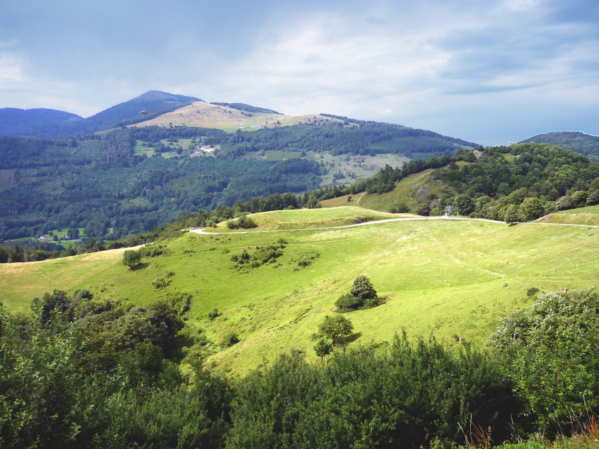
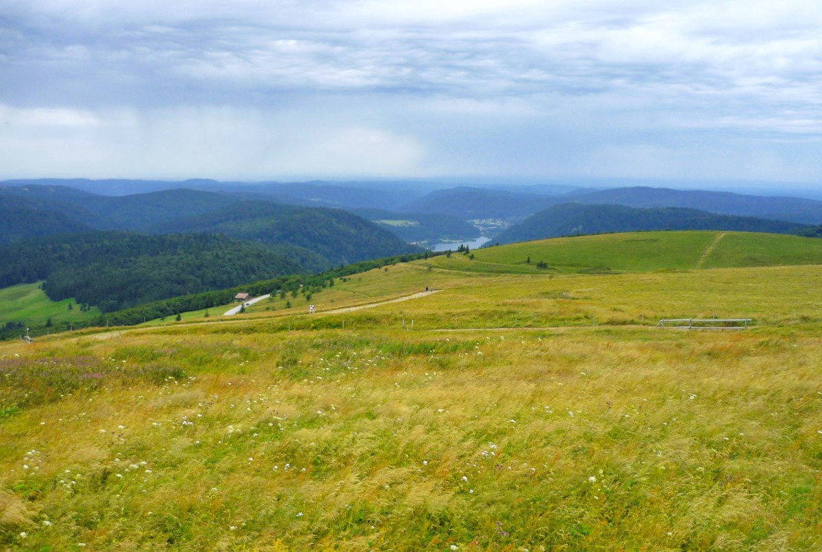
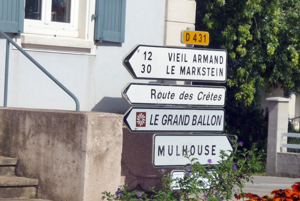
The Route des Crêtes des Vosges
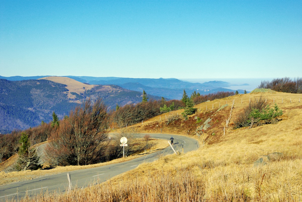
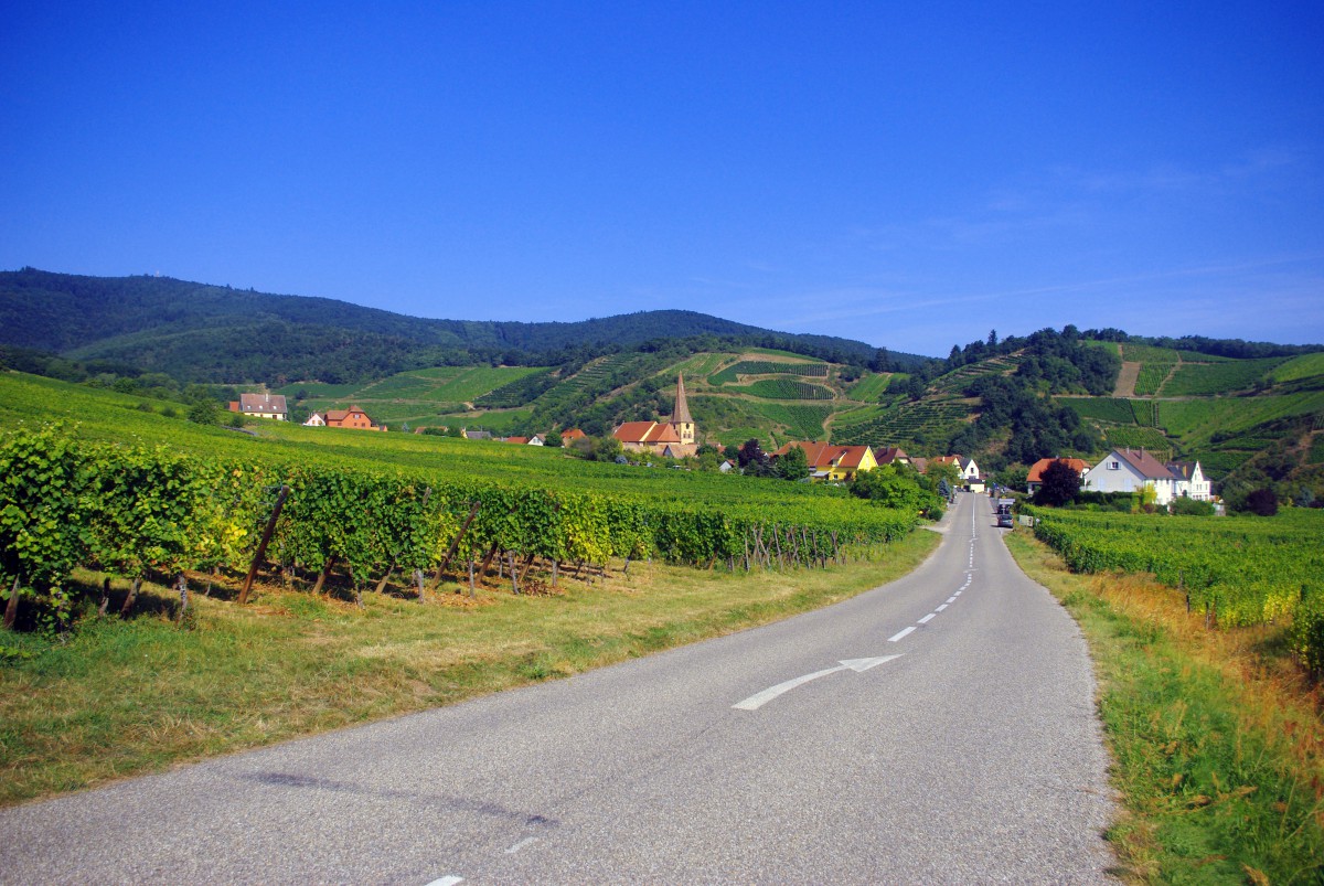
Sublime countryside, panoramic views extending to the distant Alps and riding on the hills, the Route des Crêtes in the Vosges, much like the Route des Vins d’Alsace (the Alsace Wine Route), is a reputed and highly frequented tourist itinerary during the summer period.
The road follows a ridgeline route of 80km, linking the town of Thann to the Col du Bonhomme.
The length of the road enters Lorraine at times, and Alsace at others.
Symbolically, the Route des Crêtes marks the border between Lorraine and Alsace, between the Romance and Germanic language worlds.
At each mountainside, the road travels along a bucolic countryside, opening up views of mountain passes, rounded summits, lakes, rocks, pastures, and forests of majestic pines.
Read more about the Route des Crêtes in the blog.
The Route des Vins d’Alsace
The Alsace Wine Route is 170 kilometres long and was inaugurated in 1953.
It winds through the Alsatian vineyards from north to south and is undoubtedly France’s most beautiful tourist route, featuring charming villages and countryside, which are characteristic of the foothills of the Vosges (Le Piedmont des Vosges).
What’s more, a visit to the wine cellars will allow you to taste the various vintages of Alsace wine and possibly make your own.
Read more about the Alsace Wine Route.
The Route Joffre from Thann to Masevaux
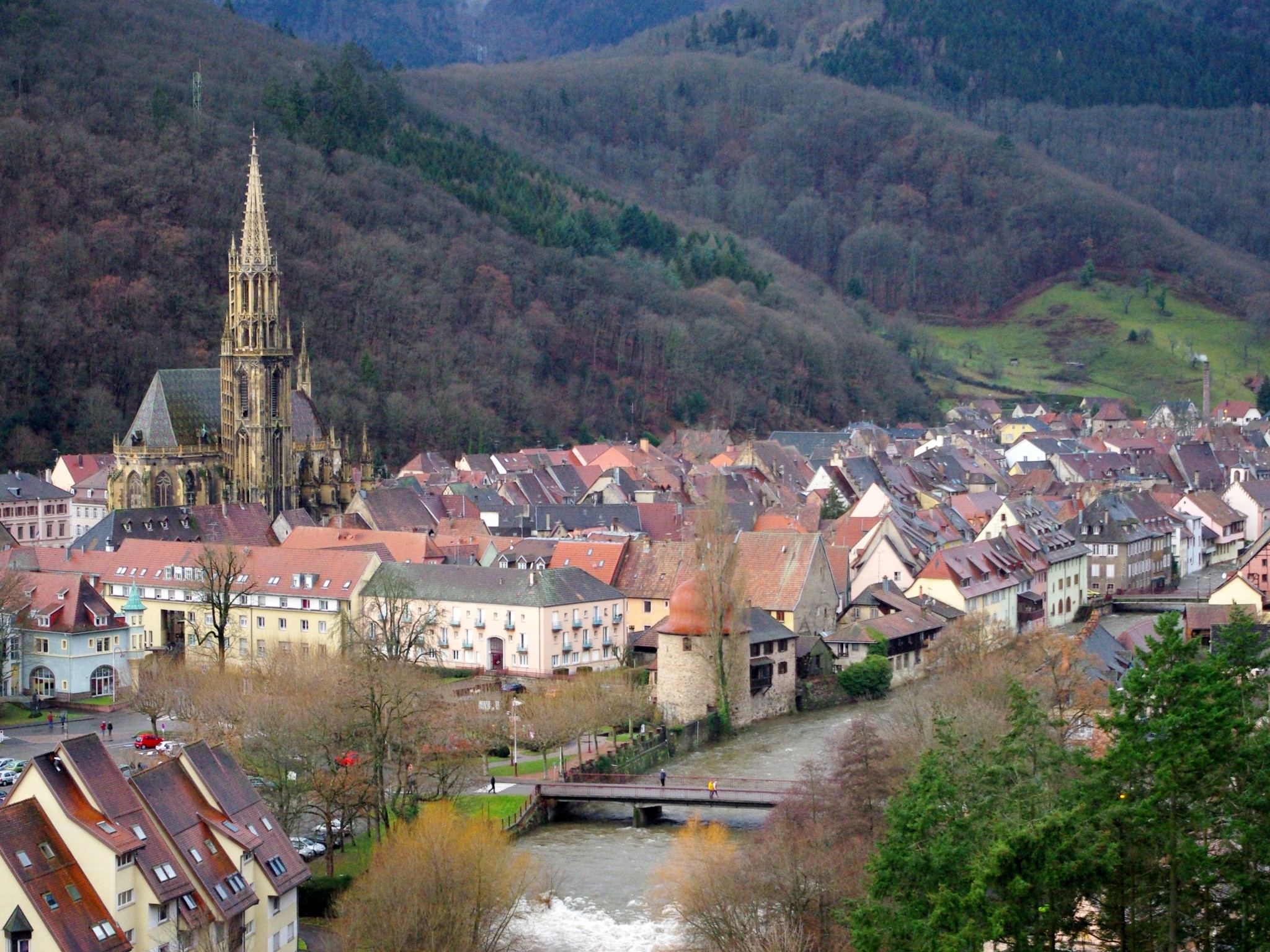
Thann is the southern gateway to the Alsace Wine Route and owes its fame to the Rangen vineyard and the elegant silhouette of the Gothic Saint-Thiébaut church.
The stunning view from the ruins of the Engelbourg castle extends over the Alsace Plain and the Jura.
Route Joffre is a scenic road that links Thann to Masevaux via the Col du Hundsruck [Hundsruck Pass] (748m) and the peaceful Vosges village of Bourbach-le-Haut (600m), offering magnificent panoramas between the Thur Valley and Doller Valley.
The Doller Valley and the Ballon d’Alsace
The Doller Valley is one of the southernmost valleys of the Vosges and has the small town of Masevaux as its capital.
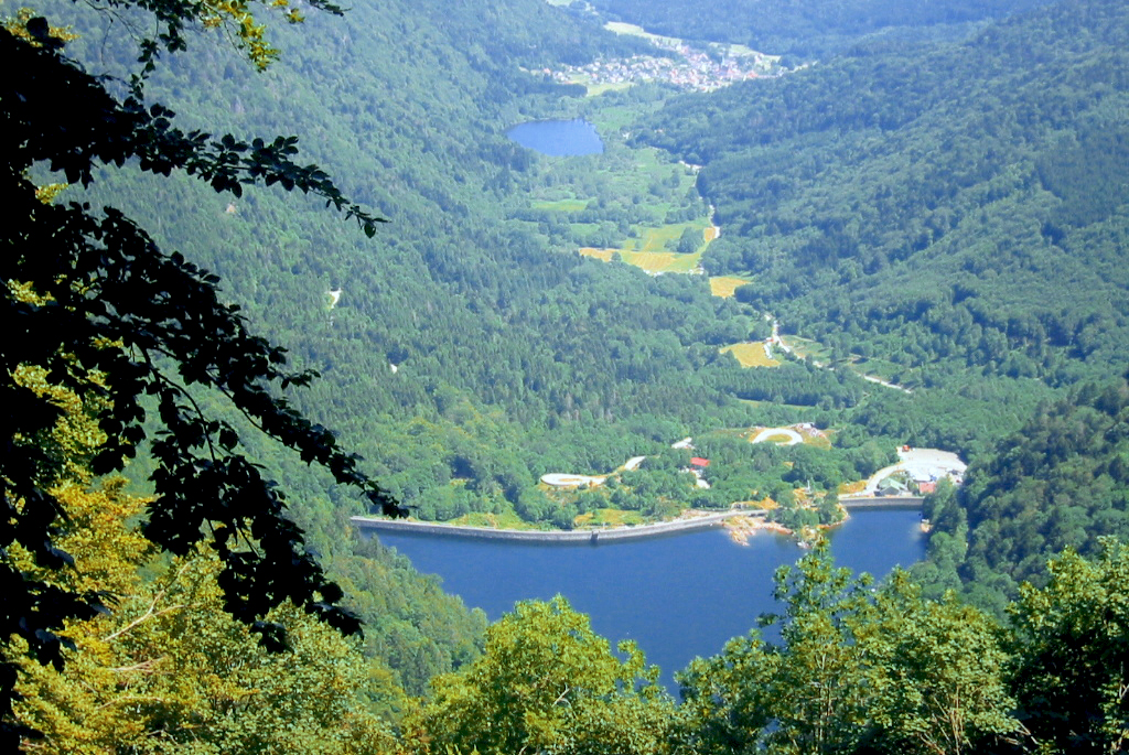
A series of pretty villages leads to two lakes, Lac de Sewen and Lac d’Alfeld.
The Ballon d’Alsace (1,247 m) overlooks the valley and is located on the borders of Alsace, Franche-Comté and Lorraine.
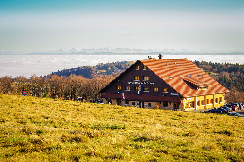
The view from the Ballon is spectacular, offering the Black Forest to the east, the Bernese Alpine chain to the south towards Mont Blanc (Savoie), which can be seen on a clear day, and the crests of the Vosges to the north.
The route between Munster and Gérardmer
From Munster in Alsace, the road crosses the Col de la Schlucht (1,135m) near the Hohneck (1,362m), which offers a superb view over the Alsace Plain and Lorraine.
It cuts the famous Route des Crêtes at the pass, which was the border between France and Germany from 1870 to 1918.
The descent on the Lorraine side gives access to Retournemer and Longemer lakes, which are beautifully situated in lush greenery.
Gérardmer is a winter sports resort which in the summer is converted into a mountain health resort.
The Lac de Gérardmer is the largest lake in the Vosges at 2.2km long and 750m wide, and the town is built along its banks.
Gérardmer proudly competed against Chamonix to host the first Winter Olympic Games in 1924.
The first Tourist Board in France was created in Gérardmer in 1865.
The route between Sarrebourg and Saverne
![Lutzelbourg castle © Gzen92 - licence [CC BY-SA 4.0] from Wikimedia Commons](https://frenchmoments.eu/wp-content/uploads/2018/06/Château-de-Lutzelbourg-©-Gzen92-licence-CC-BY-SA-4.0-from-Wikimedia-Commons.jpg)
This route also serves as a track linking Lorraine to Alsace.
All ground transportation (highway, roads, railway line, TGV, Rhine-Marne Canal) converge here to allow access to Strasbourg, Nancy, Metz and Paris.
The little town of Sarrebourg (population of 13,500) still belongs to the Lorraine plateau but provides quick access to the forest-covered mountains of the Vosges.
This corner of the Vosges marks the border between the Middle Vosges and Northern Vosges, and is full of interesting places to visit, including the small walled city of Phalsbourg; the Rocher de Dabo (Dabo Rock); the Rocher du Nutzkopf, and the castles of Haut-Barr and Lutzelbourg.
The Saint Louis-Arzviller inclined plane is one of the engineering marvels of the Vosges mountain range.
Located on the Rhine-Marne Canal near the Col de Saverne, it is somewhat of a giant bathtub (a trolley tray) for boats, which allows for them to be transported over a 44.55-metre drop, and in doing so avoiding the need to cross 17 locks.
The Col de Saverne is one of the lowest of the Vosges’ great mountain passes, at 385 metres high.
It is also the only one to have a highway running through it: the autoroute A4, which links Paris to Strasbourg. A tunnel will soon be built to let the TGV pass through, linking the Alsatian capital to Paris in a journey of fewer than two hours.
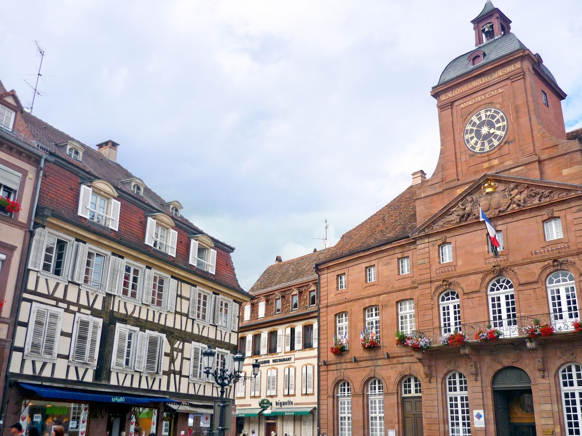
Last but not least, Saverne is beautifully situated at the foothills of the Vosges and features magnificent half-timbered houses (including the Katz house) and the Rohan Castle (home to a wealthy family of cardinals).
The Northern Vosges from Bitche to Wissembourg
There is some 50 km which separate the Lorraine town of Bitche from Wissembourg in Alsace.
Following the D35, then D3, the route allows you to visit the most beautiful sites that the Northern Vosges have to offer.
Bitche is known for being a military city and retains from its past the admirable citadel of Vauban, in pink sandstone from the Vosges.
Just before entering Alsace, the ruined castle of Falkenstein stands on a rocky outcrop that overlooks the forest from 20 metres above.
Once inside Alsace, you can see several castles that bore witness to the territorial fragmentation during the Middle Ages and the friction between the bishops of Speyer and Strasbourg, and the Dukes of Lorraine.
These include the Old Winstein, the New Windstein, and the Fleckenstein castles.
In Lembach, the track climbs towards the Col du Pigeonnier (432 metres), which gives a superb view over the Rhine Plain, as well as the Palatinate Mountains and the Black Forest in Germany.
The final stage is Wissembourg, which is at Germany’s border and comprises several medieval houses within its fortifications.
How to get to the Vosges
- The Vosges are easily accessible by car from Alsace’s main cities Strasbourg, Colmar, and Mulhouse, as well as from the Lorraine town of Nancy and Metz.
- If you travel from Australia or America, you could either take a flight to Paris Charles de Gaulle, Zurich or Frankfurt Airports and rent a car from there.
- The TGV from Paris-Gare de l’Est takes 1.30 hours to Nancy and Metz, and just over 2 hours to Strasbourg, and also stops at Colmar and Mulhouse.
Find out more about the Vosges mountains on the Tourist Office site.
Pin it for later
Liked what you read? Pin it on Pinterest: