Welcome to our comprehensive guide to the Moselle Valley!
If the Rhine is the emblematic river of Alsace, the Moselle is the backbone of Lorraine, the neighbouring region.
Indeed, this tributary of the Rhine gave its name to two French départements: Moselle [57] and Meurthe-et-Moselle [54].
But the river, which has its source in the Upper Vosges, does not just cross the countryside of Lorraine.
North of Thionville, it continues its route in Luxembourg and Germany, offering some of the most picturesque views in Europe.
After a 545 km run, the Moselle ends its course by flowing into the Rhine at Koblenz.
In this article, I wanted to put the Moselle Valley in the spotlight, by making you discover all the sites of interest along its course.
Fasten your seatbelts and let’s set off to explore historic towns, cathedrals, castles, beautiful countryside landscapes and terraced vineyards.
The Moselle, a European river
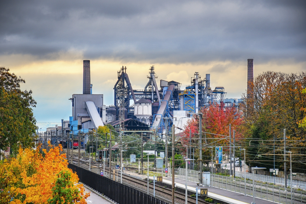
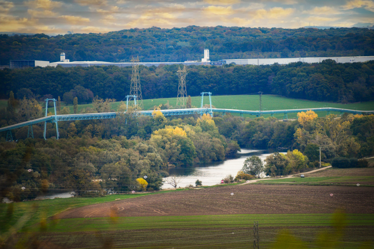
The Moselle is an old acquaintance. When I was a young kid, I followed its course by road during many round trips between Nancy, Metz and Thionville. I had a rather ‘industrial’ idea of the river … At the beginning of the 1980s, the Moselle valley in Lorraine was home to a multitude of factories: blast furnaces, steel factories, power stations … of which there is nothing left today except for a few traces.
Then, in the 1990s, I discovered the river upstream. From its source.
We lived in the south of Alsace at the time and the Col du Bussang was our point of entry into Lorraine. We followed what was only a mountain torrent down to Remiremont. With the contribution of water from the Vologne, the Moselle then became a real river watering Epinal and Charmes, before its famous loop towards Toul.
Incursions into Luxembourg have taught me that the Moselle looked different downstream from Thionville. In particular, after Trier, it flowed gently through a picturesque landscape that resembles two peas on a pod as the romantic Rhine (very close, by the way!)
It is this Moselle that I would like to reveal to you now!
The Moselle Valley Route
Like the Rhine, the Moselle is a river that flows north.
544 km long, it crosses three countries:
- France (314 km),
- Luxembourg (26 km) and
- Germany (204 km).
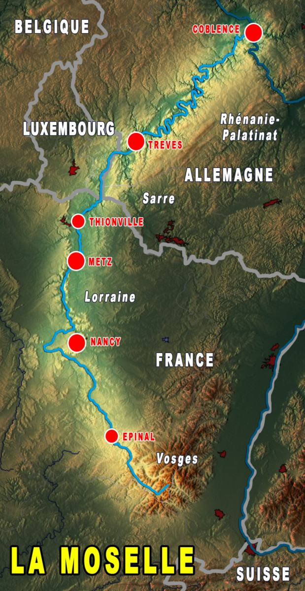
The river marks the border between Luxembourg and Germany for 26 km, then becomes exclusively German for 204 km.
From its source in the Vosges, it makes its way towards Remiremont then Epinal.
The Moselle Loop
Near Toul, it forms a giant loop, a distinctive feature of the river. This is explained by a hydrographic phenomenon: the ‘capture’ of the Moselle.
Previously (that is to say, thousands of years ago!), the river continued its path through Pagny-sur-Meuse and joined the Meuse River. Then, the Moselle changed its course by turning away from its original course. It turned to the east and followed the course of a stream that flowed into the Meurthe near Frouard. In doing so, it crossed the foot of the current Côtes de Moselle.

Thus, the Moselle stole the show from the Meurthe, hence becoming the main artery of the Moselle Sillon!
As far as Thionville, the river follows the Côtes de Moselle then it becomes a tourist river from Sierck-les-Bains. Until its confluence with the Rhine in Koblenz, it follows a tortuous course, forming countless small meanders.
Why the name “Moselle”?
The river takes the name of:
- Moselle in French and English,
- Mosel in German, and
- Musel in Luxembourgish.
- Mosela is its Latin name. It means “Little Meuse” (made up of the Celtic word Mosa and the Latin diminutive -ella). It is the same suffix that we find in the Alsatian dialect: Bredala / Bredele – small biscuit, Mannala / Mannele – little man, Lammala / Lammele – little lamb)
The corresponding adjective in French is “mosellan”. It applies to the regions crossed by the Moselle.
The inhabitants of the Moselle département in France are therefore Mosellans, and those of Meurthe-et-Moselle, Meurthe-et-Mosellans. As for Moselle wines, they are sometimes referred to as Vins de Moselle or Moselwein.
The Moselle basin
The Moselle basin covers an area of 28,153 km2 (54.5% in France, 33.8% in Germany, 9% in Luxembourg and 2.7% in Belgium).
It includes several regions, provinces and lander:
- Lorraine (now in the Grand-Est administrative region)
- Luxembourg
- Saarland
- Rhineland-Palatinate
- North Rhine-Westphalia
- Wallonia
The main tributaries of the Moselle
The 10 longest tributaries of the Moselle are:
- the Saar (227 km)
- the Sauer (173 km)
- the Meurthe (161 km)
- the Kyll (142 km)
- the Seille (138 km)
- the Madon (97 km)
- the Orne (86 km)
- the Lieser (74 km)
- the Salm (63 km)
- the Elzbach (59 km)
The 10 tributaries of the Moselle according to their flow:
- the Saar (78.2 m3 / s)
- the Sauer (53.8 m3 / s)
- the Meurthe (41.1 m3 / s)
- the Moselotte (13.7 m3 / s)
- the Orne (12.4 m3 / s)
- the Madon (11.1 m3 / s)
- the Seille (10.5 m3 / s)
- the Kyll (10.2 m3 / s)
- the Vologne (9.7 m3 / s)
- the Alf (4.5 m3 / s)
The 10 tributaries of the Moselle according to the surface of their basin:
- the Saar (7,431 km2)
- the Sauer (4,259 km2)
- the Meurthe (3,085 km2)
- the Seille (1348 km2)
- the Orne (1,268 km2)
- the Madon (1032 km2)
- the Kyll (843 km2)
- the Lieser (402 km2)
- the Rupt de Mad (385 km2)
- the Vologne (369 km2)
The Moselle: a European waterway
Today, the Moselle is navigable from Koblenz to Neuves-Maisons, in the south of Nancy.
It was on April 10, 1952 that a French law ratifying the Treaty of the Economic Coal and Steel Community (ECSC, the ancestor of the EU), decreed the project of channeling the Moselle to large gauge between Koblenz and Thionville.
It was completed in 1964 to Metz and the inauguration of the new canal took place in the presence of the Grand Duchess Charlotte of Luxembourg, the German Federal Chancellor Konrad Adenauer and their host, General de Gaulle, President of the French Republic.
Then, the canalisation works extended to Neuves-Maisons in 1979, making Nancy accessible to barges of 3000 t.
These achievements allowed the industrial basin of Lorraine to have direct access to the North Sea, via the Rhine at Koblenz.
The Moselle is navigable for 394 km. It has become one of the busiest waterways in Europe.
![The navigable Moselle in Remich © MMFE - license [CC BY-SA 3.0] from Wikimedia Commons](https://frenchmoments.eu/wp-content/uploads/2021/01/Moselle-in-Remich-©-MMFE-licence-CC-BY-SA-3.0-from-Wikimedia-Commons.jpg)
The course of the river is sequenced by 28 dams :
- 16 in France,
- 2 along the German-Luxembourg border, and
- 10 in Germany.
The towns crossed by the Moselle
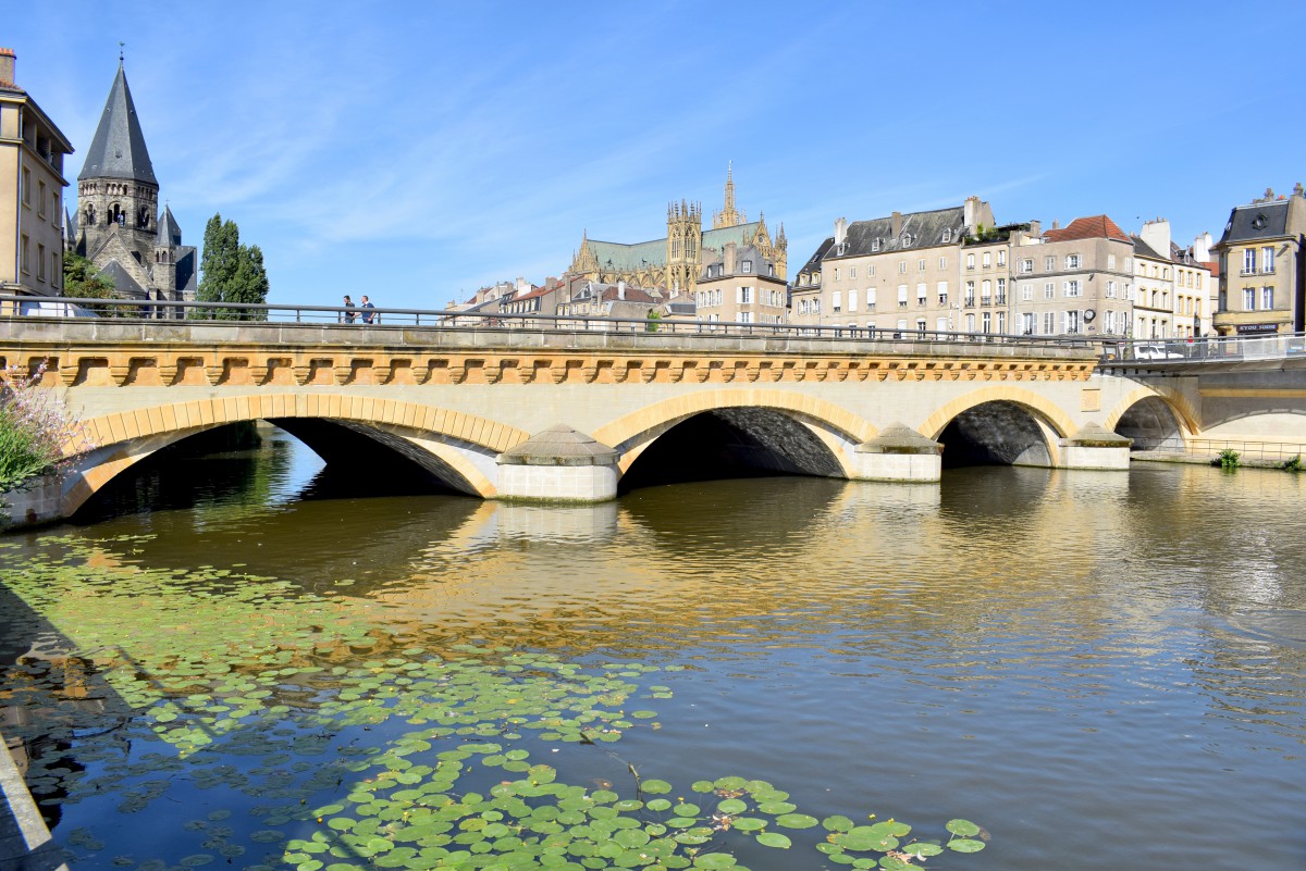
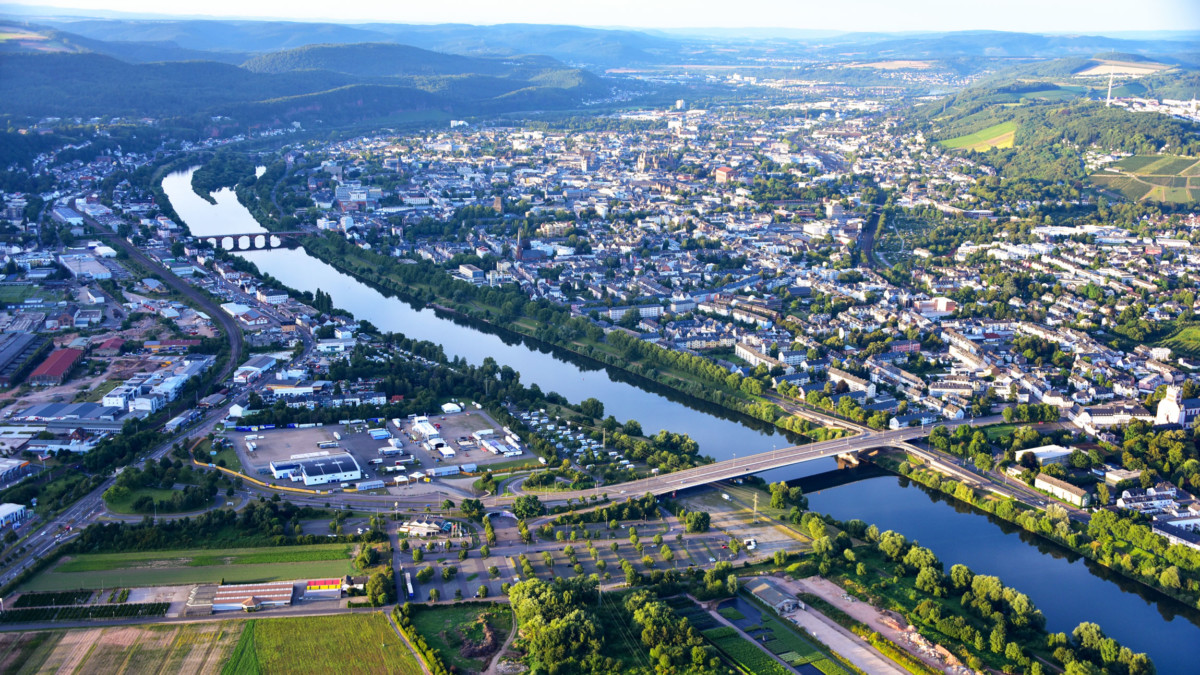
The Moselle crosses five large cities of more than 30,000 inhabitants:
- Epinal
- Metz
- Thionville
- Trier
- Koblenz
![Moselle Valley - Koblenz © Holger Weinandt - licence [CC BY-SA 3.0 de] from Wikimedia Commons](https://frenchmoments.eu/wp-content/uploads/2021/01/Koblenz-02-©-Holger-Weinandt-licence-CC-BY-SA-3.0-de-from-Wikimedia-Commons.jpg)
The Moselle Sillon
The Moselle is the backbone of Lorraine … or at least, its common thread.
In Lorraine, its valley concentrates half of the region’s population, ie 1,205,000 inhabitants.
The Moselle Sillon inspired the creation in 1999 of another area: the Lorraine Sillon.
This Lorraine metropolitan hub extends along the A31 motorway and the Metrolor high-frequency railway, from Remiremont to the Luxembourg border. It includes the four metropolitan areas of Epinal, Nancy, Metz and Thionville.
The Moselle vineyards
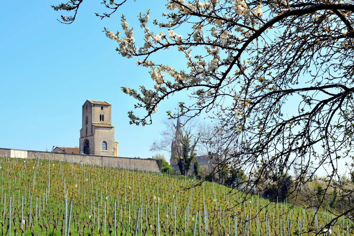
From Sierck-les-Bains and up to Koblenz, the Moselle valley is covered with famous vineyards which are part of the Moselle terroir (formerly Moselle-Sarre-Ruwer). These Riesling varieties mainly produce dry white wines.
Formerly, the Moselle region in Lorraine included large wine estates which disappeared at the beginning of the 20th century. There are still a few vineyards which are gradually coming back to life: the Côtes de Toul (with the famous ‘Gris de Toul’ vineyards totalling 110 hectares) and the Côtes de Moselle (130 hectares).
In all three countries, the Moselle vineyard covers a total area of 10,540 hectares (i.e. less than the planted vineyard of Alsace: 15,500 ha):
- Germany (Land of Rhineland-Palatinate and Saarland): 9,000 hectares
- Luxembourg: 1300 hectares
- France (Lorraine): 250 hectares
Tourism along the Moselle Valley
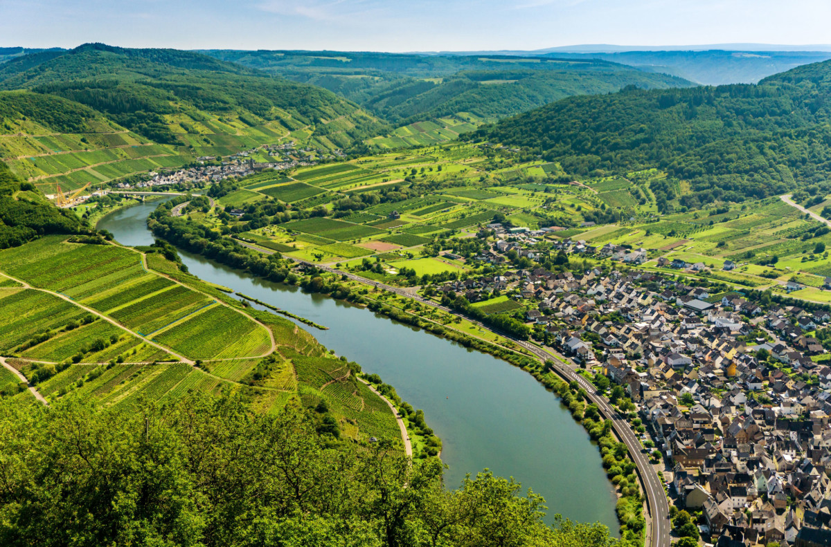
No offence to the people of Lorraine, but the most picturesque part of the Moselle is in Germany. Between Trier and Koblenz, the river weaves its way between the Eifel and Hunsrück massifs, in a beautiful valley dotted with charming villages. Here and there, ruined castles dominate the stream, from the top of steep hills covered with vines.
![Meander in the Moseltal in Bremm © Mâchoire - license [CC BY 2.0] from Wikimedia Commons](https://frenchmoments.eu/wp-content/uploads/2021/01/Bremm-Moselschleife-©-Mâchoire-licence-CC-BY-2.0-from-Wikimedia-Commons.jpg)
You can follow the river by taking the Moselle Wine Route. This trail stretches for 242 km and connects Perl to Koblenz. It is doubled by the Moselle cycle path which departs from Metz.
![The Moselle Valley in Hatzenport © EwaStudio [Envato Elements]](https://frenchmoments.eu/wp-content/uploads/2021/01/landscape-with-the-river-moselle-in-germany-panora-PUKBM2G-by-EwaStudio-Envato-Elements.jpg)
Another tourist route is the Luxembourg wine route, which begins in Bad Mondorf and ends in Schengen via Wasserbillig.
Many cruises are offered to tourists, similar to those in the neighbouring Rhine Valley.
Upstream from Thionville, there are some beautiful places in Lorraine to see: the region between Pont-à-Mousson and Metz, the Moselle loop between Frouard and Neuves-Maisons, the upper Moselle valley between Remiremont and Bussang.
The Roman Moselle
What strikes the minds of those who follow his entire journey is the strong link with the Romans.
A bond of common history unites the three nations crossed by the river. Whether in Metz or Trier, in small wine-growing villages or in the Moselle countryside, the precious vestiges of the Roman era bring us back to 2000 years of history.
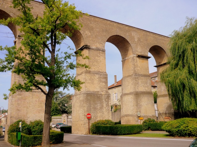
Along the Moselle Valley: from the source to the confluence
Here is a suggested discovery route along the Moselle, from its source in the Vosges to its confluence with the Rhine in Koblenz. Throughout the course, you will quickly realise the alternation of landscapes that the stream offers us. Have a nice trip!
Stages in the département of the Vosges
Our route begins in the Vosges, at the Col de Bussang.
The Bussang pass
Culminating at an altitude of 727 m , it is one of the most frequented passes in the Vosges mountains, alongside those of Schlucht, Bonhomme and Saverne.
Two mountains dominate it:
- the Tête des Neufs-Bois (1,228 m) to the south
- the Grand Drumont (1,200 m) to the north
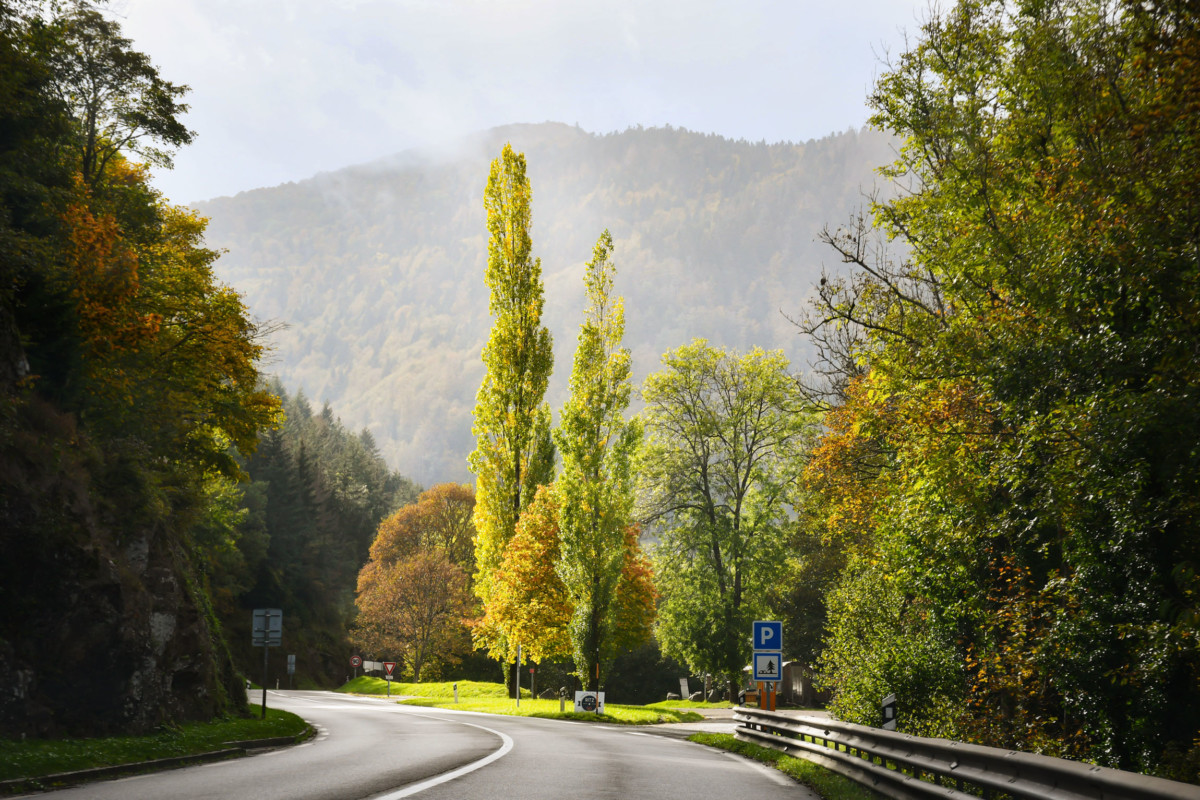
The pass connects Alsace and Lorraine by the national road 66 and, more generally, the valley of the Moselle (Trier, Metz, Épinal) to the valley of the Rhine and its main tributary, the Ill (Mulhouse, Basel). This historic route follows the old Metz-Basel Roman road (Divodurum – Augusta Basiliensis).
Today, the pass defines two municipalities: Bussang (Lorraine side) and Urbès (Alsatian side).
Apart from this geographical and historical importance, the pass is of no tourist interest.
![Col de Bussang. Photo: Tangopaso [Public Domain]](https://frenchmoments.eu/wp-content/uploads/2021/01/Col-de-Bussang-by-Tangopaso-Public-Domain.jpg)
The source of the Moselle
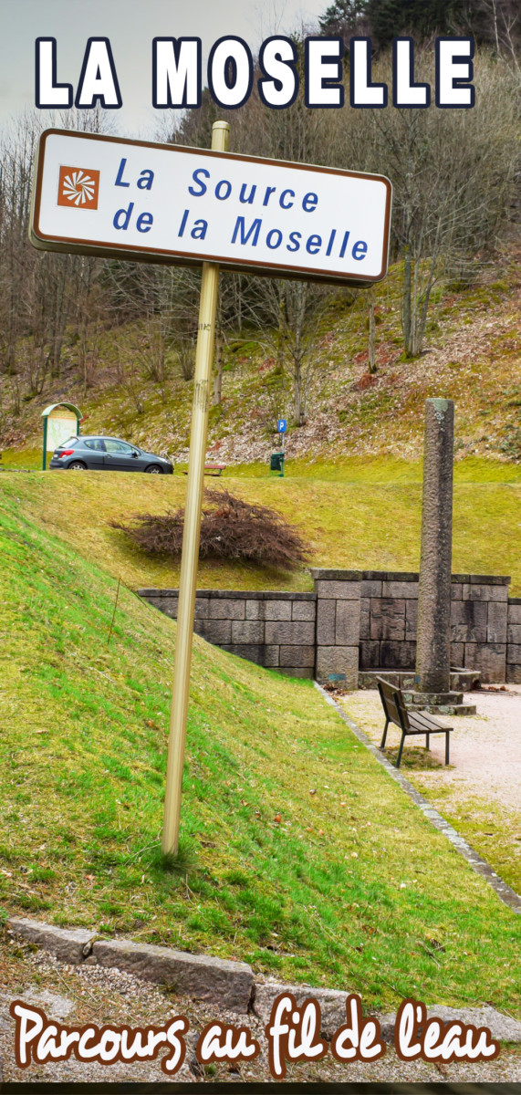
A few steps from the Col du Bussang, a fountain monument located at an altitude of 731 meters serves as the official source of the Moselle.
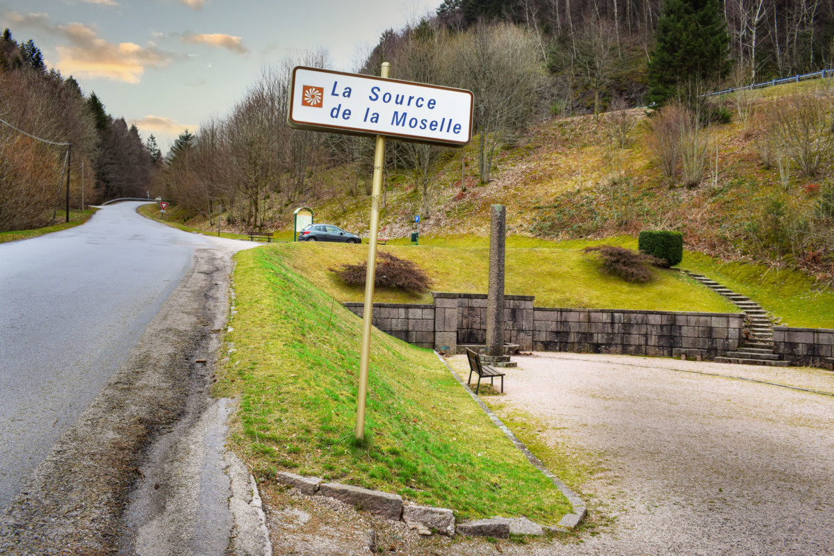
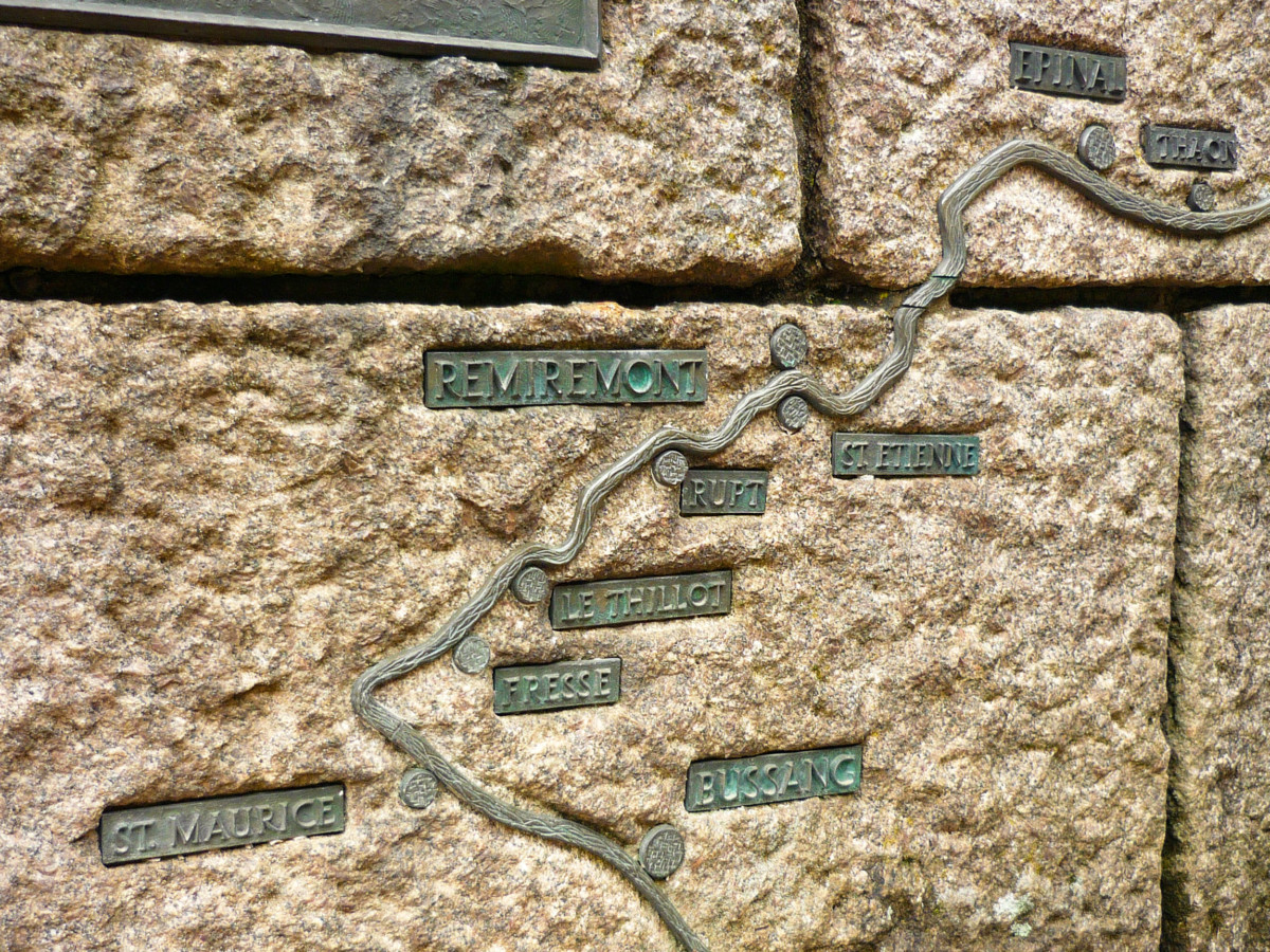
In reality, the torrent arises from small streams which meet quickly on the slopes of the Grand Drumont, at an altitude of over 1000 meters. The course of the river is engraved on the monument, from Bussang to the confluence of Koblenz.
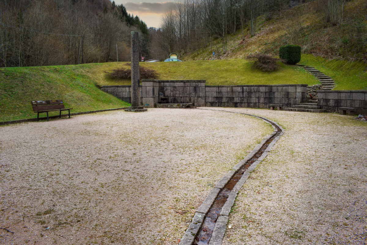
The village of Bussang, which enjoys the status of a spa town, has a unique theatre in France, entirely built in wood (1895): the Théâtre du Peuple.
For the anecdote, Michel de Montaigne is said to have dined in Bussang in 1580 during his visit to the legendary silver mines.
The Upper Moselle Valley
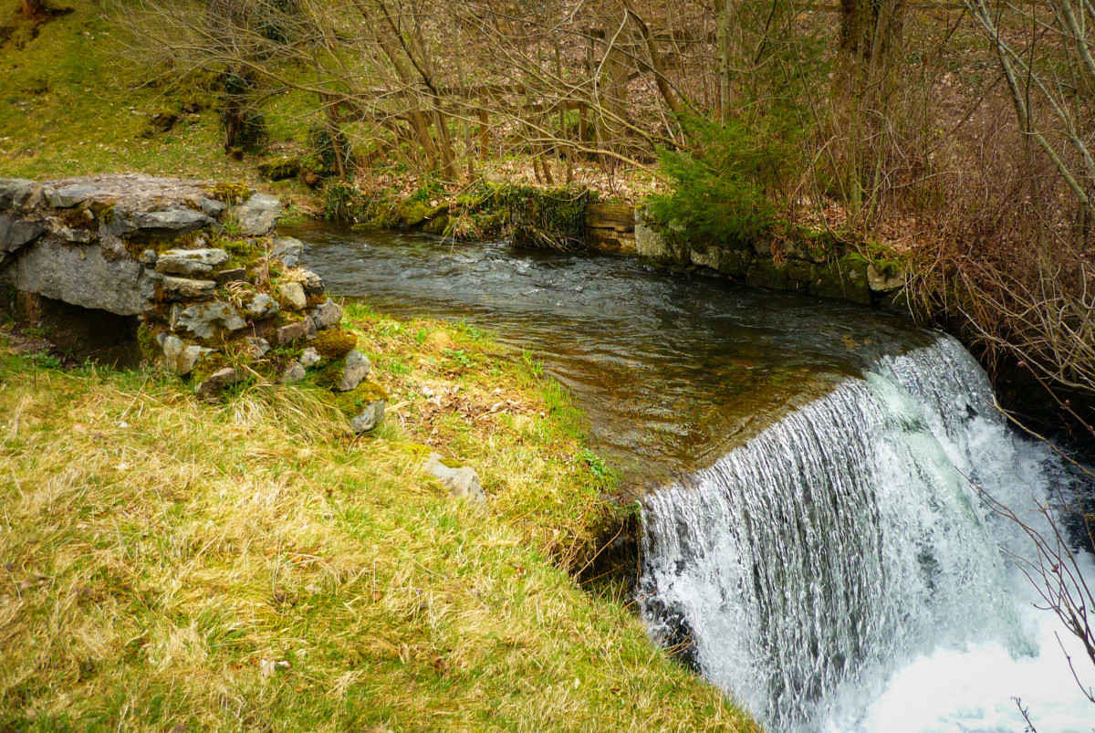
From Bussang to Remiremont, the stream resembles a mountain torrent which describes beautiful meanders between wooded hills. This Vosges portion bears the name of Upper Moselle valley (Haute-vallée de la Moselle).
During the first 35 kilometres, the river passes from an altitude of 735 m to 385 m. The glacial valley crosses 11 municipalities including Bussang, Saint-Maurice-sur-Moselle, Le Thillot and Rupt-sur-Moselle.
Formerly, the Upper Moselle was a French stronghold of the textile industry. The river supplied many factories with hydraulic energy. Some vestiges of this industrial past remain, including buildings with jagged roofs and old workers’ houses (cités ouvrières).
Today, the valley lives on the forestry sector and tourism. At the foot of the Ballon d’Alsace are many hiking trails and small family-friendly ski resorts.
Remiremont
At Remiremont, the Vologne flows into the Moselle, giving the latter the majestic appearance of a noble stream.
Remiremont was the seat of a famous abbey for women. The little town bears the enviable nickname of “La belle des Vosges” (the beautiful lady of the Vosges).
What to see:
- the abbey church and its emblematic onion bell tower,
- the neoclassical facade of the former abbot’s Palace,
- and the houses with flowered arcades on rue Charles-de-Gaulle which make the old town very picturesque.
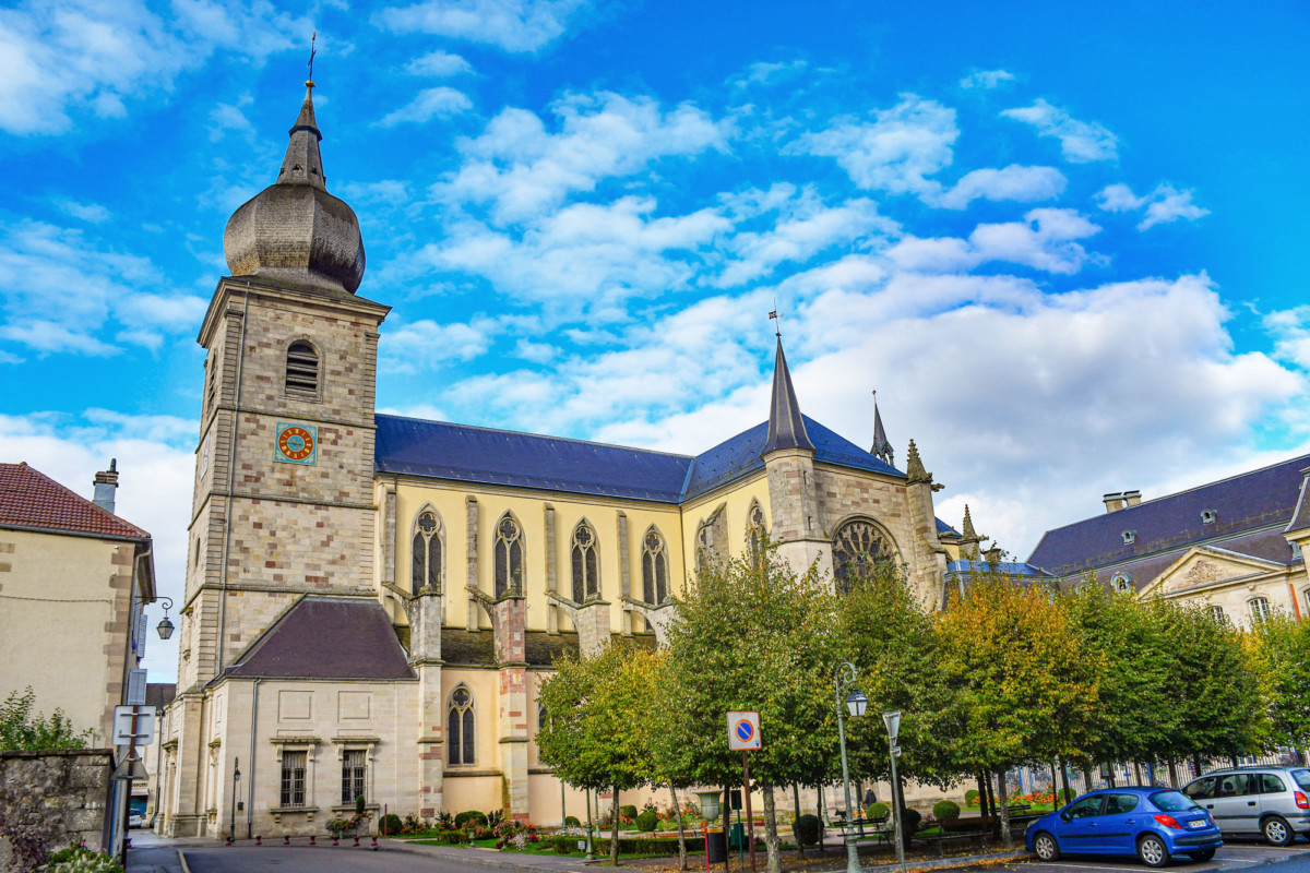
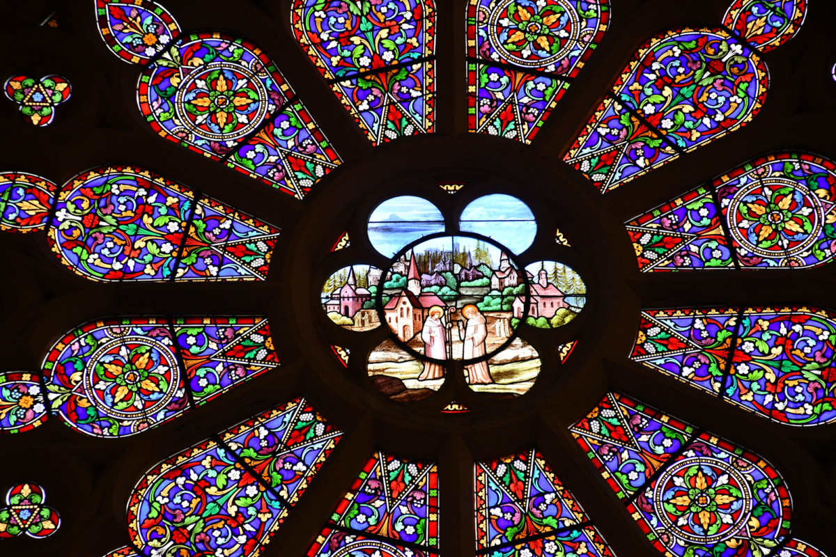
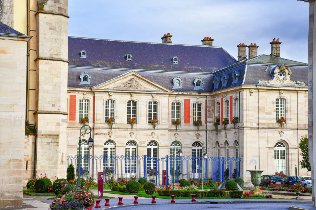
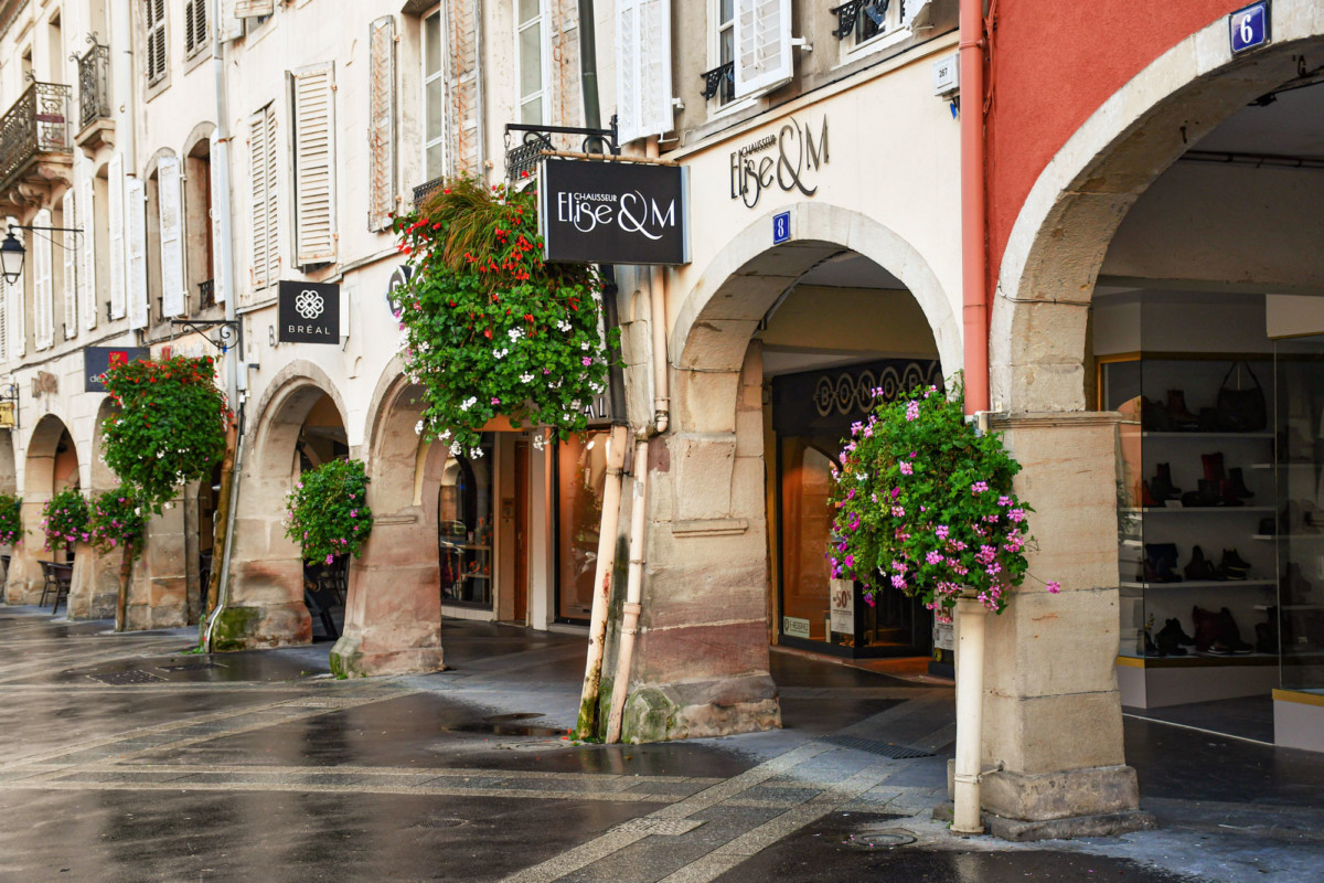
Walking up the Promenade du Calvaire, you can enjoy a beautiful view of the city and the Moselle valley.
Continue on the road towards Epinal, following the right bank. The route offers lovely views over the Moselle and passes at the foot of beautiful sandstone escarpments between Archettes and Epinal.
Climb to the Tête des Cuveaux (781m). A belvedere with an orientation table offers a beautiful panorama over the Moselle valley, the Lorraine plateau and the Vosges.
Epinal
It is in Epinal that the Moselle leaves the mountain to make its way through flatter landscapes.
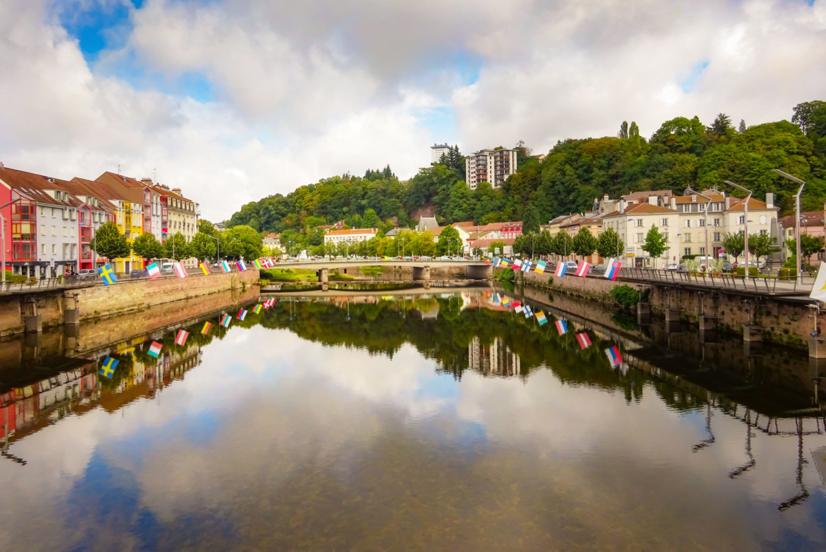
The préfecture of the Vosges département was made famous by its imagery, founded by Pellerin in the 18th century.
The historic center of Epinal contains the Saint-Maurice basilica, the Place des Vosges lined with arcaded houses, as well as some remains of medieval ramparts.
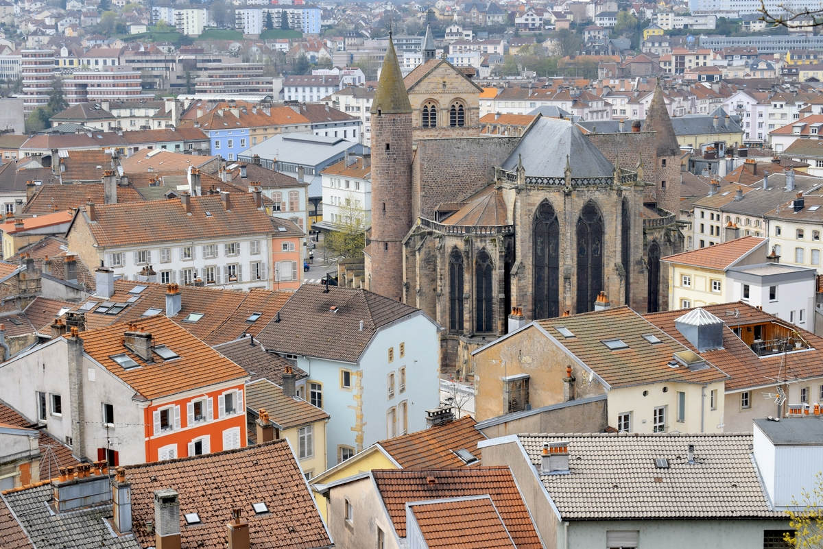
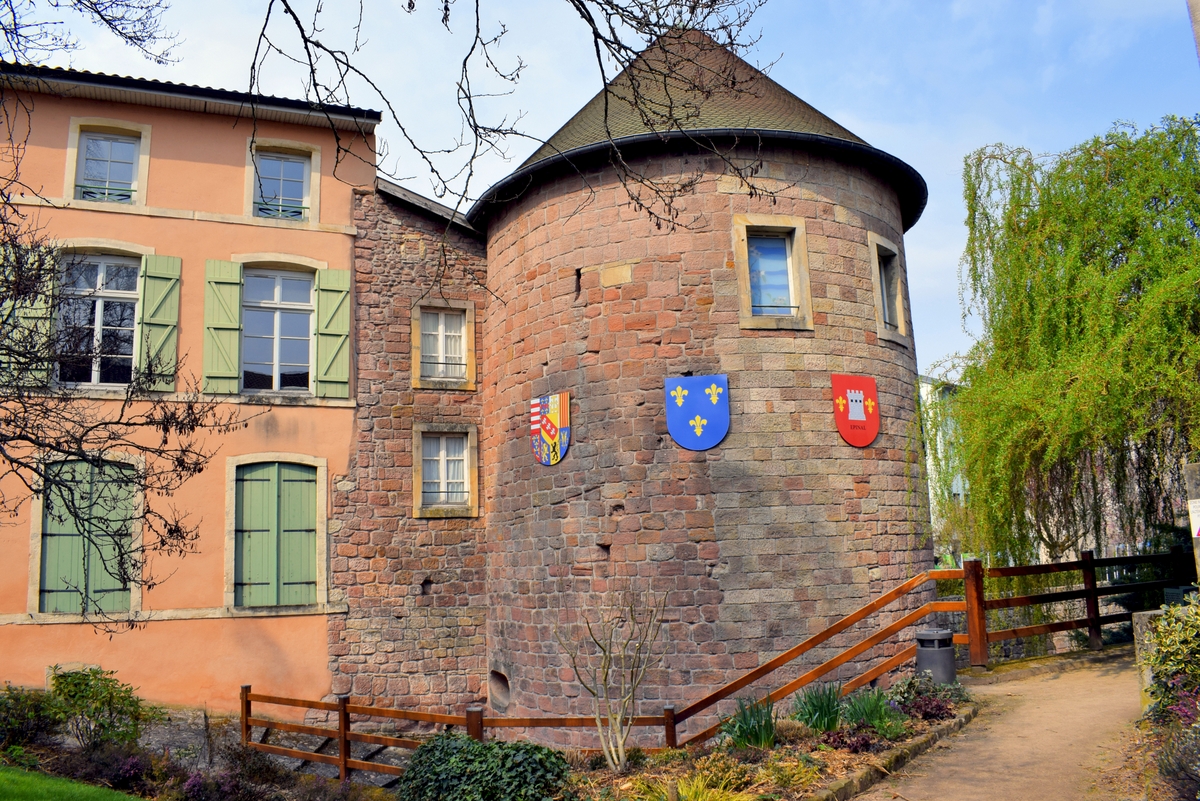
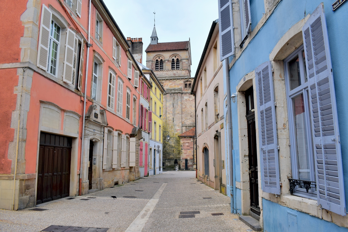
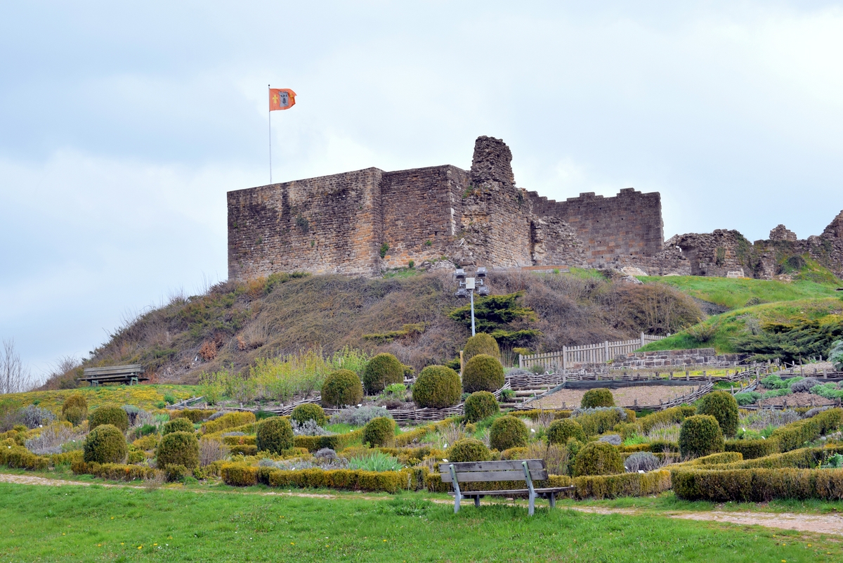
In the centre of a forest park of 26 ha, the ruins of the castle of Epinal dominate the city.
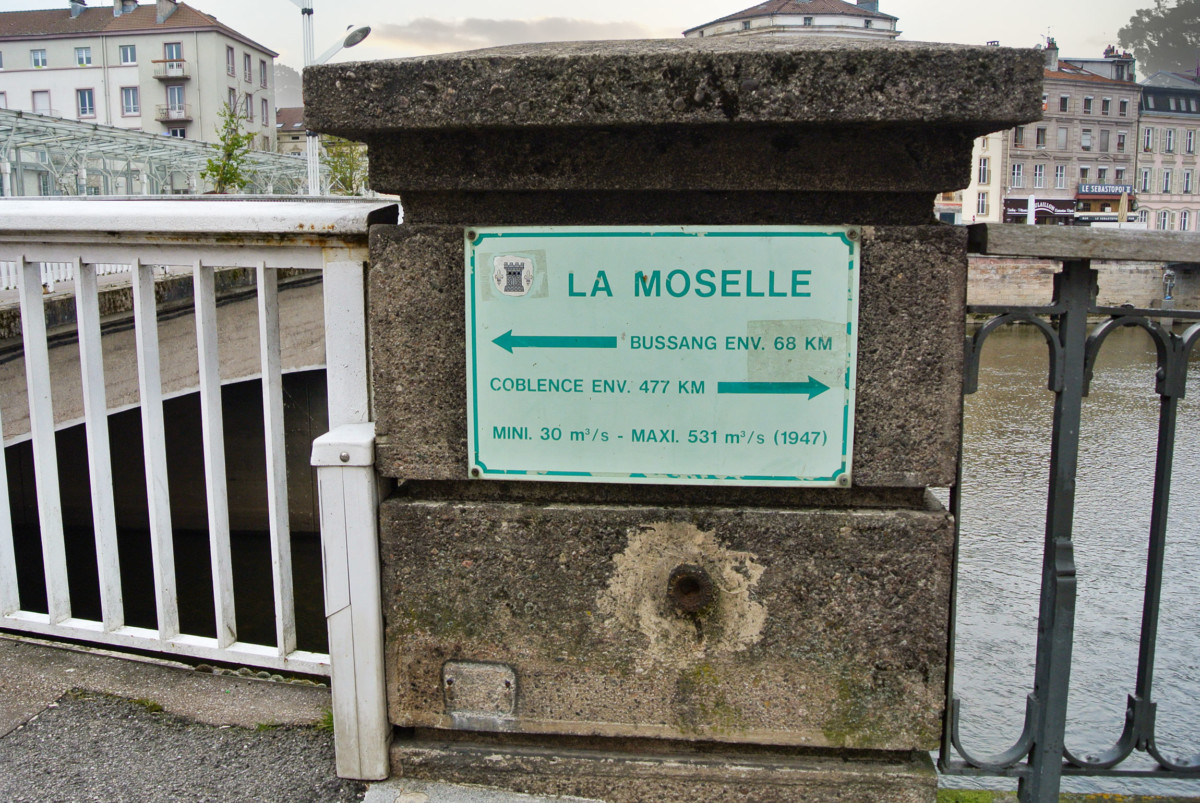
An inscription informs that the river “is only” 477 km from its mouth in Koblenz!
Chatel-sur-Moselle
20 km north of Epinal is a largely unknown tourist site: the fortress of Châtel-sur-Moselle.
Its ruins indicate that it was one of the largest fortified castles in Europe. The fortress had 22 towers, 1400 metres of ramparts and covered an area of 5 hectares.
![Chatel-sur-Moselle © M.Minderhoud - license [CC BY-SA 3.0] from Wikimedia Commons](https://frenchmoments.eu/wp-content/uploads/2021/01/Chatel-sur-Moselle-©-M.Minderhoud-licence-CC-BY-SA-3.0-from-Wikimedia-Commons.jpg)
The medieval stronghold was founded in 1072. First a Burgundian enclave in the Duchy of Lorraine, the castle was acquired by the Vaudémont family, then by the Neufchâtel family.
Portieux
5 km north of Châtel-sur-Moselle, the Portieux glassworks site opens access to my Glass and Crystal Route in Lorraine.
The Portieux Glassworks was founded in 1690 by François Magnien, a butler of the Duke of Lorraine.
![Portieux crystals © Chaanara - licence [CC BY-SA 4.0] from Wikimedia Commons](https://frenchmoments.eu/wp-content/uploads/2018/06/Portieux-Ritz-©-Chaanara-licence-CC-BY-SA-4.0-from-Wikimedia-Commons.jpg)
Today, the manufacturer specialises in glassware and the design of decorative and fancy articles. Its most famous Parisian clients are Maxim’s, Brasserie Lipp and Hotel Crillon.
Stages in the département of Meurthe-et-Moselle
From Chamagne (the family village of a certain Ségolène Royal), the Moselle enters the département of Meurthe-et-Moselle. The D570 road allows you to follow its route, in parallel with the Canal de l’Est.
The Moselle enters the Nancy metropolitan area in Flavigny-sur-Moselle (a Benedictine priory church with a 12C tower, 15th-century nave, and apse), where a certain Jacques Lang (a French politician) spent part of his childhood.
Neuves-Maisons
The industrial town of Neuves-Maisons is not a tourist destination … but it nevertheless remains one of the symbols of the glorious industrial past of Lorraine.
Neuves-Maisons developed strongly from the second half of the 19th century, during the industrial revolution. The subsoil of the town was rich in Minette, the Lorraine iron ore. Some say that the mines of Neuves-Maisons and Ludres supplied the steelworks of Pompey with the iron intended for the construction of the Eiffel Tower…
The mines have been closed since 1968, but the steel plant is still in operation. Visitors can still visit the Val de Fer, an old refurbished mine gallery.
Fans of industrial heritage will appreciate the well-preserved and remarkable line of the Cités of Messein (rue Pierre and Marie Curie).

The Moselle loop
From Maron, the D909 follows the river’s course through one of Lorraine’s most beautiful sites: the Moselle loop.
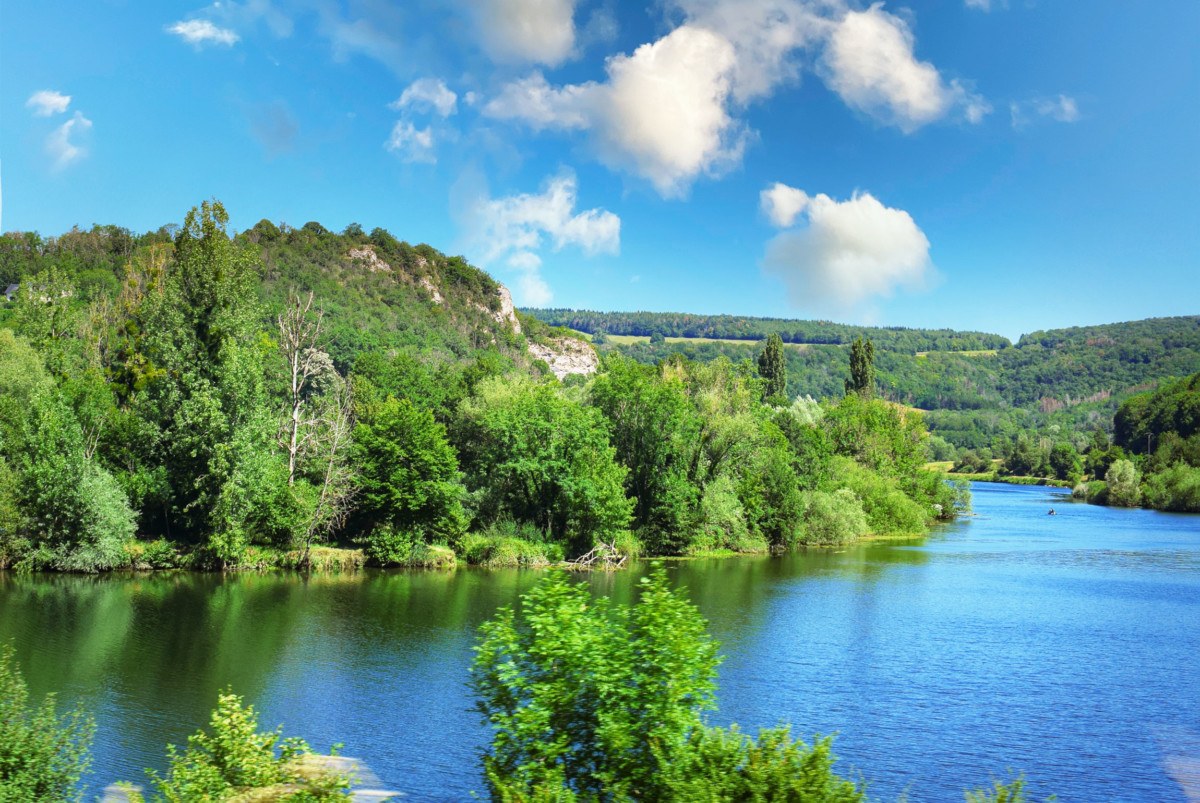
This great meander of about fifty kilometres crosses the forest of Haye, a vast forest massif mainly made up of beeches, located west of Nancy.
As I mentioned above, the Moselle (meaning Petite Meuse) initially headed towards the Meuse via Toul and Foug.
But one day, she chose another destiny … and succumbed to the charm of the romantic Rhine. In Toul, the Moselle suddenly branched off to the east to join the Meurthe at Frouard, becoming the dominant river in the process.
This change of trajectory explains what appears on a map as a “great fluvial bypass” of Nancy.
Villey-le-Sec
Between Neuves-Maisons and Toul, the fort of Villey-le-Sec belongs to the Séré de Rivières system of the stronghold of Toul, built in the 1870s (after the Franco-Prussian war). The fortification has remained largely intact to this day because it was located outside the combat zones of the First World War.
![Villey-le-Sec from above - Wikimedia Commons [Public Domain]](https://frenchmoments.eu/wp-content/uploads/2021/01/Villey-le-Sec-from-above-Retrieved-from-Wikimedia-Commons-Public-Domain.jpg)
The Fort of Villey-le-Sec can be visited and includes a ride aboard a wagon towed by an old diesel locomotive. The Fort Villey-le-Sec tourist railway (1.3 km long) is a partial reconstruction of the old railway line that linked the fort to Dommartin-lès-Toul.
Toul
Let us now stop in Toul, an old military stronghold still surrounded by ramparts.
Toul is also a historic city dating back to Gallo-Roman times, the seat of one of the Three Bishoprics (with Verdun and Metz).
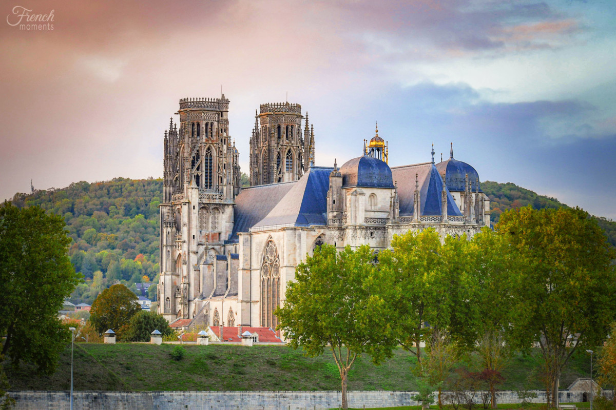
This brilliant past has given Toul superb religious and military buildings:
- the St. Stephen’s Cathedral, a jewel of Gothic art in Lorraine (13th-16th centuries)
- the gothic church of Saint-Gengoult
- the Gothic cloisters of the cathedral and Saint-Gengoult
- some old Renaissance houses
- the ramparts with their gates and their glacis
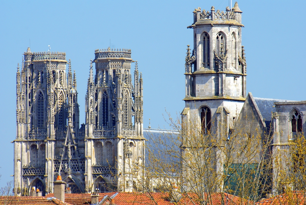
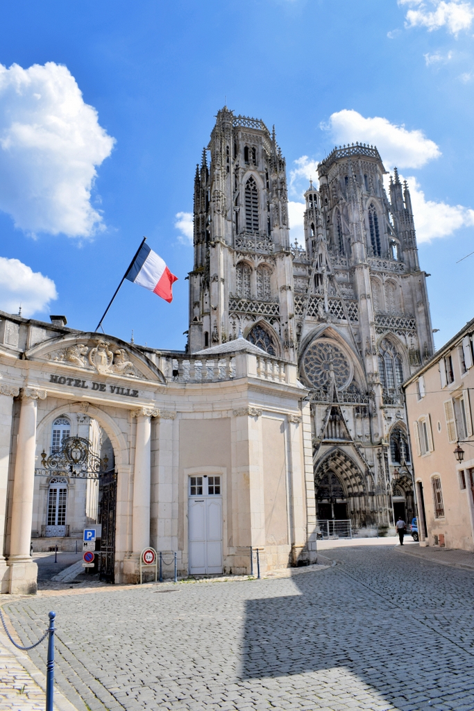
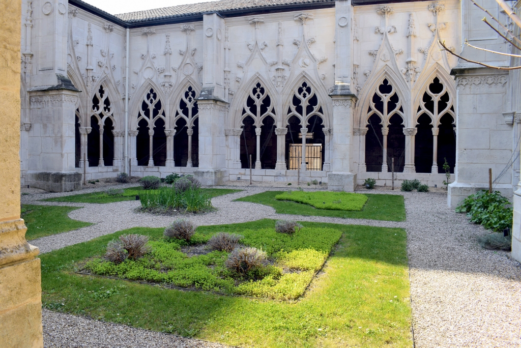
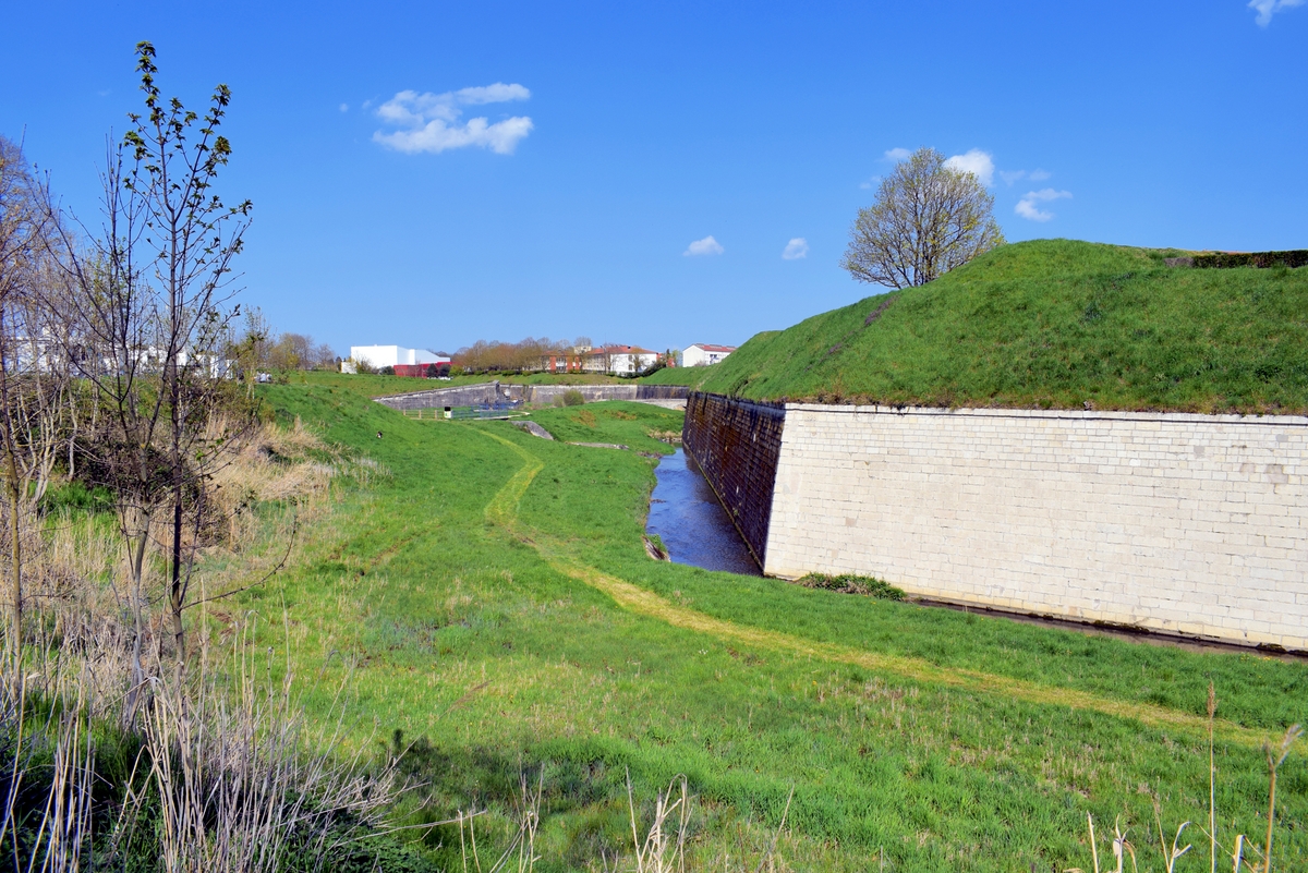
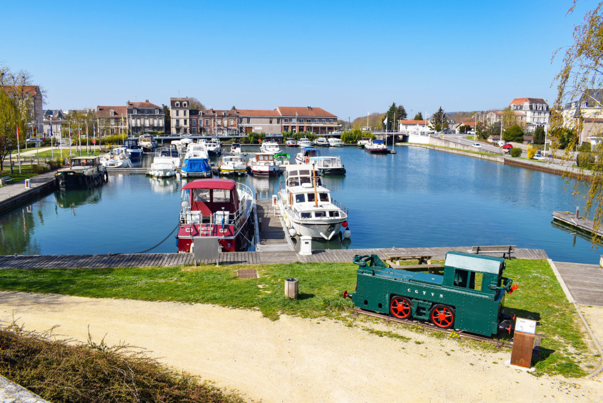
It is in Toul that the Moselle is linked to the Meuse, the Saône and the Rhône via the Marne-Rhine canal. The marina, labelled Blue Flag, can accommodate around sixty boats.
The Côtes de Toul
The Toulois (the Toul region) is famous for its vineyard which covers the slopes of the Côtes de Toul.

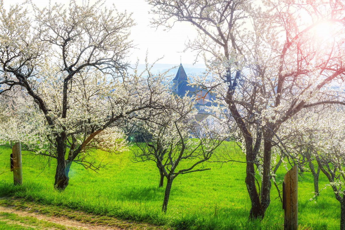
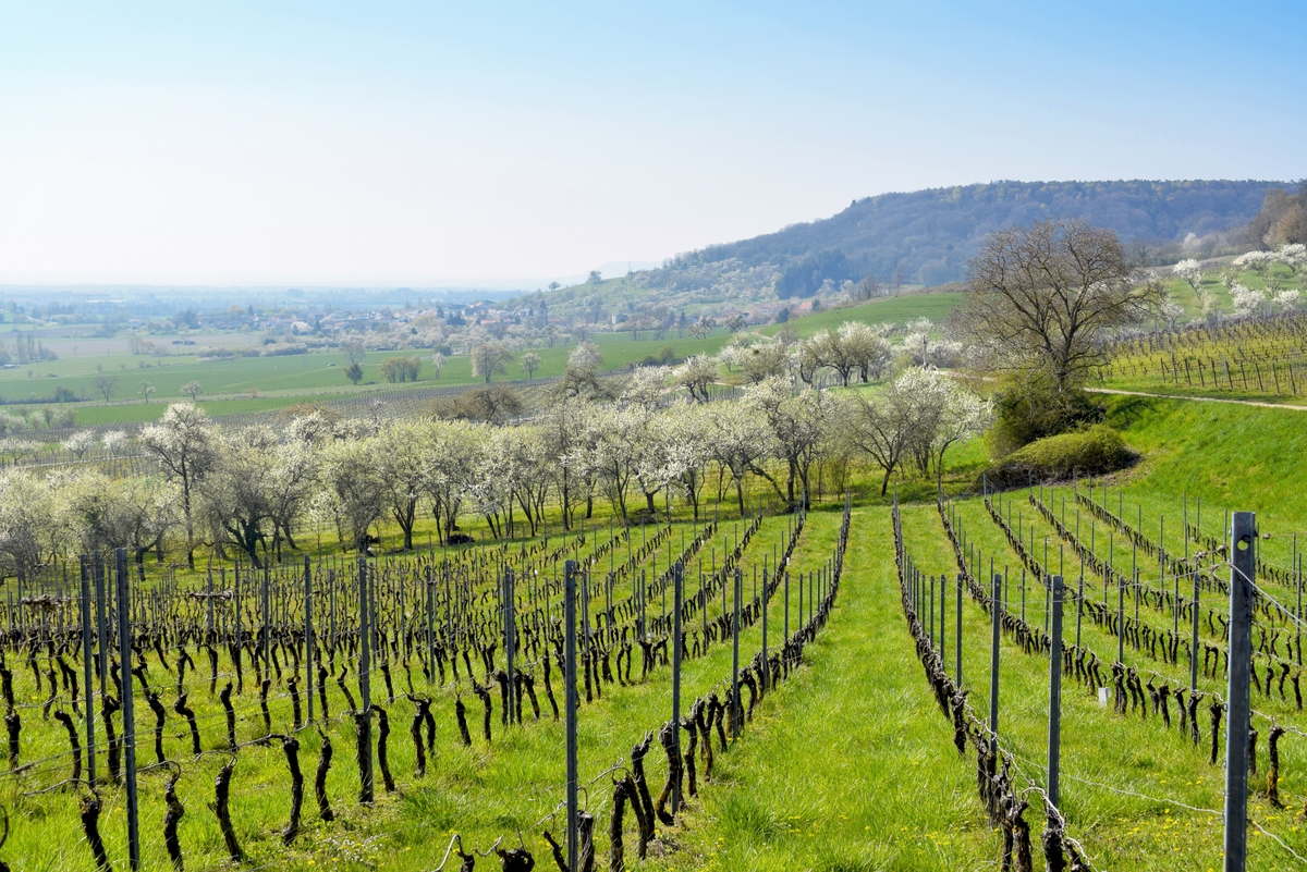
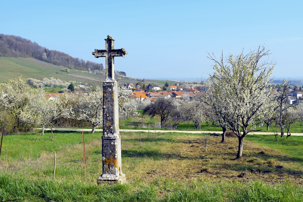
The vineyard stretches from Colombey-les-Belles to Boucq, via Toul. Each year, nearly 500,000 bottles of AOC Côtes-de-Toul are produced there. The Gris de Toul, with its shimmering salmon colour, deliciously combines local gourmet dishes (quiche Lorraine, Lorraine hotpot, tourte Lorraine, pâté lorrain).
Liverdun
The small town of Liverdun dominates a bend in the Moselle.
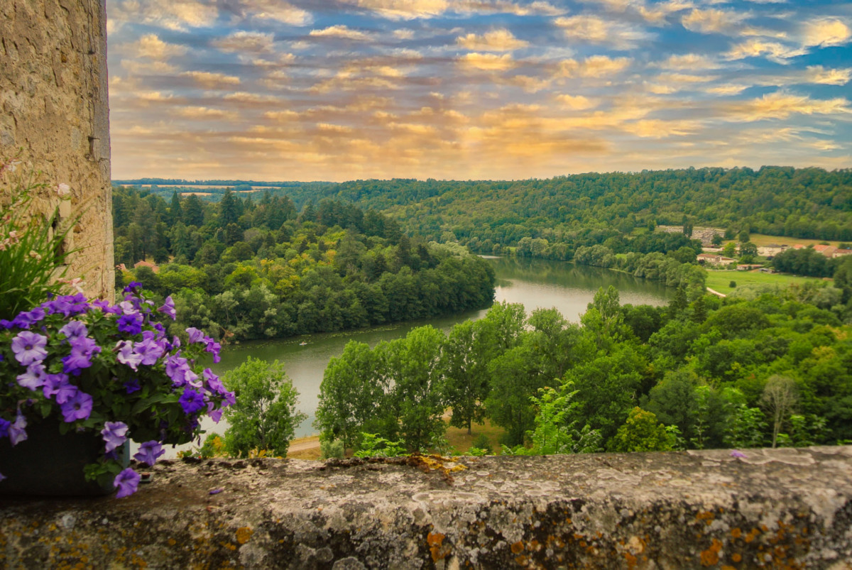
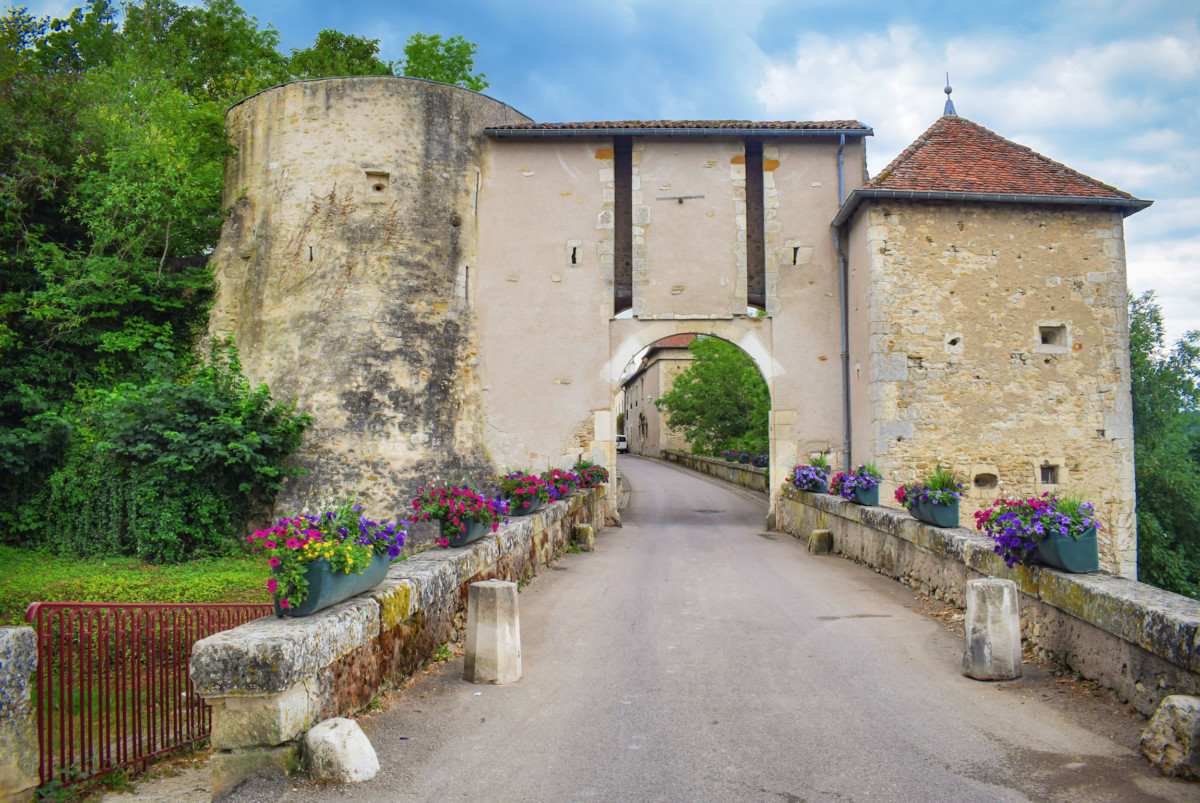
You enter the old center through a 16th-century fortified gate.
The church was consecrated in 1261 on foundations from the end of the 12th century. Note the Place de la Fontaine, lined with 16th-century arcaded houses. If you have time, stop by the Liverdun Madeleines shop, a renowned local delicacy.
Nancy
In Frouard, the Moselle joins the Meurthe. After a long detour of about fifty kilometres, the stream once again enters the metropolitan area of Nancy.
If the Moselle does not water the city of Nancy geographically, the fact remains that the capital of the Dukes of Lorraine is considered a “Mosellan” city, which confirms the map engraved at its source at the Col de Bussang. In any case, like Metz, Nancy is located at the foot of the Côtes de Moselle.
Nancy is world famous for its architectural ensemble from the 18th century, three of which are listed as World Heritage by Unesco: Place Stanislas, Place de la Carrière and Place d’Alliance.
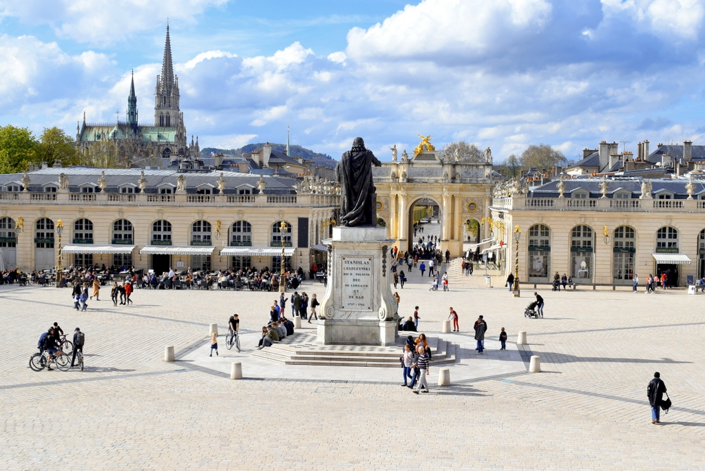
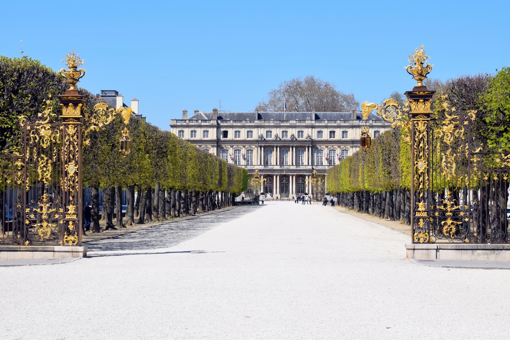
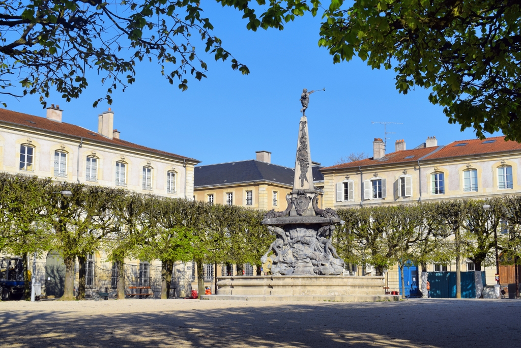
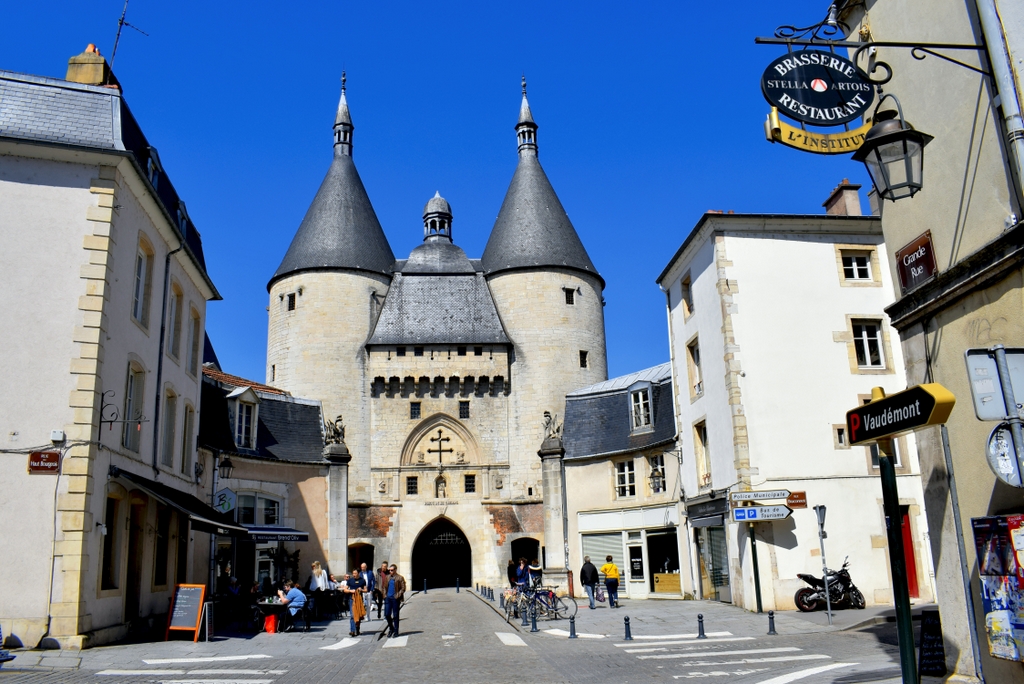
The Old Town of Nancy, of medieval origin, includes the Ducal Palace, the Porte de la Craffe, the neo-Gothic Saint-Epvre basilica, as well as many Renaissance houses.
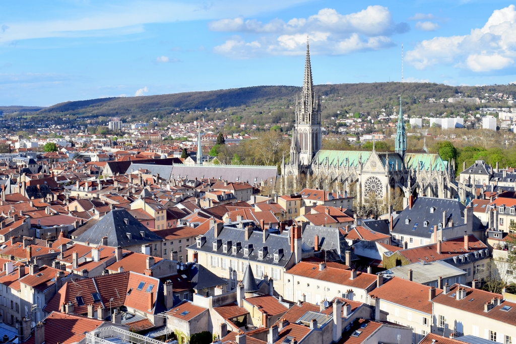
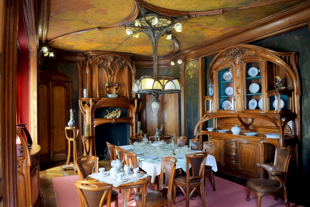
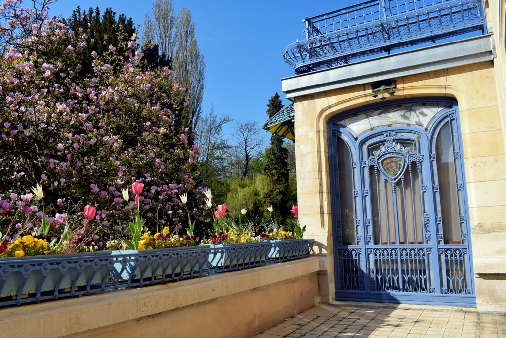
Finally, Nancy was an important centre of Art Nouveau (late 19th – early 20th century), which gave birth to the artistic and cultural movement of the School of Nancy.
Pompey
Let’s retrace our steps and take the direction of Pont-à-Mousson.
Pompey was the site of an impressive steelworks: La Société des Hauts Fourneaux et Aciéries de Pompey, created in 1872. It distinguished itself in 1887 with an order placed by Gustave Eiffel’s company to build a 300-meter-high iron tower in Paris: the Eiffel Tower!
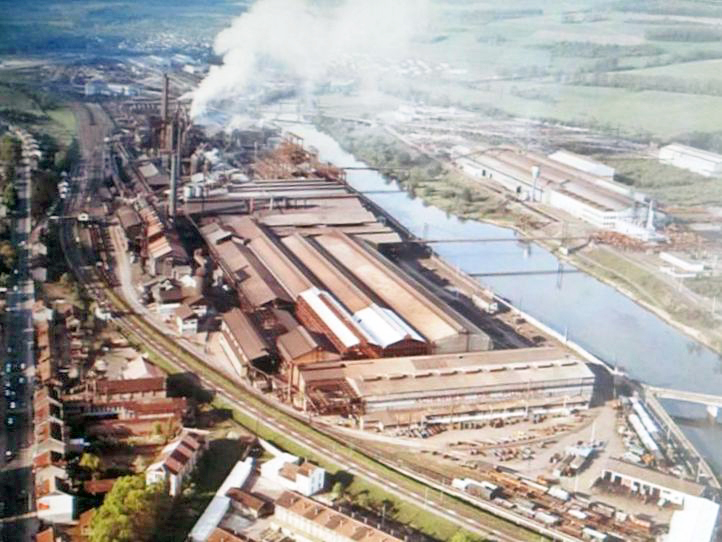
Victim of the metallurgical crisis in Lorraine, the last blast furnace of the factory was stopped on May 25, 1986. Since then, the buildings of the steelworks have disappeared from the landscape, leaving the memento of its existence in the memory of the inhabitants.
Dieulouard
Known as Scarpone during the Gallo-Roman era, the industrial town of Dieulouard has retained its castle and a well-restored church.
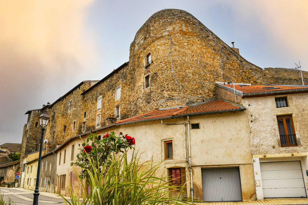
Formerly, the Château de Dieulouard belonged to the Bishop of Metz. The fortress is quite unique, with the houses leaning against its walls 20 meters high.
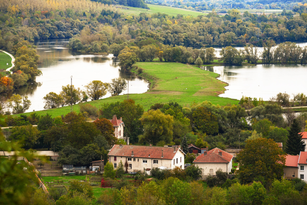
From the top of the belvedere of the Notre-Dame-des-Airs chapel (commemorative chapel of the First World War), there is a panoramic view of the Moselle valley and the ponds laid out between the arms of the Moselle.
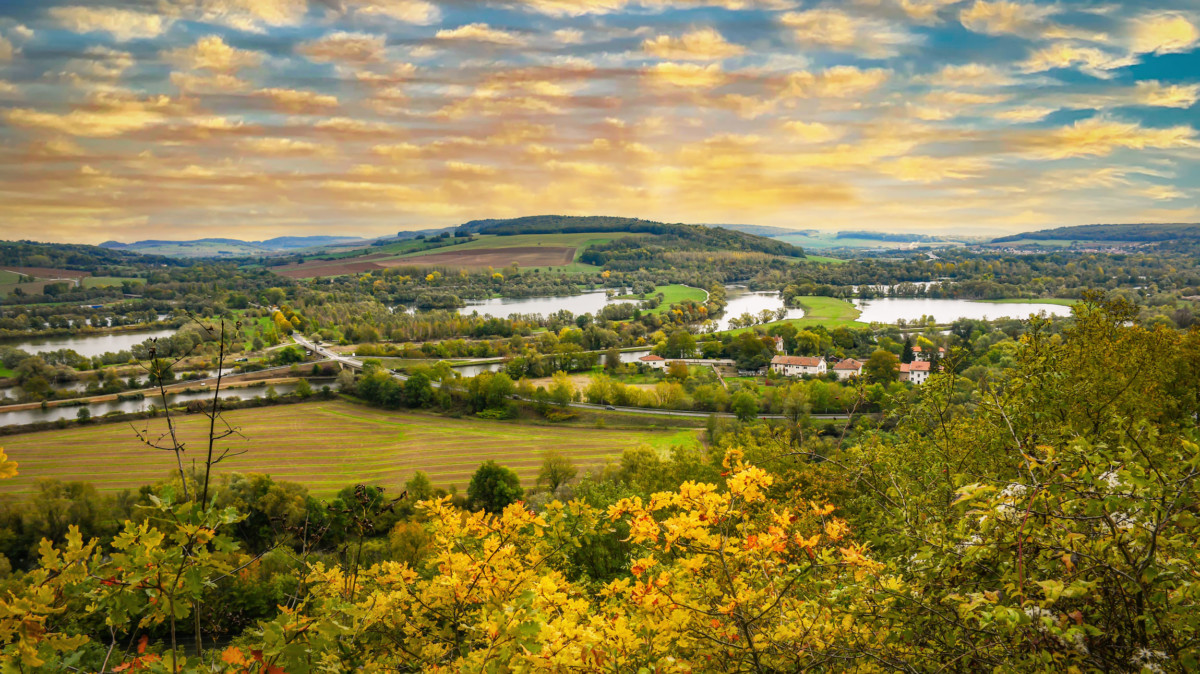
Dieulouard is the gateway to the Little Switzerland of Lorraine, a bucolic countryside renowned for its beautiful landscapes.
Pont-a-Mousson
The city of Pont-à-Mousson owes its name and origin to the bridge which, from the 9th century, crossed the Moselle at the foot of the feudal hillock of Mousson.
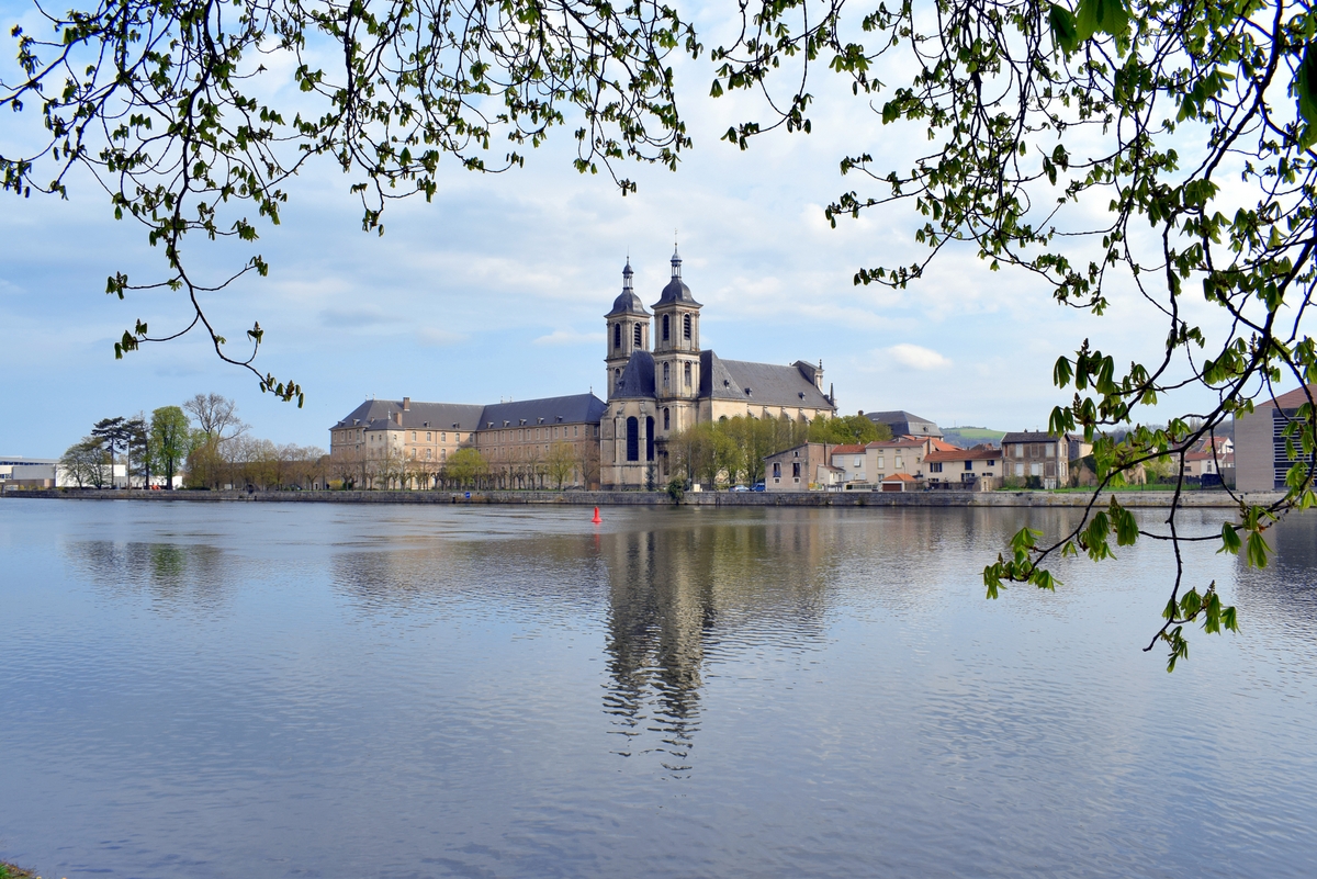
The main sights of the city are:
- The Duroc Square, lined with houses with 16th-century arcades,
- the Saint-Martin church, built in the 14th and 15th centuries on the model of Toul cathedral
- the former Premonstratensian abbey (Abbaye des Prémontrés), a fine example of 18th century monastic architecture.
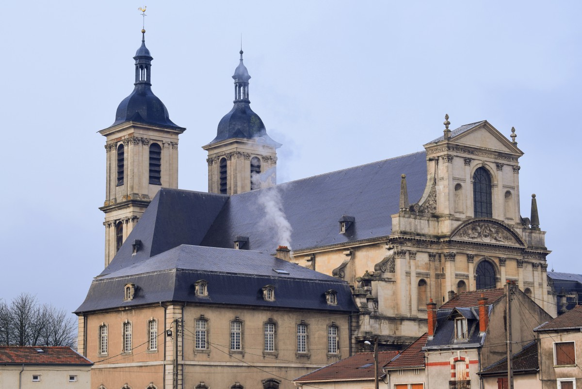
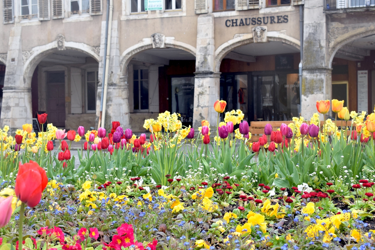
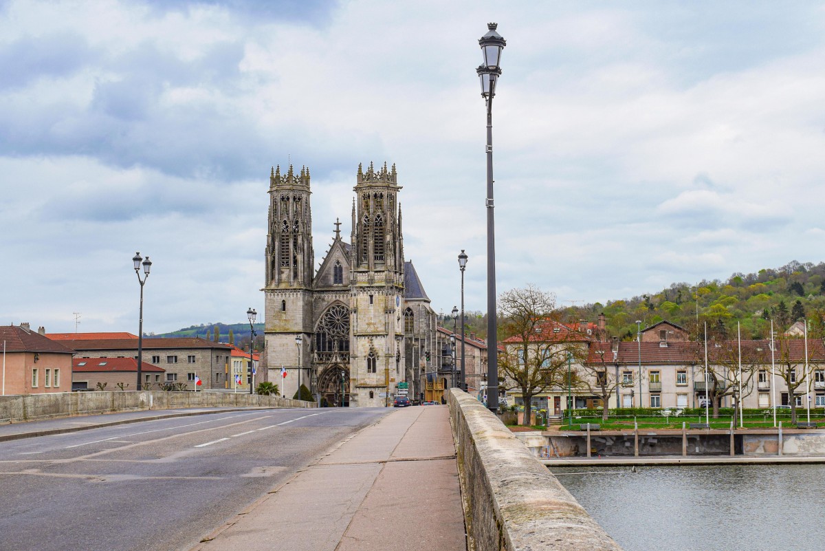
Dominating the city and the valley, the Butte de Mousson is occupied by a village and the ruins of the feudal castle of the Counts of Bar. It is a first-rate belvedere: remarkable panorama over the Lorraine region and the Moselle valley.
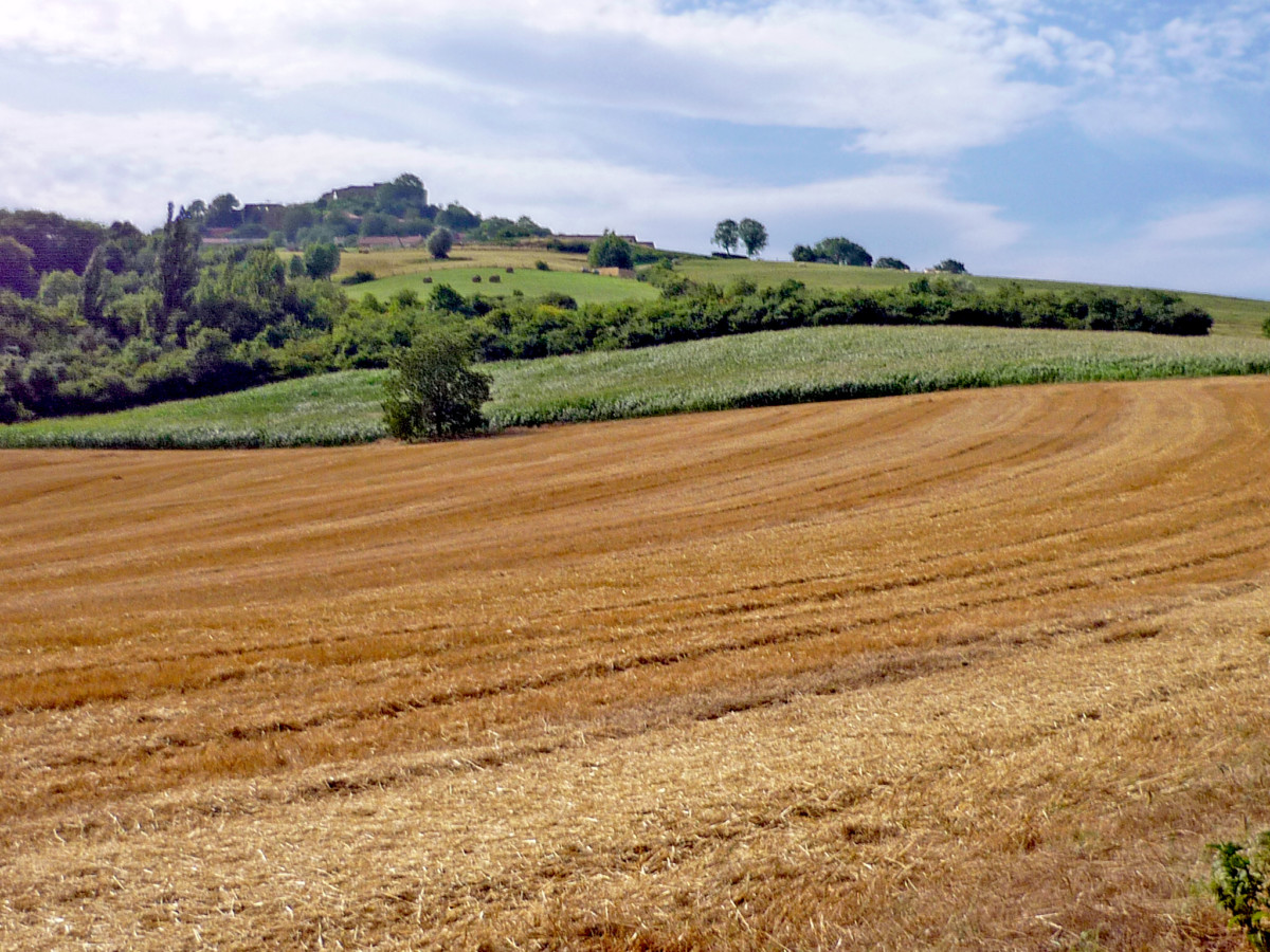
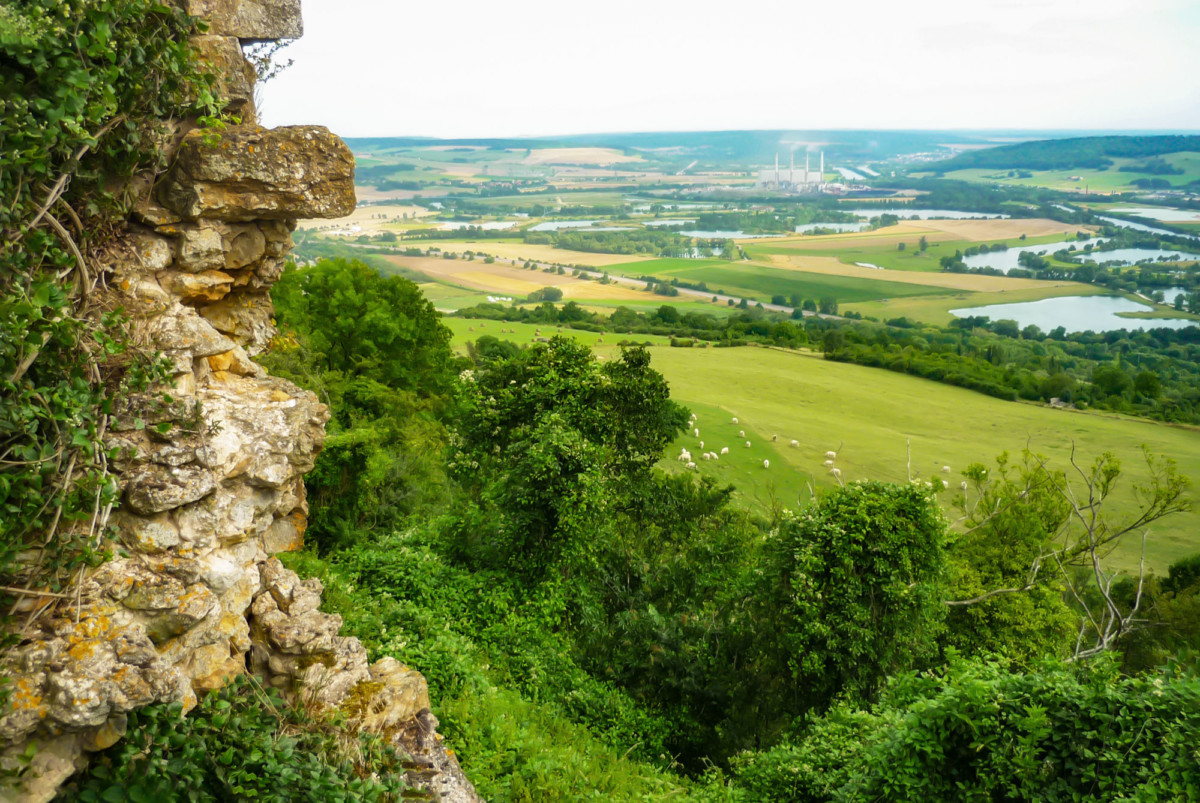
Prény
North of Pont-à-Mousson, the perched village of Prény dominates the valley at an altitude of 365 m. The ruins of its feudal castle are very old: they date back to the 9th century. It was the main residence of the Dukes of Lorraine before Nancy. Richelieu dismantled the castle.

From the castle, there is a lovely view over the valley and the village of Pagny-sur-Moselle.
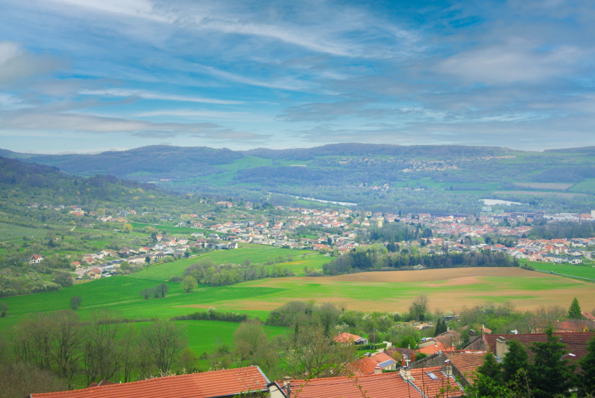
Stages in the département of Moselle
The Moselle enters the French département of Moselle in Novéant-sur-Moselle! (one couldn’t be prouder of the river!)
Gorze
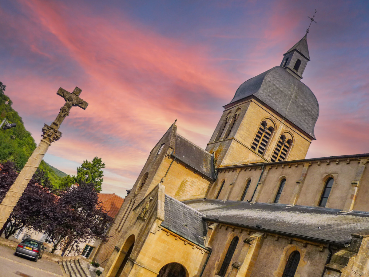
This very old town was formed around a Benedictine abbey founded in the 8th century by Saint Chrodegang, bishop of Metz. Gorze church dates from the late 12th – early 13th century and has a Romanesque exterior and a Gothic interior.
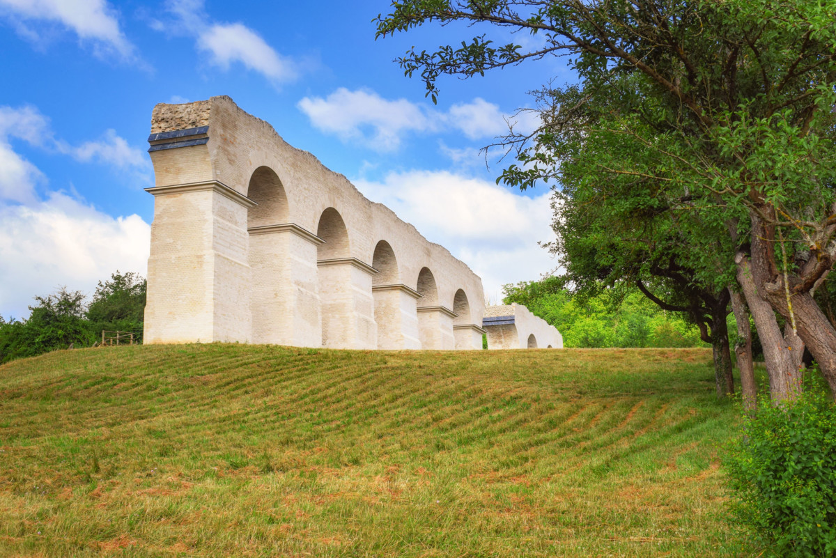
The Roman aqueduct that reached Metz began in Gorze. Some remains of the conduit are found along the D12 road and then in Ars-sur-Moselle and Jouy-aux-Arches.
The place called Croix Saint-Clément offers a magnificent view of Metz (to discover in the afternoon to avoid the backlight).
The slopes on the left bank are dotted with vineyards: the Côtes de Moselle.
Scy-Chazelles
As we have said, the Moselle is a European river.
This assertion is partly explained by Scy-Chazelles, a village backing onto Mont Saint-Quentin, on the heights of Metz.
The picturesque village of Pays Metz is home to the house of Robert Schuman (1896-1963), one of the “Fathers of Europe”. His last home is open to visitors and faithfully recreates the politician’s sober living environment.
![Robert Schuman's house in Scy-Chazelles © TCY - license [CC BY-SA 3.0] from Wikimedia Commons](https://frenchmoments.eu/wp-content/uploads/2021/01/Maison-de-Robert-Schuman-à-Scy-Chazelles-©-TCY-licence-CC-BY-SA-3.0-from-Wikimedia-Commons.jpg)
![The fortified church of Saint-Quentin in Scy-Chazelles © TCY - license [CC BY-SA 3.0] from Wikimedia Commons](https://frenchmoments.eu/wp-content/uploads/2021/01/Scy-Chazelles-Eglise-Saint-Quentin-©-TCY-licence-CC-BY-SA-3.0-from-Wikimedia-Commons.jpg)
Metz
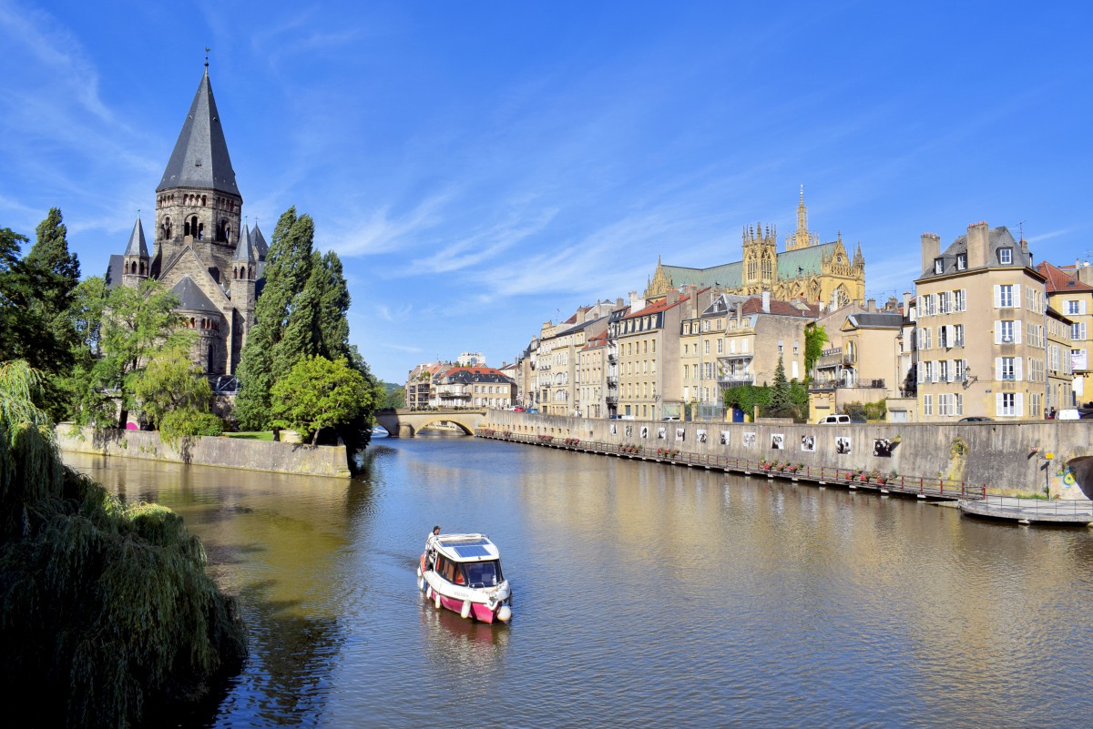
At Metz, the Moselle branches out into several arms before welcoming the waters of the Seille. These rivers run through a large part of the city centre, giving it the pleasant atmosphere of a city where “la vie est belle“.
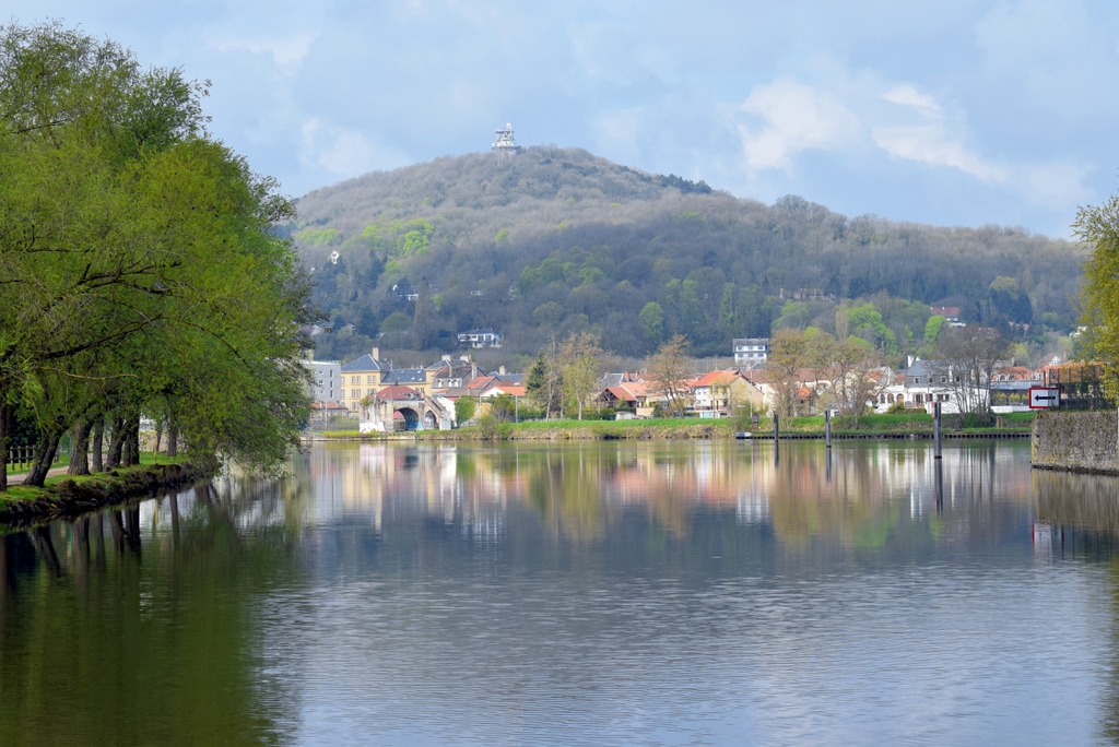
Metz has more than 2000 years of history. Monuments, churches and museums that deserve an extended stay are:
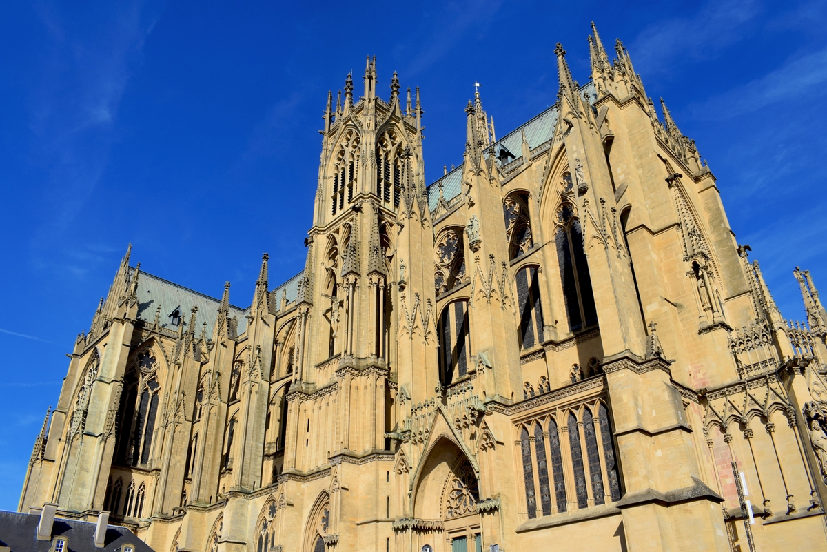
- the Saint-Etienne cathedral, nicknamed the Lantern of the God for the surface of its stained glass windows. A Gothic gem, the sanctuary celebrates its 800th anniversary in 2019-2020.
- the banks of the Moselle, a popular place for strolling in Messins, including the esplanade and the Saulcy Lake.
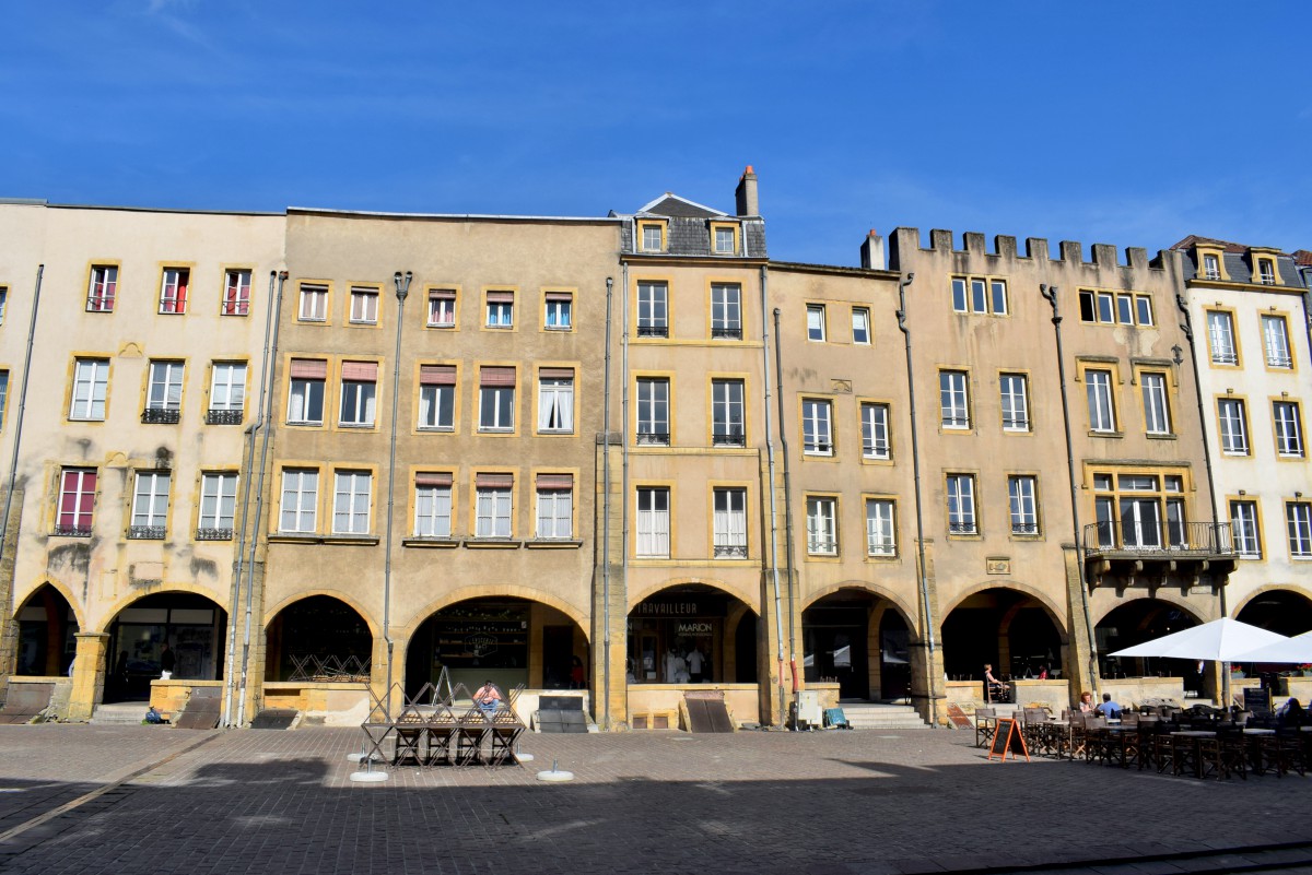
- the Place Saint-Louis, bordered by arcaded houses from the Middle Ages.
- the churches of Metz (Saint-Pierre-aux-Nonnains, Saint-Vincent, Saint-Martin, Saint-Eucaire …) some of which have fantastic stained-glass windows.
- the German gate (Porte des Allemands), a little castle spanning the Seille.
- the German imperial district and the railway station, one of the most beautiful stations in France.
- the Musée de la Cour d’Or and the Pompidou-Metz Centre.

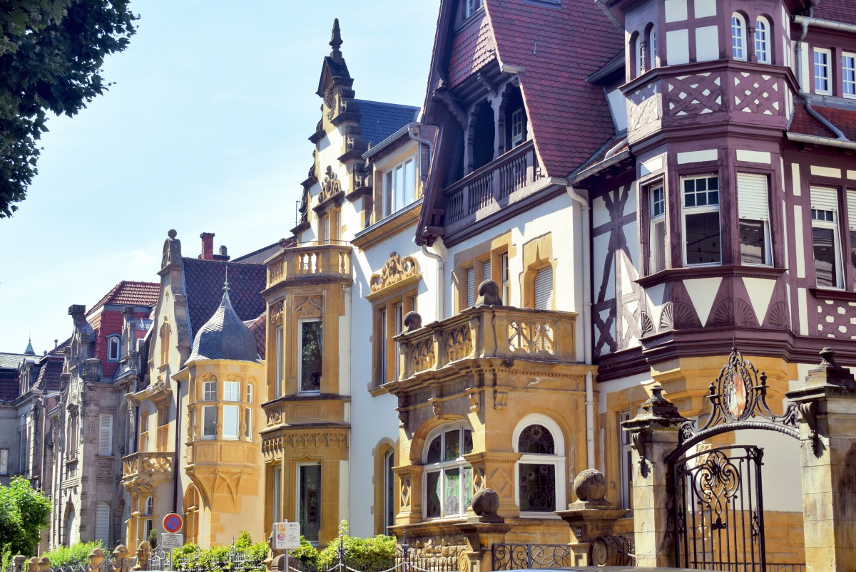
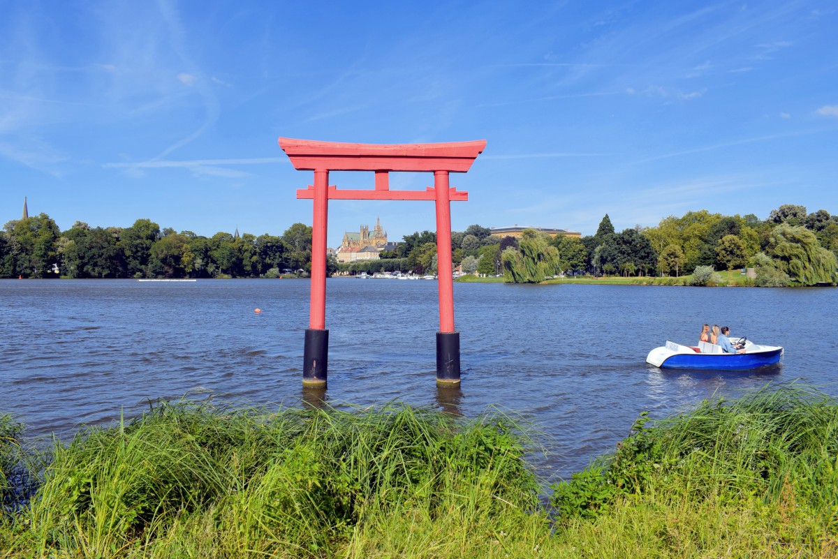
North of Metz, the valley presents only a succession of installations scattered over an area of exceptional industrial density.
The industrial river is dotted with localities that, until recently, housed forges, foundries, steelworks, sheet metal works, wire-drawing works, etc.
Although this setting is not very advantageous for tourists, there are nevertheless some popular attractions, notably in Amnéville-les-Bains.
Amnéville-les-Bains
For several decades, the municipality of Amnéville has made a name for itself in the tourism sector in Lorraine. Between Metz and Thionville, the former industrial centre of Amnéville has undertaken a successful conversion.
Today, the city is home to a thermal spa in the heart of a vast forest, coupled with a leading zoological park.
Three kilometres south of Amnéville, the Walygator Grand-Est theme park is the fourth busiest tourist site in Lorraine.
Uckange
Shortly before Thionville, Uckange is a town with a marked working-class past. From the industrial era, it has retained a blast furnace.
The U4 Blast Furnace Park
The last of the 6 blast furnaces at the Uckange plant, the U4 survived the decline of the steel industry in Lorraine thanks to its inclusion in the supplementary inventory of historic monuments.
The “iron monster” ceased its activity on December 17, 1991. After two years of work, the Haut Fourneau Park opened its doors to the public in 2007. On this site, we discover the production process of cast iron.
Thionville
Who remembers that Thionville was one of Charlemagne’s favourite residences and a former stronghold from the Middle Ages?
Many have only remembered its industrial past. Indeed, until the 1980s, Thionville, alias “the Iron Metropolis” was the nerve centre of an entire industrial zone extending on the left bank of the Moselle.
Remains of Thionville’s pre-industrial past can be admired in the old town and in the immediate surroundings:
- the Flea Tower (Tour aux Puces), the only vestige of the old feudal castle, dating from the 11th and 12th centuries
- the belfry (beffroi), a tower built in the 16th century with a capped lantern fitted with a bulb
- the church of Saint-Maximin and its beautiful baroque altar canopy from the 18th century
- the market square (Place du Marché) and its arcades
- the castle of Volkrange (16th century)
- the lock-bridges over the Moselle, from the 18th century, intended to strengthen the city’s fortifications
- the Château de la Grange, built in 1731 and its English-style park
![The Créhange hotel in Thionville. Photo: Aimelaime [Public Domain]](https://frenchmoments.eu/wp-content/uploads/2021/01/Thionville-Hotel-Créhange-by-Aimelaime-Public-Domain.jpg)
![The Belfry of Thionville. Photo: Aimelaime [Public Domain]](https://frenchmoments.eu/wp-content/uploads/2021/01/Thionville-Beffroi-by-Aimelaime-Public-Domain.jpg)
![The castle of Volkrange in Thionville. Photo: Aimelaime [Public Domain]](https://frenchmoments.eu/wp-content/uploads/2021/01/Thionville-Chateau-de-Volkrange-by-Aimelaime-Public-Domain.jpg)

![Château de La Grange Moselle © Château de La Grange - licence [CC BY-SA 3.0] from Wikimedia Commons](https://frenchmoments.eu/wp-content/uploads/2021/01/Château-de-La-Grange-Moselle-©-Château-de-La-Grange-licence-CC-BY-SA-3.0-from-Wikimedia-Commons.jpg)
Cattenom
The north of the Moselle département is marked by the vapours which escape from four enormous cooling towers with a height of 165 m. It is the Cattenom nuclear power plant, operated by Electricité de France (EDF) and commissioned from 1986 to 1992.
![Cattenom and Lake Mirgenbach © Bassaar - license [CC BY-SA 3.0] from Wikimedia Commons](https://frenchmoments.eu/wp-content/uploads/2021/01/Cattenom-Lac-du-Mirgenbach-©-Bassaar-licence-CC-BY-SA-3.0-from-Wikimedia-Commons.jpg)
In France, Cattenom is the second nuclear power plant for its electricity production (behind that of Gravelines).
Sierck-les-Bains
At the extreme northern tip of the Moselle département, very close to the border with Germany and Luxembourg, Sierck occupies a picturesque location. The vines are there with pleasure: it is the northern zone of the Côtes de Moselle.
![Sierck-les-Bains © Johannes Philipp - license [CC BY-SA 3.0] from Wikimedia Commons](https://frenchmoments.eu/wp-content/uploads/2021/01/Sierck-les-Bains-Moselle-©-Johannes-Philipp-licence-CC-BY-SA-3.0-from-Wikimedia-Commons.jpg)
Its narrow streets, dominated by the ruins of the castle, evoke a past steeped in history.
The castle of the Dukes of Lorraine stands on a rocky promontory overlooking the Moselle. Built in the 11th century, it was one of the favourite residences of the Dukes of Lorraine.
![Moselle Valley - Sierck-les-Bains © Christian Ries - license [CC BY-SA 3.0] from Wikimedia Commons](https://frenchmoments.eu/wp-content/uploads/2021/01/Sierck-les-Bains-©-Christian-Ries-licence-CC-BY-SA-3.0-from-Wikimedia-Commons.jpg)
To enjoy a superb view of the Sierck site, climb up to Stromberg, with slopes covered with vines.
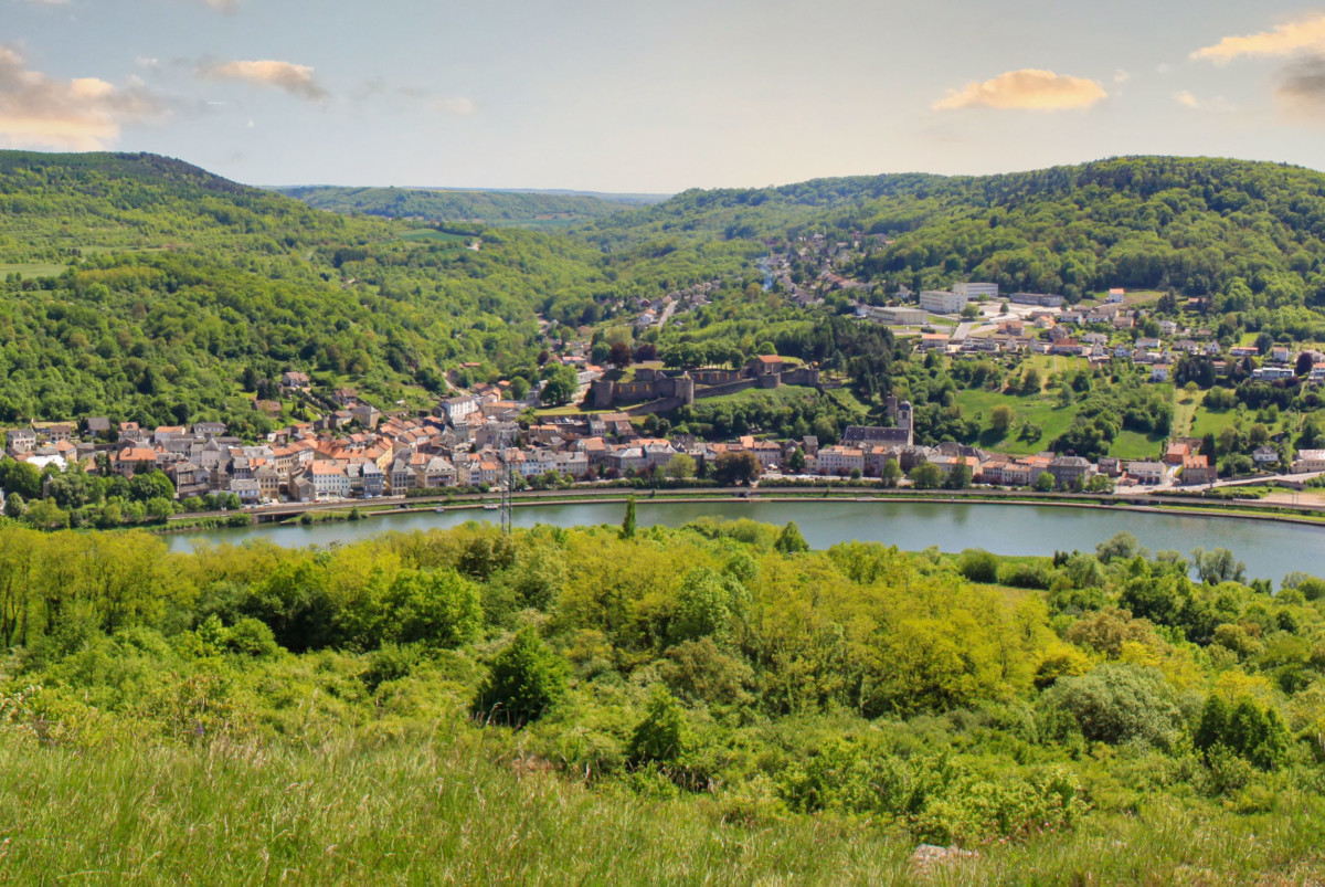
8 km from Sierck is the fantastic Château de Malbrouck. Located in the municipality of Manderen, the 15th-century fortress underwent extensive restoration in the 1990s.
![Malbrouck Castle © Cornischong - license [CC BY-SA 3.0] from Wikimedia Commons](https://frenchmoments.eu/wp-content/uploads/2021/01/Malbrouck-©-Cornischong-licence-CC-BY-SA-3.0-from-Wikimedia-Commons.jpg)
From Sierck, the Moselle leaves the large open spaces of Lorraine. The river rushes into a valley with steep slopes covered with vines, a prelude to a landscape that will be her own until the end of her course.
Thus ends our trip along the Moselle in Lorraine. Now let’s cross the Luxembourg border (left bank) and stop in a village whose name was made famous by a European treaty.
Stages in Luxembourg
The Moselle marks the border between Luxembourg and Germany. It is about 25 kilometres long, from Schengen to Wasserbillig. The landscape is picturesque to perfection, consisting of hillsides covered with vines dotted with villages and small towns.
Schengen
Schengen: here is the first Luxembourg municipality to be watered by the river, at the border Tripoint (or Three Country Point) between Luxembourg, France and Germany. The small village of 425 inhabitants gave its name to the eponymous convention, instituting the abolition of controls at European borders.
![Moselle in Schengen seen from Markusberg © Cayambe - license [CC BY-SA 3.0] from Wikimedia Commons](https://frenchmoments.eu/wp-content/uploads/2021/01/Schengen-du-Markusberg-©-Cayambe-licence-CC-BY-SA-3.0-from-Wikimedia-Commons.jpg)
A first agreement (the Schengen Agreement) was signed there on June 14, 1985 by five members of the EEC: Germany, Belgium, France, Luxembourg and the Netherlands. The signing of the agreement was organised on a boat, the Princess Marie-Astrid anchored on the Moselle.
Five years later, on June 19, 1990, European leaders signed a treaty extending to the whole of the European Union: the Schengen Convention.
Since 2010, the village has housed the European Schengen Museum, presenting the history and significance of the Schengen Agreements.
Perl
Cross the Moselle for a short detour into the German land of Saarland. In Perl, there is a tourist attraction from Ancient times: the Roman villa of Nennig and its magnificent mosaic floor.
![Ruins of the Roman Villa of Nennig © Carole Raddato - license [CC BY-SA 2.0] from Wikimedia Commons](https://frenchmoments.eu/wp-content/uploads/2021/01/Roman-villa-in-Nennig-©-Carole-Raddato-licence-CC-BY-SA-2.0-from-Wikimedia-Commons.jpg)
The site was discovered by chance by a peasant in 1852 and then restored in 1960. The Roman mosaic in the reception hall has stood the test of time. It is considered the largest and the best preserved north of the Alps.
![Mosaic of the Roman villa of Nennig © Carole Raddato - license [CC BY-SA 2.0] from Wikimedia Commons](https://frenchmoments.eu/wp-content/uploads/2021/01/Roman-Mosaics-in-Nennig-©-Carole-Raddato-licence-CC-BY-SA-2.0-from-Wikimedia-Commons.jpg)
Remich
Let us now return to Luxembourg, on the left bank of the Moselle.
Remich, nicknamed the “Pearl of the Moselle” is an ancient city of fishermen and boatmen.
![Moselle Valley - The river at Remich. Photo by Jwh [Public Domain]](https://frenchmoments.eu/wp-content/uploads/2021/01/Remich-et-Moselle-by-Jwh-Public-Domain.jpg)
It dates back to Roman times (Remacum) and was the site of the Battle of Remich (April 11, 882), opposing the Vikings to the Franks. Its old center is made up of narrow streets whose layout dates back to the Middle Ages.
Nowadays, cruise ships offer river tours on the Moselle.
After Stadtbredimus, take road 146, which joins Greiveldange, to admire beautiful views of the vineyards and the Moselle valley.
Wasserbillig
In Wasserbillig, the Luxembourg river of the Sûre flows into the Moselle which, from then on, becomes entirely German.
![Moselle Valley - Wasserbillig © Denise Hastert - license [CC BY-SA 4.0] from Wikimedia Commons](https://frenchmoments.eu/wp-content/uploads/2021/01/Wasserbillig-©-Denise-Hastert-licence-CC-BY-SA-4.0-from-Wikimedia-Commons.jpg)
Stages in Germany
As the crow flies, the distance between Wasserbillig (Luxembourg border) and Koblenz (the confluence) is 107 km. However, the Moselle crosses the land of Rhineland-Palatinate for 204 km or nearly double the distance! Indeed, from Trier to Koblenz, the waterway multiplies her meanders in a picturesque landscape, similar to that of the romantic Rhine.
But for now, let’s cross the border between Luxembourg and Germany and head to Konz.
Konz
Konz is a small town located about ten kilometres south of Trier. Ancient Contionacum, its name derives from the Latin word meaning “confluence”. Indeed, it is here that the confluence of the Moselle and the Sarre is located, a river originating in the Donon massif (Vosges).
![Moselle valley in the vicinity of Konz © Rhmaster - license [CC0] from Wikimedia Commons](https://frenchmoments.eu/wp-content/uploads/2021/01/Mosel_Bei_Konz_vom_Freilichtmuseum_Roscheiderhof-©Rhmaster-licence-CC0-from-Wikimedia-Commons.jpg)
Trier
The city of Trier, twinned with Metz since 1957, attracts visitors along its lively streets and squares where the memory of a glorious Roman past calls out.
![Trier and the Moselle Valley © Rhmaster - license [CC0] from Wikimedia Commons](https://frenchmoments.eu/wp-content/uploads/2021/01/Trier-©-Rhmaster-licence-CC0-from-Wikimedia-Commons.jpg)
Trier was founded in Roman times, in the year 16 BC. AD, under the name of Augusta Treverorum. With Worms, it is considered one of the oldest cities in Germany.
From this Roman past, Trier has preserved several imposing remains, classified as World Heritage by Unesco.
- The Romans built a stone bridge (Römerbrücke) over the Moselle in AD 45. This was rebuilt between 144 and 152, making the current structure the oldest bridge in Germany.
- From the stone wall erected all around the Roman colony remains the famous Porta Nigra, which has become the symbol of the city. The historic building dates from 170.
- The Basilica of Constantine (Konstantinbasilika), adjoining the princely palace, houses the largest room that has come down to us from Antiquity (3rd century).
- The remains of the Amphitheater (Amphitheater von Trier), one of the ten largest Roman amphitheatres.
- The remains of the Roman public baths (Imperial Baths of Trier – Kaiserthermen).
![Porta Nigra in Trier. Photo: Berthold Werner [Public Domain]](https://frenchmoments.eu/wp-content/uploads/2021/01/Trier-Porta-Nigra-by-Berthold-Werner-Public-Domain.jpg)
![The Imperial Baths of Trier © Berthold Werner - license [CC BY-SA 3.0] from Wikimedia Commons](https://frenchmoments.eu/wp-content/uploads/2021/01/Trier-Kaiserthermen-©-Berthold-Werner-licence-CC-BY-SA-3.0-from-Wikimedia-Commons.jpg)
![Trier Römerbrücke (Roman Bridge in Trier) © Johnny Chicago - license [CC BY-SA 3.0] from Wikimedia Commons](https://frenchmoments.eu/wp-content/uploads/2021/01/Trier-Römerbrücke-©-Johnny-Chicago-licence-CC-BY-SA-3.0-from-Wikimedia-Commons.jpg)
Sites and monuments to visit
- the Trier Cathedral (Trierer Dom St. Peter), Germany’s oldest cathedral
- the Church of Our Lady (Liebfrauenkirche), next to the cathedral and Gothic style (1227-1243)
- the market square (Hauptmarkt) and its beautiful residences in Renaissance, Baroque and Classical styles.
- the church abbey Saint Matthias (Benediktinerabtei St. Matthias), containing the alleged tomb of the apostle Matthias.
- the episcopal palace (Kurfürstliche Palais) of Renaissance and Rococo styles, residence of the prince-bishops of Trier until 1794.
- the Schloss Monaise, in neoclassical style, built by the Lorraine architect François Ignace Mangin from 1779 to 1783.
- the Trier Rhine Museum (Rheinische Landesmuseum Trier), which is one of the main archaeological museums in Germany.
![Trier Dom (Cathedral of Trier) © Berthold Werner - license [CC BY-SA 3.0] from Wikimedia Commons](https://frenchmoments.eu/wp-content/uploads/2021/01/Trier-Dom-©-Berthold-Werner-licence-CC-BY-SA-3.0-from-Wikimedia-Commons.jpg)
![The Market Square of Trier (Marktplatz) © Lokilech - license [CC BY-SA 3.0] from Wikimedia Commons](https://frenchmoments.eu/wp-content/uploads/2021/01/Trier-Marktplatz-©-Lokilech-licence-CC-BY-SA-3.0-from-Wikimedia-Commons.jpg)
![The Prince's Palace in Trier. Photo: Berthold Werner [Public Domain]](https://frenchmoments.eu/wp-content/uploads/2021/01/Trier-Kurfuerstliches-by-Berthold-Werner-Public-Domain.jpg)
![Detail of the Episcopal Palace in Trier © Dietrich Krieger - license [CC BY-SA 3.0] from Wikimedia Commons](https://frenchmoments.eu/wp-content/uploads/2021/01/Trier-Electoral-Palace-©-Dietrich-Krieger-licence-CC-BY-SA-3.0-from-Wikimedia-Commons.jpg)
To enjoy a panoramic view of Trier, climb to the Marian Column (Mariensäule).
Finally, Trier is a good starting point for exploring the Moseltal (downstream) or the Saar valley (upstream).
The Moseltal
Moseltal is the German name given to the Moselle valley between Trier and Koblenz. This is the most picturesque and touristic part of the noble stream.
![The Moselle Valley in Hatzenport © EwaStudio [Envato Elements]](https://frenchmoments.eu/wp-content/uploads/2021/01/landscape-with-the-river-moselle-in-germany-panora-P6GA59V-by-EwaStudio-Envato-Elements.jpg)
Indeed, the Moseltal offers splendid and romantic landscapes, shaped by man for 2000 years.
The Moselle winds its way between steep slopes and hillocks planted with vines, some crowned by impressive ruined castles.
![Discovering the Moselle Valley. Photo: Twenty20 [Envato Elements]](https://frenchmoments.eu/wp-content/uploads/2021/01/overlooking-the-mighty-mosel-river-in-germany-CWNQN2T-by-Twenty20Photos-Envato-Elements.jpg)
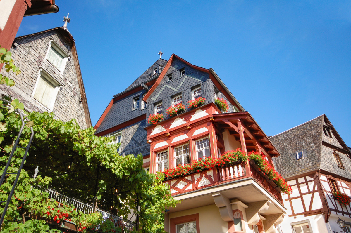
From one bend to another, it waters a multitude of picturesque wine villages. These consist of beautiful half-timbered houses huddled together and topped with slate roofs. Often, the bulbous steeple of an old church adds to the charm of the site.
Moselle wines
The vine, cultivated since the Romans, is omnipresent. Thanks to a particular exposure to the sun and clayey slate soil, the steep slopes of the Moseltal give grapes of exceptional quality. These produce particularly fine, fruity and mineral Moselle wines.
![Moseltal vineyard in Neumagen © Moltodor - license [CC BY-SA 3.0] from Wikimedia Commons](https://frenchmoments.eu/wp-content/uploads/2021/01/Märtyrrerkapelle_in_der_Weinlage_Neumagener_Rosengärtchen-©-Moltodor-licence-CC-BY-SA-3.0-from-Wikimedia-Commons.jpg)
Here, the king of the vineyard is undoubtedly the Riesling, whose colour evolves between greenish and golden yellow.
Villages and housing in the Moseltal
You will notice that many localities have compound names. These are former municipalities that merged, for the most part, in the early 1970s.
It is from Trier that the traditional habitat changes. The stone houses to which we were accustomed since the birth of the river in the Vosges are now giving way to Germanic-style half-timbered houses, as we see in Alsace … with a difference that said: the beams are often painted in Burgundy Red.
![Half-timbered house in Bernkastel © LoKiLeCe - license [CC BY-SA 4.0] from Wikimedia Commons](https://frenchmoments.eu/wp-content/uploads/2021/01/Bernkastel-©-LoKiLeCe-licence-CC-BY-SA-4.0-from-Wikimedia-Commons.jpg)
Do not hesitate to deviate from the road bordering the river and go up the coast to enjoy beautiful views of the valley.
In addition, to go from one bank to the other, you can use the ferries… Handy if the next bridge is several kilometres away!
The first picturesque landscapes of the Moselle Valley can be discovered from Schweich, 15 km north of Trier.
Schweich
Schweich is the gateway to the Roman Wine Route (Römische Wein Strasse whose territory covers 19 towns in the Schweich region, from Issel to Trittenheim.
![The Faehrturm in Schweich © Schweich - license [CC BY-SA 3.0] from Wikimedia Commons](https://frenchmoments.eu/wp-content/uploads/2021/01/Faehrturm-schweich-©-Schweich-licence-CC-BY-SA-3.0-from-Wikimedia-Commons.jpg)
The tourist route partly follows the ancient Roman roads which were traced along the river to facilitate trade.
The Moseltal is said to be the oldest wine region in contemporary Germany. Archaeological excavations have shown that the Romans cultivated vines there from the 1st century AD.
As a result, the Schweich region is home to several Roman remains: Villa Urbana in Longuich, Villa Rustica in Mehring, a Roman cellar in Kenn …
Neumagen-Dhron
Neumagen-Dhron is considered the oldest wine village in Germany.
It owes this title to the discovery in 1878 of the Neumagener Weinschiff. This stone tomb of a Roman wine merchant from AD 220 takes the form of a wine cellar. This is a tanker fitted out for the transport of wine which the Romans used to supply their empire with wines from the Moseltal.
![The Neumagener Weinschiff © Stefan Kühn - license [CC BY-SA 3.0] from Wikimedia Commons](https://frenchmoments.eu/wp-content/uploads/2021/01/Neumagener-Weinschiff-©-Stefan-Kühn-licence-CC-BY-SA-3.0-from-Wikimedia-Commons.jpg)
A life-size wooden replica was built in 2007. It is the largest reconstructed Roman barge in the German countries.
![The Roman Pinardier of Neumagen (reconstruction) © Neumagener-Weinschiff Crew - license [CC BY 3.0] from Wikimedia Commons](https://frenchmoments.eu/wp-content/uploads/2021/01/Neumagener-Weinschiff-©-Neumagener-Weinschiff-Crew-licence-CC-BY-3.0-from-Wikimedia-Commons.jpg)
Lieser
The small town of Lieser is dominated by the late Baroque parish church of St. Peter. Its old centre is made up of old winegrowers’ houses.
![Lieser Parish Church © Gudrun Meyer - license [CC BY-SA 3.0] from Wikimedia Commons](https://frenchmoments.eu/wp-content/uploads/2021/01/Lieser-Pfarrkirche-©-Gudrun-Meyer-licence-CC-BY-SA-3.0-from-Wikimedia-Commons.jpg)
Along Moselstrasse, Schloss Lieser is an imposing castle built between 1884 and 1887 in the Wilhelminian style then in vogue in Germany.
![The Lieser Schloss © Berthold Werner - license [CC BY-SA 4.0] from Wikimedia Commons](https://frenchmoments.eu/wp-content/uploads/2021/01/Lieser-Schloss-©-Berthold-Werner-licence-CC-BY-SA-4.0-from-Wikimedia-Commons.jpg)
Bernkastel-Kues
With 7,100 inhabitants, the thermal spa of Bernkastel-Kues is one of the largest towns in the Moseltal. The historic district of Bernkastel on the right bank is the most picturesque.
![Moselle Valley - Bernkastel-Kues. Photo: Berthold Werner [Public Domain]](https://frenchmoments.eu/wp-content/uploads/2021/01/Bernkastel-Kues-by-Berthold-Werner-Public-Domain.jpg)
The market square (Marktplatz) and its surroundings have beautiful half-timbered and gabled houses from the 17th century.
![Bernkastel Market Square by Berthold Werner [Public Domain]](https://frenchmoments.eu/wp-content/uploads/2021/01/Bernkastel-by-Berthold-Werner-Public-Domain.jpg)
Among them stands out the famous pointy house from 1416 (Spitzhäuschen):
![Pointy house of Bernkastel. Photo: Berthold Werner [Public Domain]](https://frenchmoments.eu/wp-content/uploads/2021/01/Bernkastel-Spitzhäuschen-by-Berthold-Werner-Public-Domain.jpg)
Also worth seeing is the parish church of Saint Michael and Saint Sabastian, with its bell tower, which was originally built in 1291 to serve as a defensive tower.
From the ruins of Landshut castle, a magnificent viewpoint over the town and the Moseltal vineyards.
![The Burg Landshut in Bernkastel-Kues © DooFi - license [CC BY-SA 3.0] from Wikimedia Commons](https://frenchmoments.eu/wp-content/uploads/2021/01/Burg-Landshut-Bernkastel-Kues-©-DooFi-licence-CC-BY-SA-3.0-from-Wikimedia-Commons.jpg)
Traben-Trarbach
![Moselle Valley - Traben-Trarbach © Guenni - license [CC BY-SA 3.0] from Wikimedia Commons](https://frenchmoments.eu/wp-content/uploads/2021/01/Traben-Trarbach-Panorama-©-Guenni-licence-CC-BY-SA-3.0-from-Wikimedia-Commons.jpg)
Established on both sides of the river, the village of Traben-Trarbach is home to several Jugendstil (Art Nouveau) villas. They were built for wealthy wine merchants. In fact, in the 1900s, Traben-Trarbach became the second wine trading centre in Europe after Bordeaux. In high demand, Moselle Riesling was exported mainly to the United Kingdom and beyond Europe. This trade led to the creation of a hundred wine companies, contributing to the prosperity of Moseltal.
![Hotel_Moselschlößchen, Traben-Trarbach © giggel - license [CC BY 3.0] from Wikimedia Commons](https://frenchmoments.eu/wp-content/uploads/2021/01/Traben-Trarbach-Hotel_Moselschlößchen-©-giggel-licence-CC-BY-3.0-from-Wikimedia-Commons.jpg)
Also to be seen in Traben-Trarbach:
- the Bridge Gate (Brückentor). This symbol of the city was built in 1899 after the completion of the bridge over the Moselle.
- Jugendstil villas (Hotel Bellevue, Villa Huesgen, Villa Nollen, etc.)
- the ruins of Grevenburg (circa 1350), the former residence of the Counts of Sponheim, were destroyed by the French in July 1734.
- the ruins of the Mont Royal fortress (1687-1688), built by Vauban under Louis XIV.
![Brigde Gate, Traben-Trarbach © Henk Monster - license [CC BY 3.0] from Wikimedia Commons](https://frenchmoments.eu/wp-content/uploads/2021/01/Traben-Trarbach-Mosel-bridge-©-Henk-Monster-licence-CC-BY-3.0-from-Wikimedia-Commons.jpg)
![Moselle Valley: Traben-Trarbach © Steffen Schmitz - license [CC BY-SA 3.0 de] from Wikimedia Commons](https://frenchmoments.eu/wp-content/uploads/2021/01/Traben-Trarbach-©-Steffen-Schmitz-licence-CC-BY-SA-3.0-de-from-Wikimedia-Commons.jpg)
Zell
This small seaside resort located on the right bank of the Moselle was founded by the Romans in 70 AD.
![Moselle Valley - Zell © Michael Pabst - license [CC BY-SA 3.0 de] from Wikimedia Commons](https://frenchmoments.eu/wp-content/uploads/2021/01/Zell-Mosel-©-Michael-Pabst-licence-CC-BY-SA-3.0-de-from-Wikimedia-Commons.jpg)
Recognisable by its bulbous bell tower, the parish church of Saint-Pierre has a precious reliquary from Limoges. Dated 1180-1190, this one allegedly contains a bone of Saint-Pierre.
The town castle of Zell (Schloss Zell) is a two-winged building in the Gothic style (1530-1542).
![Zell Schloss © Rolf Kranz - license [CC BY-SA 4.0] from Wikimedia Commons](https://frenchmoments.eu/wp-content/uploads/2021/01/Zell-Schloss-©-Rolf-Kranz-licence-CC-BY-SA-4.0-from-Wikimedia-Commons.jpg)
The remains of medieval fortifications, the Bach Tower (Viereckigerturm) and the Powder Tower (Pulverturm), stand in the vineyards.
![The Moselle Valley in Zell by Ramessos [Public Domain]](https://frenchmoments.eu/wp-content/uploads/2021/01/Zell-Mosel-by-Ramessos-Public-Domain.jpg)
For the anecdote, Zell is twinned with Crépy-en-Valois in the French département of Oise (Hauts-de-France).
Bremm
The charming village of Bremm is famous for its Calmont vineyard. It is the steepest vineyard in Europe, with a height of 120 meters and a slope with an inclination of up to 68 degrees. The vines produce famous Grand Cru wines: Bremmer Calmont.
Beilstein
The village of Beilstein occupies an exceptional site which one must admire from the other bank of the Moselle.
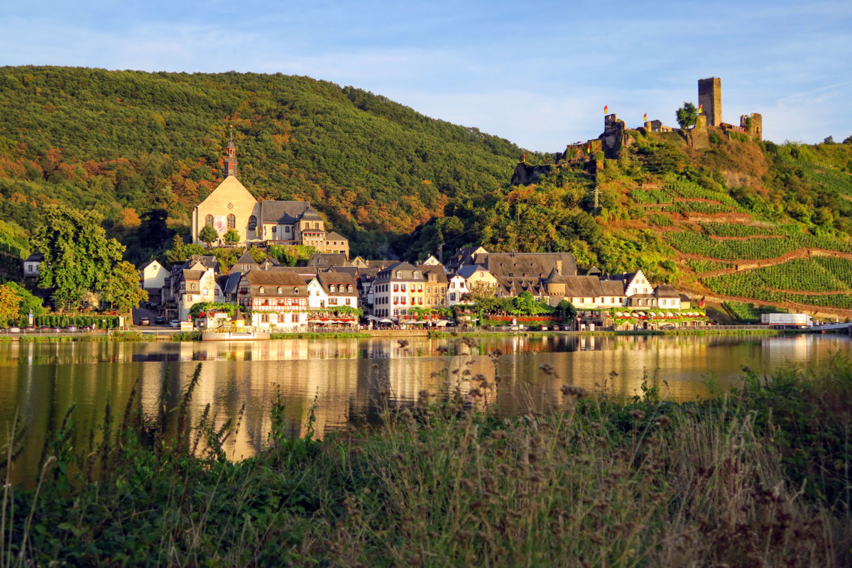
Nicknamed “ The Sleeping Beauty of the Moselle ”, the village is dominated by the romantic ruins of Burg Metternich.
Cochem
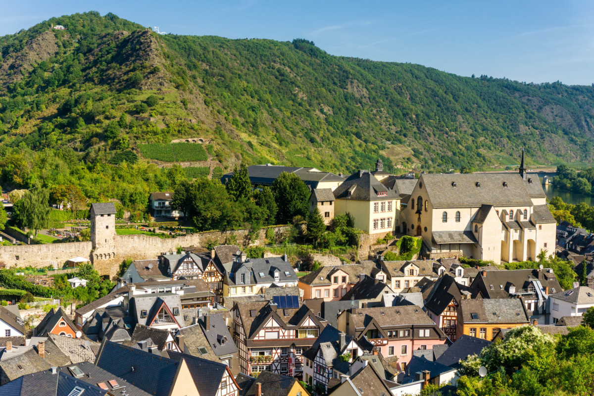
Here we are at the emblematic site of the Moselle Valley. A remarkable site photographed many times.
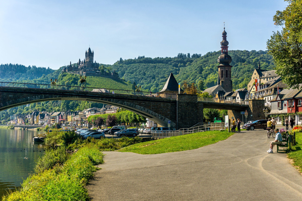
With its castle placed as if by magic on a hill planted with vines on the banks of the Moselle, Cochem is one of the most romantic sites in Germany.
![Cochem's Reichsburg © Steffen Schmitz- license [CC BY-SA 3.0 DE] from Wikimedia Commons](https://frenchmoments.eu/wp-content/uploads/2021/01/Cochem-Reichsburg-©-Steffen-Schmitz-licence-CC-BY-SA-3.0-DE-from-Wikimedia-Commons.jpg)
The site was already occupied during the time of the Celts and Romans. Cochem was first mentioned in 886 under the name of Villa Cuchema.
From 1294 until the French occupation in 1794, Cochem belonged to the territories of the Archdiocese of Trier. In 1332, Cochem obtained city status, which allowed the inhabitants to fortify their city. Some sections and gates of the medieval rampart remain today.
In 1689, Louis XIV‘s troops set fire to the castle of Winneburg and then conquered Cochem and its castle.
After Napoleon dissolved the Electorate of Trier, Cochem and its castle were ruled by the French and then the Prussians.
What to see in Cochem
- the half-timbered houses of old Cochem
- the Town Hall (Rathaus), built in 1739 in the Baroque style
- the market square (Marktplatz) and the Saint-Martin fountain (Martinsbrunnen), mentioned for the first time in 1459
- the fortified gates of Enderttor, Balduinstor, Stadtmauertor Kirchgasse and Martinstor
- the parish church Saint-Martin (Pfarrkirche St. Martin), built from 1456, Gothic choir of the 15th century. The tower of the church is surmounted by a magnificent onion bell tower
- the old mustard mill (Senfmühle)
- the walk along the Moselle
- the fantastic Reichsburg castle, mentioned for the first time in 1130. It was destroyed by the troops of Louis XIV in 1689 and rebuilt in the second half of the 19th century by its new owner, the Berlin entrepreneur and patron Louis Fréderic Jacques Ravené. As its name suggests, he was a descendant of a French Huguenot family who took refuge in Berlin in 1685 following the revocation of the Edict of Nantes. The castle can be visited and houses a museum.
- the ruins of the perched castle of Winneburg. The castle, built around 1300, was burnt down by the troops of Louis XIV in 1689.
- the Brauselay nature reserve, characterised by Mediterranean vegetation.
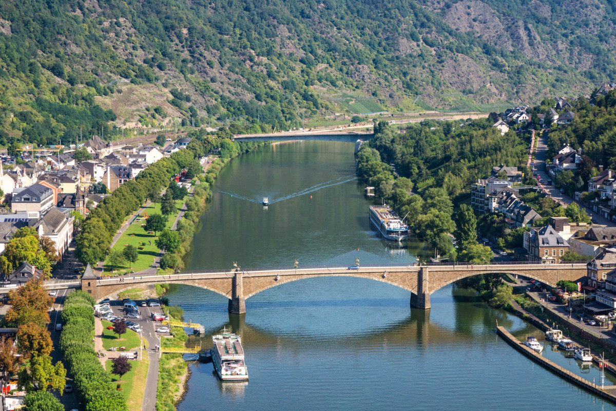
![The Reichsburg in Cochem. Photo © haveseen [Envato Elements]](https://frenchmoments.eu/wp-content/uploads/2021/01/beautiful-reichsburg-castle-on-a-hill-in-cochem-ge-A2T7GA8-by-haveseen-Envato-Elements.jpg)
![The Market Square in Cochem © Michael Pabst - license [CC BY-SA 3.0 de] from Wikimedia Commons](https://frenchmoments.eu/wp-content/uploads/2021/01/Cochem-Marktplatz-©-Michael-Pabst-licence-CC-BY-SA-3.0-de-from-Wikimedia-Commons.jpg)
To admire a panoramic view of Cochem, go to the Pinnerkreuz. You can access it by a chairlift. At the top is also an animal and leisure park.
For the anecdote, Cochem has been the twinning town of Avallon in Burgundy since 1966.
From Cochem, the Moselle route ceases to meander without, however, adopting a straight course.
Klotten
Four kilometres downstream from Cochem, the pretty village of Klotten, built in stages on the slope of a hill, dominates the picturesque site. The romantic ruins of Coraidelstein Castle are also nearby.
![Klotten © Rolf Kranz - license [CC BY-SA 4.0] from Wikimedia Commons](https://frenchmoments.eu/wp-content/uploads/2021/01/Klotten-©-Rolf-Kranz-licence-CC-BY-SA-4.0-from-Wikimedia-Commons.jpg)
Eltz Castle
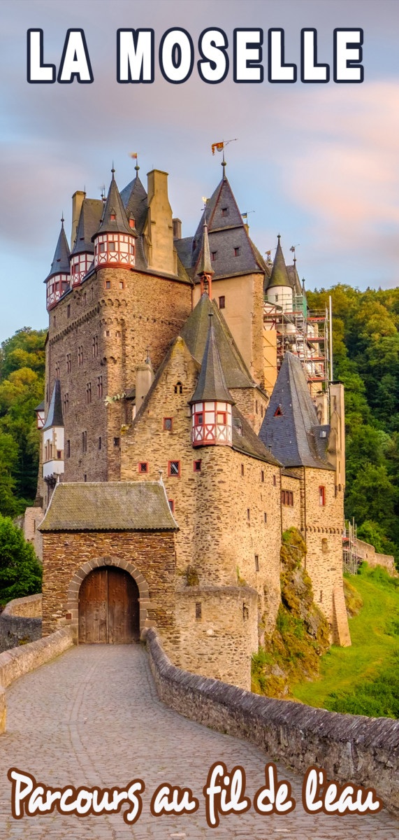
Three kilometres away from the Moselle Valley, stands one of the most famous castles in Germany: the Burg Eltz.
Photographed many times, the castle is also extremely popular on social networks, particularly on Instagram. Sure, it looks straight out of a tale…
![Burg Eltz. Photo © haveseen [Envato Elements]](https://frenchmoments.eu/wp-content/uploads/2021/01/burg-eltz-castle-in-rhineland-palatinate-at-sunset-PESR7QZ-by-haveseen-Envato-Elements.jpg)
This powerful fortress, placed as if by magic in the middle of hills covered with a thick forest, has something to dream of.
The first mention of the castle dates from 1157. It refers to a deed of donation of the domain of Frederick Barbarossa to Rudolf zu Eltz. The castle was restored in the 19th century and welcomed famous guests such as Victor Hugo and Kaiser Wilhelm II.
![Burg Eltz. Photo © haveseen [Envato Elements]](https://frenchmoments.eu/wp-content/uploads/2021/01/burg-eltz-castle-in-rhineland-palatinate-at-sunset-PG2Q7YQ.-by-haveseen-Envato-Elementsjpg.jpg)
The castle is open to visitors. We discover many rooms, some furnished (weapons room, Rübenach living room, Rübenach bedroom, Princes-Electors room, Knights room, etc.).
And for the little anecdote, this castle belongs to the Eifel massif, a region of hills from which came the ancestors of a certain Gustave Bönickhausen known as Eiffel: yes, the engineer who designed a famous iron tower of 300 meters in Paris. Remember, it was the Pompey factory, upstream of the Moselle, who delivered him the tower’s puddle iron…
Alken
Another one of those irresistible villages in which charm operates! Between Moselle and vineyards, Alken extends on the left bank, in the shade of its powerful fortified castle.
![Thurant Castle in Alken. Photo © HaveSeen [Envato Elements]](https://frenchmoments.eu/wp-content/uploads/2021/01/thurant-castle-and-vineyards-above-moselle-river-n-PUPEN9Y-by-HaveSeen-Envato-Elements.jpg)
To see in Alken:
- the old half-timbered houses in the village centre (especially on Von-Wiltbergstrasse and Oberstrasse)
- the Saint-Michael chapel (Michaelskirche), one of the oldest churches in the Moseltal
- the castle of the Archbishops of Trier (Burghaus der Trierer Erzbischöfe), built around 1350 and rebuilt in the 17th century
- the Wiltberg wine cellar with vaulted cellars dating from the 1700s
- the imposing fortified castle of Thurant (Burg Thurant) whose two round towers stand proudly above the village. The Palatine Count Henri, brother of King Otto VI, had it built in 1197, on his return from the Crusades. It was named in memory of the occupation by the Crusaders of the fortress of Toron (now in Lebanon).
To admire a magnificent view of Alken and Thurant Castle, cross the river to reach the right bank.
Kobern-Gondorf
This compound name unsurprisingly reveals two different localities, Kobern and Gondorf, each with its own historic district.
Their old centres have preserved a considerable amount of medieval buildings, and no less than four castles!
In Gondorf, the river castle von der Leyen (Schloss von der Leyen) dates from the 14th and 17th centuries. This historic residence of the princes von der Leyen stands on a small promontory which shelters it from the floods of the Moselle. In 1971, during the construction of federal road 416 between the railway line and the river, part of the ground floor of the castle was opened to allow the road to pass through.
Von der Leyen, does that remind you of anything? Curiously, this is the married name of the current President of the European Commission: Ursula von der Leyen. Is her husband’s family originally from Moseltal?
![Schloss Gondorf © Steffen Schmitz - license [CC BY-SA 3.0 de] from Wikimedia Commons](https://frenchmoments.eu/wp-content/uploads/2021/01/Kobern-Gondorf-Schloss-Gondorf-©-Steffen-Schmitz-licence-CC-BY-SA-3.0-de-from-Wikimedia-Commons.jpg)
The lower Gondorf Castle (Niederburg Gondorf or Schloss Liebieg) dates from the 13th century but was restored in the middle of the 19th century.
Two 12th-century castles dominate Kobern: the Lower Castle (Niederburg Kobern) and the Upper Castle (Oberburg Kobern), perched on a ridge 200 meters above sea level.
![The Niederburg in Kobern © Phantom3Pix - license [CC BY-SA 4.0] from Wikimedia Commons](https://frenchmoments.eu/wp-content/uploads/2021/01/Niederburg-in-Kobern-©-Phantom3Pix-licence-CC-BY-SA-4.0-from-Wikimedia-Commons.jpg)
The Moseltalbrücke
As we approach the penultimate stage of our trip, here is the Moseltalbrücke. It is a motorway bridge crossing the Moseltal. Inaugurated in 1972, it allows the A61 to link the Hunsrück to the Eifel.
![Moseltalbrücke © Rolf Kranz - license [CC BY-SA 4.0] from Wikimedia Commons](https://frenchmoments.eu/wp-content/uploads/2021/01/Moseltalbrücke-©-Rolf-Kranz-licence-CC-BY-SA-4.0-from-Wikimedia-Commons.jpg)
Seen from the valley, it makes a great impression with its height of 136 metres. It is indeed the third-highest bridge in Germany. You can admire the belvedere of the motorway rest areas … and take the opportunity to discover Roman ruins nearby.

Winningen
Here we are in the last city of the charm of the Moseltal before arriving in Koblenz.
Winningen is one of the most beautiful villages in Rhineland-Palatinate and annually hosts the Winninger Moselfest, Germany’s oldest wine festival. It is also the longest party of its kind, spanning 10 days, from late August to early September.
Thus, the Winningen Riesling variety, which thrives on slate terraces, is, according to experts’ judgment, one of the best wines in the world.
![The Winningen terraced vineyard © Rolf Kranz - license [CC BY-SA 4.0] from Wikimedia Commons](https://frenchmoments.eu/wp-content/uploads/2021/01/Winningen-Winninger-Roettgen-©-Rolf-Kranz-licence-CC-BY-SA-4.0-from-Wikimedia-Commons.jpg)
The parish church is a baroque hall church from 1695 flanked by a Romanesque tower.
In the centre of the village, half-timbered houses surround a fountain bearing the name Weinhexbrunnen (the fountain of the wine witch). This name alludes to the witch trials that took place in the area in the 17th century.
On the Witches Hill (Hexenhügel), which dominates the village, a small monument of 1925 commemorates the twenty women victims of the filthy witch hunt. It is the oldest memorial of its kind.
![The witch-hunt victims memorial in Winningen (Hexendenkmal) © Klaus Graf - license [CC BY 2.0] from Wikimedia Commons](https://frenchmoments.eu/wp-content/uploads/2021/01/Winningen-Hexendenkmal-©-Klaus-Graf-licence-CC-BY-2.0-from-Wikimedia-Commons.jpg)
The witch hunt was not exclusive to Moseltal. There were also similar acts in Bergheim in Alsace.
Koblenz
Koblenz (Coblence in French) derives from the word “confluence”.
Indeed, at the confluence of the Moselle and the Rhine, Koblenz marks the end of the journey.
![General view of Koblenz © Holger Weinandt - license [CC BY-SA 3.0 DE] from Wikimedia Commons](https://frenchmoments.eu/wp-content/uploads/2021/01/Koblenz-©-Holger-Weinandt-licence-CC-BY-SA-3.0-DE-from-Wikimedia-Commons.jpg)
The city is a starting point for cruises on the Rhine and the Moselle, and it belonged to the electorate of Trier for a long time (from 1018 to 1797).
Deutsches Eck
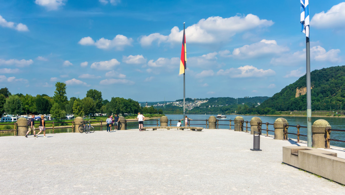
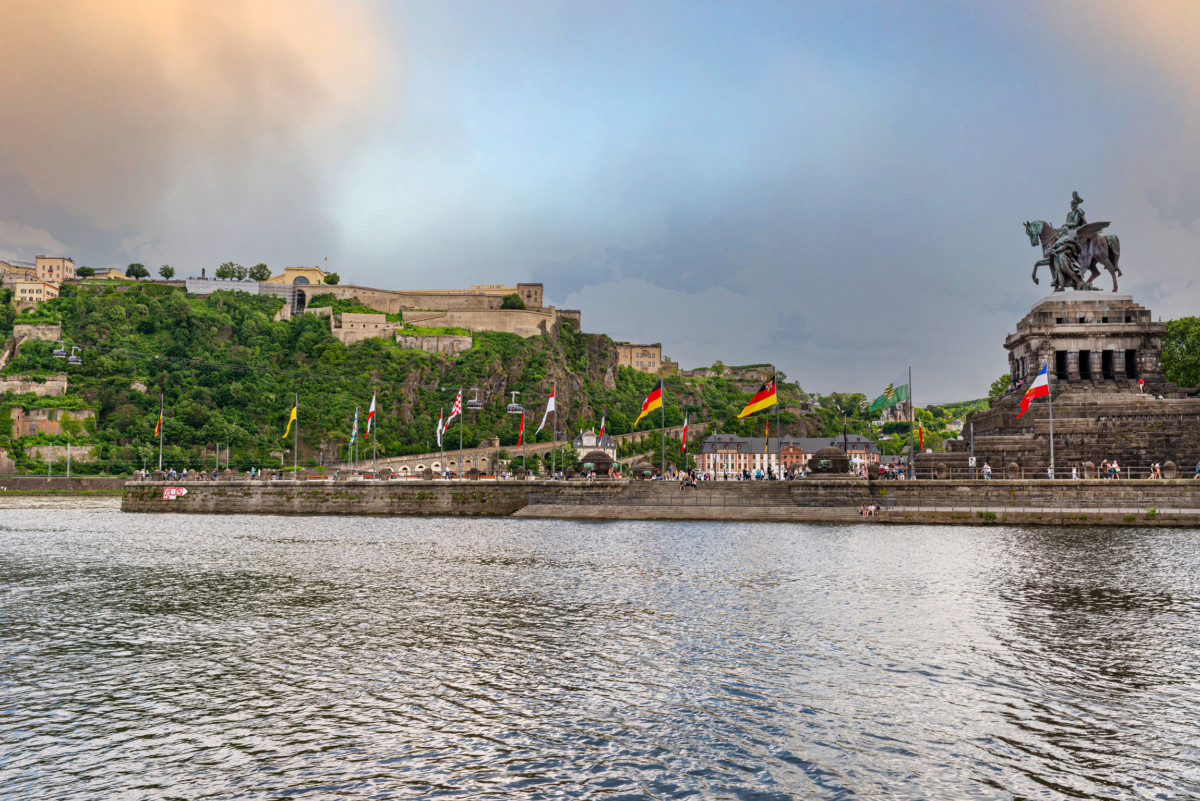
The actual confluence is marked by a monument: the Deutsches Eck, to the glory of Emperor William I. Deutsches Eck means “corner of Germany“.
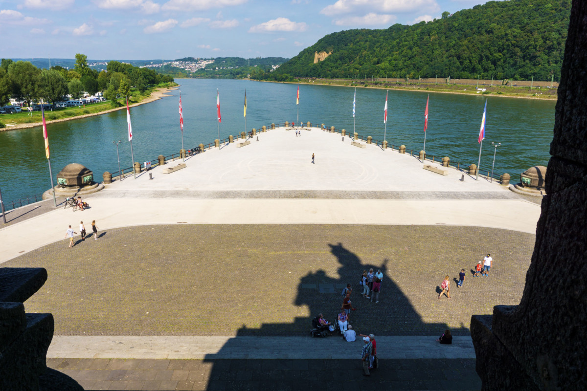
The Kaiser, who died in 1888, was represented by a monumental statue … destroyed by artillery fire in 1945. For a long time, a German flag replaced the statue of William I. The municipality of Koblenz restored and inaugurated the present monument in 1993, after long controversies.
Other monuments and sites to see
The city centre of Koblenz is pedestrian-friendly, which allows you to discover some monuments while strolling through the streets…
- the Church of Our Lady of Koblenz (Liebfrauenkirche). This Romanesque sanctuary was remodelled in the 13th century. Its Gothic choir dates from the 15th century and its baroque bell towers from the 17th century.
- the Romanesque Basilica of St. Castor (Kastorkirche), the oldest church in Koblenz.
- the castle of the Princes-Electors (Kurfürstliches Schloss), built at the end of the 18th century according to the plans of the French architects Pierre-Michel d’Ixnard and Antoine-François Peyre.
- the palace of the Prussian government (preußische Regierungsgebäude), erected between 1902 and 1905, and whose belfry resembles that of Metz station.
- the fortress of Ehrenbreitstein towers 118 meters above the site of the confluence. Property of the bishops of Trier, the strategic place has been occupied since the 10th century. The Prussians built the current buildings between 1816 and 1832. You can reach it via a cable car from the city centre.
![The Kurfürstliches Schloss in Koblenz © Holger Weinandt - license [CC BY-SA 3.0 de] from Wikimedia Commons](https://frenchmoments.eu/wp-content/uploads/2021/01/Koblenz-Kurfürstliches-Schloss-©-Holger-Weinandt-licence-CC-BY-SA-3.0-de-from-Wikimedia-Commons.jpg)
![Koblenz Old Town © Holger Weinandt - license [CC BY-SA 3.0] from Wikimedia Commons](https://frenchmoments.eu/wp-content/uploads/2021/01/Koblenz-Altstadt-©-Holger-Weinandt-licence-CC-BY-SA-3.0-from-Wikimedia-Commons.jpg)
Since 1963, Koblenz has been twinned with Nevers in France.
Finally, for the little anecdote, it was in Koblenz that a President of the French Republic was born in 1926: Valéry Giscard d’Estaing.
Find out more about the Moselle Valley
- Read the French version of this article
- Discover the 5 great Rivers of France
- Find all my blog articles on Lorraine
- The site Lorraine Tourism
- The site Visit Luxembourg
- Rhineland-Palatinate tourist board
- Cochem wine region tourist board
- The article dedicated to the Moselle on Wikipedia
- Story of a hike along the Moselle Valley, from the source to Koblenz [in French]
The Moselle Valley: Pin it on Pinterest
