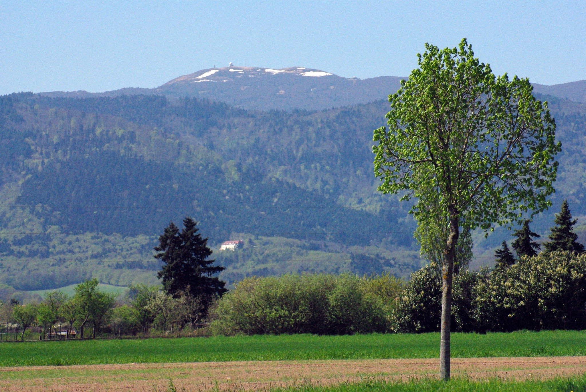


The Grand Ballon, at 1,424 metres / 4,672 ft above sea level, is the highest summit in the Vosges Mountains.
It is also the highest point in the historic region of Alsace and in the Haut-Rhin département.
In short, when it comes to dominating the surrounding landscape, it does not do things by halves.
Visible from the Alsace Plain and easily recognisable thanks to the large white radar dome near its summit, the Grand Ballon is one of the most emblematic sites in the Vosges.
People come here for the view, for the Route des Crêtes, for hiking, for cycling… and sometimes simply to enjoy a breath of fresh mountain air when the Alsace Plain is gently starting to roast in summer.
In 2026, the Grand Ballon also returns to the spotlight thanks to the Tour de France.
It is the perfect opportunity to rediscover this Vosges summit: a mountain many people know by name, but have not always taken the time to explore properly.
The Grand Ballon or Ballon de Guebwiller
The Grand Ballon is also known as the Ballon de Guebwiller.
The reason is simple: the town of Guebwiller lies only a few kilometres to the east, at the foot of the massif.
It is sometimes confused with the Ballon d’Alsace, another famous Vosges summit, located further to the south-west.
To put it simply: the Ballon d’Alsace has a very strong place in the history of the Tour de France, but the Grand Ballon is higher.
In German, the Grand Ballon is known as Belchen or Großer Belchen.
This name reflects the long history of a mountain located in a region where French, Alsatian and Germanic influences have crossed paths for centuries.
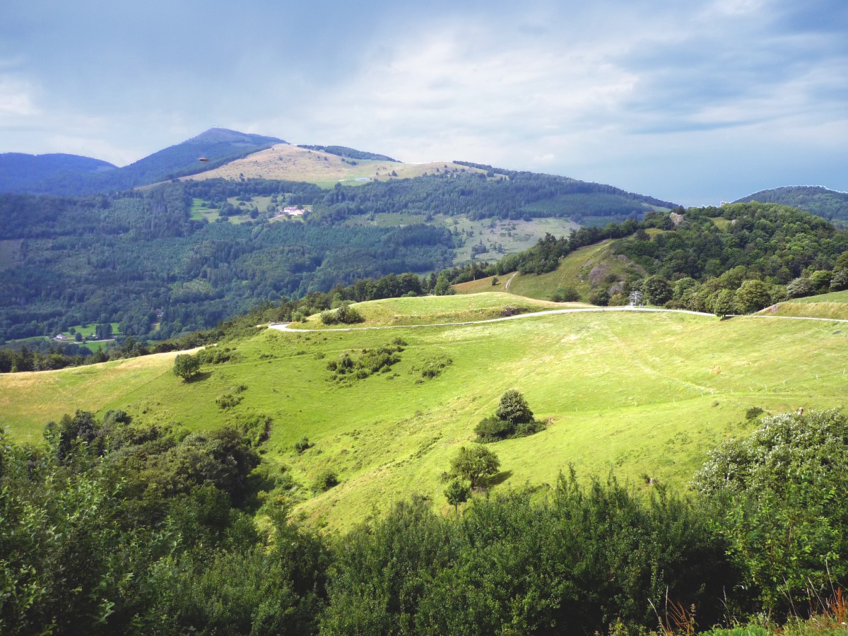
Grand Ballon © French Moments
From the Alsace Plain, the Grand Ballon is impressive because of its height difference.
Of course, 1,424 metres / 4,672 ft is not Mont Blanc. But when you start from Mulhouse, much lower down in the plain, the mountain suddenly takes on a very different scale.
Where is the Grand Ballon?
The Grand Ballon is located in the Haut-Rhin département, in the heart of the Ballons des Vosges Regional Nature Park.
It overlooks the Guebwiller area, the Lauch valley to the north and the Thur valley to the south.
As the crow flies, Mulhouse lies about 25 km to the south-east. On a clear day, from the town and its surroundings, you can easily spot this great rounded mass closing the Vosges horizon.
The summit itself is not directly on a major road. The famous Route des Crêtes passes just below it, skirting the Grand Ballon on its eastern side.
You then need to leave the car in one of the car parks and walk up to the highest point.
Do not worry: this is not a Himalayan expedition. From the road, it takes around 15 minutes on foot to reach the summit.
Depending, of course, on your fitness, your pace and your tendency to stop every twenty metres to take another photograph.
The Col du Grand Ballon: not to be confused with the summit
It is important to distinguish between the Grand Ballon itself, the summit at 1,424 metres / 4,672 ft, and the Col du Grand Ballon.
The Col du Grand Ballon lies on the Route des Crêtes at around 1,341 metres above sea level.
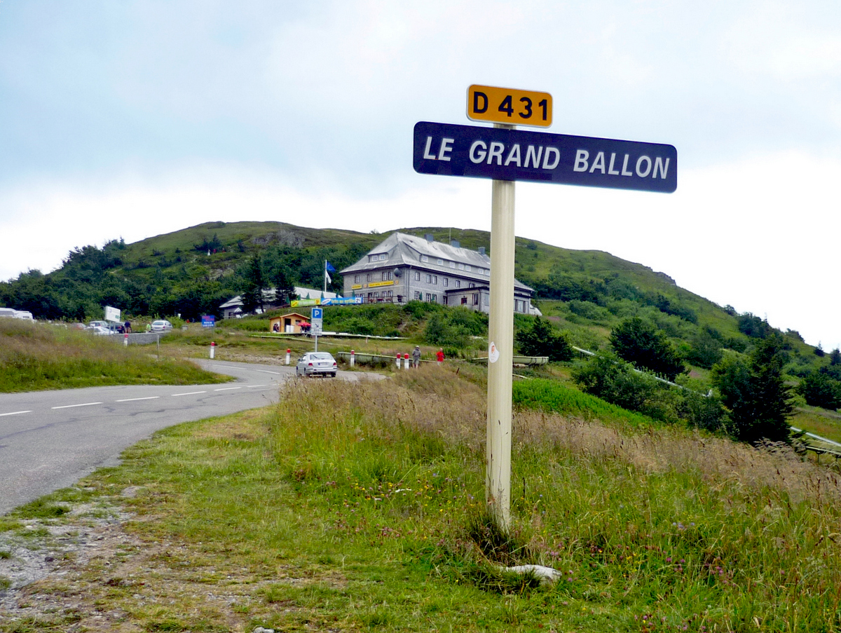
Col du Grand Ballon © French Moments
It skirts the summit on the eastern side and connects, among other places, the Markstein area with the Vieil-Armand and Col Amic sectors.
This is the pass you take by car, motorbike or bicycle when following the Route des Crêtes.
It is also a particularly important passage for cyclists, as it forms one of the major road accesses to the high ridges of the Vosges.
By bike, the Col du Grand Ballon can be climbed from several directions.
The best-known routes rise from the Alsace Plain, notably via Soultz, Uffholtz, Wattwiller or Willer-sur-Thur.
Some of these ascents are long, irregular and demanding, especially in the final kilometres after Col Amic.
This is where the word “ballon” can make you smile.
It sounds soft, round and almost friendly. Then the gradient kicks up, the calves begin to complain, and you realise that in the Vosges, even poetic names can hide a rather sharp sense of humour.
The Grand Ballon and the Tour de France 2026
In 2026, the Tour de France passes through the Grand Ballon during Stage 14, between Mulhouse and Le Markstein Fellering.
This Vosges stage promises to be a demanding one, with several climbs on the programme.
The Grand Ballon appears early in the day, after the riders have left Mulhouse, climbed towards the Hartmannswillerkopf and passed through Col Amic.
They then reach the Ferme du Grand Ballon area before continuing towards Col du Haag and Le Markstein.
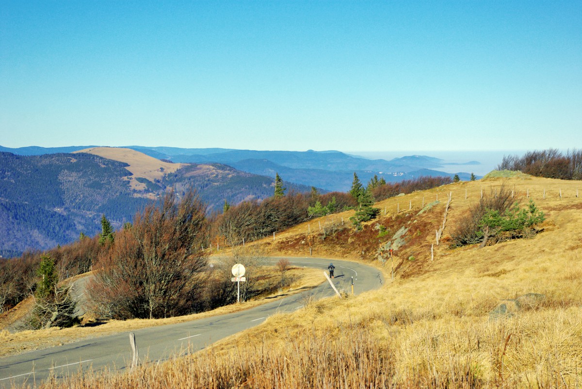
The Route des Crêtes of the Vosges © French Moments
On the official stage profile, the Grand Ballon is classified as a Category 1 climb.
The announced ascent is more than 21 km long, with an average gradient that may seem reasonable on paper. But averages can be deceptive in the Vosges: they combine gentler sections with much tougher stretches.
The Grand Ballon is not new to the Tour de France.
The race has passed through the area several times since 1969: in 1973, 1976, 1992, 1997, 2005, 2014, 2019 and 2026.
The summit and its pass belong to the great tradition of Vosges stages: lower than the Alps, perhaps less legendary than the Pyrenees, but often nervous, tricky and spectacular.
On television, the images of the Grand Ballon are usually magnificent: winding roads, dark forests, open high pastures, spectators lining the roadside, and sometimes a vast view over the Alsace Plain.
For a few minutes, viewers discover that the Vosges are not just gentle rounded hills. They also know how to make legs hurt.
The Hautes-Chaumes of the Grand Ballon
The upper part of the Grand Ballon is largely treeless. Here you enter the world of the Hautes-Chaumes, the open high pastures typical of the Vosges summits.
These are upland meadows, swept by the wind, where the atmosphere can change very quickly.
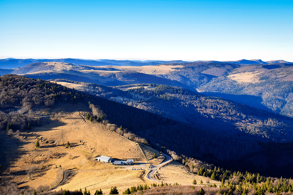
The Upper Vosges seen from the Grand Ballon © French Moments
One moment, you are walking in sunshine with a vast view over Alsace. A few minutes later, a cloud rolls in, the temperature drops, and you remember that you are still more than 1,400 metres above sea level.
In summer, these high pastures offer a very different landscape from the forests that cover the slopes of the massif.
You will find remarkable mountain flora, grazing land and sometimes the beautiful Vosges cows, recognisable by their black-and-white coats.
The Grand Ballon is therefore at once a panoramic summit, a fragile natural environment and a pastoral landscape. A kind of summary of the High Vosges in a single place.
The monuments at the summit
The radar of the Grand Ballon
Today, the Grand Ballon is easily recognisable thanks to its white radar dome, installed near the summit.
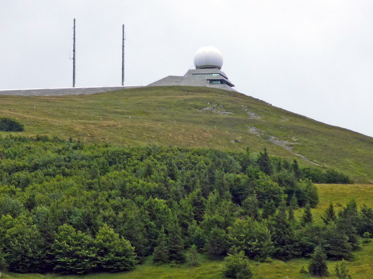
The radar © French Moments
This modern, almost futuristic structure always looks slightly surprising in a landscape of high pastures and ancient mountains. You could almost imagine that a spaceship landed there one misty day and eventually decided to stay.
The radar is used for civil aviation. Its white silhouette has become one of the visual symbols of the Grand Ballon. Like the chalet on the Hohneck or the chapel on Mont Sainte-Odile, it is one of those landmarks that you immediately recognise in the landscape.
Around the radar, a path leads to the orientation table and the highest point, marked by a boundary stone. This is where the real spectacle begins.
The Monument to the Diables Bleus
Near the summit, you will also find the Monument to the Diables Bleus.
It honours the Chasseurs Alpins, nicknamed the Blue Devils, who fought in the Vosges during the First World War. The monument was inaugurated in 1927 by President Raymond Poincaré.
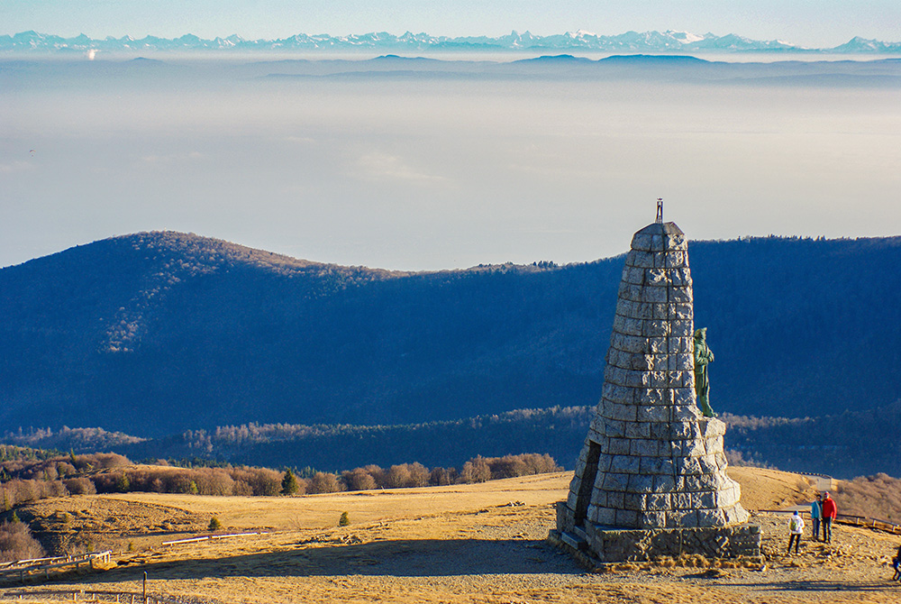
Diables Bleus Monument © French Moments
This historical reminder is important. The landscapes of the Grand Ballon may seem peaceful today, but this whole part of the Vosges was deeply marked by the fighting of 1914–1918. The battlefield of the Hartmannswillerkopf, or Vieil-Armand, lies only about ten kilometres away.
The Grand Ballon is therefore also a place of remembrance. Here, the beauty of the panorama coexists with the memory of a tragic history.
A breathtaking panorama
The panorama from the Grand Ballon is one of the finest in eastern France.
In the foreground, you can see the neighbouring Vosges summits: the Markstein, the Molkenrain, the Petit Ballon, the Hohneck, the Ballon d’Alsace and many other rounded heights that form the famous blue line of the Vosges, so familiar to people in Alsace.
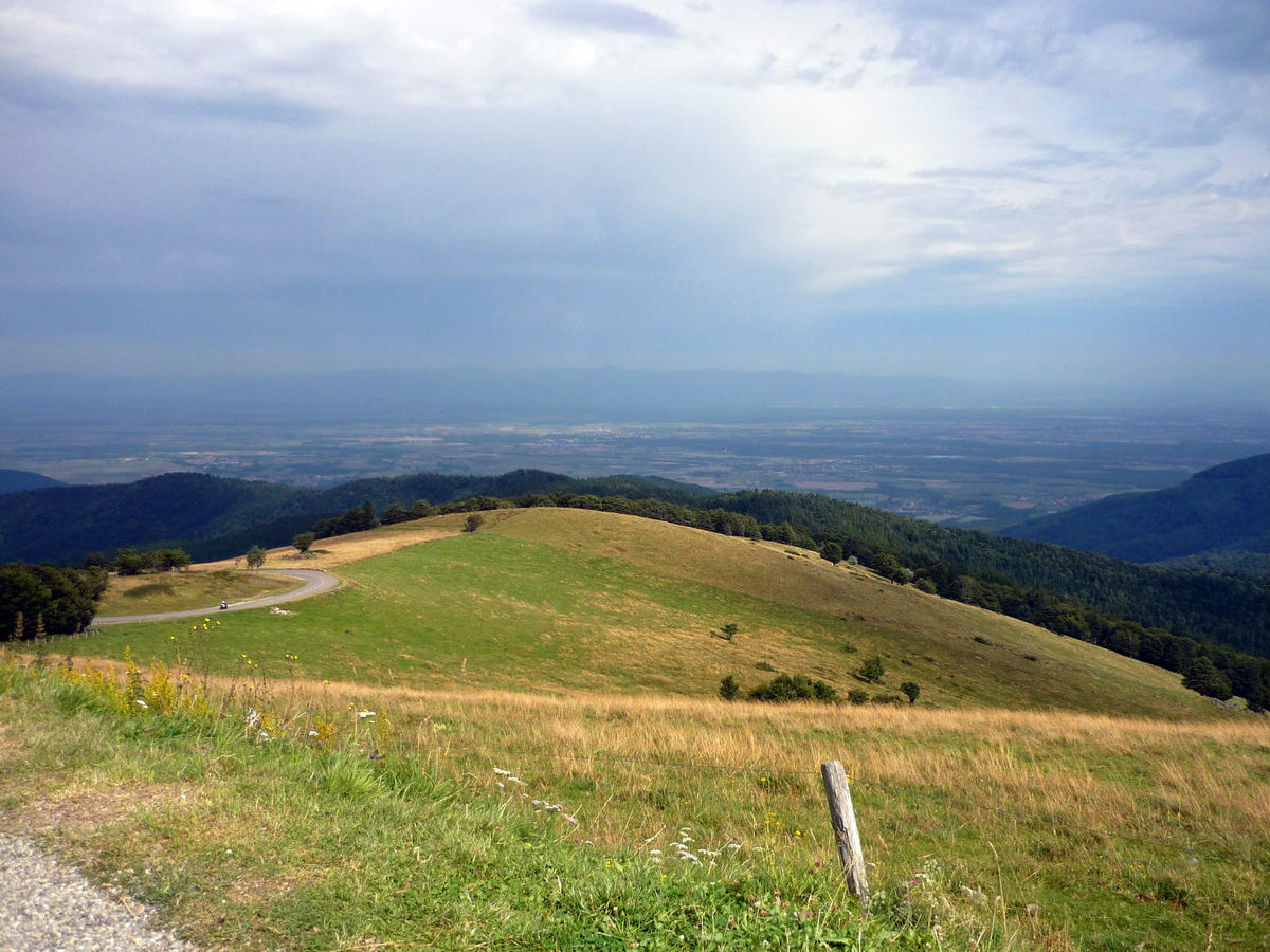
The view of the plain of Alsace © French Moments
Lower down stretches the Alsace Plain, with Mulhouse, Basel and, on a clear day, Freiburg im Breisgau on the German side. Beyond that, you can make out the Black Forest, the Swiss and French Jura, and, when conditions are truly favourable, the Alps.
And that is the great moment.

Mont-Blanc from Grand Ballon (Alsace) © French Moments
Seeing the Alps from the Vosges is always a magical experience. You can sometimes spot Mont Blanc, the Bernese Alps and a large part of the Alpine chain.
To maximise your chances, it is best to go up between autumn and spring, on a clear day, when the air is dry and visibility is excellent.
It is one of my favourite panoramas in France. There is something deeply moving about seeing, from the Vosges, that immense white barrier drawn across the horizon.
Hiking, cycling and the Route des Crêtes
The Grand Ballon is an ideal starting point for many hikes.
The GR5, the long-distance hiking trail linking the North Sea to the Mediterranean, passes through the area. From the summit, you can reach the Markstein on one side or descend towards the valleys on the other.
The Route des Crêtes also makes it easy to explore some of the great sites of the massif: the Markstein, the Hohneck, the Col de la Schlucht, the Vosges lakes, the high pastures and the viewpoints.
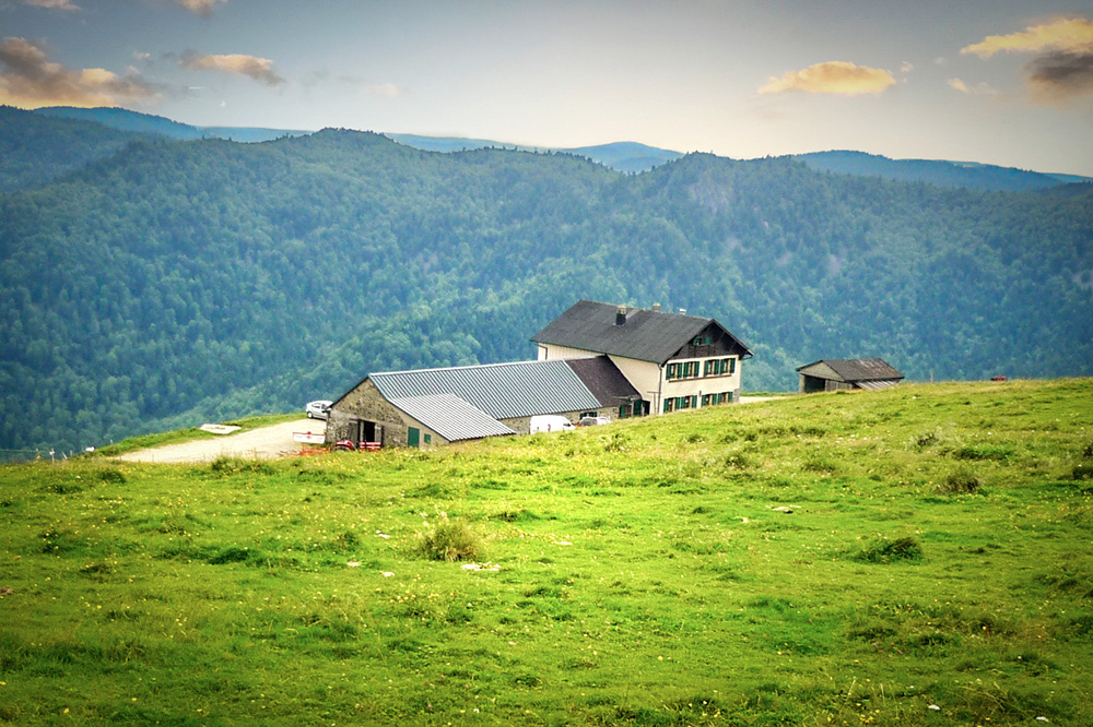
A farm inn in the Vosges near Le Markstein © French Moments
By car, it is one of the most beautiful mountain roads in eastern France.
By bike, it is another story. Beautiful, yes. But sometimes painful.
Let us say that the beauty of the landscape helps you forget the gradient… at least for a few seconds.
In winter, access depends heavily on the weather. Some sections of the Route des Crêtes may be closed because of snow. The Grand Ballon then takes on a wilder, harsher, almost Alpine atmosphere.
My view of the Grand Ballon
The Grand Ballon is one of those places I have known for a long time. When you have ties to Alsace and Lorraine, sooner or later you always end up passing along the Route des Crêtes.
I like this mountain because it brings together so much of what I love about the Vosges: landscapes that are accessible but never ordinary, a dense history, mountain farm inns never too far away, great forests, luminous high pastures and, on lucky days, that incredible view of the Alps.
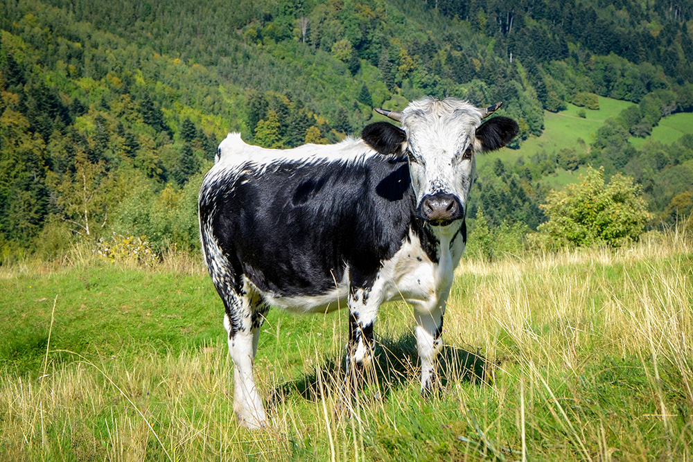
The Vosges cow - la Vosgienne © French Moments
The Grand Ballon is not simply “the highest summit in the Vosges”. It is a landmark.
A mountain beacon for the whole of southern Alsace. A place where you go to gain height, both literally and figuratively.
And in July 2026, when the Tour de France riders climb towards the Grand Ballon, this emblematic Vosges summit will once again enjoy its moment of glory.
It certainly deserves it.