
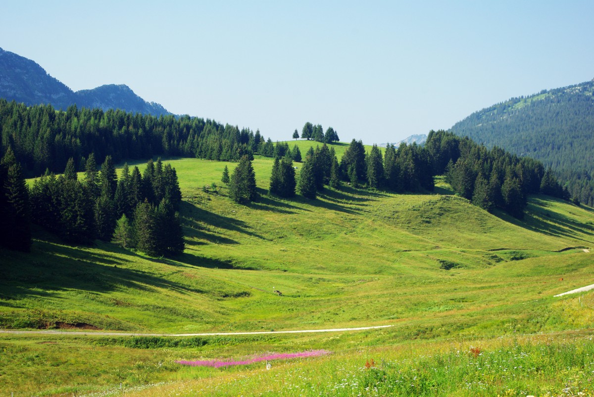
Since we arrived in Annecy, we’ve been told the Glieres Plateau (Plateau des Glières) was a must-to-see in the region. Coming from Thorens-Glières, the road climbs the impressive limestone escarpments of the mountains in 10 hairpin turns. Suddenly you arrive at the plateau where the high-pasture land alternate with conifers and rocky crests. At the Glières Pass, the Memorial remembers the fierce fighting between the French Resistance and the German army during the Second World War. We’ve been there for a family outing a few days ago and here is what we discovered…
[lwptoc]
Where is the Glieres Plateau located?
The Plateau des Glières is part of the Bornes massif in the French Alps of Haute-Savoie. The limestone plateau is situated between La Roche-sur-Foron and Annecy, both distant of 30 km. The site belongs to the communes of Glières-Val-de-Borne and Fillière.
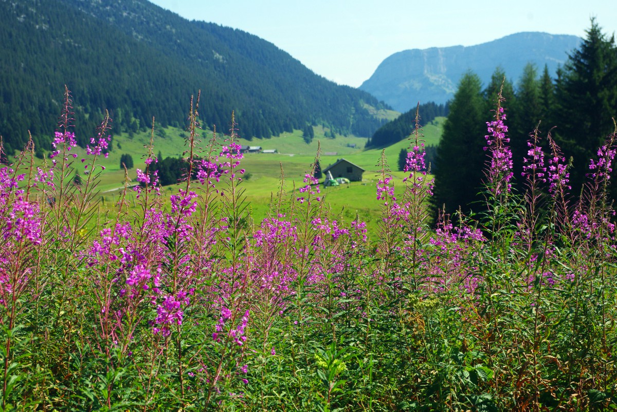
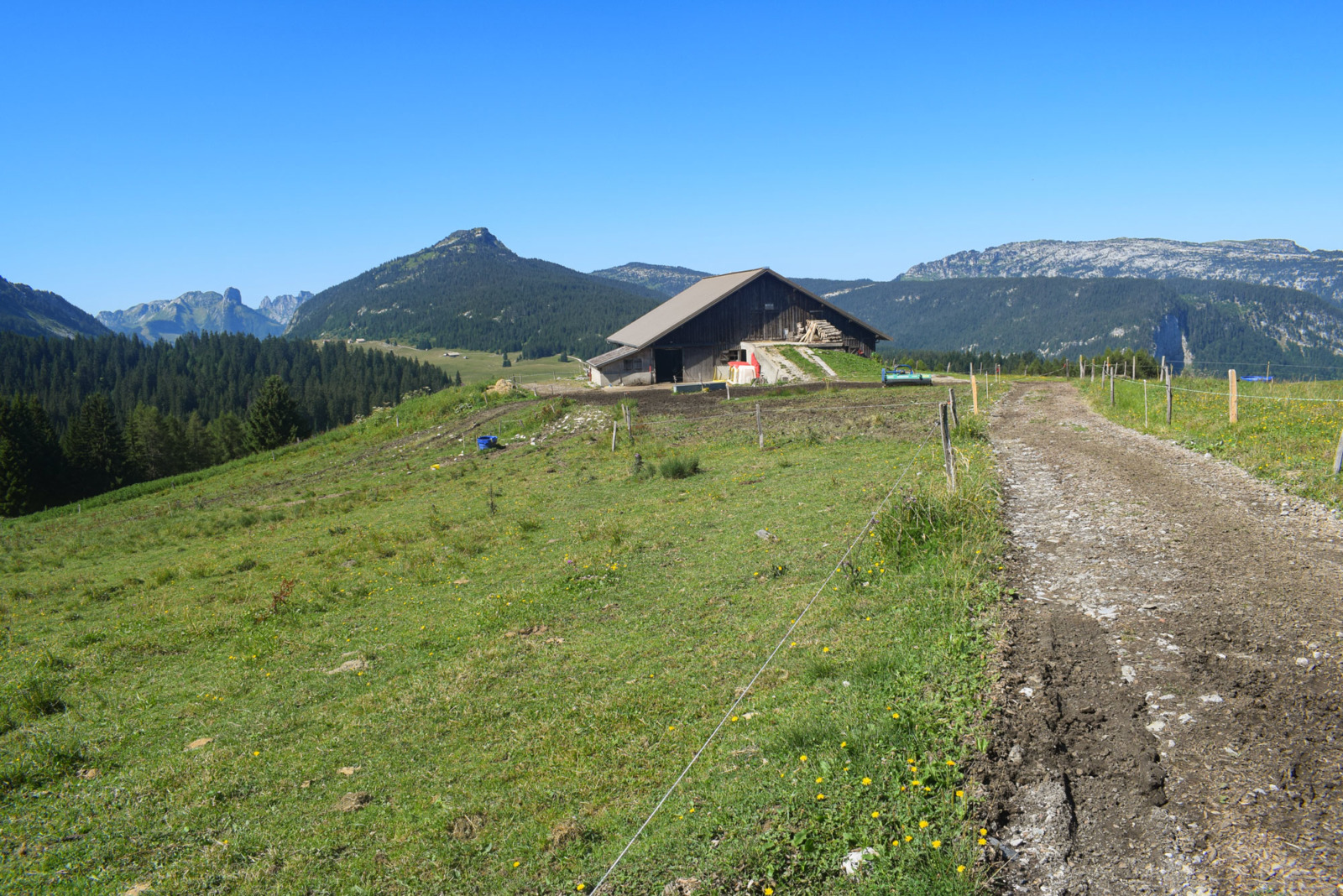
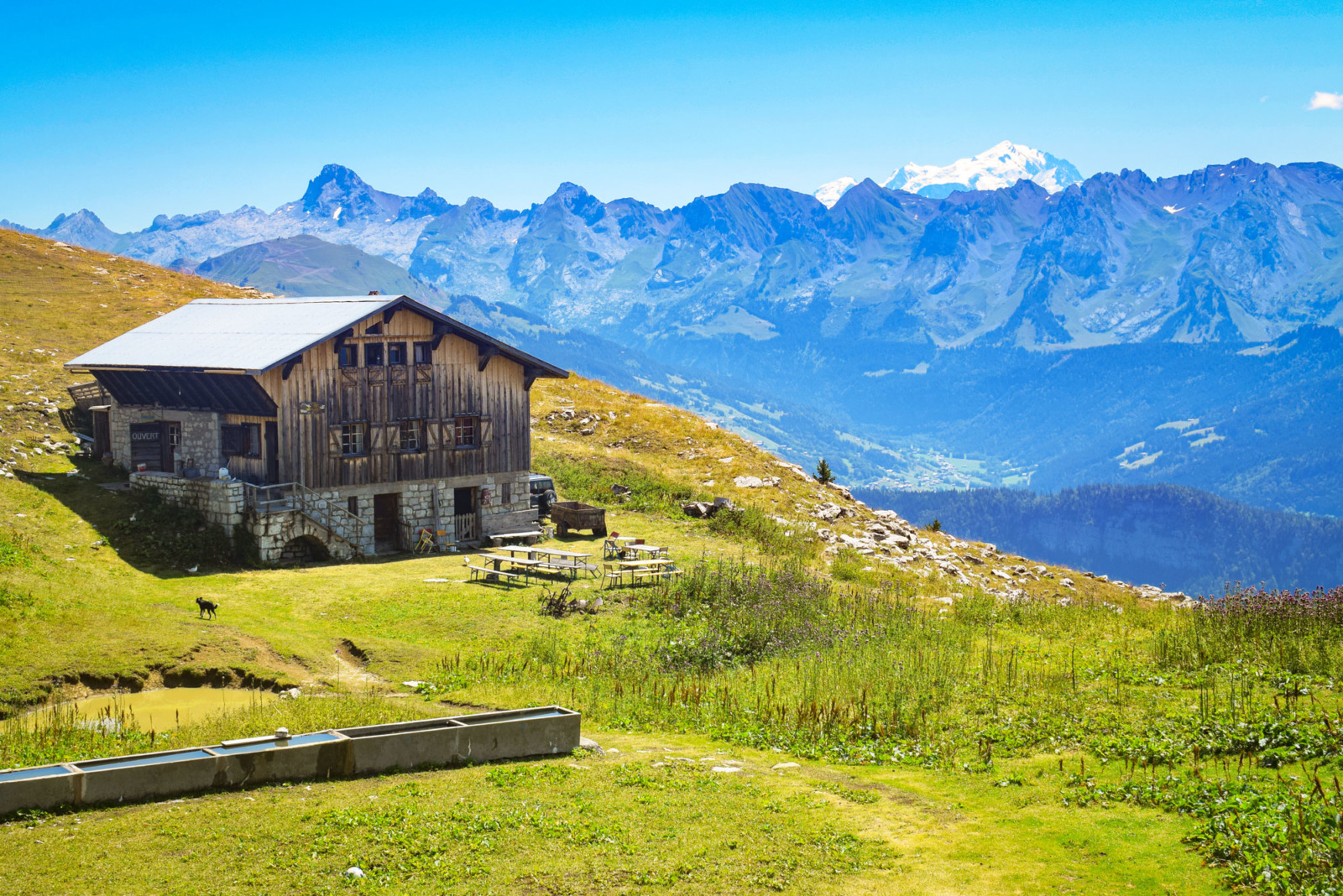
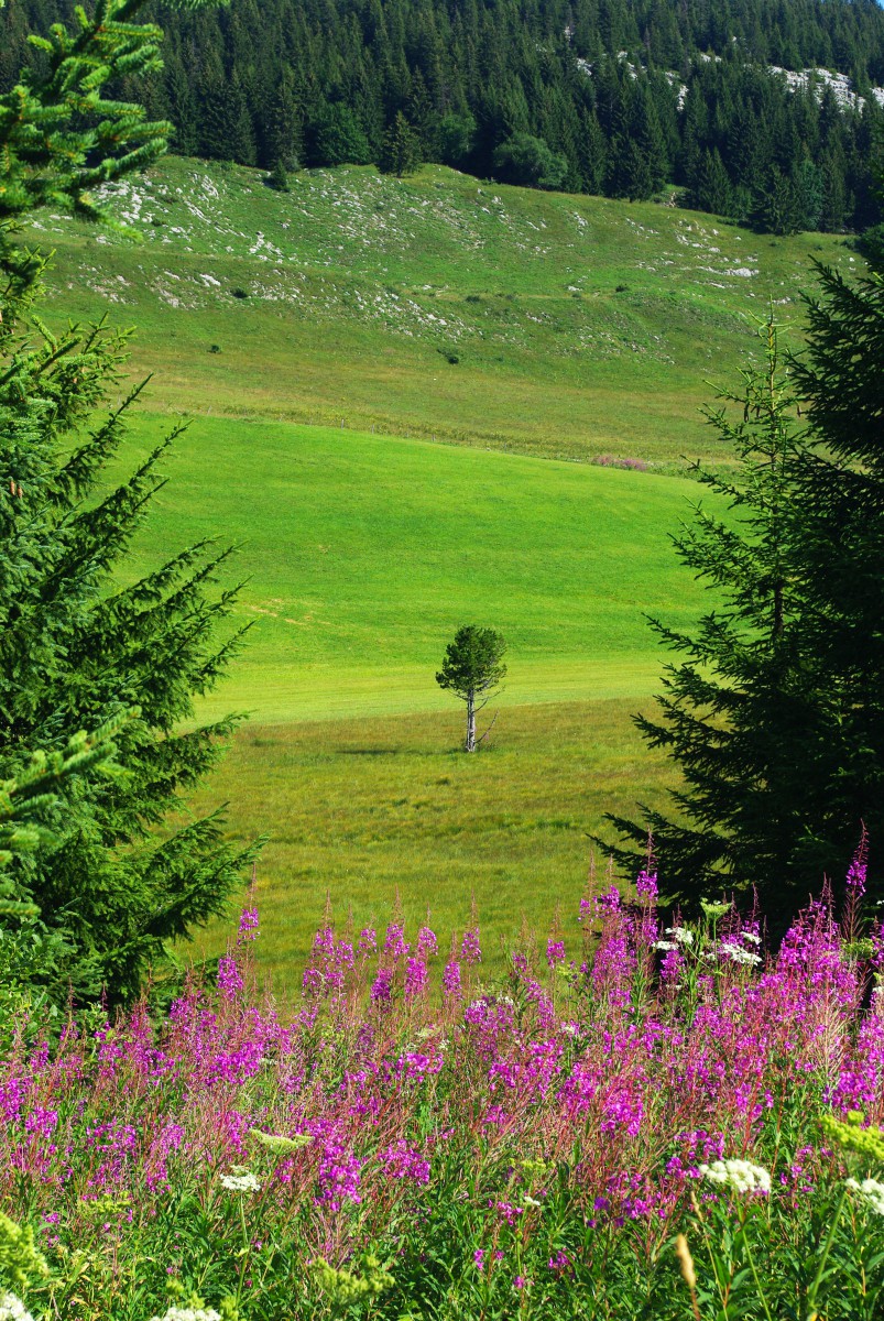
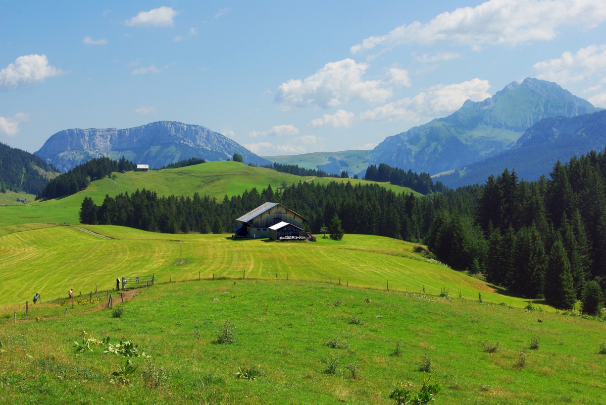
Actually, les Glières is not a plateau but a flat valley perched at an altitude of 1400-1500 m between the mountains of Auges and Frêtes. The Alpine pastures intended for cow grazing is dotted with old farms and chalets, some of which have been transformed into restaurants or gîtes.
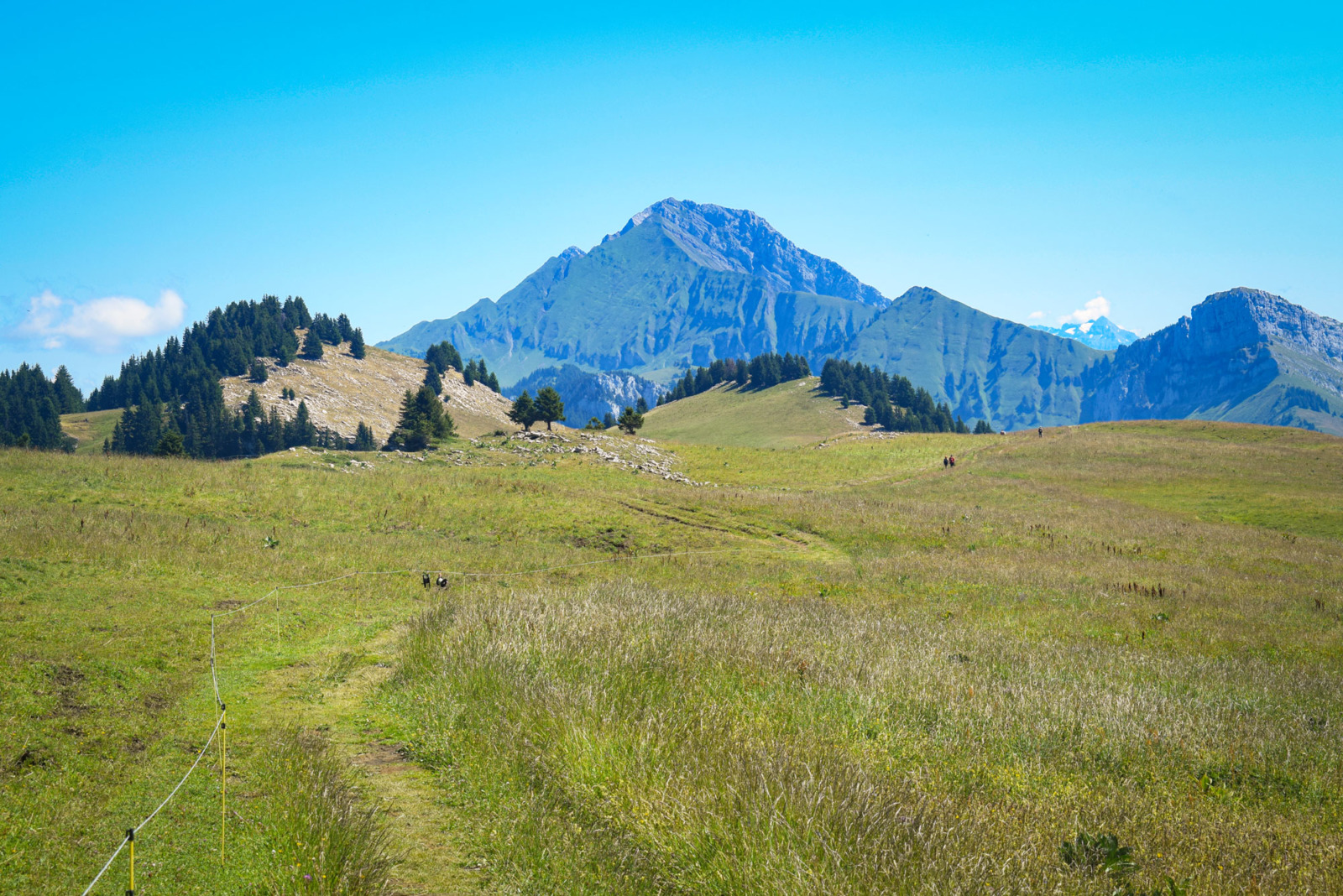
A rocky and sandy plateau

The long grassy stretches of the plateau offer wide views of the surrounding mountains.
- The plateau itself is home to various open environments: peat bogs, hay meadows, pastures and various types of grassland.
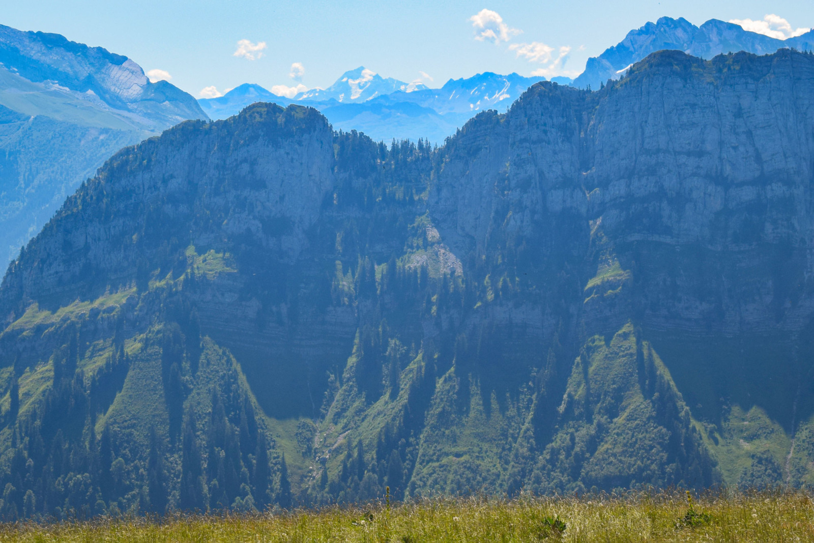
- The slopes (Auges and Frêtes mountains) are mainly composed of spruce forests on lapiaz and beech forests at lower altitudes.
- Then rocky limestone bars mark a break in the slope.
- On the summits and ridges, there are dry grasslands and some pine forests.
The word ‘Glière’ means a rocky and sandy plateau without rivers. That’s true, curiously you won’t see any much water up there! On this topic an informative sign along the Sentier nature reads:
A lot of water falls on the plateau des glières (about 1,750 mm). Strange as it may seem, there are few streams or torrents to be found: where does the water go?
The Plateau des Glières is made up of sedimentary soils of marine origin.
The surface water network is well developed when it occupies the bottom of valleys filled with impermeable soils (sandstone schists) which give rise to peat bogs and marshlands. However, this network is practically nonexistent on very crocked and eroded limestone areas (karren) through which rainwater can pass unhindered.
The limestone is dissolved by the rain water containing carbon dioxide and the water eats out underground shafts, galleries and halls. In the Frêtes mountain the development of these underground hollows follows the direction of the waters flowing into an underground river located beneath the Plateau des Glières. This river channels the waters until they reappear at MORETTE in the Fier valley (near THONES).
The Glières in the past
Before the road was built, the climb to the plateau was done on foot or, in winter, with sledges pulled by horses. This was the only way to supply the inhabitants.
In 1914, there were 120 houses and barns on the Plateau des Glières. 150 people lived there all year round. Until the dawn of the Second World War, there were several cafés, two grocery shops, a school and two sawmills.
The Resistance at the Glieres Plateau
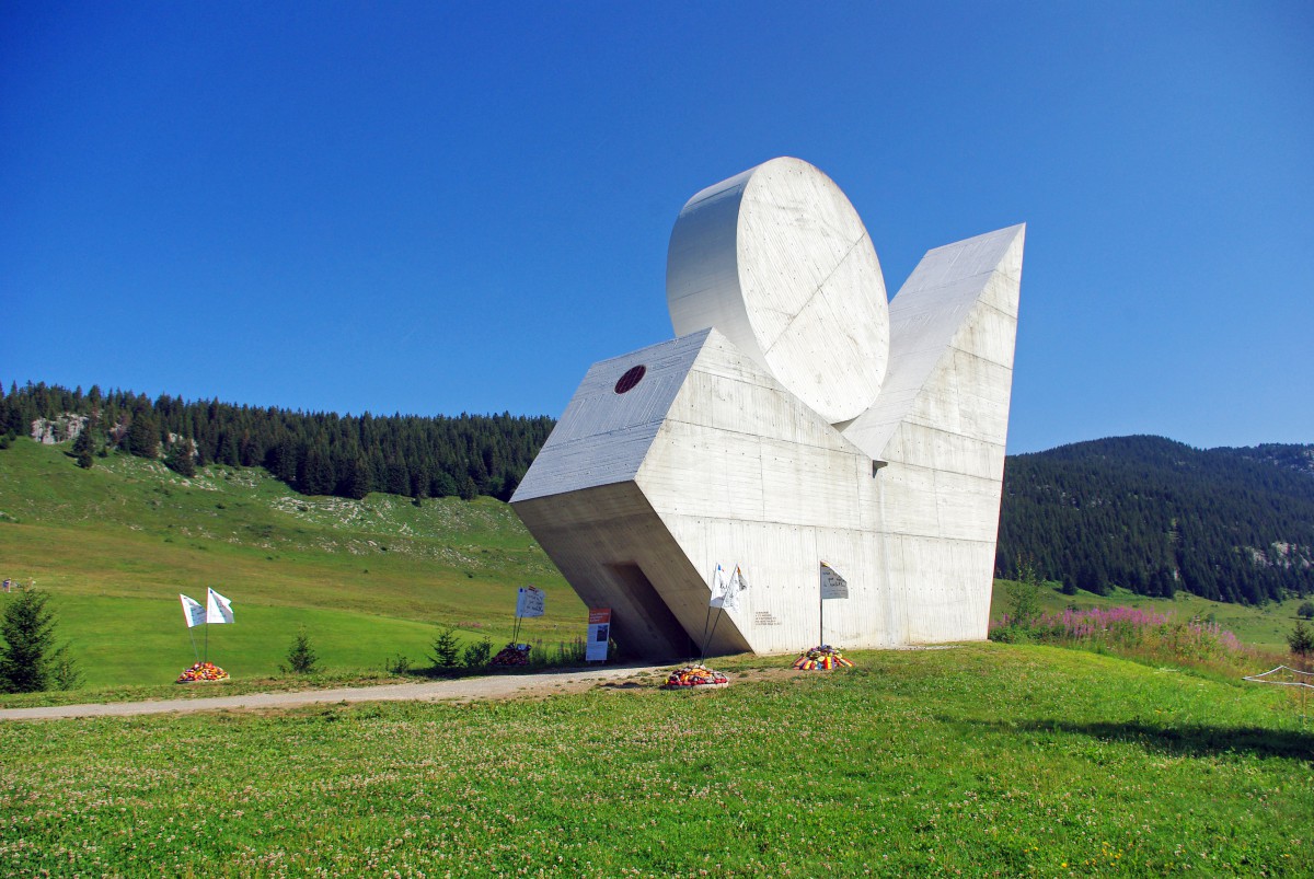
Standing slightly below the Col des Glières is the national monument of the Resistance. The white memorial was designed in 1973 by Émile Gilioli to recall the souvenir of the local Resistance who fought here against the Wehrmacht.
From the 31st January to the 26th March 1944 some 465 men gathered on the Glieres Plateau to organise the local Resistance against the collaborationist Vichy régime. They collected parachute drops of weapons from the Royal Air Force. The remote site had a number of advantages for it was poorly accessible by road, making it hard for the enemy to plan an attack.
Twice in February and March 1944, the Vichy security forces failed to eliminate the Resistance of the Glières. Then on the 26th March 1944, the 157th alpine division of the German army forced the Resistants to retreat. 129 members of the Resistance were killed.
The local Resistance reconstituted and eventually regained possession of the Glieres Plateau. Along with other Resistance groups, the Maquis de Glières contributed to the liberation of the whole region. Haute-Savoie was then the first French département to have been liberated without the help of the Allied forces.
A signposted trail (Sentier histoire) leads you around the 1944 parachute drop zones with informative panels (in English) on the life of the men who fought in severe cold weather condition.
The Memorial’s crypt and the central flagpole
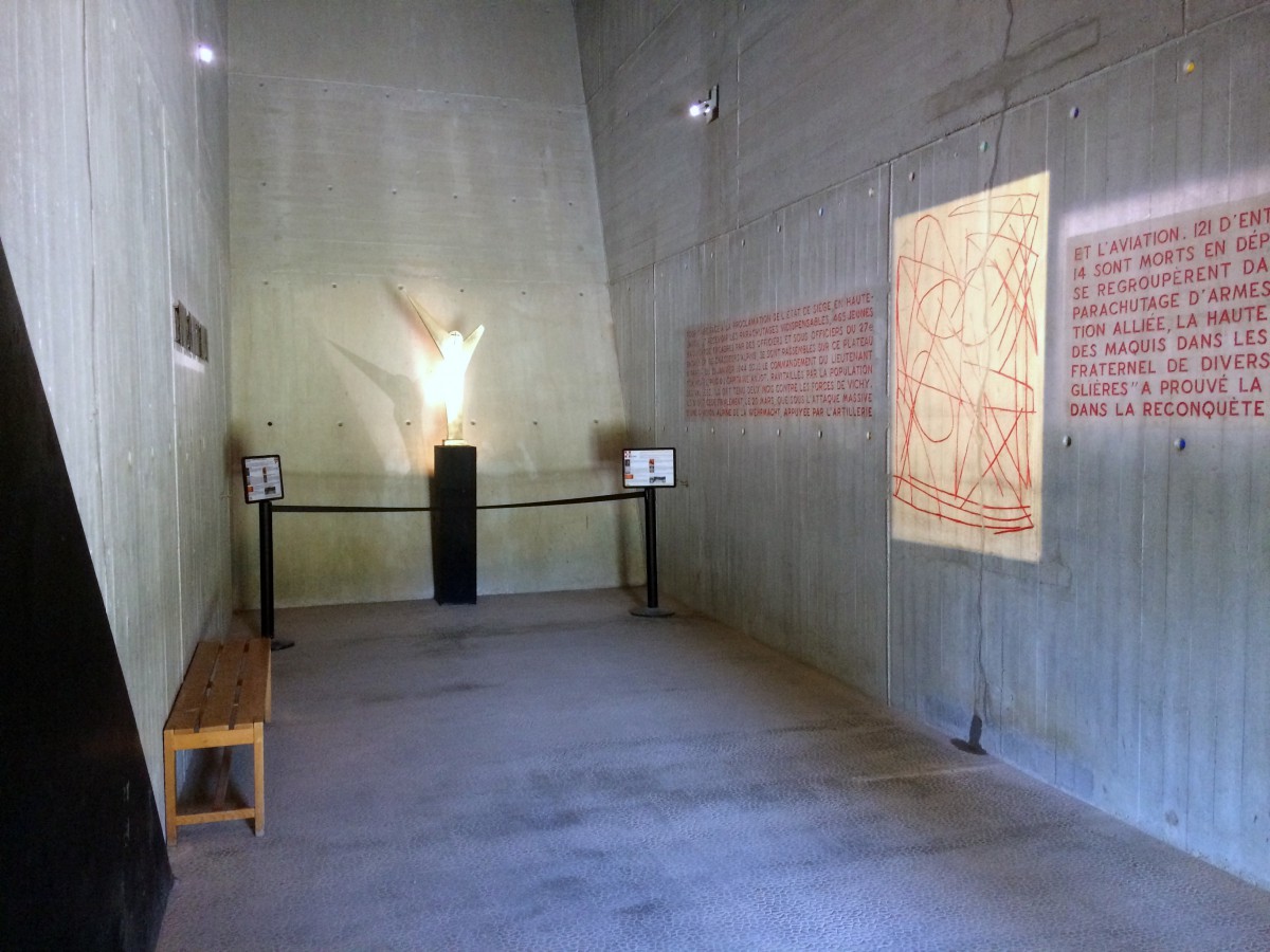
The national monument of the Resistance is a symbol of victory, hope and resistance, edified in memory of all those who took part in the French Resistance. It contains a crypt where you can enter.
The interior of the monument houses works of art that were all donated by the sculptor of the monument, Émile Gilioli (1911-1977). The monument was inaugurated on 2 September 1973 by André Malraux. Gilioli designed the crypt to echo the outside of the monument.

The central flagpole
Next to the monument is the central flagpole. An informative panel reads:
The French flag stamped with the Lorraine cross was hoisted to the top of this pole. Resistance-fighters from each section gathered here at three decisive moments.
- The 20th February: at this time the Battalion numbers 320 resistance-fighters. Tom Morel solemnly presents to them the pennant which bears the motto: LIVE FREE OR DIE.
- The 13th March: Lieutenant Jourdan has replaced Tom who was killed in the night of the 9th March along with warrant-officer Georges Decour. They are buried at the foot of the flagpole after receiving military honours. Their bodies are transferred to Morette in May.
- The 18th March: Captain Anjot takes command of the 465 men who now form the Battalion. In his officer’s uniform of the 27th Battalion of Chasseurs Alpins he reviews his troops and runs up the colours. A week later the Germans attack.
The colours are taken down from the flagpole by Alphonse Métral during the disengagement on the 26th March at 10pm and hidden in the valley.
Outdoor activities at the Glieres Plateau
The Glières Plateau offers a wide array of activities.
In winter
![Plateau des Glières in winter © B. Brassoud - licence [CC BY-SA 4.0] from Wikimedia Commons](https://frenchmoments.eu/wp-content/uploads/2017/07/Plateau-des-Glières-en-hiver-©-B.-Brassoud-licence-CC-BY-SA-4.0-from-Wikimedia-Commons.jpg)
The main activity in winter is cross-country skiing. The Glieres Plateau gives access to over 30 groomed trails at all difficulty levels. Other activities include snowshoeing and a sledge run for kids.
In summer

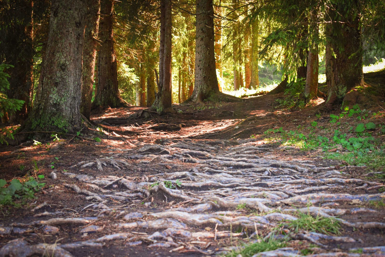
In summer, outdoor activities include hiking and speleology. A number of accompanied hikes are organised to discover the local fauna and flora, as well as the Resistance heritage. However, all the tours are usually conducted in French.

The ‘Sentier Nature’
This place is great if you come with kids! In July, we followed the discovery trail (Sentier nature) across the alpine pasture. This is the best way to discover the Glieres Plateau.
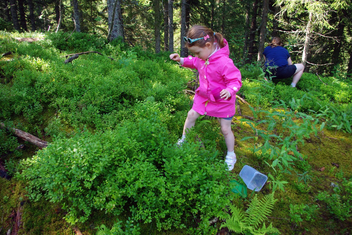
The ‘Sentier Nature‘ is 1hr to 1.50hrs long and starts at the Col des Glières (Glières Pass).
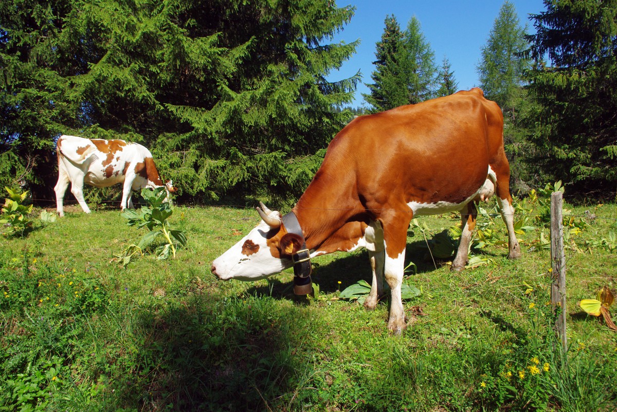
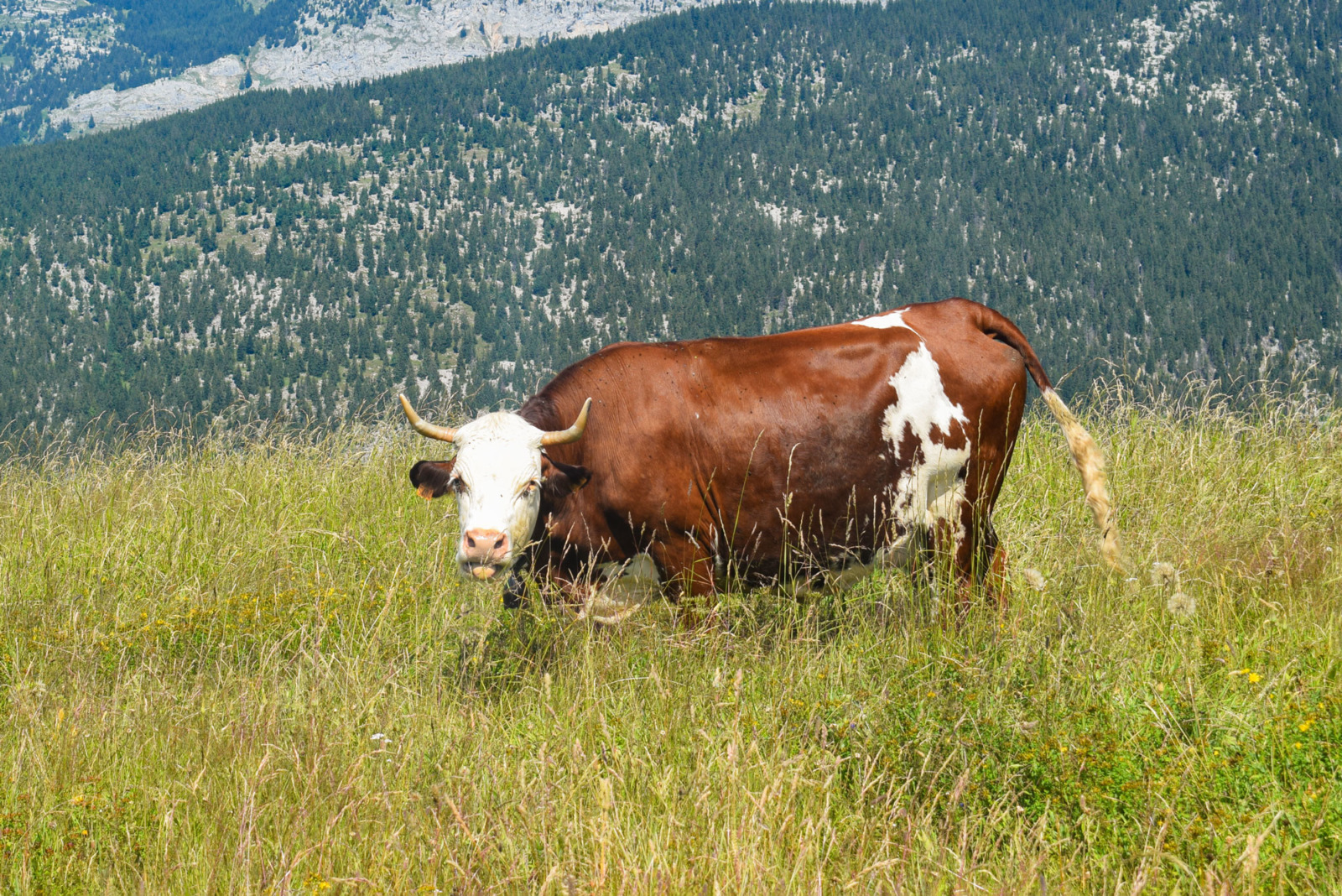
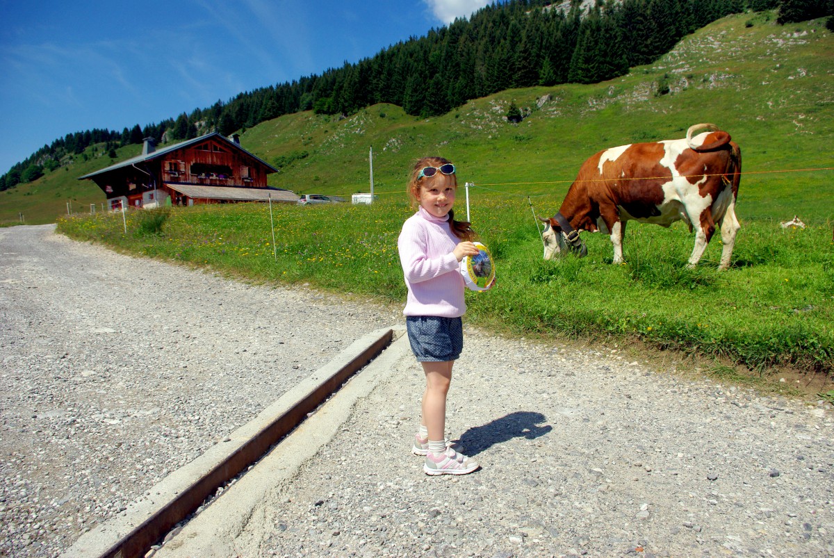
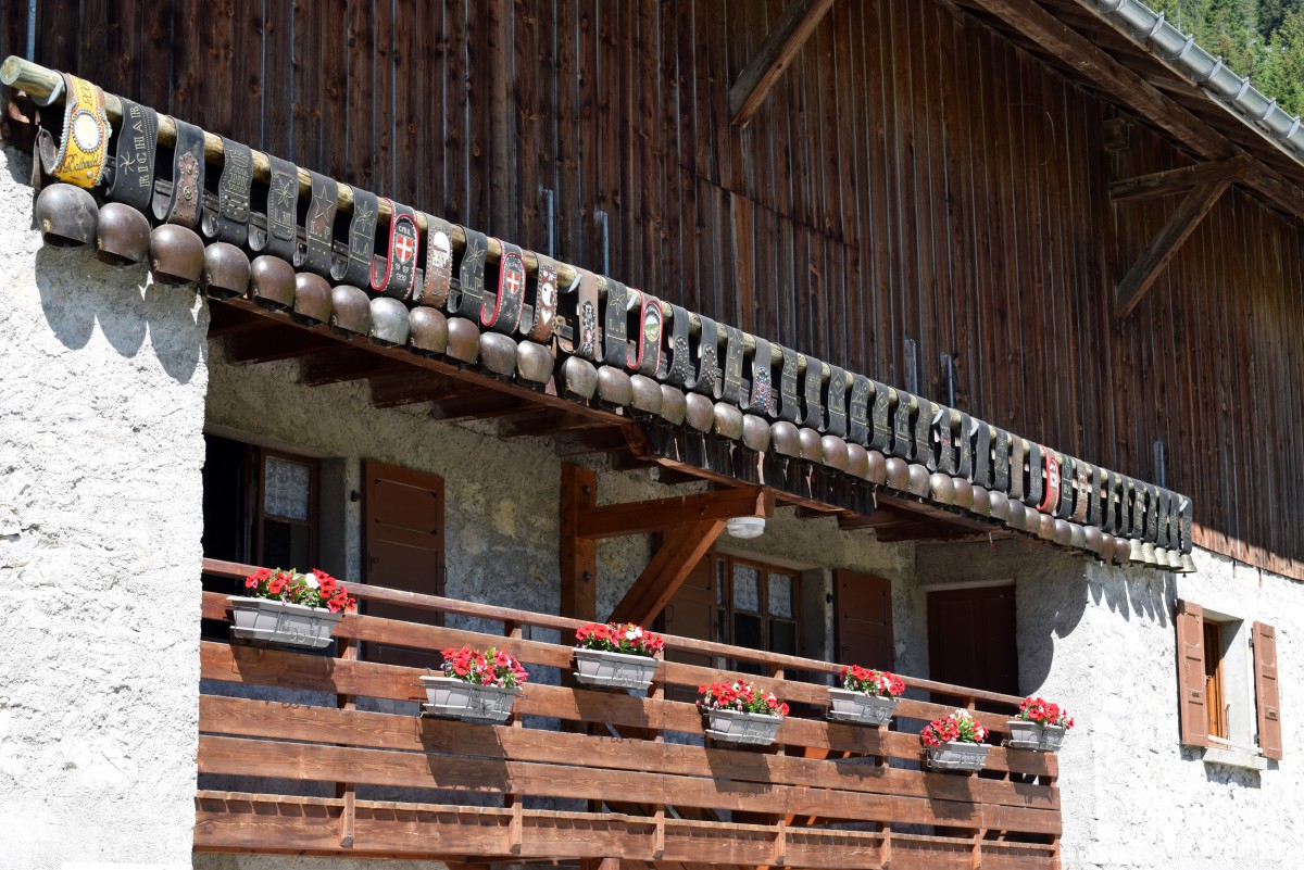
Our 4-year-old daughter was very excited to observe cows (with their bells), ant-hills, grand pine trees, an alpine stream, and we even took the time to fill a pot of wild blueberries.
The distant sound of cowbells from the herds of Abondance cows definitely contributes to the alpine atmosphere.
All along the route, 12 informative panels explain the diversity and natural beauty of the Plateau des Glières.

Click here to download the itinerary of the Sentier Nature.
The hamlet of Auges
This is my favourite hike on the Glières plateau. Its course makes us cross several zones of mountain pastures.
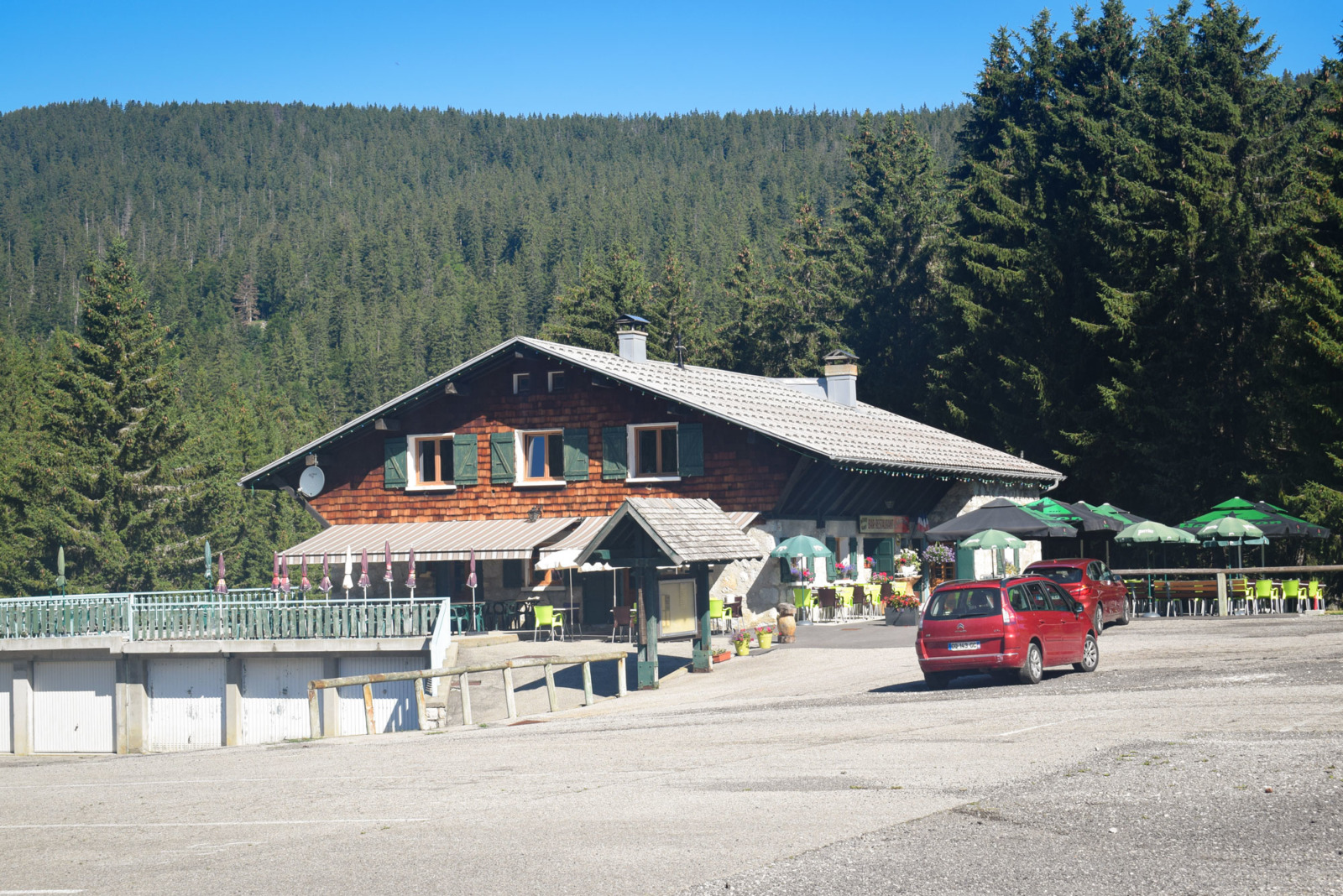
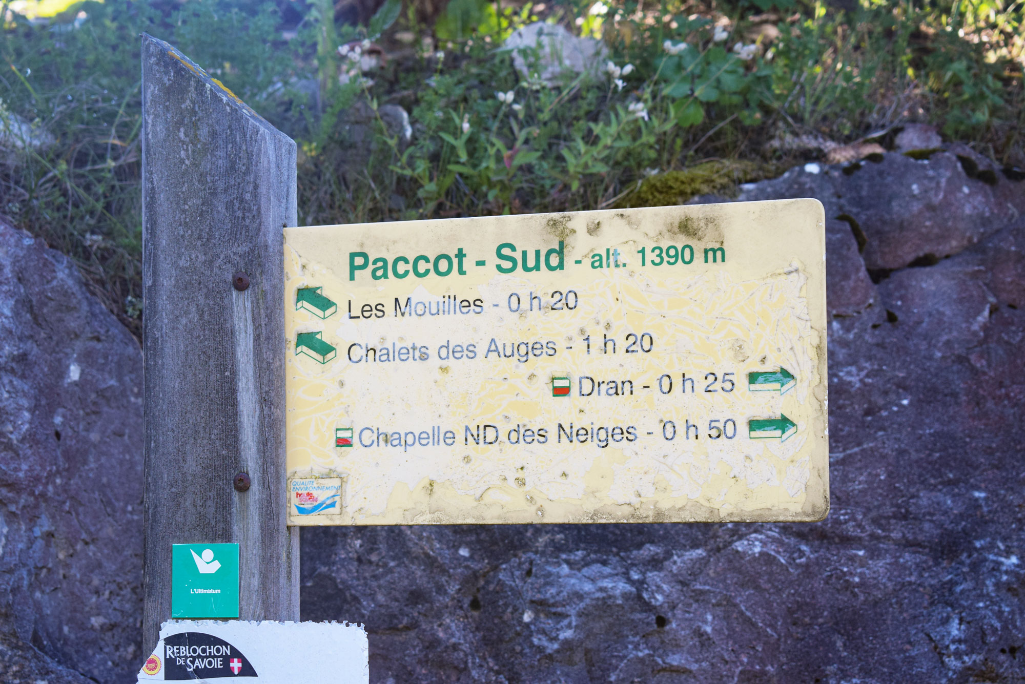
I park at the car park near the Gautard restaurant (take the small tarmac road of the Chemin du Collet), at 1,390 m. This place is called Paccot-Sud.
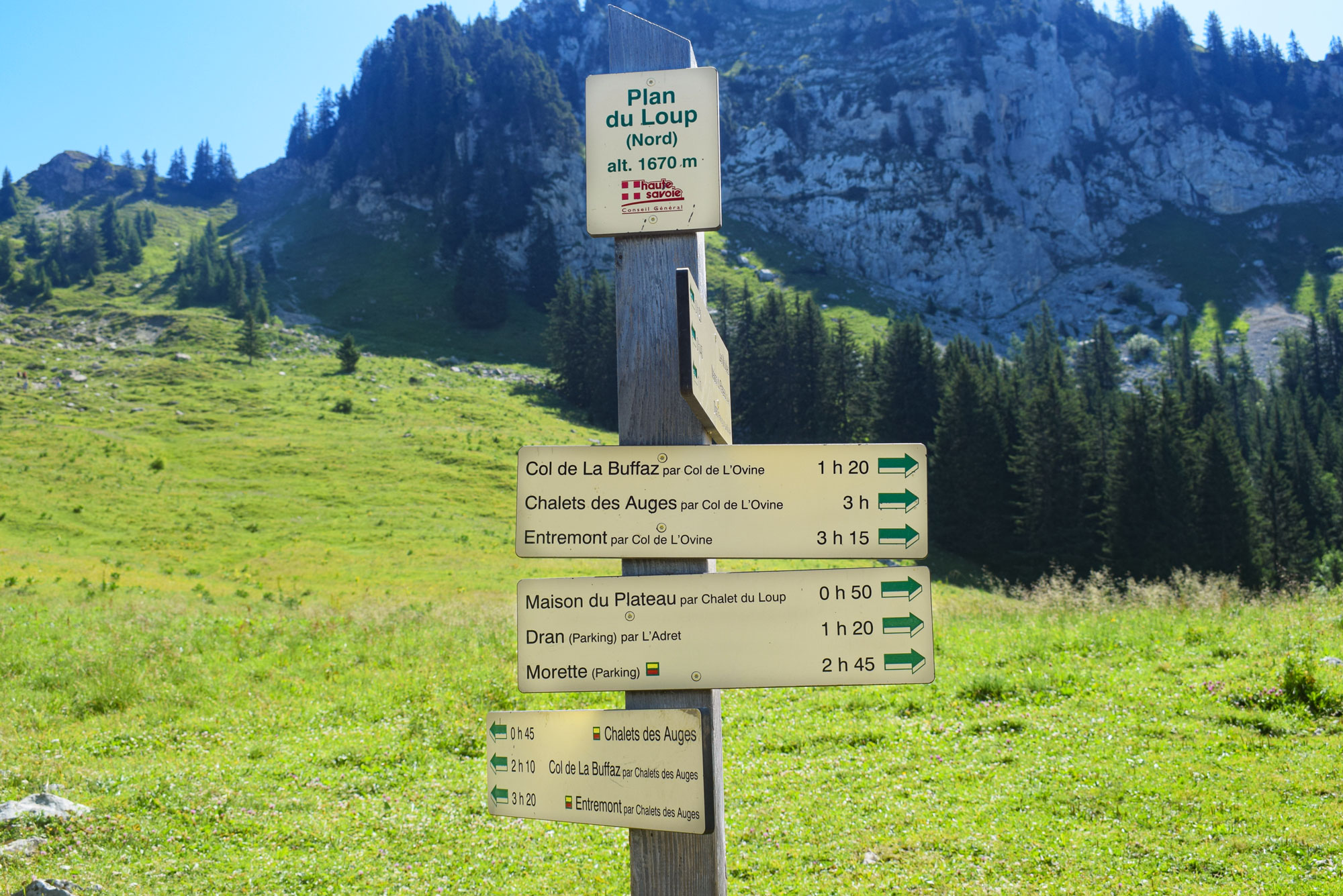
The ascent to the Pas du Loup through mountain pastures and forests
The signpost informs us that the climb to the Chalets des Auges will take 1h20.
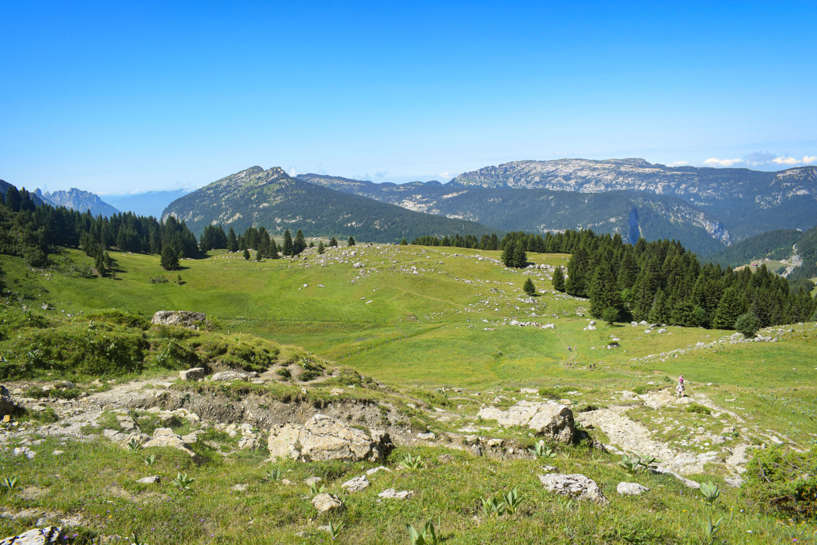
The path goes up following a stream in the Alpine pastures to a farm: the chalet des Mouilles (1,500 m).
A beautiful pastoral landscape awaits us: the alpage des Mouilles.

At the Plan des Mouilles (1,525 m), the path joins the one from the Maison du Plateau.

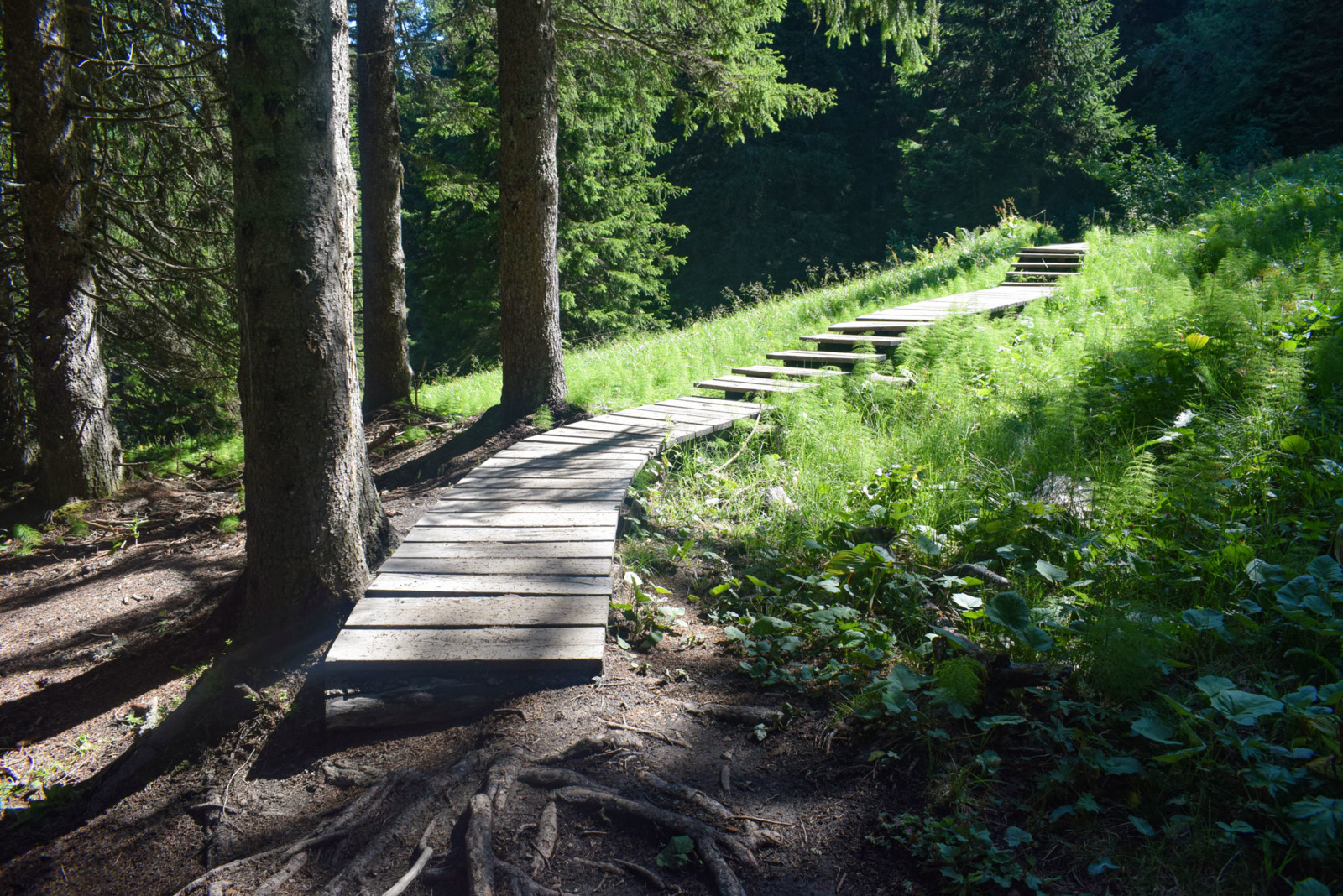
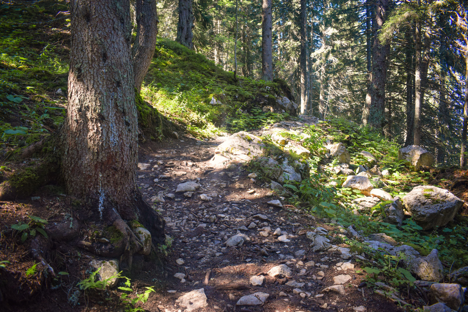
Further on, the path climbs into the spruce forest.
A few metres of it is laid out to allow us to cross the wetland on dry foot.
Then the path starts to climb seriously!
The Plan du Loup (North) is reached at 1,670 m. It takes on the appearance of a cirque over which the alpine meadows extend.
Then the path climbs even higher to the place called Pas du Loup (Wolf Passage).
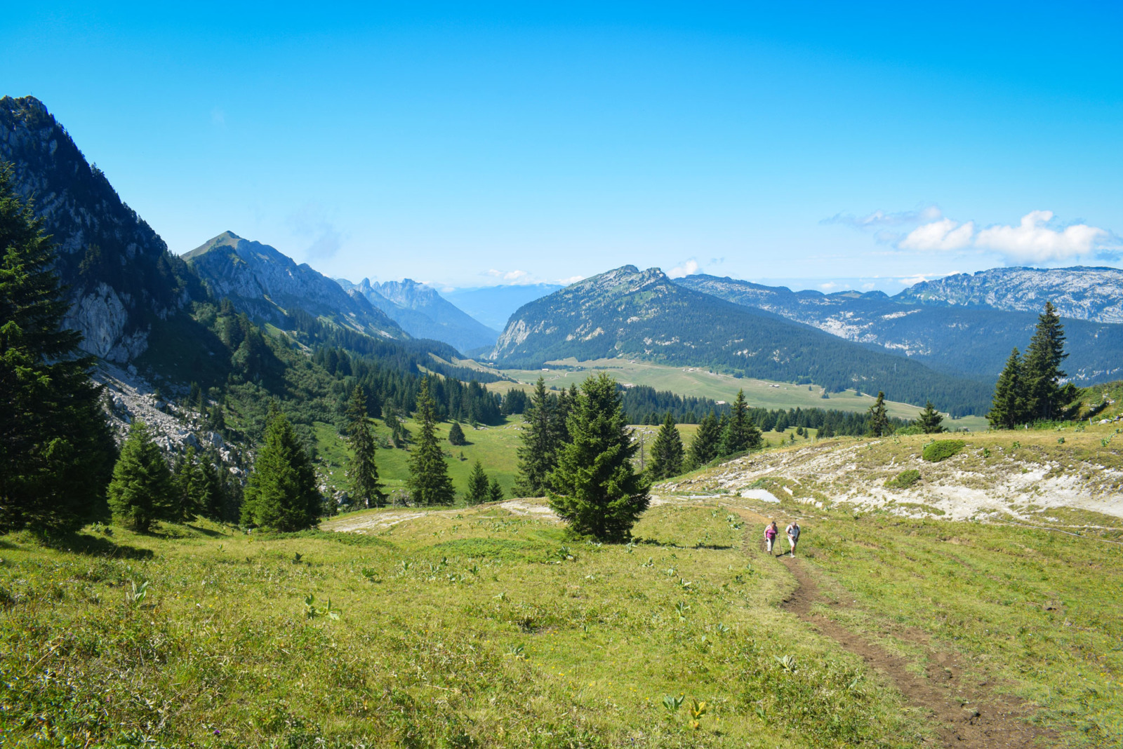
The view from the Pas du Loup
From there, a magnificent view of the Glières plateau, the Pre-Alps, the Sous-Dine and the Parmelan, as well as the Jura Mountains in the distance.
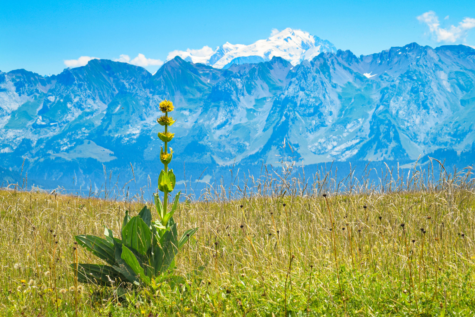
We soon reach a ridge with another fabulous view, this time to the east: the Aravis range and Mont Blanc.

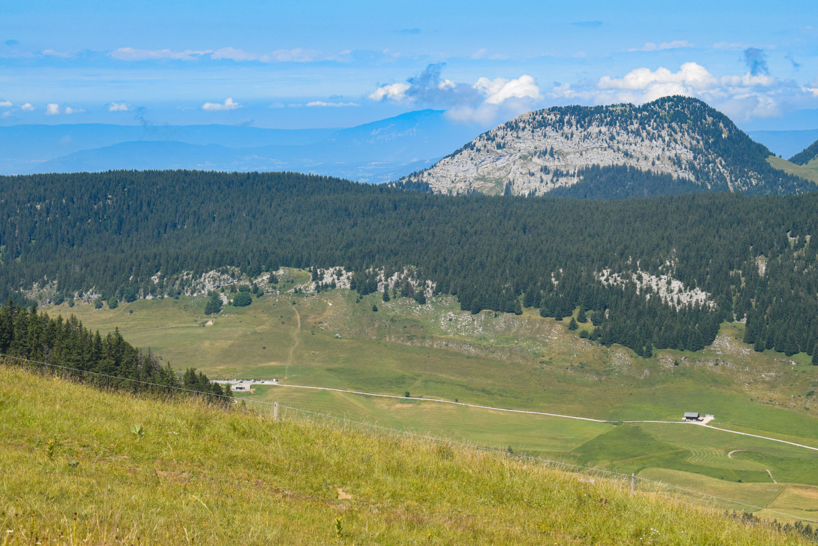
The rural path, known as “Les Auges”, takes us to the hamlet of Les Auges. It follows the crest of the Auges mountain with the Pic de Jallouvre (2,408 m) in the background.
This is where herds of abondance cows and sheep graze.
Depending on the season, you can observe typical alpine flora: yellow gentian, orchis, European trolleys, centaury, alpine snowbells and spring gentian.
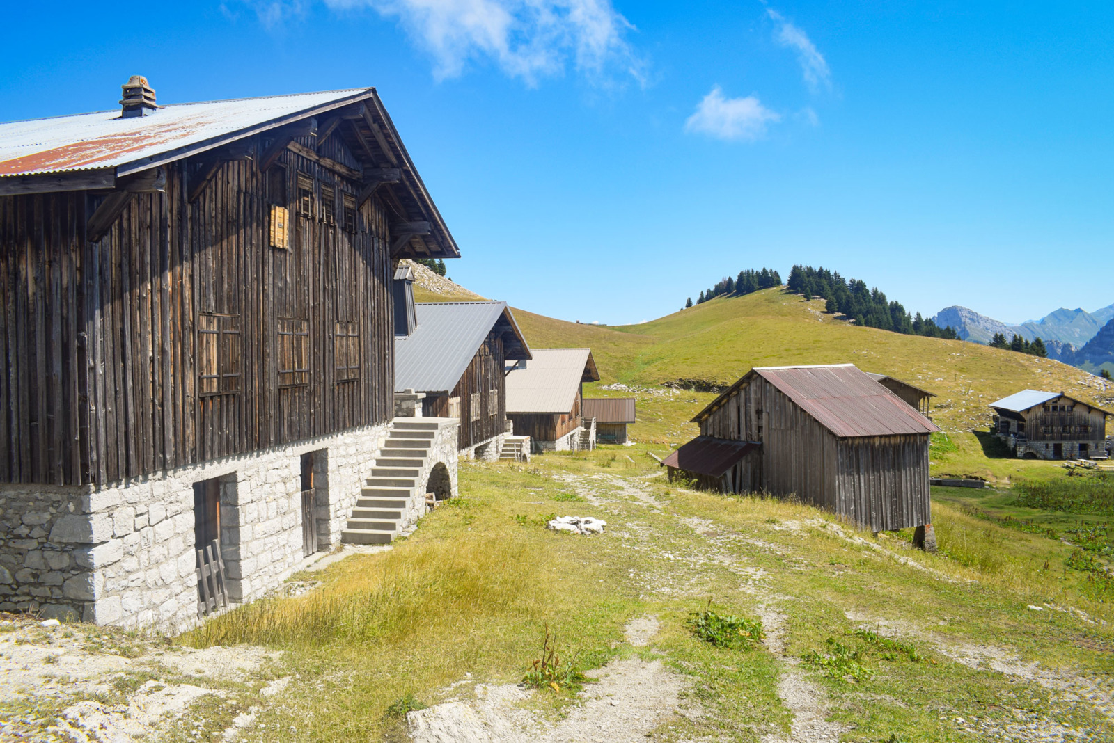
The hamlet of Les Auges
Before 1944, the hamlet had 12 cottages belonging to private owners.

The site was subjected to numerous German air attacks during the Second World War. Then, in March 1944, the cottages were burnt down by the Wehrmacht so as not to shelter any maquisards.
From 1967 onwards, the owners rebuilt eight of them with the help of war damage. The chalets are now used as second homes.
They all offer a view of the Aravis mountains and the Mont Blanc!
With binoculars, you can admire the sparkling glaciers of the massif:
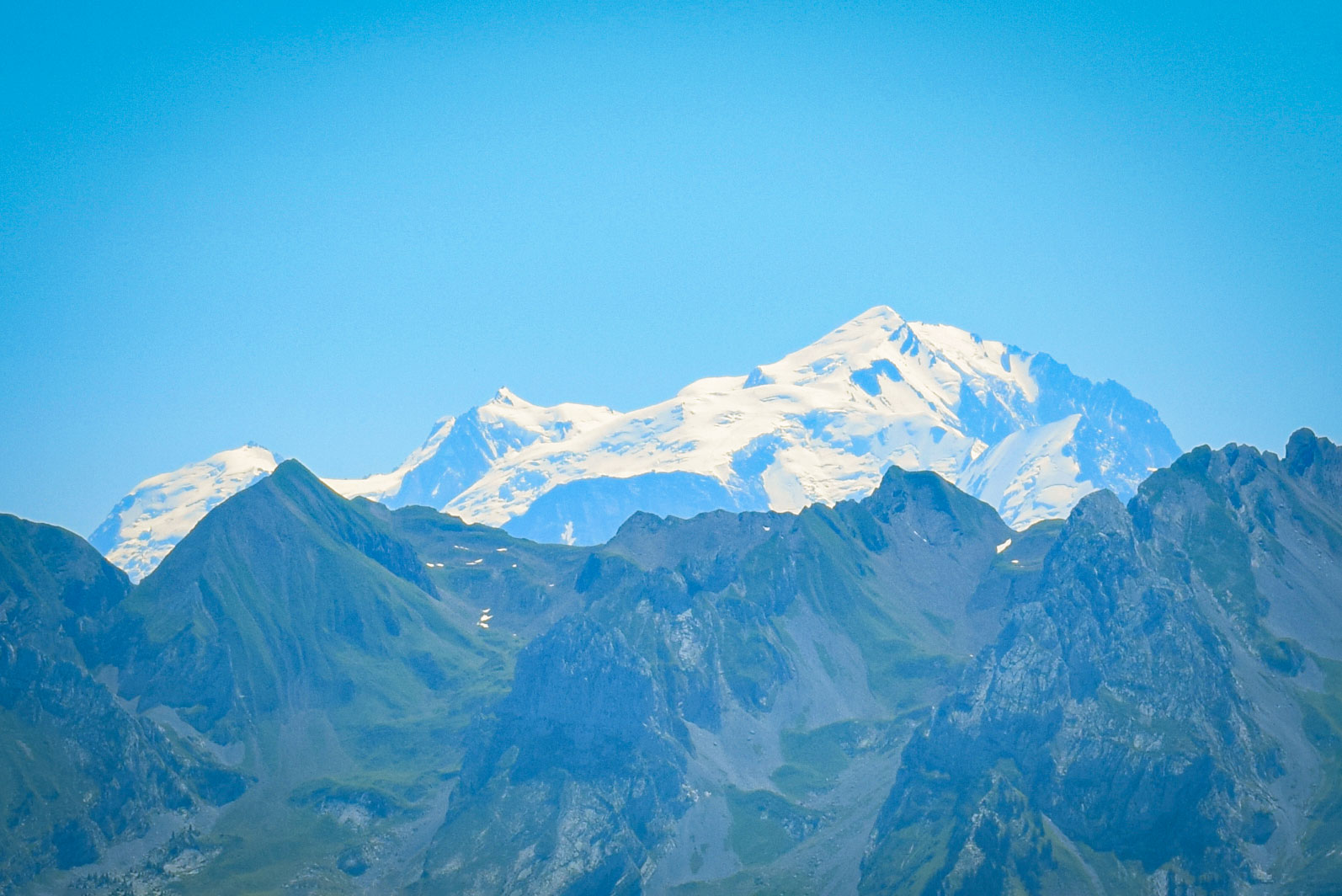
I even saw the Mont Pourri (3,779 m), one of the highest peaks of the Vanoise massif:
Plan your visit to the Glieres Plateau
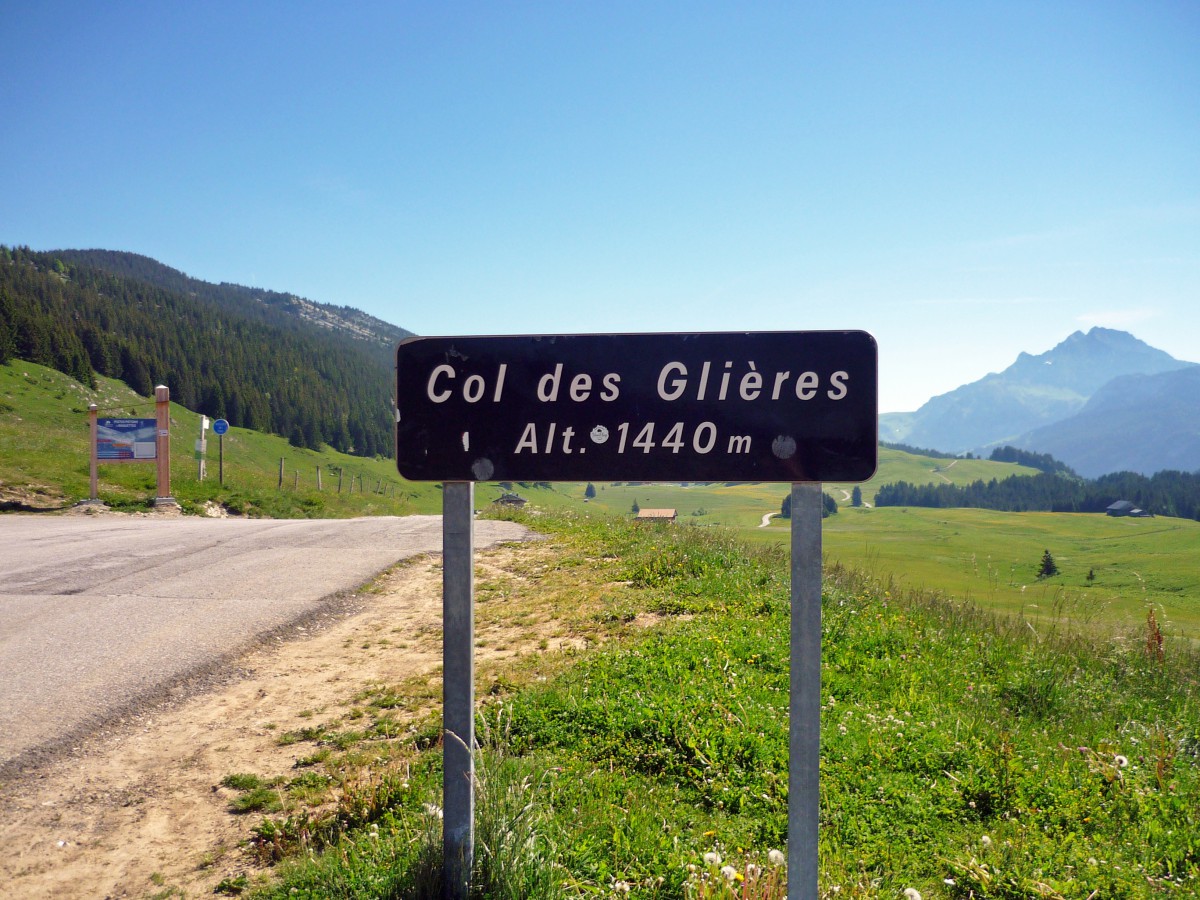
The high-pasture area of the Glières Plateau is accessible from Thorens-Glières through the valley of Usillon (D55). The winding paved road was opened in 1967 and ends of the Col des Glières where there is ample parking. From the pass, the dirt road continues to Chez la Jode where it reaches the paved backroad that goes down to Le Petit-Bornand-les-Glières.
Places where to eat
There are a number of chalets opened in the plateau that provide great food and/or alpine cheese such as reblochon or tomme of Savoie. In one of them, we bought a full-cream / raw milk reblochon.
We didn’t (yet) try any of the restaurants up there but locals told us the Gautard Restaurant (121 Route du Plateau, 74570 Thorens-Glières) was their favourite.
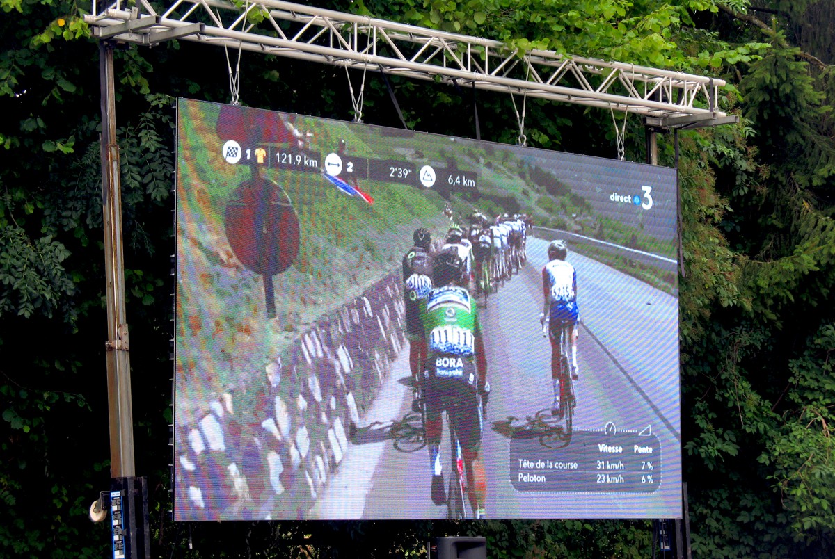
The Tour de France at the Plateau
While driving up to the plateau we saw a few cyclists courageously climbing the steep hairpins. If you are a fan of cycling, read about Will’s 5 climbs of the Plateau des Glières on Cycling Challenge.
In 2018, the Plateau hosted the Tour de France for the first time. An extremely popular stage of the cycling race, the Plateau des Glières was again included in the 2020 cyclist race.
If you are more interested in hiking in the area, check out the Massif des Bornes-Aravis walking guide you can get on Amazon (French only):
You can also get the IGN map (the one I got before moving to the area) number 3430ET (La Clusaz – Le Grand-Bornand) which covers the Plateau des Glières.
Did you like what you read? If so, share this article on Facebook, Twitter or Pinterest!
More photos!

Pin it for later!

