An imposing citadel on a rocky outcrop in a spectacular setting of high mountain peaks… this is the fortified town of Briançon.
And it hardly leaves anyone indifferent!
Here we are in the Hautes-Alpes département, in the northern edge of the Provence-Alpes-Côte d’Azur region.
‘Hautes-Alpes’ literally means ‘Upper Alps’.
Indeed, Briançon is bordered to the west by the Ecrins, one of the highest massifs in the French Alps.
Briançon is also noted for being the highest town of France at 1330 m.
Why Briançon is worth visiting
In the 17th century, a certain Vauban described the region as such:
“The area includes mountains reaching for the sky and valleys sinking to incredible depths”.
Moreover, what makes Briançon such a fascinating place is its historic fortifications from the late 17th and early 18th centuries.
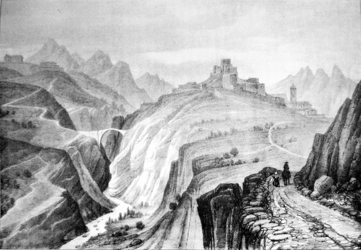
Unsurprisingly, the citadel town is situated in a frontier area (Italy is a mere 15 km away).
In fact, French military engineer Sébastien Le Preste de Vauban (1633-1707) clearly understood its crucial position.
He made it one of the greatest military strongholds of his time.
This explains Vauban’s formidable ring of forts that surrounds Briançon.
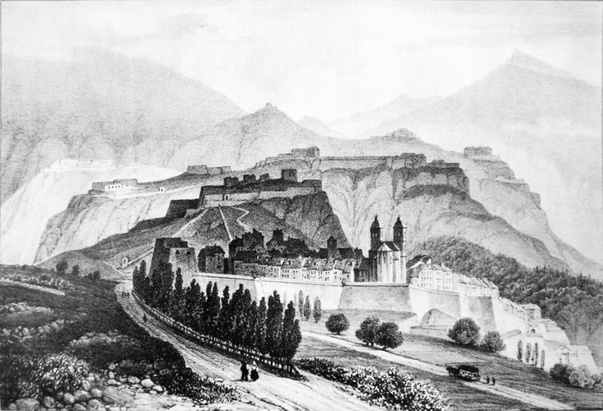
Let’s have a look at the sights and landmarks worth discovering in the town.
Roughly speaking, the fortified town of Briançon consists of two distinct towns.
- the lower town (ville basse). In other words, this is the modern town with its shopping precinct (rue centrale) and railway station.
- the upper town (ville haute), the major point of interest for tourists.
Cité Vauban: the fortified town of Briançon
The Romans already fortified the site of Briançon to guard the road from Milan to Vienne.
Perched above the valley, the upper fortified town of Briançon is surrounded by thick walls, a masterpiece of Vauban.
![The fortified town of Briançon Vauban © Etienne Baudon - licence [CC BY-SA 3.0] from Wikimedia Commons](https://frenchmoments.eu/wp-content/uploads/2020/09/Briançon-Vauban-©-Etienne-Baudon-licence-CC-BY-SA-3.0-from-Wikimedia-Commons.jpg)
The streets of the walled town
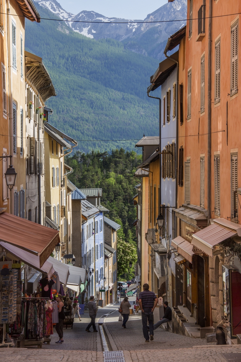
The narrow, steep winding streets are worth discovering, particularly if you’re fond of small-scale heritage.
If you take time, you’ll observe sundials, old fountains, colourful 18th century-old façades reminiscent of Provence, arcades and columns…
![The Fontaine des Soupirs in the old town © René Boulay - licence [CC BY-SA 3.0] from Wikimedia Commons](https://frenchmoments.eu/wp-content/uploads/2020/09/Briancon-Fontaine-des-Soupirs-©-René-Boulay-licence-CC-BY-SA-3.0-from-Wikimedia-Commons.jpg)
![The Sundial of Briançon's Collegiate © nicomic - licence [CC BY 2.0] from Wikimedia Commons](https://frenchmoments.eu/wp-content/uploads/2020/09/Briançon-Sundial-©-nicomic-licence-CC-BY-2.0-from-Wikimedia-Commons.jpg)
In addition, Grande Rue is the town’s narrow main street.
It is lined with shops, souvenir stores, restaurants and cafés.
![Fortified Town of Briançon © Maxence - licence [CC BY 2.0] from Wikimedia Commons](https://frenchmoments.eu/wp-content/uploads/2020/09/Briançon-©-Maxence-licence-CC-BY-2.0-from-Wikimedia-Commons.jpg)
It bears the nickname ‘La Grande Gargouille’ – in other words, the Great Gargoyle.
This is due to the presence of a small canal where a little stream runs down the middle of the street.
Notre-Dame Collegiate
The Notre-Dame collegiate church was designed between 1703 and 1718 under the supervision of Vauban.
It is a neo-classical sanctuary with two bell towers topped with domes and small lanterns.
![The fortified town of Briançon © Shesmax - licence [CC BY-SA 4.0] from Wikimedia Commons](https://frenchmoments.eu/wp-content/uploads/2020/09/Briançon-©-Shesmax-licence-CC-BY-SA-4.0-from-Wikimedia-Commons.jpg)
![Collegiate © Shesmax - licence [CC BY-SA 4.0] from Wikimedia Commons](https://frenchmoments.eu/wp-content/uploads/2020/09/Briançon-Collegiate-©-Shesmax-licence-CC-BY-SA-4.0-from-Wikimedia-Commons.jpg)
Flanking the town-hall, the Cordeliers church features remarkable medieval frescoes from the late 14th century.
The Military structures
The military structures of the walled town are worth mentioning too.
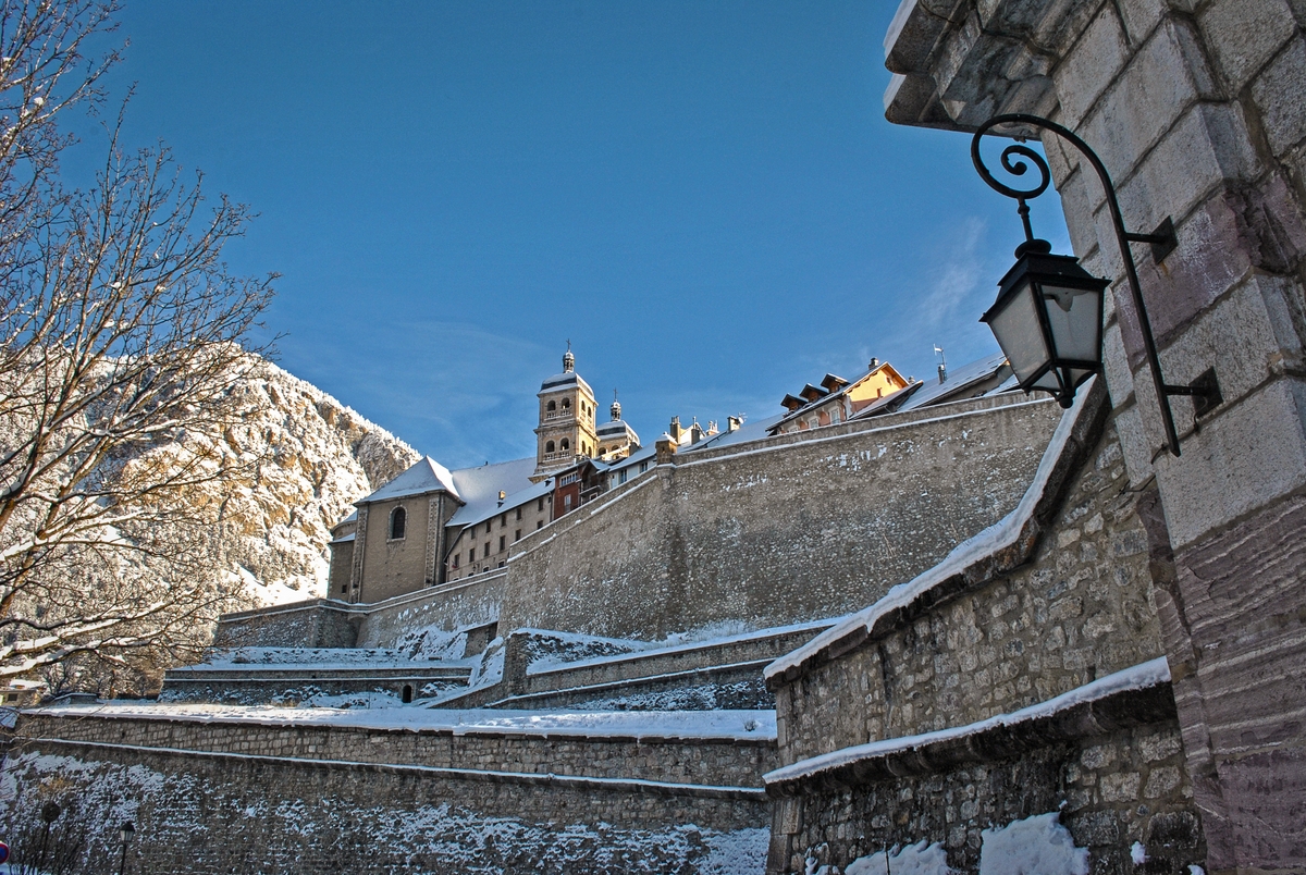
Four gates give access to the town:
- to the north, porte Dauphine and
- porte Pignerol (which is where you enter the town from the Champ de Mars car park),
- to the southwest, porte d’Embrun, and
- to the east, porte de la Durance.
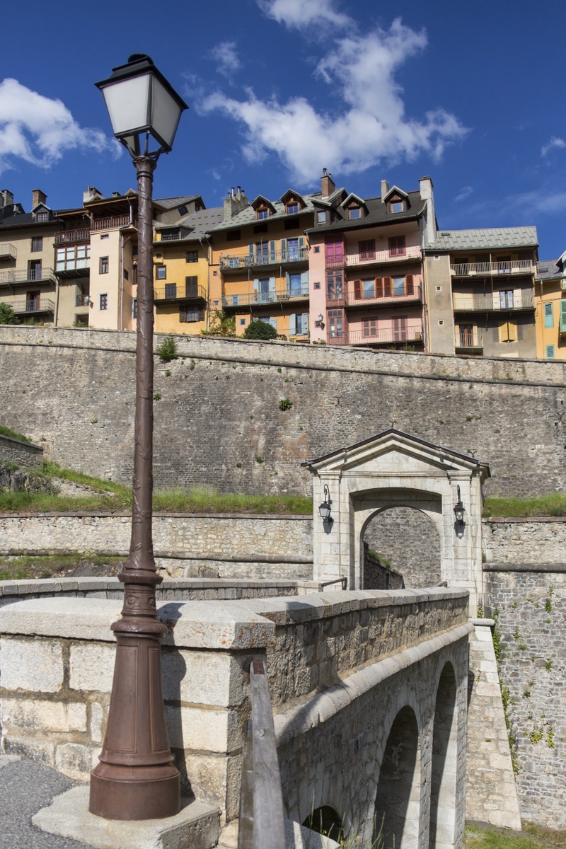
![Porte Dauphine, fortified town of Briançon © MOSSOT - licence [CC BY 3.0] from Wikimedia Commons](https://frenchmoments.eu/wp-content/uploads/2020/09/Briançon-Porte-Dauphine-©-MOSSOT-licence-CC-BY-3.0-from-Wikimedia-Commons.jpg)
![Porte Pignerol, fortified town of Briançon © MOSSOT - licence [CC BY 3.0] from Wikimedia Commons](https://frenchmoments.eu/wp-content/uploads/2020/09/Briançon-Rampart-©-MOSSOT-licence-CC-BY-3.0-from-Wikimedia-Commons.jpg)
Take a walk along the chemin de ronde supérieur.
The upper line of defence overlooks the roofs of the walled town.
![The chemin de ronde, fortified town of Briancon © Alessio Sbarbaro - licence [CC BY-SA 2.5] from Wikimedia Commons](https://frenchmoments.eu/wp-content/uploads/2020/09/Briancon-©-Alessio-Sbarbaro-licence-CC-BY-SA-2.5-from-Wikimedia-Commons.jpg)
The formidable forts of Briançon
Vauban imagined the protection of the fortified city of Briançon with four forts dominating the Durance Valley on the adjacent highlands.

Access to the forts is restricted, however, it is possible to visit many of them via guided tours (Fort du château, Fort des Têtes, and Fort des Salettes).
The forts form a network of fortifications that UNESCO listed in 2008 along with 11 other sites across France. For instance, these are
- Besançon,
- Neuf-Brisach,
- Longwy,
- Arras,
- Saint-Vaast-la-Hougue,
- Camaret-sur-Mer,
- Saint-Martin-de-Ré,
- Blaye,
- Mont-Louis,
- Villefranche-de-Conflent, and
- Mont-Dauphin.

In addition, the UNESCO-listed sites in Briançon include the following structures:
- the rampart of the old town (including the Collegiate church, the Place d’Armes and the two powder magazines)
- the Asfeld Bridge,
- the Fort des Têtes,
- the ouvrage de la communication Y,
- the Fort du Randouillet, and
- the Fort des Salettes.
Fort du Château
The top of the upper town’s outcrop is occupied by the Vauban citadel or Fort du Château. In the late 17th century it replaced a small medieval castle.
![General View of the fortified town of Briançon © MOSSOT - licence [CC BY 3.0] from Wikimedia Commons](https://frenchmoments.eu/wp-content/uploads/2020/09/Briançon-General-View-©-MOSSOT-licence-CC-BY-3.0-from-Wikimedia-Commons.jpg)
From there the military could guard the strategic intersection of four valleys: the Durance, the Guisane, the Cerveyerette, and Clarée.
Pont d’Asfeld
The Pont d’Asfeld is a bridge that spans the Durance some 70 metres above the river.
![Pont d'Asfeld © Alessio Sbarbaro - licence [CC BY-SA 2.5] from Wikimedia Commons](https://frenchmoments.eu/wp-content/uploads/2020/09/Briancon-Pont-dAsfeld-©-Alessio-Sbarbaro-licence-CC-BY-SA-2.5-from-Wikimedia-Commons.jpg)
The military structure served as a direct link between the fortified town of Briançon and the Fort des Têtes that overlooks the town and its surroundings.
Work ended in 1734 and its daring height gave it the alternative name of Devil’s bridge.
However, it takes its name from the Marquis d’Asfeld (1665-1743), a French Marshal of France who continued Vauban’s work in Briançon.
The Fort des Têtes
The infantry fort occupies the Têtes plateau at 1440 m high. Vauban investigated the construction of the fort but died after it commenced in 1721.
![Fort des Têtes, fortified town of Briançon © Benj05 - licence [CC BY-SA 3.0] from Wikimedia Commons](https://frenchmoments.eu/wp-content/uploads/2020/09/Fort-des-Têtes-in-Briançon-©-Benj05-licence-CC-BY-SA-3.0-from-Wikimedia-Commons.jpg)
Moreover, the Fort des Têtes comprises three bastioned fronts overlooking the south of the Durance Valley.
The Fort du Randouillet
At 1604 m high, the Fort du Randouillet (1724-1734) dominates the Fort des Têtes which in turn towers over the fortified town of Briançon.
It is an irregular-shaped structure which includes barracks, magazines and a single fortified front.
The army installed a cable car to connect the fort to the valley.
An atypical structure connects it to the Fort des Têtes: the communication Y.
![Communication Y, fortified town of Briançon © Edouard Hue - licence [CC BY-SA 3.0] from Wikimedia Commons](https://frenchmoments.eu/wp-content/uploads/2020/09/Communication-Y-Briançon-©-Edouard-Hue-licence-CC-BY-SA-3.0-from-Wikimedia-Commons.jpg)
The ouvrage de la communication Y
The unusual structure served to prevent access to the east side of the Upper Durance Valley, and particularly the Cerveyrette Valley that leads to the Queyras.
![Ouvrage de la communication Y © Les Berges des Pierres - Moselle Association - licence [CC BY-SA 4.0] from Wikimedia Commons](https://frenchmoments.eu/wp-content/uploads/2020/09/Ouvrage-de-la-communication-Y-©-Les-Berges-des-Pierres-Moselle-Association-licence-CC-BY-SA-4.0-from-Wikimedia-Commons.jpg)
As its name implies, the Ouvrage de la Communication Y is a 150 m long vaulted passageway that allows secure ‘communication / transfer‘ of provisions and men between the Fort de Randouillet and the Fort des Têtes.
The Fort des Salettes
Vauban initially planned the Fort des Salettes and it was the Marquis of Asfeld who constructed the fort between 1709 and 1712, after Vauban’s death.
![Fort des Salettes, fortified town of Briançon © MOSSOT - licence [CC BY 3.0] from Wikimedia Commons](https://frenchmoments.eu/wp-content/uploads/2020/09/Briançon-Fort-des-Salettes-©-MOSSOT-licence-CC-BY-3.0-from-Wikimedia-Commons.jpg)
The infantry fort guarded the route to Italy. It dominates the fortified town of Briançon at 1538 m high.
Other forts around Briançon
The great plan of Vauban remained incomplete in the 18th century.
In the 1870s, Raymond Adolphe Séré de Rivières (1815-1895) revolutionised the design of fortifications in France.
The French military engineer and general created the Séré de Rivières system, an ensemble of fortifications built in 1874 along the borders and coasts of France.
For this purpose, five new forts complemented the fortified town of Briançon from 1874, at heights exceeding 2000 metres:
- Croix de Bretagne,
- Enlon,
- Gondrands,
- Infernet, and
- Janus.
![Fort de l'Infernet © Les Berges des Pierres - Moselle Association - licence [CC BY-SA 4.0] from Wikimedia Commons](https://frenchmoments.eu/wp-content/uploads/2020/09/Fort-de-lInfernet-©-Les-Berges-des-Pierres-Moselle-Association-licence-CC-BY-SA-4.0-from-Wikimedia-Commons.jpg)
The French army modernised the Janus fort in 1930 to include it in the Alpine Maginot Line.
Explore the surroundings of Briançon
Briançon makes an excellent base for exploring the upper Durance, bordered by the Ecrins massif in the west and the Queyras massif in the east.
In fact this region also takes the name of ‘Briançonnais’.
Croix de Toulouse
The Croix de Toulouse (Toulouse’s Cross) is an eagle’s nest perched at an altitude of 1,956 m.
The Belvedere offers a stunning view of Briançon, its forts and the Upper Durance valley.
An orientation table provides the names of all the major landmarks.
![Briançon Panorama from the Croix de Toulouse © Etienne Baudon - licence [CC BY-SA 3.0] from Wikimedia Commons](https://frenchmoments.eu/wp-content/uploads/2020/09/Briancon-Panorama-from-the-Croix-de-Toulouse-©-Etienne-Baudon-licence-CC-BY-SA-3.0-from-Wikimedia-Commons.jpg)
From Briançon the ascent takes 2 hrs.
Télécabine de Prorel
The gondola departs from Avenue René-Froger in the Lower Town and connects Briançon with the ski resort of Serre-Chevalier.
In addition, there are plenty of walks to enjoy in the area in summertime.
One of them is the ascent to the nearby Sommet du Prorel (2,566 m / 8,418 ft).
There’s an exceptional panoramic view to admire from the top: Briançon, the Upper Durance valley, the Ecrins massif, the Aiguilles d’Arves, Mont Thabor, Monte Viso…
The Ski-resort of Serre Chevalier
The people of Briançon are fortunate to have a ski resort just around the corner: Serre Chevalier.
![Serre Chevalier by Fredrik Lähnn [Public Domain]](https://frenchmoments.eu/wp-content/uploads/2020/09/Serre-Chevalier-by-Fredrik-Lähnn-Public-Domain.jpg)
The station’s 250 ski runs cover the eastern edge of the Ecrins massif, making it the largest ski resort in the southern Alps.
The Ecrins National Park
Briançon is very close to the Ecrins National Park.
The picturesque mountain village of Vallouise (21 km) is one of the entrance gates to the National Park.
![Vallouise © patano - licence [CC BY-SA 3.0] from Wikimedia Commons](https://frenchmoments.eu/wp-content/uploads/2020/09/Vallouise-©-patano-licence-CC-BY-SA-3.0-from-Wikimedia-Commons.jpg)
The D204 road climbs up to the stunning mountain scenery of Pré de Madame Carle from where you can see the famous Barre des Ecrins (4,102 m / 13,458 ft).
![Hamlet of Ailefroide in the Ecrins Massif © MOSSOT - licence [CC BY-SA 3.0] from Wikimedia Commons](https://frenchmoments.eu/wp-content/uploads/2020/09/Hameau-de-Ailefroide-©-MOSSOT-licence-CC-BY-SA-3.0-from-Wikimedia-Commons.jpg)
![Pré de Madame Carle © MOSSOT - licence [CC BY-SA 3.0] from Wikimedia Commons](https://frenchmoments.eu/wp-content/uploads/2020/09/Pré-de-Madame-Carle-and-Barre-des-Ecrins-©-MOSSOT-licence-CC-BY-SA-3.0-from-Wikimedia-Commons.jpg)
![Pré de Madame Carle © MOSSOT - licence [CC BY-SA 3.0] from Wikimedia Commons](https://frenchmoments.eu/wp-content/uploads/2020/09/Pré-de-Madame-Carle-©-MOSSOT-licence-CC-BY-SA-3.0-from-Wikimedia-Commons.jpg)
The peak is the only mountain reaching 4,000 m outside the Mont Blanc massif.
In fact, it was the highest mountain in France before the annexation of Savoy in 1860.
The Clarée Valley
To the north of the fortified town of Briançon, the Clarée Valley (in French, Vallée de la Clarée) is a listed natural site with stunning mountain scenery and preserved heritage.
![Vallée de la Clarée © MOSSOT - licence [CC BY 3.0] from Wikimedia Commons](https://frenchmoments.eu/wp-content/uploads/2020/09/Vallée-de-la-Clarée-©-MOSSOT-licence-CC-BY-3.0-from-Wikimedia-Commons.jpg)
Furthermore, you can drive via the picturesque mountain village of Névache to the chalets de Laval at 2,015 m high.
![Hamlet of Névache in the Vallée de la Clarée © MOSSOT - licence [CC BY 3.0] from Wikimedia Commons](https://frenchmoments.eu/wp-content/uploads/2020/09/Névache-Vallée-de-la-Clarée-2-©-MOSSOT-licence-CC-BY-3.0-from-Wikimedia-Commons.jpg)
![Hamlet of Névache in the Vallée de la Clarée © MOSSOT - licence [CC BY 3.0] from Wikimedia Commons](https://frenchmoments.eu/wp-content/uploads/2020/09/Névache-in-Vallée-de-la-Clarée-©-MOSSOT-licence-CC-BY-3.0-from-Wikimedia-Commons.jpg)
Col de Montgenèvre
The Col de Montgenèvre (1,854 m / 6,083 ft) is an important mountain pass that links Briançon to the Susa Valley in Italy.
It is one of the lowest road passes in the Alps between Lake Geneva and Menton on the French Riviera.
Above all this explains why several defensive forts have been built on the French side in the past (Briançon, Fort Janus, Fort du Gondran, Fort des Trois-Têtes, Fort de l’Infernet and Fort de la Croix de Bretagne).
![Montgenèvre © Omonchic - licence [CC BY-SA 3.0] from Wikimedia Commons](https://frenchmoments.eu/wp-content/uploads/2020/09/Montgenèvre-©-Omonchic-licence-CC-BY-SA-3.0-from-Wikimedia-Commons.jpg)
As in 2020, the Tour de France crossed the Montgenèvre pass at least 10 times.
The Queyras massif
Beyond the Izouard Pass (2,361 m) stretches the Queyras.
The massif is also a Regional Natural Park and boasts many quaint and picturesque alpine villages around the castle village of Château-Queyras.
For instance, one of them is Saint-Véran, France’s most elevated commune.
![Château-Queyras © patano - licence [CC BY-SA 3.0] from Wikimedia Commons](https://frenchmoments.eu/wp-content/uploads/2020/09/Château-Queyras-©-patano-licence-CC-BY-SA-3.0-from-Wikimedia-Commons.jpg)
![Church of Saint-Véran © Fabrice AMOROS - licence [CC BY-SA 4.0] from Wikimedia Commons](https://frenchmoments.eu/wp-content/uploads/2020/09/Church-of-Saint-Véran-©-Fabrice-AMOROS-licence-CC-BY-SA-4.0-from-Wikimedia-Commons.jpg)
![Saint-Véran © Fabrice AMOROS - licence [CC BY-SA 4.0] from Wikimedia Commons](https://frenchmoments.eu/wp-content/uploads/2020/09/Saint-Véran-©-Fabrice-AMOROS-licence-CC-BY-SA-4.0-from-Wikimedia-Commons.jpg)
What makes Briançon a good holiday base?
![The fortified town of Briançon © MOSSOT - licence [CC BY 3.0] from Wikimedia Commons](https://frenchmoments.eu/wp-content/uploads/2020/09/Briançon-©-MOSSOT-licence-CC-BY-3.0-from-Wikimedia-Commons.jpg)
In conclusion, let’s end this discovery of the fortified town of Briançon by a number of thumbs-ups!
- The town boasts an amazing and rich architectural heritage, mainly military with castles and forts.
- Then it is a great summer destination with lots of walks in the mountains (Ecrins and Queyras).
- Briançon’s connection to the ski domain of Serre-Chevalier makes it a top destination if you enjoy skiing or any other winter activities.
- Also, the town is 50 km / 31 mi from the town of Susa, which makes a nice day excursion to neighbouring Italy.
- And finally, you can easily access Briançon by train: Paris (less than 7 hrs), Lyon (5 hrs 30) and Marseille (6 hrs).
![Briançon's Railway Station © Alexdevil - licence [CC BY-SA 4.0] from Wikimedia Commons](https://frenchmoments.eu/wp-content/uploads/2020/09/Gare-de-Briançon-©-Alexdevil-licence-CC-BY-SA-4.0-from-Wikimedia-Commons.jpg)
Have you ever visited the fortified town of Briançon? Leave a comment below with your favourite thing about the citadel town. I’d love to hear from you!
Inspired by the fortified town of Briançon?
Save this Pin for later!


Featured image: © Shesmax – licence [CC BY-SA 4.0] from Wikimedia Commons


