
The flooding of the Seine is an integral part of the history of Paris. Through the annals of time, the Seine River has witnessed history’s ebb and flow, shaping the heart of Paris. Amidst charming bridges and iconic landmarks, a lesser-known facet of the city’s narrative emerges – the historic floods that have left their mark on its streets, buildings, and collective memory. One such chapter stands out: the unforgettable Seine flood of 1910. But this event is merely a thread woven into a tapestry of inundations that have tested the resilience of Parisians throughout the centuries. From the dramatic heights of the Seine flood of 1910 to the recent deluge of 2016, which I had the privilege of capturing through my lens for my “Paris floods” photo reportage, Paris has stood firm against the challenges brought by rising waters. As we delve into the depths of history, let’s navigate the currents of these historic floods and unveil how Paris has faced and triumphed over the challenges brought by the ebb and flow of its iconic river.
The history of the Paris floods
It seems that the Roman emperor Julian first mentioned a flood during the winter of 358-359.
Gregory of Tours recounted the flood of January 583 in chapter XXV of Book VI of his History of the Franks.
Floods have often been fatal to the bridges of Paris. In 1280, a flood swept away the Grand Pont. In December 1296, another considerable flood swept away all the bridges in Paris (which at the time supported houses).
The most significant flood in Parisian history, known with sufficient certainty, dates from 1658. That year, the Seine reached its highest level, 8.96 metres.
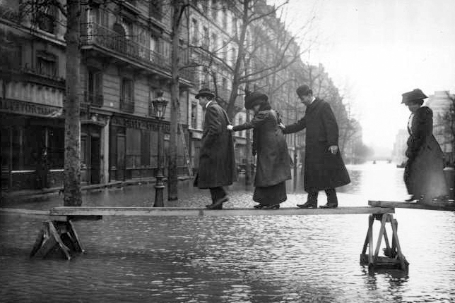
But the historic flood that is still most vividly remembered by Parisians is the 1910 Great Flood of Paris, which lasted nine days, from the 20th to the 28th of January 1910.
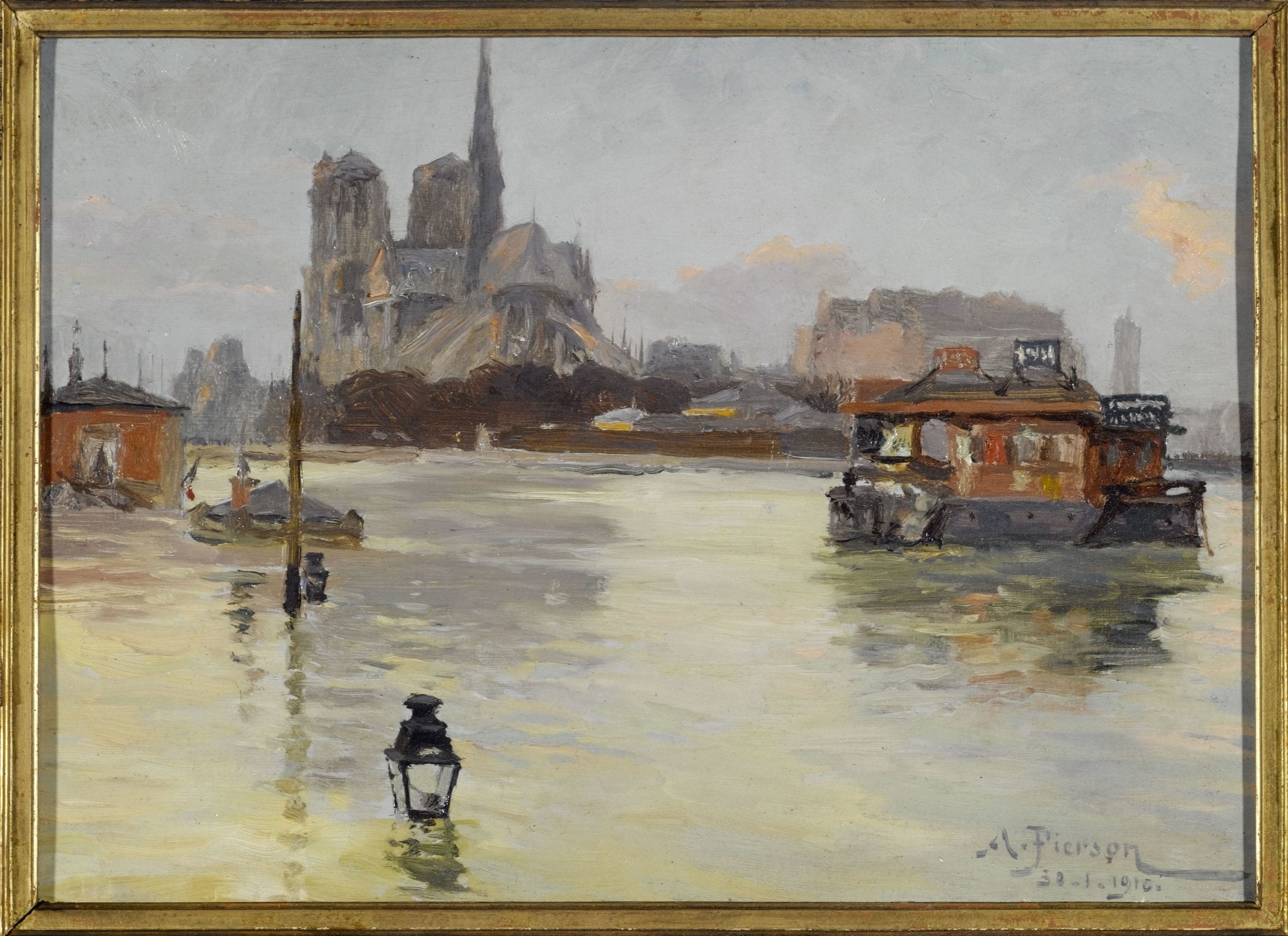
The 1910 Great Flood of Paris
The 1910 Great Flood of Paris (Crue de la Seine de 1910), often called the “centennial flood,” was the most considerable overflow the Seine had seen since 1658.
It affected much of the river’s valley and, while not very deadly, caused significant damage to the local economy, especially in Paris. Many parts of the city and riverside towns were impacted for several weeks before and after the event.
The water rose in about ten days to peak at 8.62m above the average height and receded over 35 days. Due to their interconnected systems, other rivers joining the Seine were similarly affected to varying degrees. Suburban areas also faced significant damage.
What were the causes of the 1910 Seine flood?
A combination of various factors brought about the Paris flood of 1910:
- Heavy rainfall,
- Snowfall and freezing temperatures,
- Overflow of several upstream rivers: Yonne, Loing, Grand Morin,
- Saturated ground in the entire Paris Basin (shaped like a bowl). It’s worth noting that in January 1910, significant flooding also occurred in Alsace, which was then part of Germany, and in Nancy in Lorraine.
The Timeline of the 1910 Seine Flood
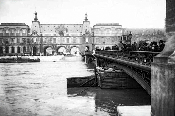
20th of January: Navigation on the Seine at Paris was halted as there wasn’t enough clearance under the bridges.
21st of January: The urban compressed air plant in the 13th arrondissement was shut down, stopping public clocks and elevators.
23rd of January: The Seine’s water level reached the top of the quays designed to withstand a flood similar to 1876. Parts of Paris became flooded.
28th of January: The Seine reached its highest point, measuring 8.62 meters on the hydrometric scale of the Austerlitz Bridge in Paris. The Zouave statue on the Alma Bridge, which Parisians use to gauge the height of Seine floods, had water up to its shoulders.
The receding of the floodwaters lasted for around 35 days until mid-March.
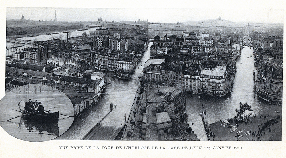
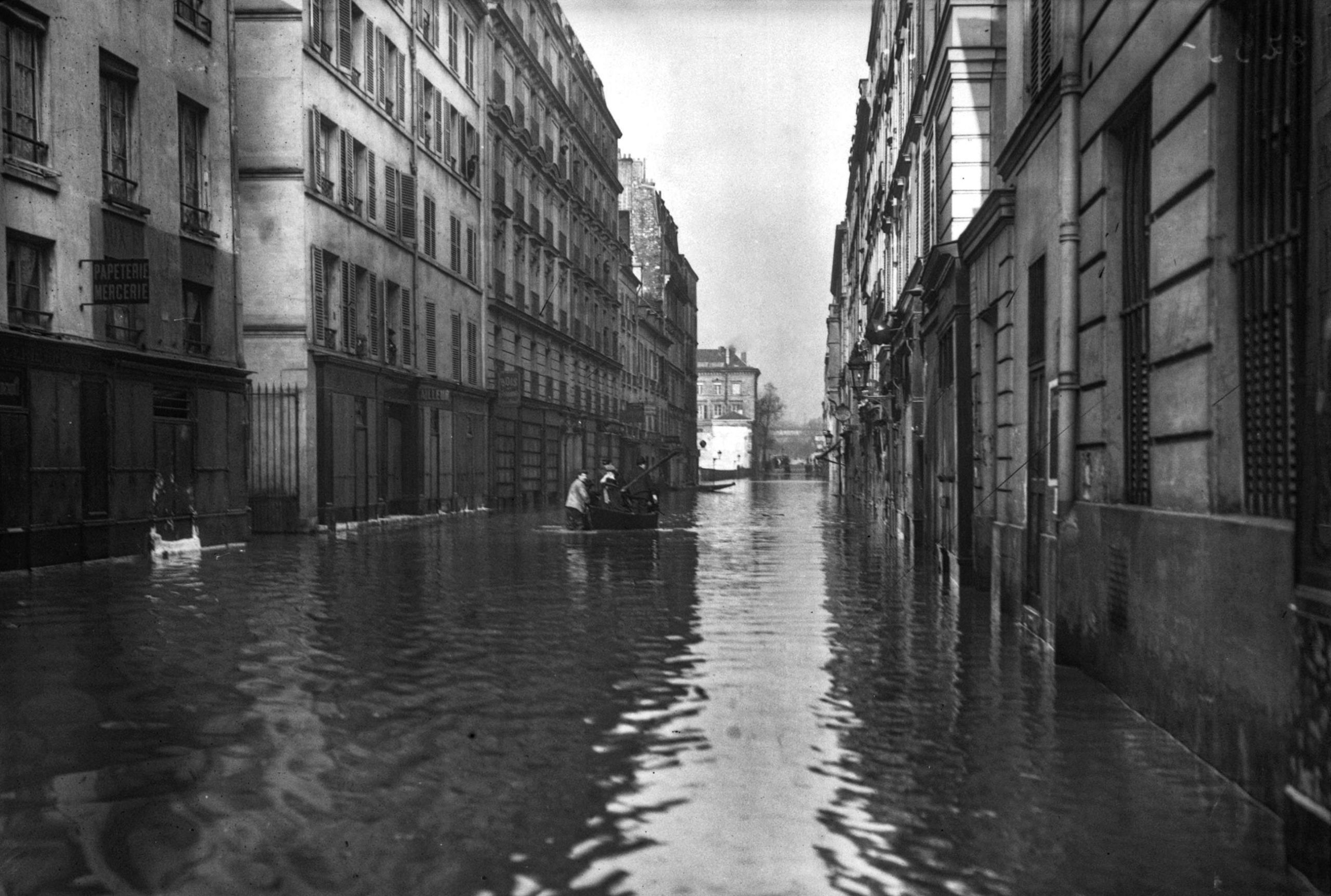
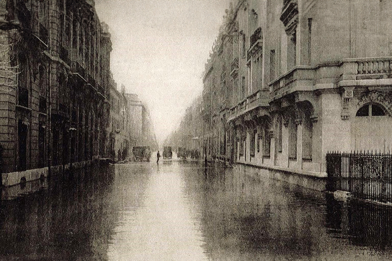
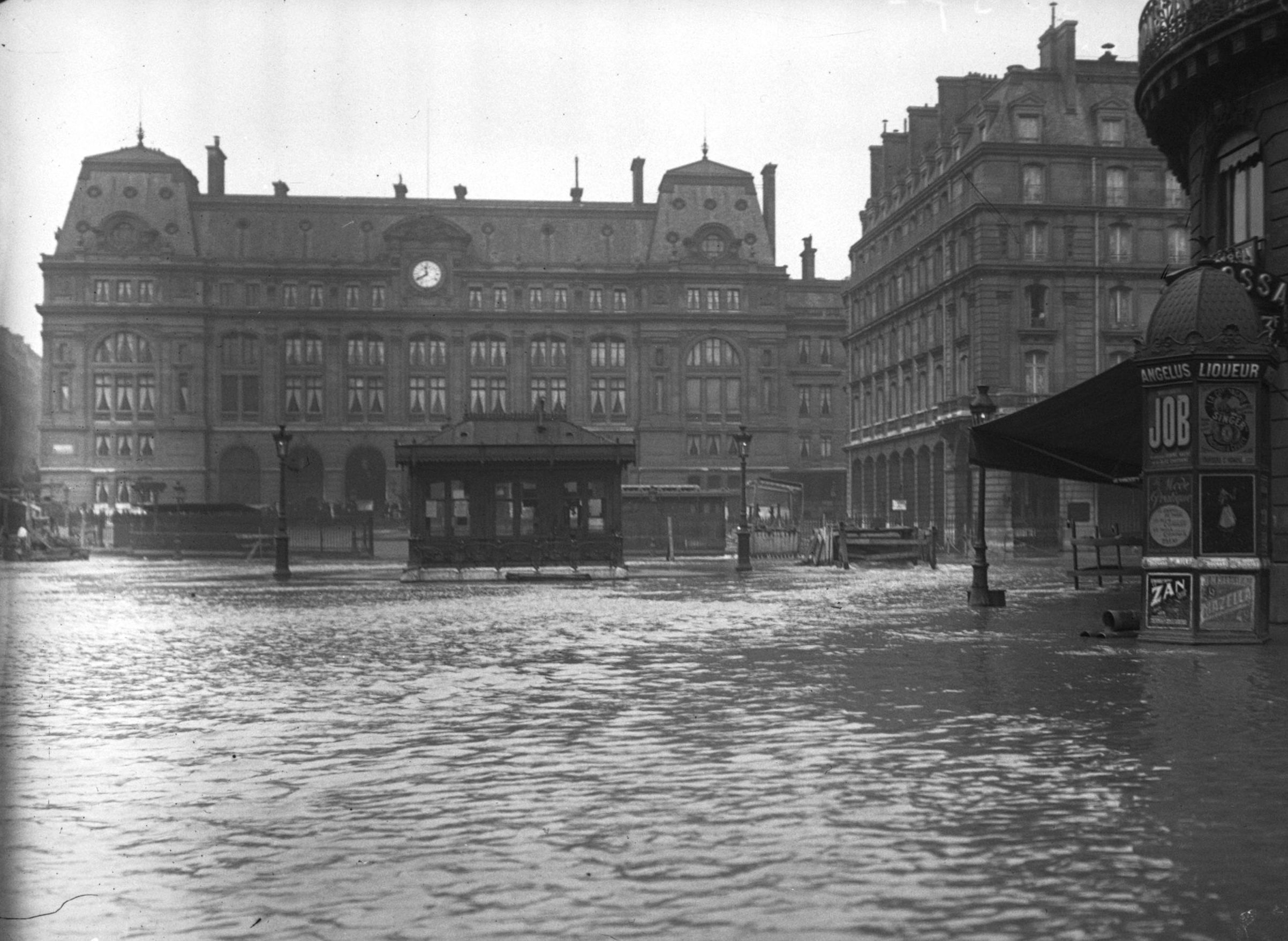
The Effects of the 1910 Flood
The floodwaters affected these areas due to the Seine’s overflow and its historical course, leaving a mark on the city’s geography and history.
Affected Areas: The flooded areas corresponded to the alluvial zones of the Seine’s meander, stretching along the left bank, especially in the 15th arrondissement. It also extended to the former course of the Seine, which flowed north of the grand boulevards on the right bank, to the Alma Bridge, where the great sewer, covered around 1760, discharged.
![Map of 1910 Paris Flood. [Public Domain via Wikimedia Commons]](https://frenchmoments.eu/wp-content/uploads/2016/06/Map-of-1910-02.-Public-Domain-via-Wikimedia-Commons.jpg)
Marais District: A significant portion of the Marais district, which initially consisted of the broad riverbed in the Neolithic era and gradually transformed into marshes progressively developed from the Middle Ages onwards, was submerged.
Submerged Metro: Half of the existing metro network at the time was flooded. This included Line 4, which had been inaugurated just a few weeks earlier, and had to be closed due to the flooding. The rising waters disrupted the city’s transportation system, illustrating the extent of the flood’s impact on daily life in Paris.
Health Concerns
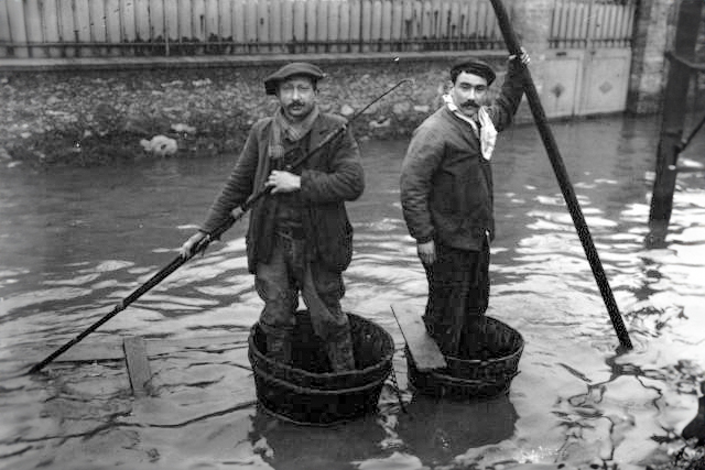
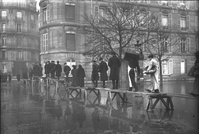
On January 28, 1910, hundreds of streets, 22,000 buildings in Paris, and over 30,000 houses in the suburbs were inundated by icy and increasingly polluted water as the sewers began to back up.
The issue arose because tens of thousands of cesspools in basements that were not connected to the city’s sewer system were flooded. Additionally, tanker boats meant to transport waste from Paris could not pass under the bridges.
As a result, the health situation became worrying, with typhoid and scarlet fever cases reported. The flood’s impact extended beyond infrastructure, affecting public health and underscoring the urgency of addressing the consequences of the rising waters.
![Quai de Passy in January 1910. Collection personnelle Scanné par Claude Shoshany [Public Domain via Wikimedia Commons]](https://frenchmoments.eu/wp-content/uploads/2016/06/Quai-de-Passy-1910.-Collection-personnelle-Scanne-par-Claude-Shoshany-Public-Domain-via-Wikimedia-Commons.jpg)
Other Consequences of the Historic Paris Flood
It wasn’t until mid-March that the flood was receded entirely. The flood’s aftermath revealed the economic and logistical challenges the city and its residents had to overcome to recover from the disaster.
- The flood had a significant impact on various sectors. Librarians and publishers, for instance, faced heavy losses as their entire stocks were permanently destroyed.
- To kickstart the resumption of work, Members of Parliament set an example by commuting to the National Assembly in boats.
- In terms of direct damages, the flood resulted in losses amounting to 400 million gold francs (equivalent to over 1.6 billion euros today), with an additional 50 million gold francs distributed as relief aid.
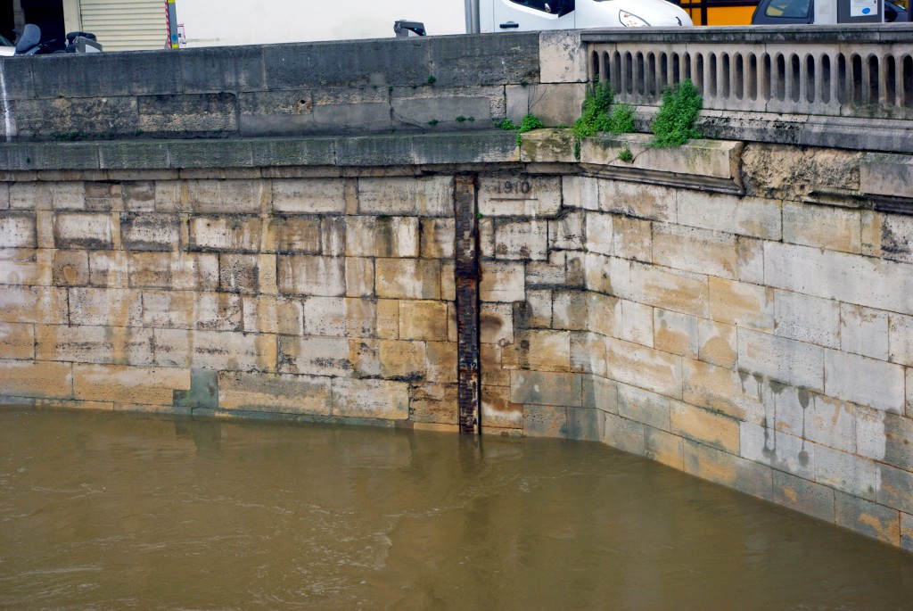
The high water marks of the 1910 Paris Floods
Take a stroll along the banks of the Seine, and you’ll come across high water marks of the 1910 Paris Floods. These markers are historical markers placed in a stable place over time and visible to the public. They serve to keep alive the memory of these fortunately rare events.
Beyond the memorial aspect, the presence of high water marks in public places aims to raise awareness among citizens and stakeholders of the risk of flooding, which is always real, and to enable them to plan ahead.
In flood-prone areas of Paris, building regulations now require ground floor levels to be above the 1910 flood level.

More photos of the 1910 Paris Floods
![Wooden paving stones loosened during the 1910 flood [Public Domain via Wikimedia Commons].](https://frenchmoments.eu/wp-content/uploads/2016/06/Paves-en-bois-descelles-durant-la-Crue-de-1910-Public-Domain-via-Wikimedia-Commons.jpg)
![Paris Floods - Avenue Daumesnil 1910. Collection personnelle Scanné par Claude_villetaneuse [Public Domain via Wikimedia Commons]](https://frenchmoments.eu/wp-content/uploads/2016/06/Avenue-Daumesnil-1910.-Collection-personnelle-Scanne-par-Claude_villetaneuse-Public-Domain-via-Wikimedia-Commons.jpg)
For more photos about the Paris Floods, visit the Wikimedia page.
Summary of the Paris floods since 1658
The 13 most significant floods on the Seine in Paris, in descending order:
1658: 8,96 m
1910: 8,60 m
1740: 7,96 m
1799: 7,65 m
1802: 7,62 m
1924: 7,32 m
1955: 7,14 m
1945: 6,80 m
1876: 6,70 m
1920: 6,20 m
1982: 6,15 m
2016: 6,10 m
2018: 5,86 m
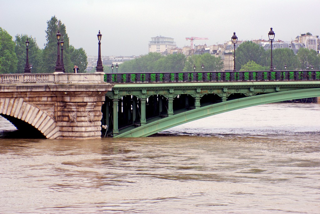
The 2016 Paris Floods
In May 2016, rainfall levels in Paris were the highest since 1873. Torrential rain caused catastrophic flooding in the Paris region. On the 4th of June 2016, the levels of the River Seine in Paris reached a 34-year high at 6.18m (20ft) above its average height. President François Hollande described this natural event as an ‘exceptional flooding’. Here are a few dramatic photos of the June 2016 Paris floods taken Saturday, the 4th of June 2016, during a walk from the Île Saint-Louis to Pont Mirabeau.
Museums and métro stations closed
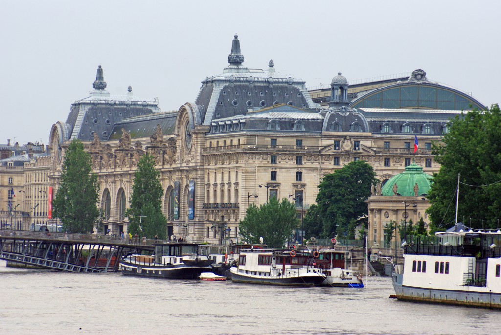
The worrying rise of the Seine led to the Louvre and Orsay museums closing for several days. Their staff were requisitioned to move art to safety. In the Louvre, more than 250,000 works of art and historic objects stored in the basement were moved to the upper floors.
The métro and RER network was not affected except for a few métro stations (Saint-Michel and Cluny-La Sorbonne), for which the authorities decided to close.

The peak of the floods took place very early on Saturday morning. The water level should remain stable over the weekend, and it will take several days for the rain-swollen river to drop back to its average level.
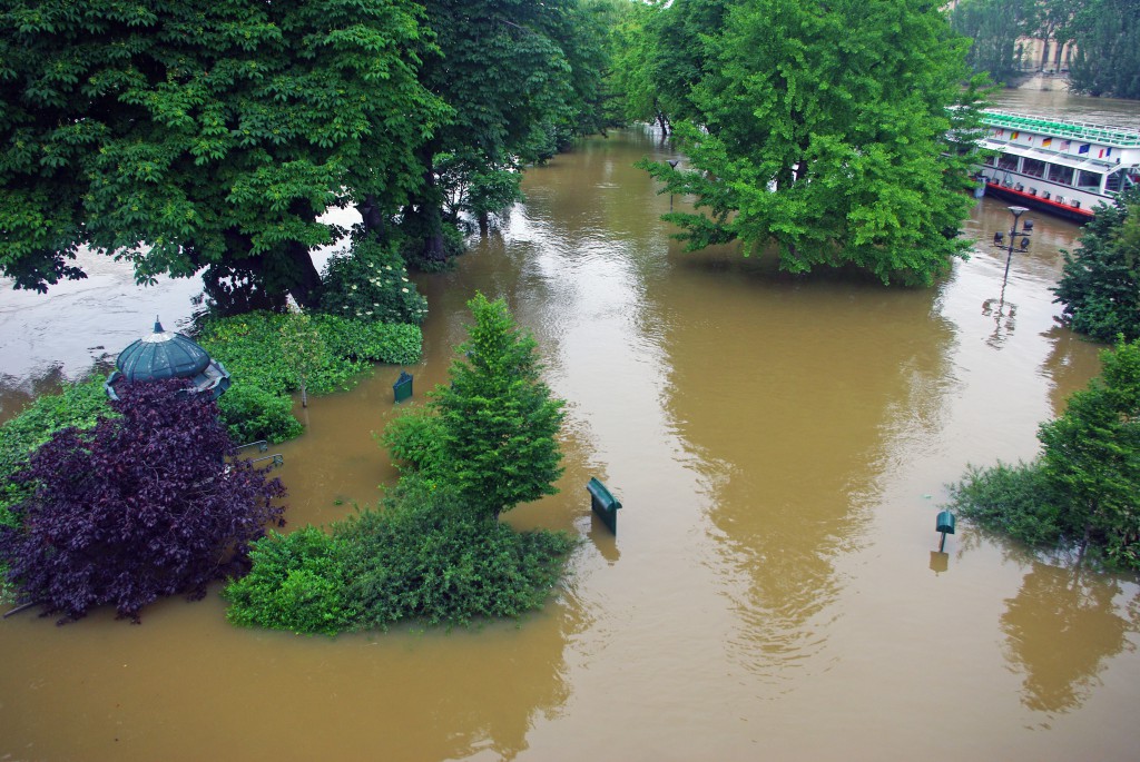
Around Ile de la Cité
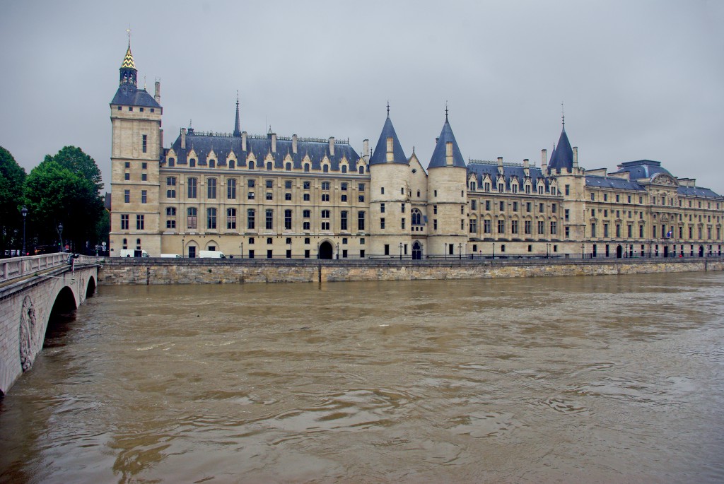
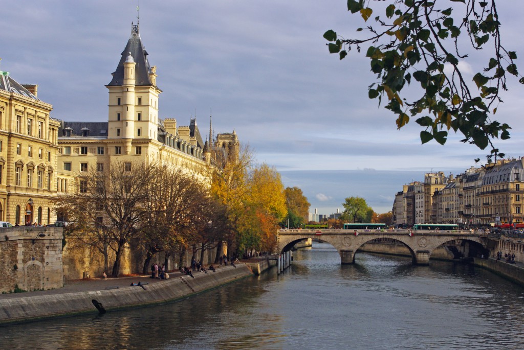
We started our 10 km walk along the banks of the River Seine at Place du Châtelet. Here is the Conciergerie and the Pont au Change:
The Pont-Neuf seen from the Pont au Change:

The Pont d’Arcole linking the Right Bank to the Île de la Cité:

The view from the Pont d’Arcole to the Tribunal de Commerce, the Pont au Change and the Conciergerie:
The Pont d’Arcole and the Île de la Cité:

The expressway Georges Pompidou is entirely underwater:

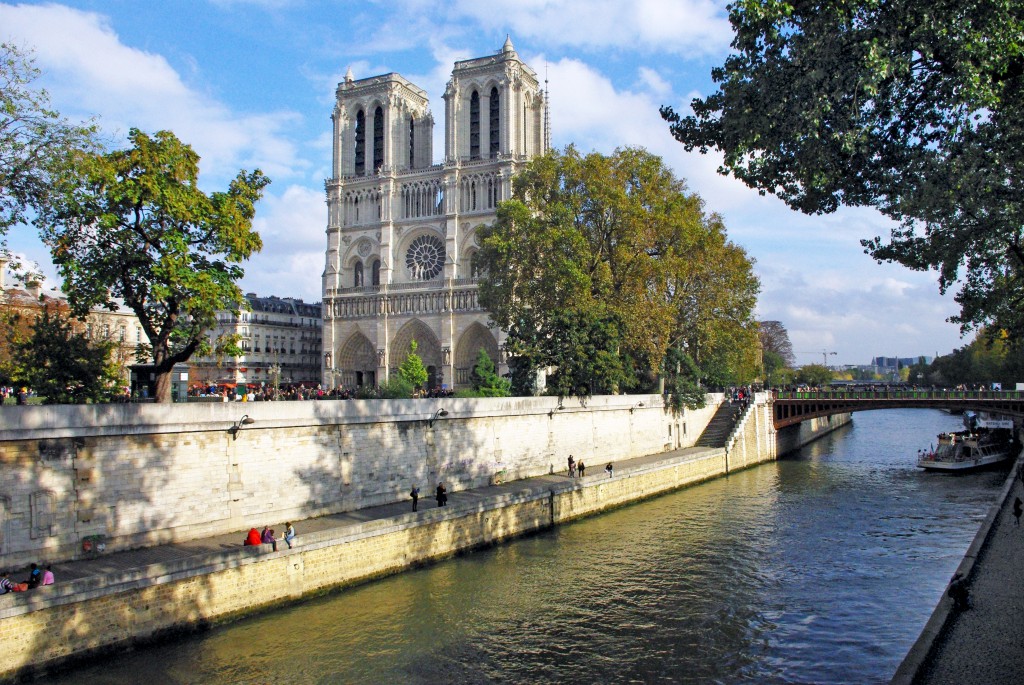
The Île de la Cité from Pont d’Arcole (Quai aux Fleurs) and the spire of Notre-Dame Cathedral:

The water level of the Great Flood of 1910 compared to that of 2016:
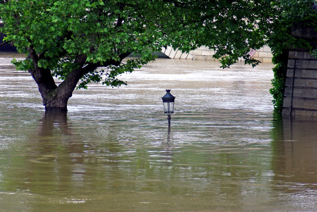
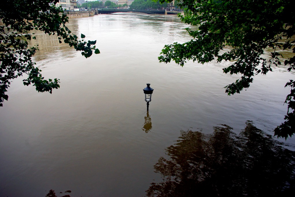
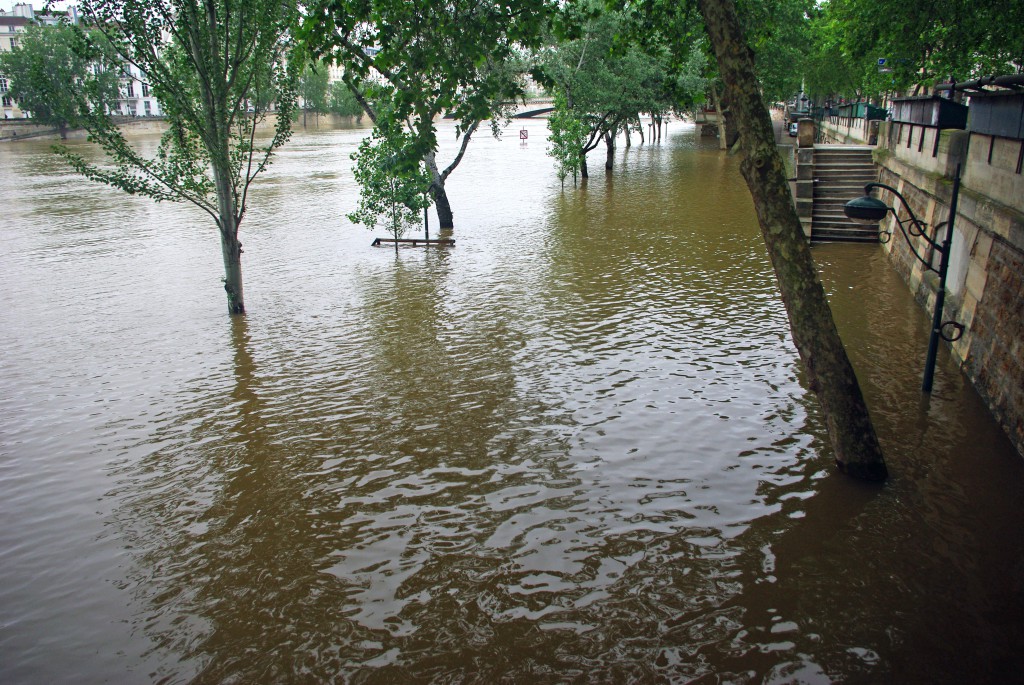
Ile Saint-Louis
Now on the Île Saint-Louis. The lower quays of Quai de Bourbon submerged… only a typical Parisian lamppost reveals the presence of a disappeared lane:
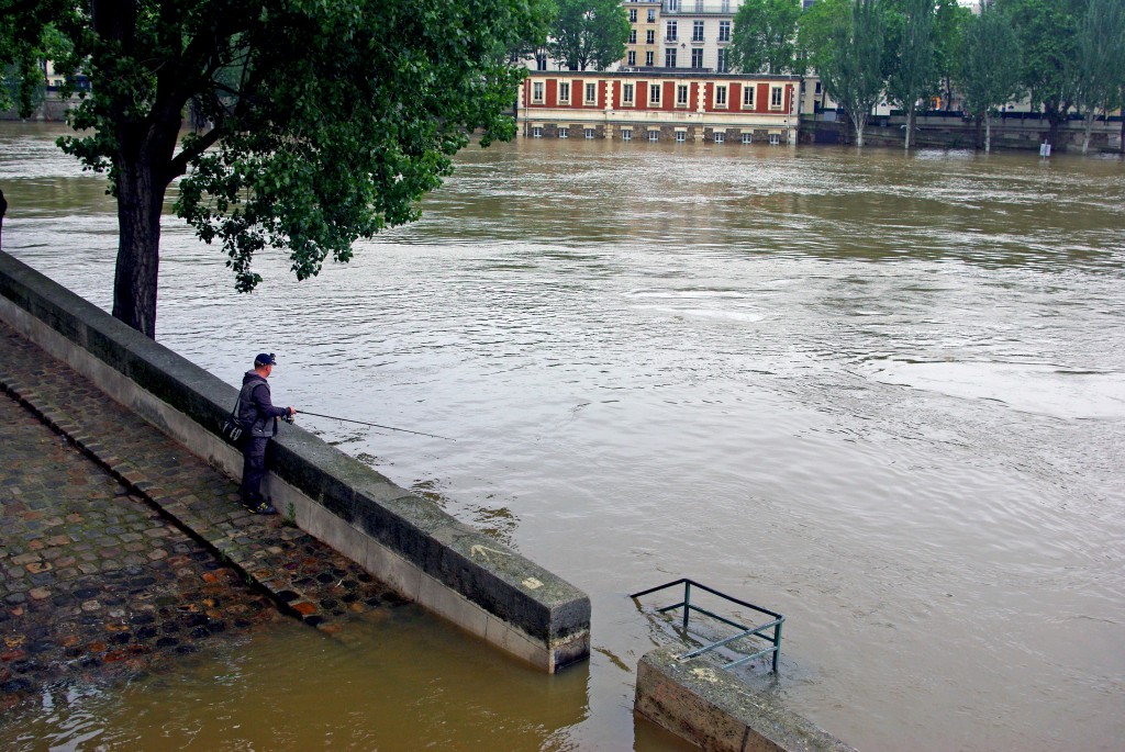
It seems so peaceful. We continued our walk across the Île Saint-Louis. Here is a happy fisherman spotted from the Quai d’Orléans:
Looking at the Pont de la Tournelle topped by a statue of St. Geneviève:

The view of the Chevet of Notre Dame from the Pont de la Tournelle:

The Port de la Tournelle flooded (Left Bank):
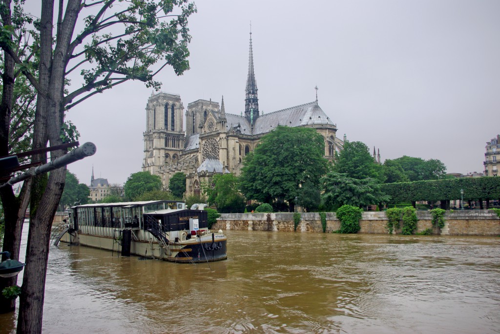
Back to Notre Dame
We often take photos of Notre Dame from this spot (Pont de l’Archevêché) but never with the water so high:
A lovely view of Notre Dame cathedral from the Petit-Pont. The water does look muddy:

The Quai des Grands Augustins (Left Bank) is on the right (!), and the Île de la Cité (on the left). Photo taken from the Pont-Neuf:
The western tip of the Île de la Cité is called the Square du Vert-Galant. It was also entirely underwater:
From the Pont-Neuf: the square du Vert-Galant (which cannot be seen except for the weeping willow) and the Eiffel Tower in the distance.

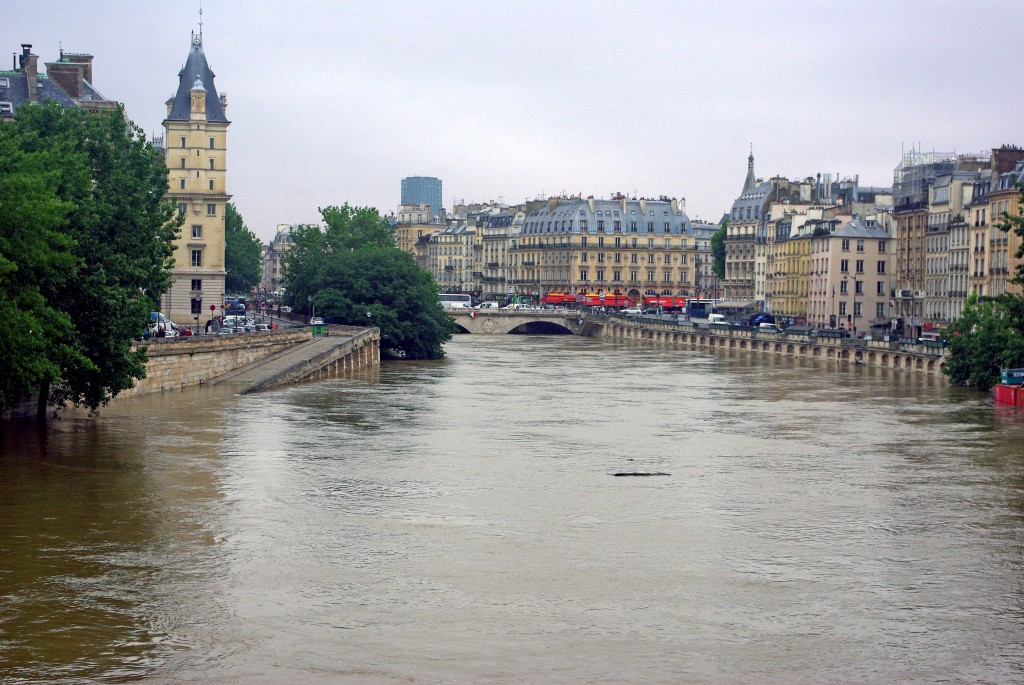
Pont-Neuf
The Pont-Neuf from the Right Bank near La Samaritaine:
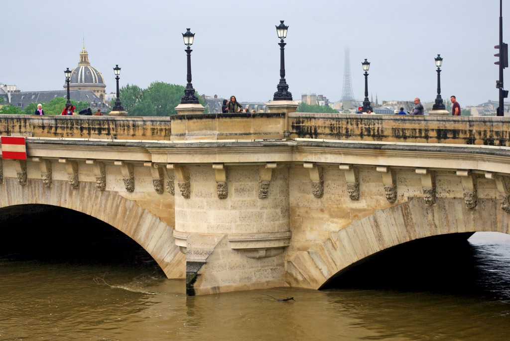
The Pont-Neuf and the Conciergerie on the Île de la Cité seen from the Quai de la Mégisserie (Right Bank) not far from the Pont des Arts:


The emergency boat of the Paris firemen navigating by the Square du Vert-Galant:

Pont des Arts to Pont de la Concorde
The Pont des Arts and the Institut de France. The footbridge that connects the Left Bank to the Louvre has been closed since the beginning of the flood:

The Pont du Carrousel:
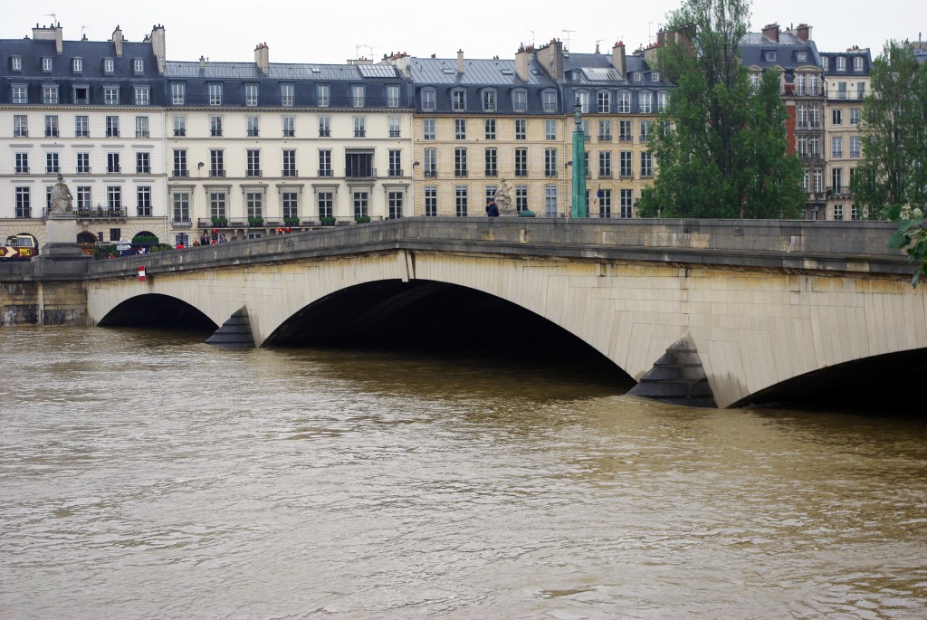
One of our favourite views of the Banks of the River Seine. Taken from the Pont du Carrousel:
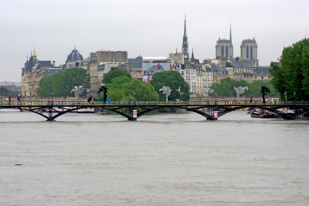
A similar view but taken from the Pont de la Concorde with the Passerelle Léopold Sédar-Senghor in the forefront. Can you see Notre Dame, the spire of the Sainte-Chapelle and the Institut de France?

Pont de la Concorde to the Eiffel Tower
After we crossed the Pont de la Concorde, there was a nice view of the Palais Bourbon, the seat of the National Assembly:

The view from the Port de la Concorde (South-eastern tip of the Place de la Concorde):

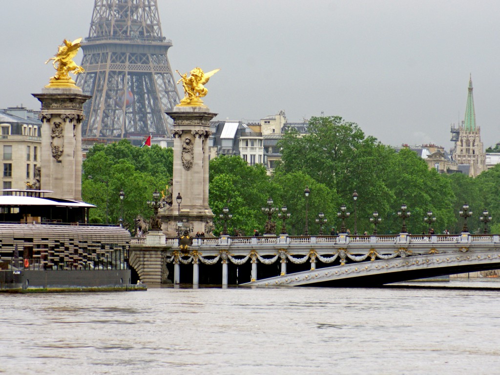
A close-up of the Pont Alexandre III and the Eiffel Tower:
Ready for a boat trip? The Seine looks as wide as the River Thames in London!

The Ministry of International Affairs threatened by the rising water of the Seine:

Approaching the Pont Alexandre III:
The Pont des Invalides seen from the Pont Alexandre III:

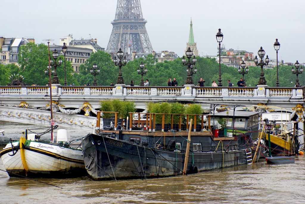
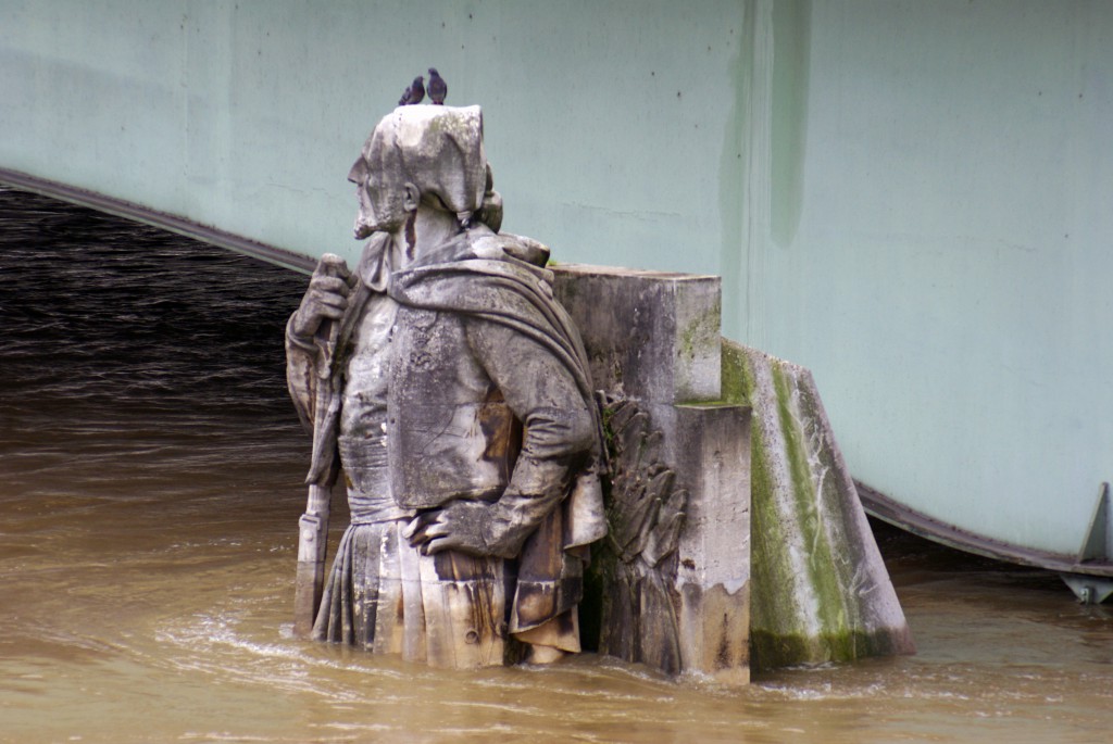
It was already mid-morning when we arrived at the famous Pont d’Alma and its zouave:
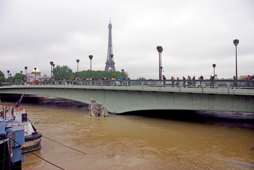
The Zouave Statue of Pont d’Alma
Since the 1910 floods, the Zouave Statue flanking the Pont d’Alma has acted as a measuring gauge. Many Parisians have been checking the rise against the statue for three days. The statue was submerged to the waist at the peak of the 2016 flooding. In 1910 the water level reached his neck.
The Pont d’Iéna (forefront) and the double-decked Pont de Bir-Hakeim (background). The Eiffel Tower is not far…

A sign of a vanished car park:
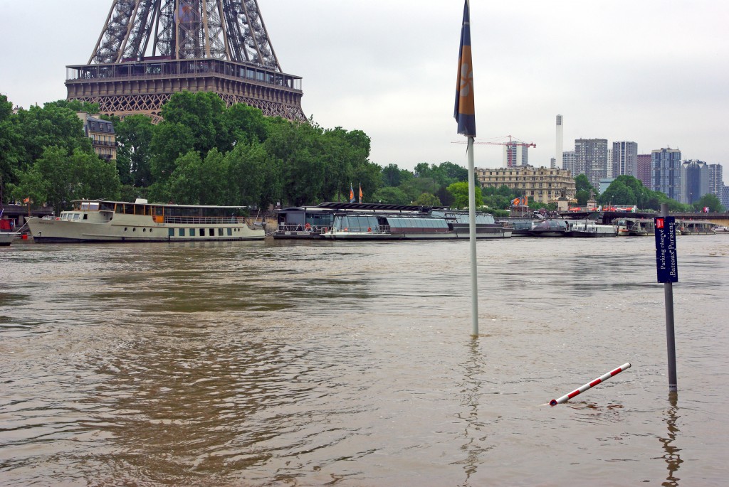
The expressway Georges Pompidou in the 16th arrondissement:

The green-tinted Pont de Mirabeau:

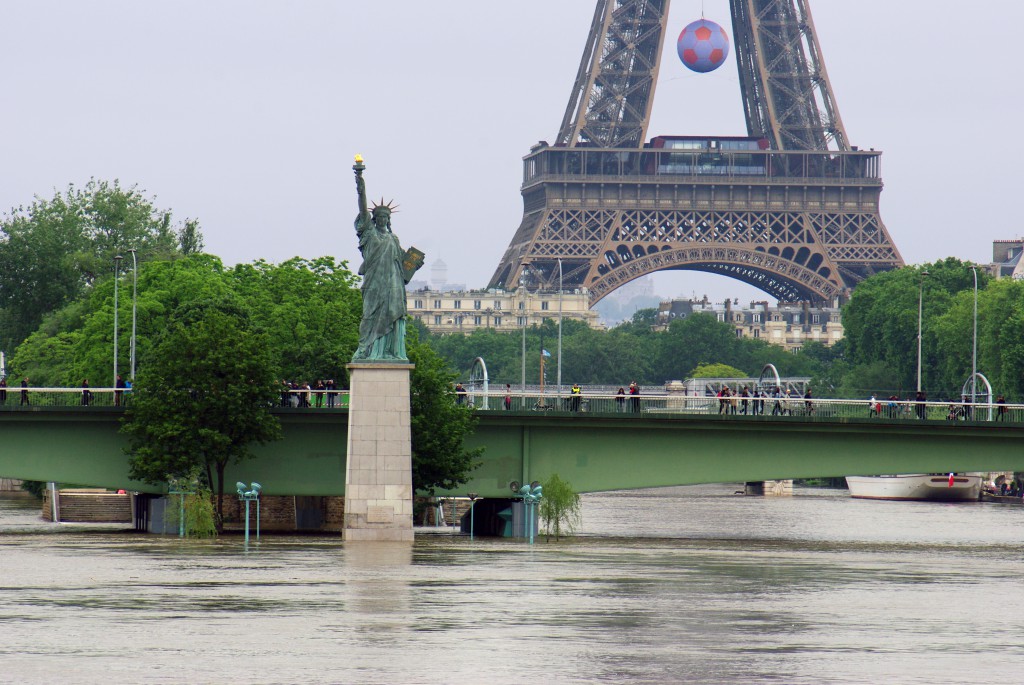
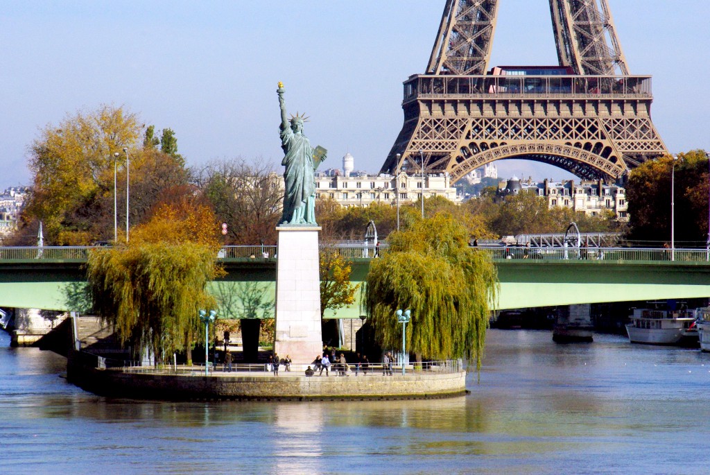
The Eiffel Tower
Our last stage: the Pont Mirabeau with the incredible view of the Eiffel Tower and the Statue of Liberty:
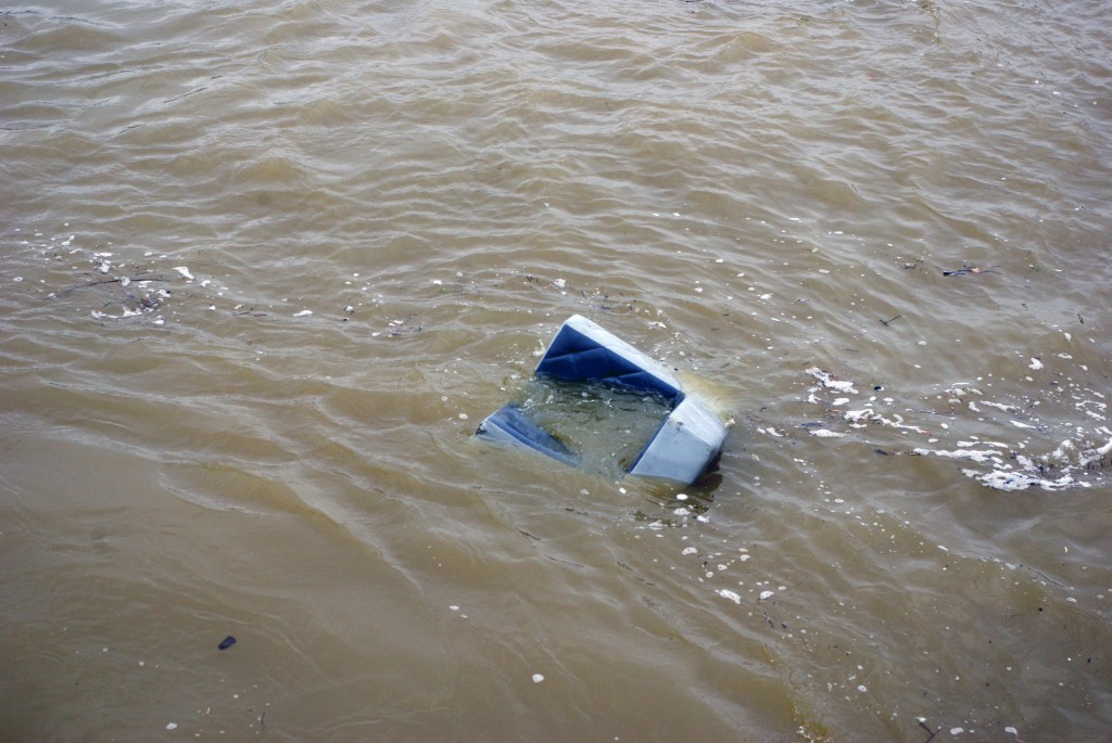
It is estimated that the flooding could cost 600 million euros. Upstream of Paris, many houses have been flooded and devastated. Some personal effects are visible from a bridge such as this ‘travelling sofa’… where does it come from? Where does it go? Well, the first question is hard to tell. But we know that it is on its way to the English Channel via Rouen and the estuary of Le Havre:
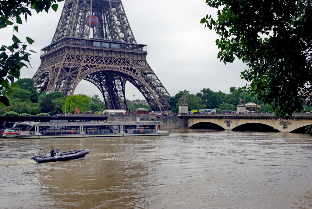
Boat and cruise traffic were banned from the Seine, and only emergency boats were allowed.
Paris before and after the 2016 Floods
One of my favourite views of Notre Dame Cathedral from the Petit-Pont (Left Bank):
The chevet of Notre Dame seen from the Pont de l’Archevêché (Left Bank):

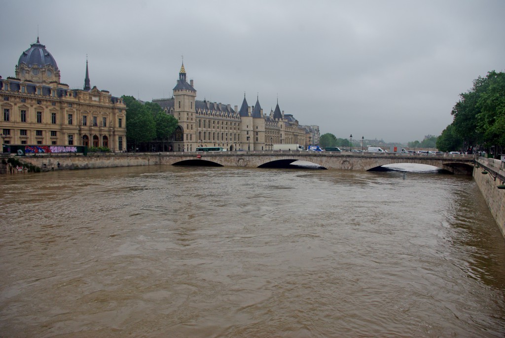
The medieval buildings of the Conciergerie from the corner of Pont au Change and Quai de la Mégisserie (Right Bank):

The Île de la Cité looking towards Saint-Michel. A view from the Pont-Neuf:
A romantic place by the river just above the tiny Place Louis Aragon on the Île Saint-Louis:
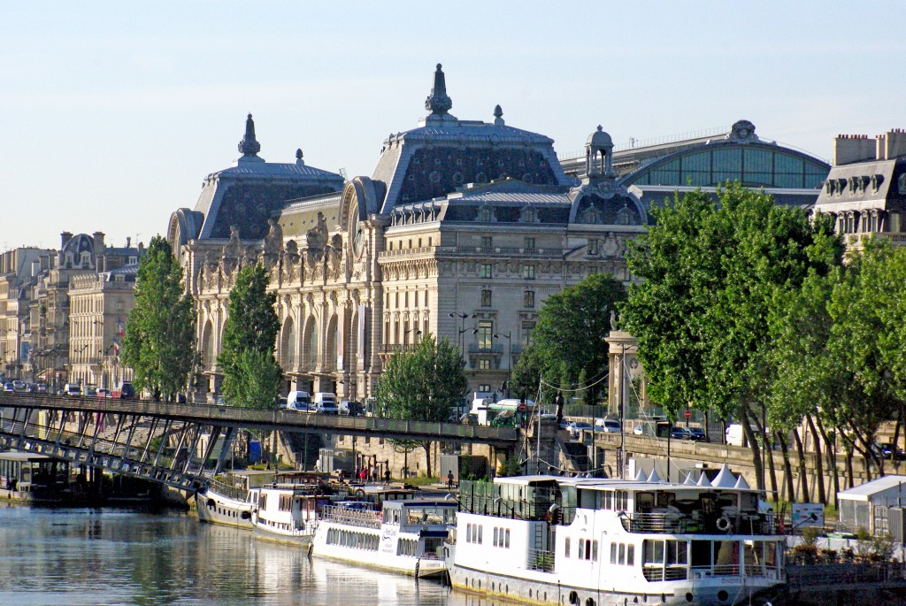
The Orsay Museum from the Pont de la Concorde:
The Quai d’Orsay building, seat of the French Ministry of Foreign Affairs:
The majestic Pont Alexandre III and the Eiffel Tower seen from the Pont de la Concorde. This place is beautiful around sunset:
The Pont des Invalides with the American Church and the Eiffel Tower in the background:
The Zouave Statue beneath the Pont d’Alma which has acted as a measuring gauge since 1910:

A stunning view of the Statue of Liberty and the Eiffel Tower from the Pont Mirabeau:
All photos of the 2016 Paris floods © French Moments

These are wonderful photos. I’ve been there several times more most recently exactly a year ago. What a difference. I tried to explain to others how high the water is, but if you’ve never seen the height of the embankments normally, it doesn’t seem that terrible. If you go back when the water has receded and take these same shots for comparison I would like to be notified. Side by side comparisons would be eye-opening. I’ve been following the news several times a day; it seems the river is finally done rising.
Good luck to you all,
Janis
Bonjour Janis! Thank you for your kind comment. Yes, you’re right, it’s better to see the differences between the ‘normal’ and extreme levels of the River Seine. I have just published a new post with photos of the level comparison I hope you’ll enjoy: https://frenchmoments.eu/paris-before-and-after-the-2016-floods/ Have a lovely day and see you soon on our blog!
To Pierre,
Just discovered your site and am really enjoying it. I was in Paris late October and fell in love with it which I was not expecting, it is truly magical. I missed the bombing by 12 days, not a close call but it was heart wrenching after my wonderful experiences there. Thanks for your posts I will be following.
Dear Ingrid,
Thank you so much for your feedback and for taking the time to write this kind comment. I am thrilled that you are enjoying discovering our website. We always hope our little discovery journey in Paris and France will bring something ‘magical’ to our readers. A très bientôt ! – Pierre