Is there any need to introduce Lyon, the capital of the Gauls and the capital of French gastronomy? The city offers visitors an incredible architectural and cultural heritage. But beyond the ancient Lugudunum, there are many sites to explore. Of course, the Monts d’Or and the Beaujolais vineyards are also natural sites, beautiful ruins, and charming localities. What are the 30 places to see in the region around Lyon? Follow the guide, and let’s go on a trip less than 40 km from Lyon city centre!
Around Lyon
What does Lyon mean to you?
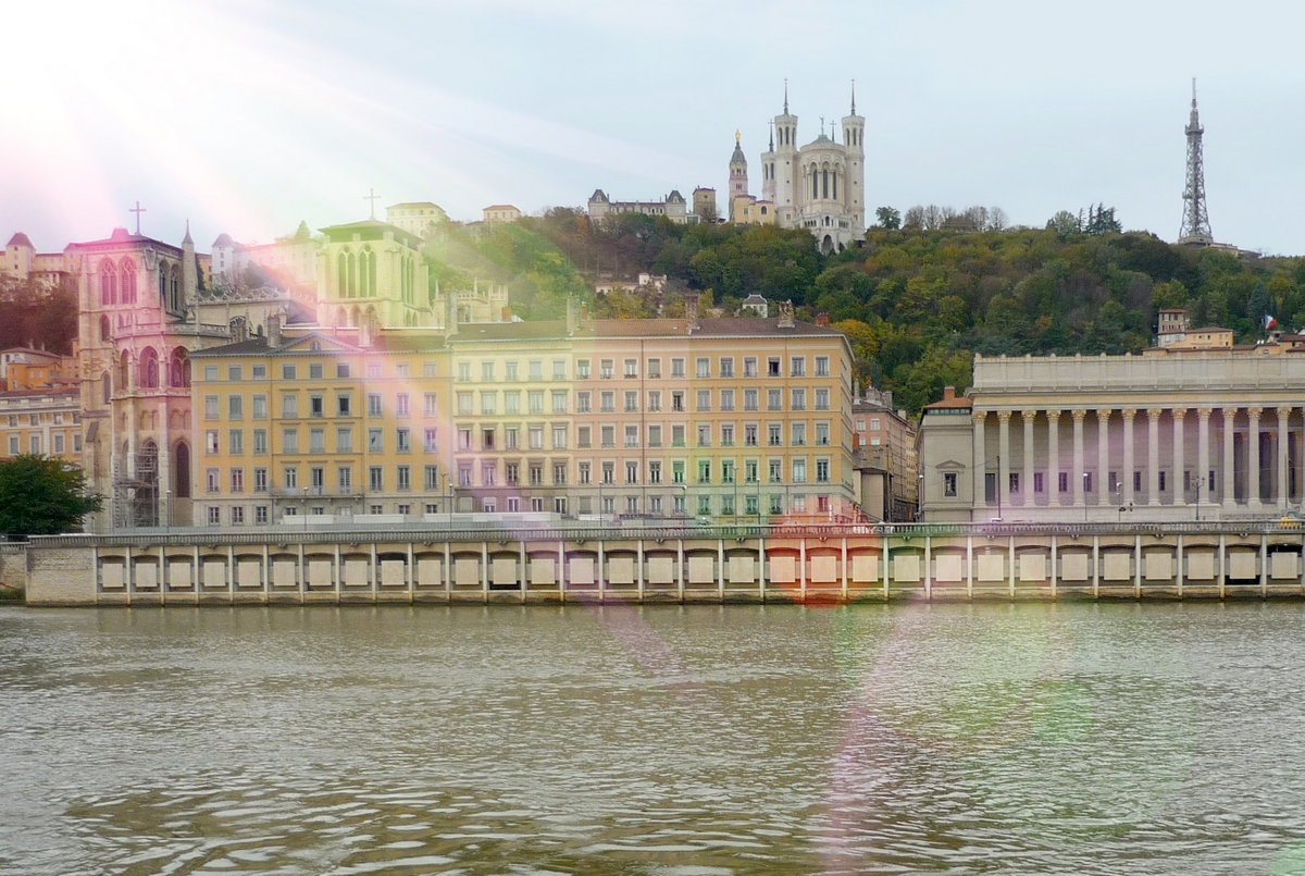
The historic Hill of Fourvière?
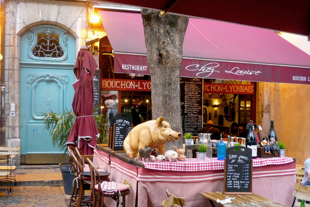
Lyon’s gastronomy and its bouchons?
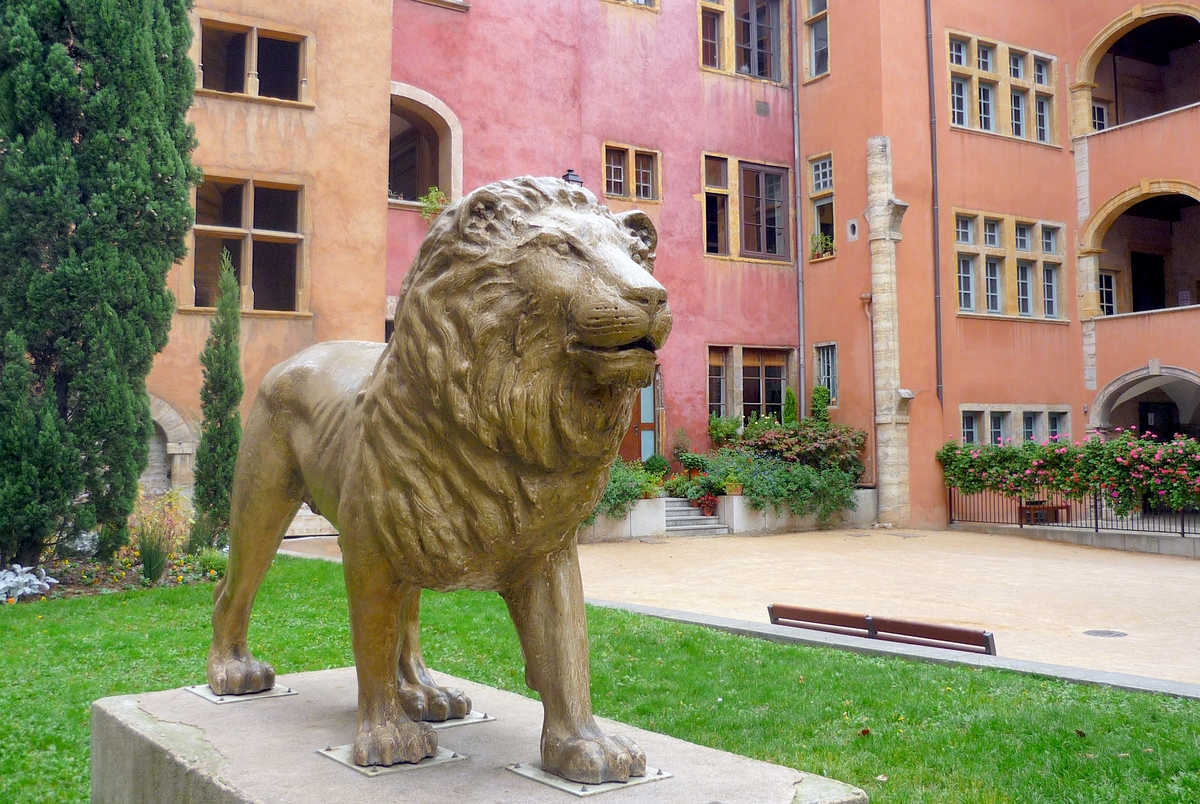
The Renaissance houses of Old Lyon and their traboules?
The opera and its unusual roof?

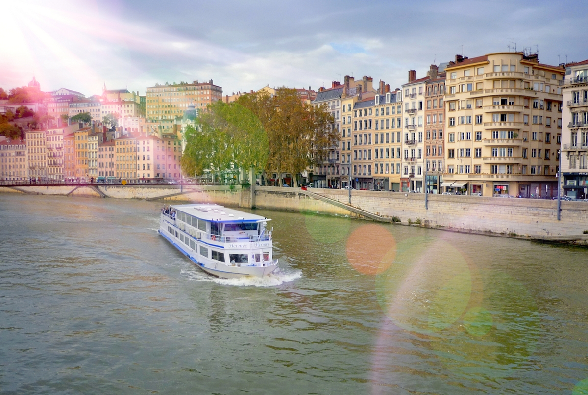
The banks of the Saône and the Rhône?
Lyon is all this… and much more!
But for now, let’s leave the city walls to explore its surroundings…
![Vue générale de Chazay d'Azergues © Romainbehar - licence [CC0] from Wikimedia Commons](https://frenchmoments.eu/wp-content/uploads/2022/03/Chazay-dAzergues-©-Romainbehar-licence-CC0-from-Wikimedia-Commons-scaled.jpg)
Staying around Lyon
To plan your accommodation around Lyon, click on this link to booking.com or browse the map below:
What to see around Lyon?
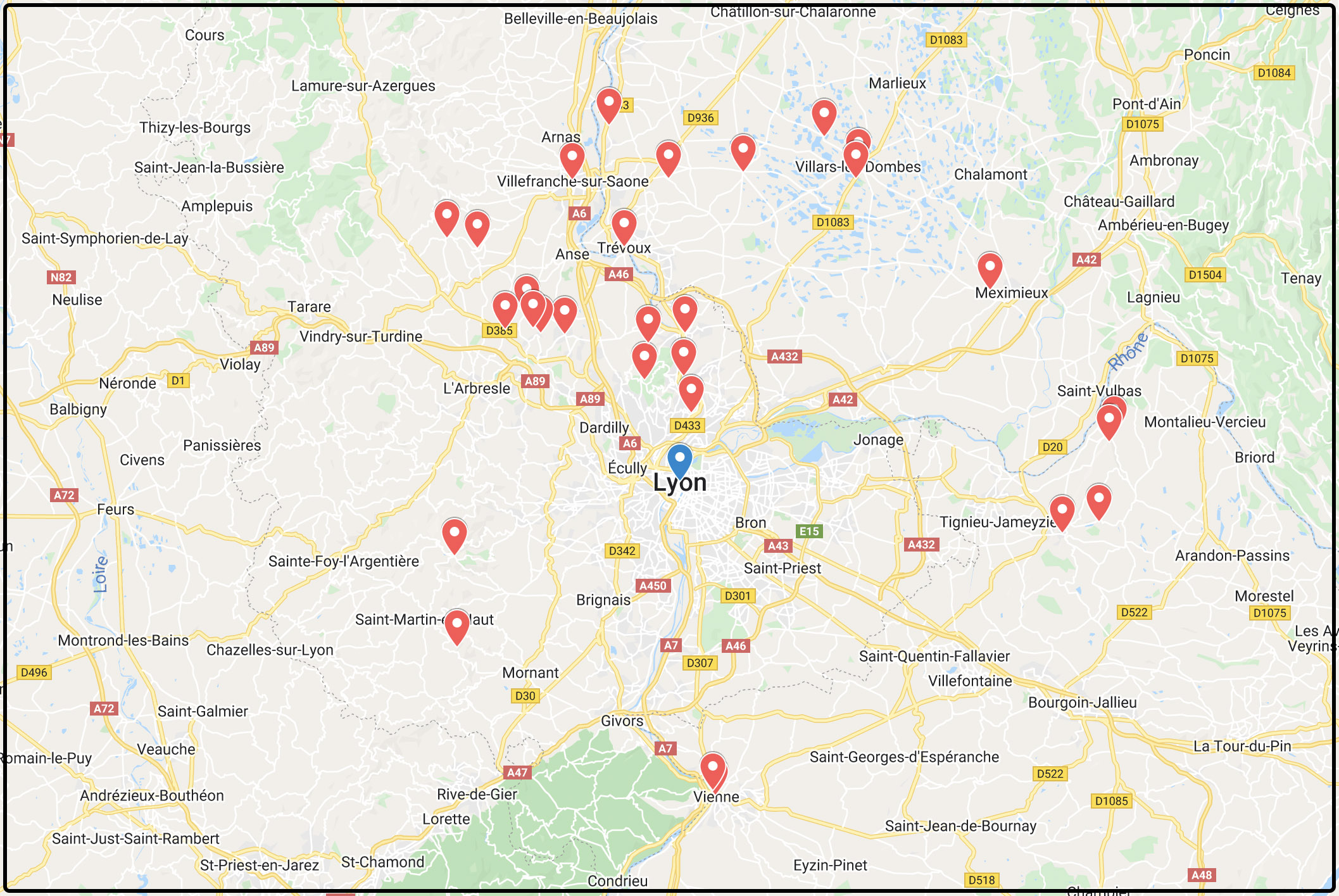
Lyon is located in the heart of a tourist region. If you venture 30, 40 or 50 km from the city centre, you can discover hundreds of points of interest. Of course, it is not possible to list them all. I have selected 30 sites grouped into ten destinations within a 40 km radius of Lyon.
► Do you have any suggestions for visits to and around Lyon? Write them in the comments at the bottom of the article!
Here are the ten main destinations we will discover around Lyon:
- Crémieu
- Pérouges
- Ambérieux-en-Dombes
- Villefranche-sur-Saône
- Oingt and Theizé
- Charnay
- Monts d’Or
- Rochetaillée-sur-Saône
- Signal de Saint-André
- Vienne and Saint-Romain-en-Gal
Check the exact location of the 30 places on our Google Map.
To help you, I have included links to the corresponding tourist offices for most of the destinations around Lyon. Don’t hesitate to go there to get personal information on natural or cultural sites to discover, hikes to find or the programme of upcoming events.
Let’s start this little trip around Lyon with a historic town in the Isère département on the road to the Alps.
Crémieu
Town 40 km east of Lyon
Crémieu is a small town of 3,375 inhabitants, part of the Dauphiné province. Today, Crémieu is part of the department of Isère, not far from the Jura.

The charming old town has picturesque squares, narrow streets with colourful facades, 16th and 17th-century houses and the remains of its medieval ramparts.
The Saint-Jean-Baptiste church in Crémieu is a hall church dating back to the beginning of the 14th century. It houses a unique collection of Augustinian paintings created at the end of the Middle Ages.
![Around Lyon - Crémieu © Rolf Süssbrich - licence [CC BY-SA 3.0] from Wikimedia Commons](https://frenchmoments.eu/wp-content/uploads/2022/03/Crémieu-©-Rolf-Süssbrich-licence-CC-BY-SA-3.0-from-Wikimedia-Commons.jpg)
The fortified hills of Crémieu
Two hills dominate the old town:
- Saint-Laurent Hill, on the east side
- Saint-Hippolyte Hill, on the west side
The ruins of the Château Delphinal (or Château Saint-Laurent) occupy the top of the Saint-Laurent hill to the east of the town. It was strategically important because the border between the Dauphiné and Savoie lay there—the remains of the fortress date from the 13th and 15th centuries.
![Around Lyon - Château delphinal © Romainbehar - licence [CC0] from Wikimedia Commons](https://frenchmoments.eu/wp-content/uploads/2022/03/Crémieu-Château-delphinal-©-Romainbehar-licence-CC0-from-Wikimedia-Commons-scaled.jpg)
To the west of the town and opposite the Delphine castle, Saint-Hippolyte Hill is home to the ruins of a Benedictine monastery, surrounded by its fortifications.
![Around Lyon - Crémieu © Romainbehar - licence [CC0] from Wikimedia Commons](https://frenchmoments.eu/wp-content/uploads/2022/03/Crémieu-©-Romainbehar-licence-CC0-from-Wikimedia-Commons-scaled.jpg)
What to see around Crémieu
The town is bordered by a natural region of hills and plateaus: L’Isle Crémieu. This area is the link between the Lyon Plain and the Bugey Jura. If you have half a day to spare, here are some sites to explore:
- The castle of Saint-Julien dominates the peaceful waters of the pond of Ry on the road to Siccieu-Saint-Julien-Carisieu.
- The archaeological site of Larina is built on a rocky limestone spur overlooking the Rhône by more than 200 metres.
- The Verbois gorges at Hières-sur-Amby and its beautiful waterfall.
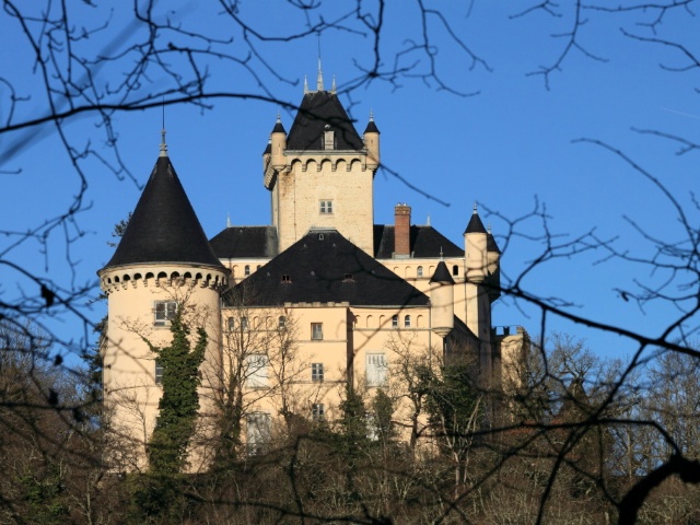
Find out more about Crémieu on the blog
For more information, visit the Crémieu tourist office website.
Pérouges
Village 40 km north-east of Lyon
The medieval town of Pérouges is one of the most visited tourist sites in the Ain département. This ancient weaver’s village is located on a hill and is part of the association Les Plus Beaux Villages de France (France’s most beautiful villages).
![Around Lyon - Pérouges © Benoît Prieur - licence [CC BY-SA 4.0] from Wikimedia Commons](https://frenchmoments.eu/wp-content/uploads/2022/03/Pérouges-©-Benoît-Prieur-licence-CC-BY-SA-4.0-from-Wikimedia-Commons-scaled.jpg)
The historic centre of Pérouges includes no less than 80 buildings listed as historic monuments. To be discovered in Pérouges :
- the town gates (Porte d’En-Bas, Porte d’En-Haut)
- the rue des Rondes (its picturesque appearance is due to its canopy roofs and the stone hooks that mark the weavers’ houses)
- the Rue des Princes, the former main street
- the Place du Tilleul and its 200-year-old lime tree planted shortly after the French Revolution
several timber-framed and corbelled houses line the Place du Tilleul, including the Hostellerie du Vieux Pérouges, which dates from the 13th century - the 15th-century fortified church of Sainte-Marie-Madeleine
![Pérouges © Daniel CULSAN - licence [CC BY-SA 4.0] from Wikimedia Commons](https://frenchmoments.eu/wp-content/uploads/2022/03/Pérouges-©-Daniel-CULSAN-licence-CC-BY-SA-4.0-from-Wikimedia-Commons-scaled.jpg)
![The Vieux Pérouges hostellerie © Chabe01 - licence [CC BY-SA 4.0] from Wikimedia Commons](https://frenchmoments.eu/wp-content/uploads/2022/03/Pérouges-Hostellerie-©-Chabe01-licence-CC-BY-SA-4.0-from-Wikimedia-Commons-scaled.jpg)
![Pérouges © Benoît Prieur - licence [CC BY-SA 3.0] from Wikimedia Commons](https://frenchmoments.eu/wp-content/uploads/2022/03/Pérouges-©-Benoît-Prieur-licence-CC-BY-SA-3.0-from-Wikimedia-Commons-scaled.jpg)
As you stroll through the streets of old Pérouges, you may recognise some film locations: Les Trois Mousquetaires (1961) and Angélique, Marquise des Anges (1964).
For more information, visit the Pérouges tourist office website.
Ambérieux-en-Dombes
36 km north of Lyon
Ambérieux-en-Dombes is located in the centre of a triangle formed by Bourg-en-Bresse, Mâcon and Lyon. The town of 1750 inhabitants is also located in the western part of the Dombes, a marshy region with various shapes and sizes of ponds.
Visitors to Ambérieux-en-Dombes see the old castle from the 12th and 14th centuries. It still has its four towers, including the keep.
![Ambérieux-en-Dombes © Benoît Prieur - licence [CC BY-SA 3.0] from Wikimedia Commons](https://frenchmoments.eu/wp-content/uploads/2022/03/Ambérieux-en-Dombes-©-Benoît-Prieur-licence-CC-BY-SA-3.0-from-Wikimedia-Commons-scaled.jpg)
In the village, notice the war memorial: it has the particularity of being surmounted by a rooster, a detail uncommon in France.
![War Memorial Ambérieux-en-Dombes © Chabe01 - licence [CC BY-SA 4.0] from Wikimedia Commons](https://frenchmoments.eu/wp-content/uploads/2022/03/Ambérieux-en-Dombes-Monument-aux-Morts-©-Chabe01-licence-CC-BY-SA-4.0-from-Wikimedia-Commons-scaled.jpg)
Excursion to the Dombes
If you have half a day to spare, take the opportunity to explore the Dombes. The natural region has more than 1,000 ponds dug in the Middle Ages by monks.
As you drive along the small roads of the Dombes, you will discover villages full of flowers, castles made of carrons (red bricks), farms made of pisé (compacted raw earth) and, of course, an array of ponds! Near Ambérieux-en-Dombes, don’t miss:
- the Bouligneux castle (a former fortified house from the early 14th century)
- the charming church of the Nativité-de-la-Sainte-Vierge in Villars-les-Dombes, in Romanesque style and dating from the 12th/13th centuries,
- the bird park in Villars-les-Dombes (one of the oldest bird parks in France. It contains a collection of more than 3,000 birds from all over the world in a 380-hectare reserve, 35 of which are accessible to the public)
- the surprising Ars Basilica in Ars-sur-Formans
![Around Lyon - Château de Bouligneux © Zairon - licence [CC BY-SA 4.0] from Wikimedia Commons](https://frenchmoments.eu/wp-content/uploads/2022/03/Château-de-Bouligneux-©-Zairon-licence-CC-BY-SA-4.0-from-Wikimedia-Commons-scaled.jpg)
![Eglise de la Nativité-de-la-Sainte-Vierge de Villars-les-Dombes © Benoît Prieur - licence [CC BY-SA 3.0] from Wikimedia Commons](https://frenchmoments.eu/wp-content/uploads/2022/03/Eglise-de-la-Nativité-de-la-Sainte-Vierge-de-Villars-les-Dombes-©-Benoît-Prieur-licence-CC-BY-SA-3.0-from-Wikimedia-Commons-scaled.jpg)
![Basilique Saint-Sixte in ars-sur-Formans © Zairon - licence [CC BY-SA 4.0] from Wikimedia Commons](https://frenchmoments.eu/wp-content/uploads/2022/03/Ars-sur-Formans-Basilique-Saint-Sixte-©-Zairon-licence-CC-BY-SA-4.0-from-Wikimedia-Commons-scaled.jpg)
For more information, visit the Dombes tourist office website.
Villefranche-sur-Sâone
35 km north of Lyon
Between Mâcon and Lyon, Villefranche-sur-Saône is a gateway to the Beaujolais (to the west) and the Dombes (to the east).
The Rue Nationale crosses the town centre for about 1500 metres. This artery brings together most of the shops, as well as the significant sites of interest in Villefranche:
- the collegiate church Notre-Dame des Marais (16th-century façade and 13th-century Romanesque bell tower)
- the Renaissance houses in the old centre, especially along the Rue Nationale.
![Collégiale Notre-Dame des Marais de Villefranche-sur-Saône © ChBougui - licence [CC BY-SA 3.0] from Wikimedia Commons](https://frenchmoments.eu/wp-content/uploads/2022/03/Villefranche-sur-Saône-Collégiale-Notre-Dame-des-Marais-©-ChBougui-licence-CC-BY-SA-3.0-from-Wikimedia-Commons-scaled.jpg)
![Renaissance staircase, Cr Rue Nationale and Rue Grenette © Chabe01 - licence [CC BY-SA 4.0] from Wikimedia Commons](https://frenchmoments.eu/wp-content/uploads/2022/03/Villefranche-sur-Saône-Rue-Nationale-Rue-Grenette-©-Chabe01-licence-CC-BY-SA-4.0-from-Wikimedia-Commons-scaled.jpg)
![Maison de l'Italien © Benoît Prieur - licence [CC BY-SA 4.0] from Wikimedia Commons](https://frenchmoments.eu/wp-content/uploads/2022/03/Villefranche-sur-Saône-Maison-de-lItalien-©-Benoît-Prieur-licence-CC-BY-SA-4.0-from-Wikimedia-Commons-scaled.jpg)
![Renaissance houses, 594 & 588 Rue Nationale © Chabe01 - licence [CC BY-SA 4.0] from Wikimedia Commons](https://frenchmoments.eu/wp-content/uploads/2022/03/Villefranche-sur-Saône-594-588-Rue-Nationale-©-Chabe01-licence-CC-BY-SA-4.0-from-Wikimedia-Commons-scaled.jpg)
Around Villefranche: the Fléchères castle
6 km from the town, in the commune of Fareins, stands the magnificent château de Fléchères.
It is the largest castle open to the public in the region around Lyon.
The building is unusual in France, built around a Protestant temple!
![Around Lyon - Château de Fléchères © Zairon - licence [CC BY-SA 4.0] from Wikimedia Commons](https://frenchmoments.eu/wp-content/uploads/2022/03/Château-de-Fléchères-©-Zairon-licence-CC-BY-SA-4.0-from-Wikimedia-Commons-scaled.jpg)
The castle was built between 1606 and 1625 on the site of a fortified house. It offers an exceptional testimony to the life of the great notables of Lyon in the 17th century.
The interior features beautiful frescoes that decorate the walls of 10 castle rooms.
The park surrounding Fléchères extends over 30 hectares and comprises beautiful terraces, long shaded paths offering perspectives, an Italian-style pool and topiaries.
More information on the Beaujolais tourist office website
Visit the website of the Château de Fléchères
Around Villefranche: Trévoux
Less than 10 km south of Villefranche, it would be a shame not to stop at Trévoux.
![Trevoux © Velvet - licence [CC BY-SA 4.0] from Wikimedia Commons](https://frenchmoments.eu/wp-content/uploads/2022/03/Trevoux-©-Velvet-licence-CC-BY-SA-4.0-from-Wikimedia-Commons-scaled.jpg)
In the Middle Ages, the Saône River acted as a border between the Kingdom of France and the Holy Roman Empire, of which Trévoux was a part.
The town grew wealthy thanks to the river toll established in Trévoux in the 13th century. Its strategic importance was reflected in the construction of a fortified castle and a rampart.
The old town centre has several historic buildings, including 17th and 18th-century townhouses. From the castle of Trévoux, there is a beautiful panorama of the Saône valley, the Dombes, the Beaujolais and the Monts d’Or.
![Trévoux © Toutaitanous - licence [CC BY-SA 3.0] from Wikimedia Commons](https://frenchmoments.eu/wp-content/uploads/2022/03/Trévoux-Saône-©-Toutaitanous-licence-CC-BY-SA-3.0-from-Wikimedia-Commons-scaled.jpg)
Oingt and Theizé
Villages 35 km north of Lyon
![Around Lyon - Oingt © Mfrays - licence [CC BY-SA 4.0] from Wikimedia Commons](https://frenchmoments.eu/wp-content/uploads/2022/03/Oingt-LR-©-Mfrays-licence-CC-BY-SA-4.0-from-Wikimedia-Commons-scaled.jpg)
To the west of Villefranche-sur-Saône lies the Beaujolais vineyards. The Pays des Pierre Dorées has charming little villages to the southwest. The countryside is often compared to Tuscany or Provence. The Monk and Nun roofing and the warm facades of the villages confirm this image. And yet, we are north of Lyon!
I suggest you visit Oingt and Theizé.
Oingt
Built at the top of a limestone ridge at over 500 metres, Oingt dominates the Azergues Valley.
![Oingt © Andrzej Harassek- licence [CC BY-SA 3.0] from Wikimedia Commons](https://frenchmoments.eu/wp-content/uploads/2022/03/Oingt-©-Andrzej-Harassek-licence-CC-BY-SA-3.0-from-Wikimedia-Commons-scaled.jpg)
The commune belongs to the association of the most beautiful villages in France and attracts many tourists.
The historic village contains small heritage features: wine presses, wells and cadoles (dry stone huts).
![Autour de Lyon - Oingt © Michiel1972 - licence [CC BY-SA 3.0] from Wikimedia Commons](https://frenchmoments.eu/wp-content/uploads/2022/03/Oingt-©-Michiel1972-licence-CC-BY-SA-3.0-from-Wikimedia-Commons-scaled.jpg)
![Oingt Eglise Saint-Mathieu © Sebleouf - licence [CC BY-SA 4.0] from Wikimedia Commons](https://frenchmoments.eu/wp-content/uploads/2022/03/Oingt-Eglise-Saint-Mathieu-©-Sebleouf-licence-CC-BY-SA-4.0-from-Wikimedia-Commons-scaled.jpg)
![A cadole in the region of Oingt and Theizé © Dominique Robert - licence [CC BY-SA 3.0] from Wikimedia Commons](https://frenchmoments.eu/wp-content/uploads/2022/03/Theizé-cabane-©-Dominique-Robert-licence-CC-BY-SA-3.0-from-Wikimedia-Commons.jpg)
The view extends to the Beaujolais vineyards, the Azergue Valley, and the Monts du Lyonnais.
![Around Lyon - Oingt Beaujolais © Sebelouf - licence [CC BY-SA 4.0] from Wikimedia Commons](https://frenchmoments.eu/wp-content/uploads/2022/03/Oingt-Beaujolais-©-Sebelouf-licence-CC-BY-SA-4.0-from-Wikimedia-Commons-scaled.jpg)
Theizé
The old village of Theizé occupies a hillside overlooking the Merloux Valley at an altitude of 450 metres.
![Theizé © Michiel1972 - licence [CC BY-SA 3.0] from Wikimedia Commons](https://frenchmoments.eu/wp-content/uploads/2022/03/Theizé-LR-©-Michiel1972-licence-CC-BY-SA-3.0-from-Wikimedia-Commons-scaled.jpg)
Its old church dates from the 12th and 13th centuries and was enlarged in the flamboyant Gothic style in the 16th century.
The Rochebonne castle is located at the top of the village. Demolished during the Hundred Years’ War, it was rebuilt in the 17th century by a member of the family of Madame de Sévigné.
![Theizé Château de Rochebonne © Tarball69 - licence [CC BY-SA 4.0] from Wikimedia Commons](https://frenchmoments.eu/wp-content/uploads/2022/03/Theizé-Château-de-Rochebonne-©-Tarball69-licence-CC-BY-SA-4.0-from-Wikimedia-Commons-scaled.jpg)
At the entrance to the village, the château de Rapetour is a 13th-century fortified house open to the public.
![Château de Rapetour © Deviego - licence [CC BY-SA 4.0] from Wikimedia Commons](https://frenchmoments.eu/wp-content/uploads/2022/03/Theizé-Château-de-Rapetour-©-Deviego-licence-CC-BY-SA-4.0-from-Wikimedia-Commons.jpg)
As in Oingt, the small heritage offers visitors many surprises throughout the commune: washhouses, wells, crosses and dry stone huts typical of the Beaujolais.
Le Pays des pierres dorées
The villages of Oingt and Theizé are part of the Pays des pierres dorées (Land of Golden Stones). This is a territory that brings together some forty communes.

Golden stones are limestone quarried in several villages northwest of Lyon. The stone is coloured with iron oxides, giving it its beautiful honey-yellow colour. The inhabitants used them as construction materials for their buildings (houses, castles, churches, etc.).
For more information, visit the Beaujolais Tourist Office website.
Charnay
27 km north of Lyon
Charnay is a good base for exploring the Pays des pierres dorées.
The perched village occupies a narrow ridge and dominates the surrounding area by over 200 metres. As a result, it offers a clear view of the Beaujolais region.
![In the vicinity of Charnay (Chemin de la Limandière) © Romainbehar - licence [CC0] from Wikimedia Commons](https://frenchmoments.eu/wp-content/uploads/2022/03/Charnay-Chemin-de-la-Limandière-©-Romainbehar-licence-CC0-from-Wikimedia-Commons-scaled.jpg)
The village of Charnay is centred on the Place du château (castle square), surrounded by golden stone houses from the 15th and 16th centuries, the church of Saint-Christophe and the castle La Mansarde (late 13th-early 14th century), now the town hall.
![Around Lyon - La Mansarde in Charnay © CHABERT Louis - licence [CC BY-SA 4.0] from Wikimedia Commons](https://frenchmoments.eu/wp-content/uploads/2022/03/Charnay-La-Mansarde-©-CHABERT-Louis-licence-CC-BY-SA-4.0-from-Wikimedia-Commons.jpg)
![Charnay - Place du Château and the church © Romainbehar - licence [CC0] from Wikimedia Commons](https://frenchmoments.eu/wp-content/uploads/2022/03/Charnay-Place-du-Château-©-Romainbehar-licence-CC0-from-Wikimedia-Commons-scaled.jpg)
Châtillon d’Azergues
A few kilometres south of Charnay, Châtillon d’Azergues is worth a visit. The village of Châtillon is dominated by the imposing ruins of its 12th-13th century castle.
![Around Lyon - The castle of Châtillon-d'Azergues © CHABERT Louis - licence [CC BY-SA 4.0] from Wikimedia Commons](https://frenchmoments.eu/wp-content/uploads/2022/03/Château-de-Châtillon-dAzergues-©-CHABERT-Louis-licence-CC-BY-SA-4.0-from-Wikimedia-Commons-scaled.jpg)
If you leave the village on the D76 in the direction of Alix, notice on the right the picturesque roof-topped well-known as “Sarracen”.
Chazay-d’Azergues
The old fortified town of Chazay-d’Azergues has preserved its belfry and some 15th and 16th-century houses.
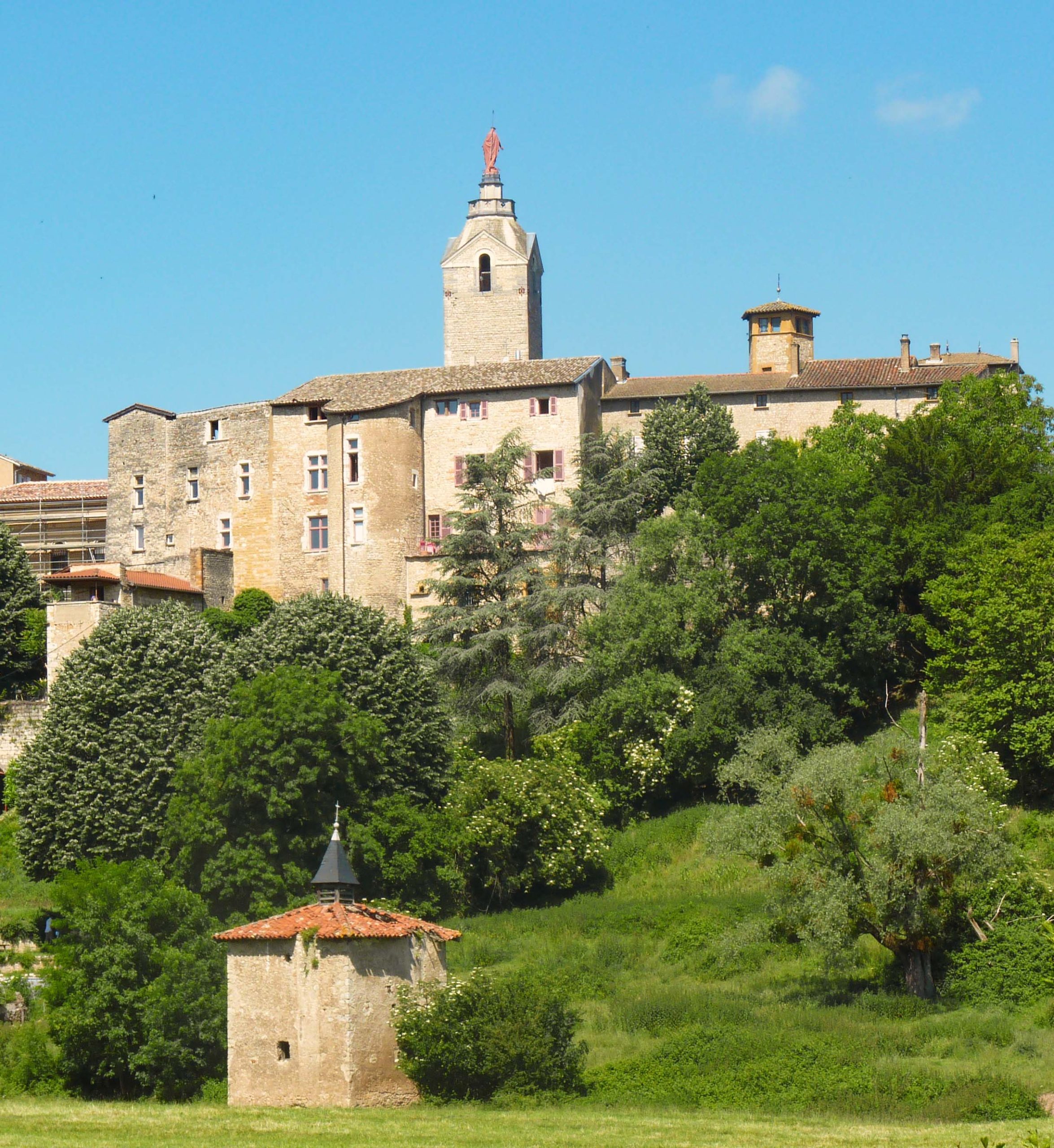
![Autour de Lyon - Chazay d'Azergues : le Musée et le beffroi © Romainbehar - licence [CC0] from Wikimedia Commons](https://frenchmoments.eu/wp-content/uploads/2022/03/Chazay-dAzergues-Musée-et-Beffroi-©-Romainbehar-licence-CC0-from-Wikimedia-Commons-scaled.jpg)
Saint-Jean-des-Vignes
This is a charming site with its small church offering a superb view of the Lyon region.
![Around Lyon - Saint-Jean-des-Vignes © Sebleouf - licence [CC BY-SA 4.0] from Wikimedia Commons](https://frenchmoments.eu/wp-content/uploads/2022/03/Saint-Jean-des-Vignes-©-Sebleouf-licence-CC-BY-SA-4.0-from-Wikimedia-Commons-scaled.jpg)
The Espace Pierre Folles
On the territory of the commune of Saint-Jean-des-Vignes is the Espace Pierres Folles. The museum dedicated to the geology and heritage of the Beaujolais region offers a historical retrospective through the geology, fossils, soil and natural resources of the region. Please note: the site is closed for extension and renovation work and should reopen in 2023.
Monts d’Or
Natural site 30 km north of Lyon
For the people of Lyon, the Monts d’Or are synonymous with Sunday walks in the affluent suburbs of the Lyon conurbation. Indeed, the municipalities established on the slopes of this small massif to the northwest of Lyon are among the hundred wealthiest communes in France (in particular Saint-Didier-au-Mont-d’Or and Saint-Cyr-au-Mont-d’Or).
![Around Lyon - The Monts d'Or from Charnay © Romainbehar - licence [CC0] from Wikimedia Commons](https://frenchmoments.eu/wp-content/uploads/2022/03/Charnay-Monts-dOr-©-Romainbehar-licence-CC0-from-Wikimedia-Commons-scaled.jpg)
The Monts d’Or extend from north to south for about ten kilometres. They are bordered to the east by the Saône and the A6, the famous Autoroute du Soleil to the west.
The massif culminates at Mont Verdun (626 metres). The second highest peak is Mont Thou (611 m). These are occupied by military installations whose origins date back to the post-war years of 1871.
The Monts d’Or offer the people of Lyon great hiking opportunities, allowing them to appreciate better the massif’s natural environment and the small heritage (the cabornes or dry stone shelters).
There are plenty of opportunities to see the surrounding countryside. Going to the Croix Rampau is essential to enjoy the most beautiful panorama. An orientation table lets you identify the surrounding sites, from the Puy de Dôme to Mont Blanc!
Further south, the panorama from Mont Thou extends from the Saône Valley to Fourvière. On a clear day, the Jura and the Alps are visible.
![Around Lyon - The view from Mont Thou © Xavier Caré - licence [CC BY-SA 3.0] from Wikimedia Commons](https://frenchmoments.eu/wp-content/uploads/2022/03/Mont-Thou-Vue-sur-Rillieux-la-Pape-©-Xavier-Caré-licence-CC-BY-SA-3.0-from-Wikimedia-Commons-scaled.jpg)
Rochetaillée-sur-Saône
13 km north of Lyon
Rochetaillée-sur-Saône, a town perched above the Saône, was once a popular bathing place for the people of Lyon. Today, it is its glazed-tile castle that attracts visitors.

Indeed, the restored former fortified castle is home to the Henri-Malartre automobile museum. Splendid collections can be discovered in the terraced park above the Sâone: automobiles (1890-1986), cycles (1818-1960), motorbikes (1904-1964), and public transport vehicles (1886-1935). Thus, of the 150 models of cars on display, 50 are pre-1914.
![Musée Henri Malartre © HReuter - licence [CC BY-SA 4.0] from Wikimedia Commons](https://frenchmoments.eu/wp-content/uploads/2022/03/Rochetaillée-sur-Saône-Musée-Henri-Malartre-©-HReuter-licence-CC-BY-SA-4.0-from-Wikimedia-Commons-scaled.jpg)

Find out more about the Henri-Malartre Automobile Museum.
Paul Bocuse’s restaurant
On the other bank of the Saône, the commune of Collonges-au-Mont-d’Or is home to the famous Auberge du Pont de Collonges, a restaurant founded by Paul Bocuse. The façade of this temple of French cuisine is decorated with paintings and sculptures by Paul Bocuse.
![Auberge de Paul Bocuse © Éric Messel - licence [CC BY-SA 4.0] from Wikimedia Commons](https://frenchmoments.eu/wp-content/uploads/2022/03/Auberge-de-Paul-Bocuse-©-Éric-Messel-licence-CC-BY-SA-4.0-from-Wikimedia-Commons--scaled.jpg)
Neuville-sur-Sâone
North of Rochetaillée, make a diversion to Neuville-sur-Sâone to discover the Château de Vimy, or the Château des Abbés de l’Île-Barbe.
![Around Lyon - Château de Vimy in Neuville-sur-Saône © Romainbehar - licence [CC0] from Wikimedia Commons](https://frenchmoments.eu/wp-content/uploads/2022/03/Neuville-sur-Saône-Château-de-Vimy-©-Romainbehar-licence-CC0-from-Wikimedia-Commons-scaled.jpg)
Then don’t forget Ombreval Castle, built in 1458 by Monsieur d’Ombreval. The castle’s park has become a public park whose moat still surrounds the building. The castle chapel is in a good state of preservation on the outside, as is the nymphaeum, a pavilion in the form of a grotto (circa 1636).
![Around Lyon - Neuville-sur-Saône: Château d'Ombreval © PHILDIC - licence [CC BY-SA 3.0] from Wikimedia Commons](https://frenchmoments.eu/wp-content/uploads/2022/03/Neuville-sur-Saône-Château-dOmbreval-©-PHILDIC-licence-CC-BY-SA-3.0-from-Wikimedia-Commons-scaled.jpg)
Signal de Saint-André
Locality 40 km west of Lyon
Located in the commune of Saint-André-la-Côte, 20 km from Lyon as the crow flies, the Signal de Saint-André is a summit belonging to the main ridge of the Monts du Lyonnais.
Culminating at 934 m, it is the second-highest summit in the massif, behind the Crêt Malherbe.
It is an important geographical location because it was here that the geographer César-François Cassini (1714-1784) had a marker erected on the summit in 1744 for the production of his famous map of the kingdom of France. It is still there today and indicates why the top was named “signal”.
The panoramic view on a clear day is magnificent. You can see the Monts du Lyonnais, the Lyon conurbation, the Jura and the Alps on the horizon.
![Saint-Martin-en-Haut © GrosDJé - licence [CC BY-SA 4.0] from Wikimedia Commons](https://frenchmoments.eu/wp-content/uploads/2022/03/Saint-Martin-en-Haut-©-GrosDJé-licence-CC-BY-SA-4.0-from-Wikimedia-Commons-scaled.jpg)
In the surroundings, don’t miss the beautiful landscapes of the Monts du Lyonnais, particularly the Ronzey Lake and the countryside of Yzeron. In this village, an orientation table on the church square offers a beautiful view of the Lyon conurbation.
![Around Lyon - Yzeron © Olivier Aumage - licence [CC BY-SA 2.0 fr] from Wikimedia Commons](https://frenchmoments.eu/wp-content/uploads/2022/03/Yzeron-©-Olivier-Aumage-licence-CC-BY-SA-2.0-fr-from-Wikimedia-Commons.jpg)
On the D2 road up to Riverie, notice the church in the centre of the village of Saint-Didier-sous-Riverie. It is an imposing sanctuary rebuilt in 1868 with granite bluestone. The church dedicated to Saint Didier de Vienne has the particularity of having two square bell towers, which is rare in the region, especially in a village the size of Saint-Didier-sous-Riverie!
![Saint-Didier-sous-Riverie © verod1 - licence [CC BY-SA 4.0] from Wikimedia Commons](https://frenchmoments.eu/wp-content/uploads/2022/03/Saint-Didier-sous-Riverie-©-verod1-licence-CC-BY-SA-4.0-from-Wikimedia-Commons-scaled.jpg)
The Route des Crêtes
To get a good overview of the Monts du Lyonnais, follow the route des crêtes from Saint-Didier-sous-Riverie to Vaugneray via :
- Riverie to Saint-Martin-en-Haut (D113)
- Saint-Martin-en-Haut to Yzeron (D122)
- Yzeron to Col de la Luère (D113)
- Then by the D24, downhill to Vaugneray.
![Around Lyon - Saint-Martin-en-Haut © Thierry GERMAIN - licence [CC BY-SA 3.0] from Wikimedia Commons](https://frenchmoments.eu/wp-content/uploads/2022/03/Saint-Martin-en-Haut-©-Thierry-GERMAIN-licence-CC-BY-SA-3.0-from-Wikimedia-Commons-scaled.jpg)
![Around Lyon - Saint-Laurent-de-Vaux © David M. - licence [CC BY 3.0] from Wikimedia Commons](https://frenchmoments.eu/wp-content/uploads/2022/03/Saint-Laurent-de-Vaux-©-David-M.-licence-CC-BY-3.0-from-Wikimedia-Commons.jpg)
![Around Lyon - Rontalon © Wayne77 - licence [CC BY-SA 4.0] from Wikimedia Commons](https://frenchmoments.eu/wp-content/uploads/2022/03/Rontalon-©-Wayne77-licence-CC-BY-SA-4.0-from-Wikimedia-Commons.jpg)
Vienne and Saint-Romain-en-Gal
34 km south of Lyon
You have to know which Vienne you are talking about!
A little geography revision: don’t confuse Vienne (the French name for Vienna, the capital of Austria), the Vienne river (which gave its name to a French département) and Vienne, a historic city and sub-prefecture of Isère.
Of course, we will mention the latter, located about thirty kilometres south of Lyon.
At the crossroads of roads leading to Lyon, the Alps, the Massif Central and Provence via the Rhône, Vienne’s strategic position is no stranger to the city’s rich built heritage.
Vienne is home to several significant monuments dating from antiquity: the Temple of Augustus and Livia, the ancient theatre from the 1st century AD, and the Roman remains of the Garden of Cybele.
![Around Lyon - The Roman temple in Vienne © Aniacra - licence [CC BY-SA 4.0] from Wikimedia Commons](https://frenchmoments.eu/wp-content/uploads/2022/03/Vienne-Temple-dAuguste-et-de-Livie-©-Aniacra-licence-CC-BY-SA-4.0-from-Wikimedia-Commons-scaled.jpg)
From the medieval period, we can mention the Saint-Maurice cathedral (12th-13th centuries), the Saint-Pierre de Vienne abbey (now an archaeological museum), the Bâtie castle (13th century), the Saint-André-le-Bas de Vienne abbey and its cloister…
![Saint-Maurice cathedral in Vienne © Aniacra - licence [CC BY-SA 4.0] from Wikimedia Commons](https://frenchmoments.eu/wp-content/uploads/2022/03/Vienne-Cathédrale-Saint-Maurice-©-Aniacra-licence-CC-BY-SA-4.0-from-Wikimedia-Commons-scaled.jpg)
The rue Marchande is lined with arcades and old courtyards in the historical centre, reminiscent of the famous traboules in the Old Lyon district.
![A Renaissance inner courtyard at number 45-49 Rue Marchande in Vienne © Romainbehar - licence [CC0] from Wikimedia Commons](https://frenchmoments.eu/wp-content/uploads/2022/03/Vienne-45-49-Rue-Marchande-Cour-intérieure-Renaissance-©-Romainbehar-licence-CC0-from-Wikimedia-Commons-scaled.jpg)
The city also has several museums: the Fine Arts and Archaeology Museum, Saint-André-le-Bas Cloister Museum, Saint-Pierre Archaeological Museum, and Drapery.
Panoramic views of Vienne
To enjoy a beautiful panorama of the city, go up to Mont Pipet. Near the chapel, the view over the city’s roofs and the cathedral is superb.
![Around Lyon - The city of Vienne from Mont Pipet © Cavit - licence [CC BY 4.0] from Wikimedia Commons](https://frenchmoments.eu/wp-content/uploads/2022/03/Vienne-Pipet-©-Cavit-licence-CC-BY-4.0-from-Wikimedia-Commons-scaled.jpg)
On a hillock overlooking the city stands the castle of La Bâtie. The former residence of the archbishops of Vienne in the Middle Ages is now in ruins.
![Vienne - Château de La Bâtie © Abderitestatos - licence [CC BY-SA 3.0] from Wikimedia Commons](https://frenchmoments.eu/wp-content/uploads/2022/03/Château-de-La-Bâtie-©-Abderitestatos-licence-CC-BY-SA-3.0-from-Wikimedia-Commons-scaled.jpg)
Saint-Romain-en-Gal
On the opposite bank of the Rhône, Saint-Romain-en-Gal reveals an important archaeological site for visitors. The numerous Gallo-Roman remains include thermal baths, a Roman granite road, habitats and mosaics…
![The Archeological National Museum of Saint-Romain-en-Gal © Chatsam - licence [CC BY-SA 3.0] from Wikimedia Commons](https://frenchmoments.eu/wp-content/uploads/2022/03/Saint-Romain-en-Gal-Musée-darchéologie-nationale-©-Chatsam-licence-CC-BY-SA-3.0-from-Wikimedia-Commons-scaled.jpg)
More information on the Vienne-Condrieu tourist office website
Practical information
Some practical advice to discover the sites around Lyon:
- You can avoid the traffic jams to get out of/into Lyon by driving outside of rush hour, mainly if you use the eastern ring road (A46-N346).
- These ten places inspire you to discover the region around Lyon (less than 40 km by road). Let yourself be surprised by other discoveries during your escapades, and stay curious! There is so much to discover, especially if you are a lover of small heritage.
- Don’t hesitate to enter the tourist office centres. During my French travels, the receptionists I met know the area and will be happy to help you discover their beautiful region.
- Click here to get ideas about accommodation in the area around Lyon.
- Visiting the region around Lyon? Think of the following hashtags: #onlylyon – #myauvergnerhonealpes – #enfranceaussi – #frenchmoments
Other blog posts that might interest you
- Read this article in French on our blog Mon Grand-Est
- Practical information for planning your visit to Lyon
- A Culinary Journey into Lyon Gastronomy!
- Discover the old town of Lyon: history and Sightseeing
- The official Tourist Board of Lyon
- Accommodation in Lyon
- Find out more about Tourism in Auvergne-Rhône-Alpes
Pin it for later
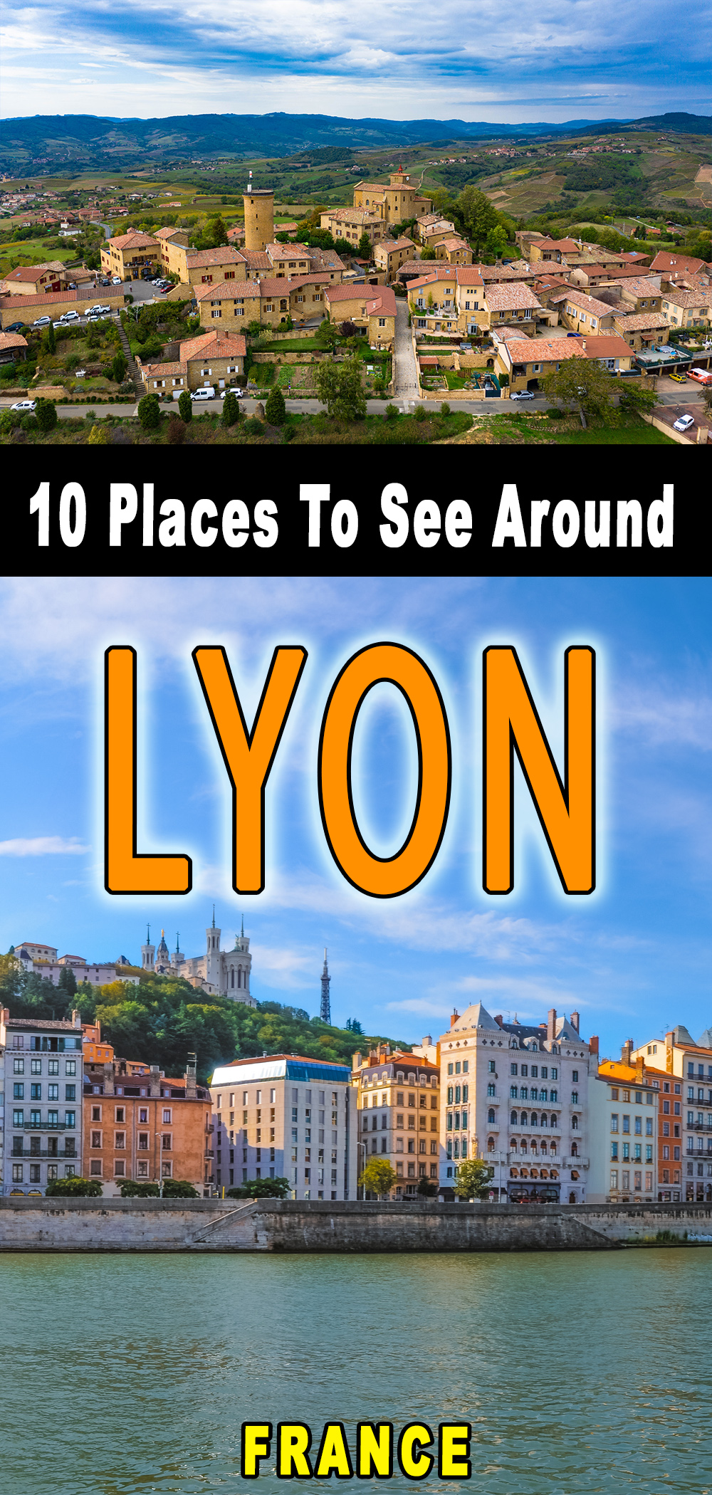
Liked what you read about what to see around Lyon. If so, please pin it on Pinterest:




Thank you Pierre, for a wonderful piece! I go to Lyon often but because I take the train, I don't visit the environs, so thanks for the nudge! One thing I would add to the Pierres Dorées village of Oingt which you may not know – in December (which is when I visited) they have an informal crèche competition – it's not really a competition but everyone decorates their windows with scenes from the Nativity. Completely brightens up the village and some are incredibly creative!
Thank you very much Leyla for the information on the Christmas Nativity scenes in Oingt! It is indeed worth a visit in December! 🙂
I will be traveling in France by train Can I visit small villages and towns close to Lyon? I am interested in Roman History.
Some of these sites are accessible by train, but hiring a car for most villages is best.