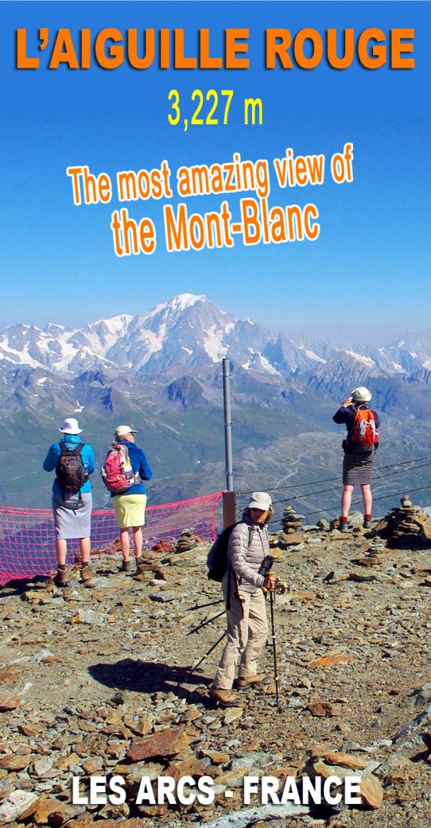

Looking for an outing for all the family in the Alps? With a few minor frights (!) to spice up your excursion? We have the right destination for you: the Aiguille Rouge in the French Alps of Savoie. At an altitude of over 3,200m (10,500 ft), the mountain top dominates the ski domain of Les Arcs. And the summit is easily accessible in Winter and Summer via cable car. In August, we were lucky to have a day out climbing the Aiguille Rouge and marvelled at the breathtaking panoramic view.
The Aiguille Rouge, a summit at 3,227m high!
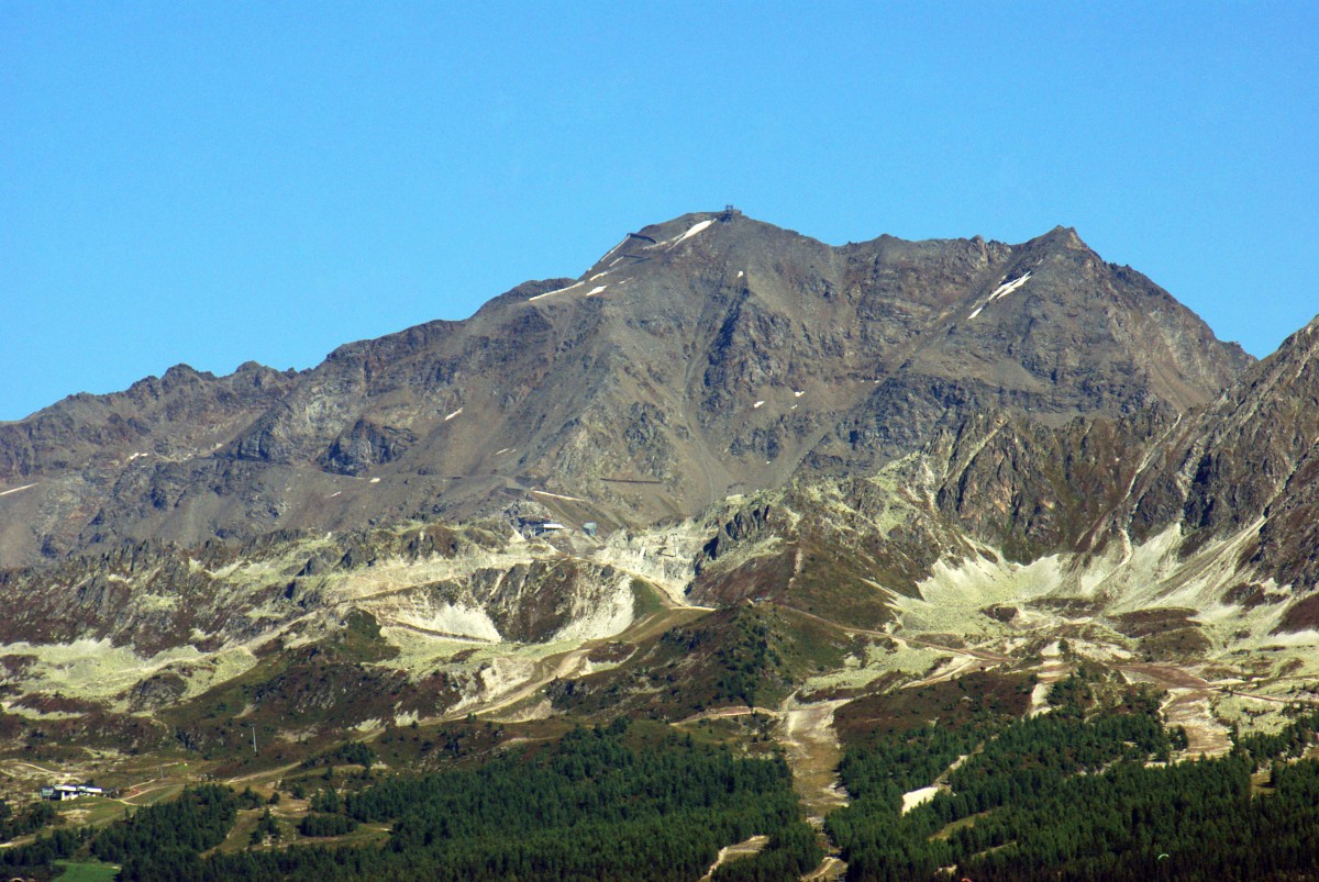
The Aiguille Rouge (3,227m/10,587ft) is north of Mont Pourri, the Vanoise‘s highest summit after the Grande Casse. Its name means “Red Needle” in English.
It’s not every day that we have the opportunity to get to more than 10,000ft high. Mainly if one is not an alpinist or an experienced climber.
The ski lifts that open in Summer are essential for reaching such heights. By the way, the Aiguille Rouge in Savoie is not the only place where ordinary people like you and me can get 10,000ft without much effort.

There is also the Aiguille du Midi in Chamonix-Mont-Blanc, the glacier of Bellecôte in La Plagne, the glacier of the Grande Motte in Tignes or the glacier of Mont-de-Lans in Deux-Alpes.
I must say that I was wowed by the Aiguille Rouge and its unobstructed panoramic views. I’ll get back to that later.
Les Arcs, one of the Alps’ largest ski domains
The summit is the culminating point of the famous ski domain Les Arcs. Part of the commune of Bourg-Saint-Maurice, the resort is accessible in Summer and Winter by road and via the funicular Les Arcs’ Express.
Les Arcs ranks amongst the most prestigious ski resorts in the world. In fact, the vast domain is made up of several “Arcs”:
- Arc 1600, accessible from Bourg-Saint-Maurice by the road or via the funicular.
- Arc 1800 dominates the Middle Tarentaise on the edge of the forest.
- Arc 1950 is the latest addition to the domain with beautiful and exclusive 5 stars holiday residences.
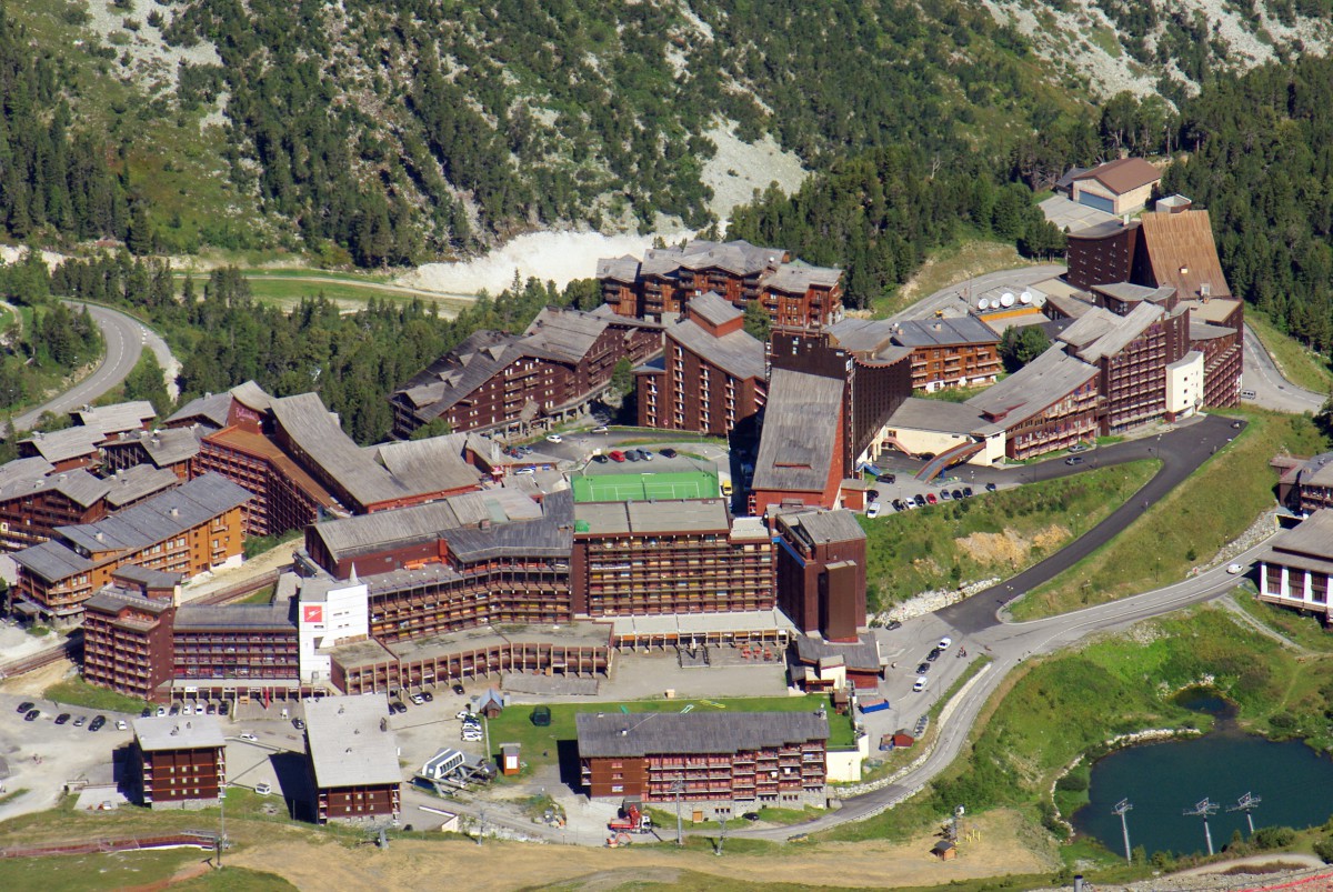
- Arc 2000, built in 1979, its daring architecture contrasts sharply with the natural environment.
Les Arcs is part of the gigantic Paradiski ski domain, one of the largest in the world. The resort is linked to that of Peisey-Vallandry, which is in turn connected to the Grande Plagne domain via the Vanoise Express cable car.
Think about it! In Winter, this large area totals more than 425km of ski runs between 1,200 and 3,250m! A true paradise for skiers! But for now, let’s stay in Summer…
Les Arcs in Summer
In the summer, Les Arcs offers an extensive range of sports activities: hiking, horse-riding, swimming, trampoline, archery, fitness, cardio-training, step, Zumba, stretching, aqua gym, circus shows, adventure forest, mini-golf, inflatable structures, paragliding…
There is something for everyone’s taste. Something for all ages. That makes Les Arcs one of the best family-friendly resorts in the French Alps.
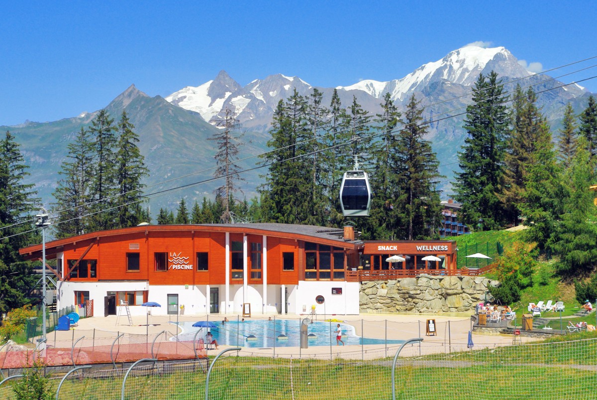
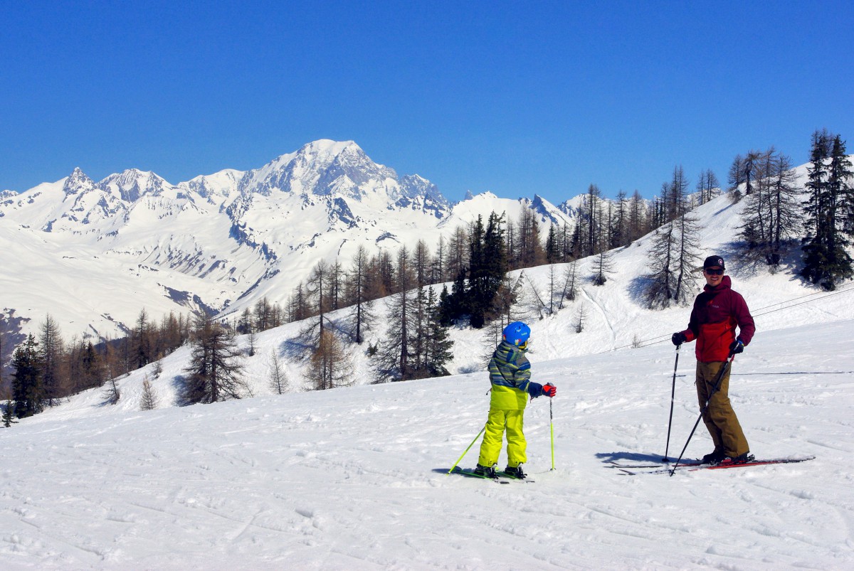
The Arc 1800 resort even has its golf course with stunning views over the Middle Tarentaise, the Beaufortain mountains and the Mont Blanc.
Find out more about Les Arcs in Summer.
Ascending the Aiguille Rouge
It was a lovely sunny morning in late August when we set out for Bourg-Saint-Maurice. We arrived at 9 am at the lower terminal of the funicular and parked our car nearby. Bourg-Saint-Maurice is a little town that gives access to the three main mountain passes of Savoie: Cormet de Roselend, Little St-Bernard and Iseran.
Les Arcs’ express funicular
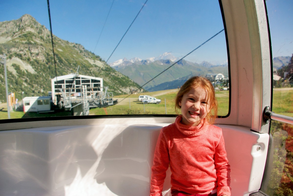
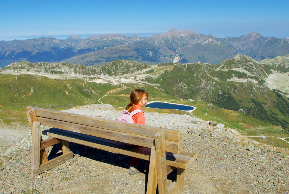
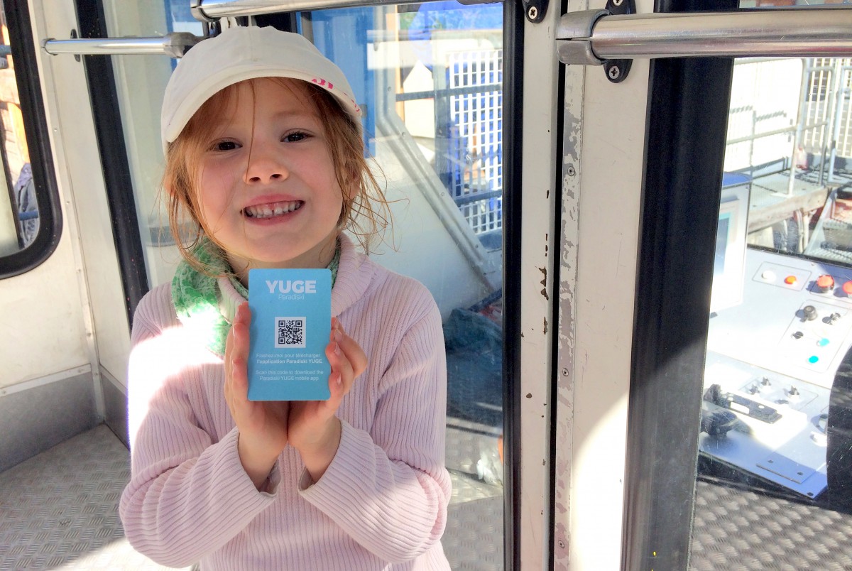
Once we got our cable car passes, we explored Les Arcs at an altitude of 750m. Our 5-year-old girl Aimée really enjoyed the steep ride!
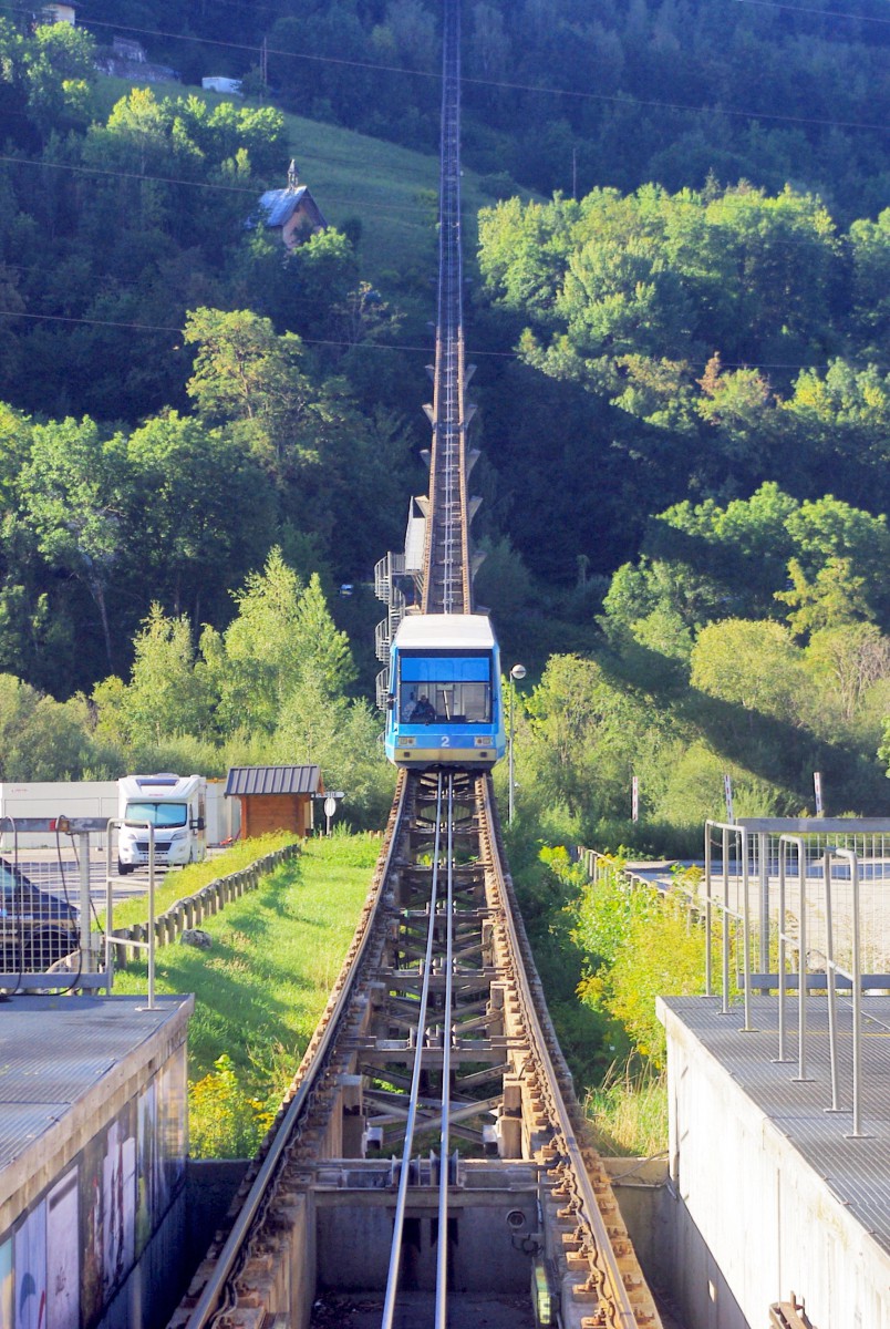
Les Arcs’ express climbs 818m between Bourg-Saint-Maurice and Arc 1600 in 7 minutes.
The free inter-resort shuttle bus
On arrival, a free inter-resort shuttle bus awaited us, a short walk to our left. It led us to Arc 1950.
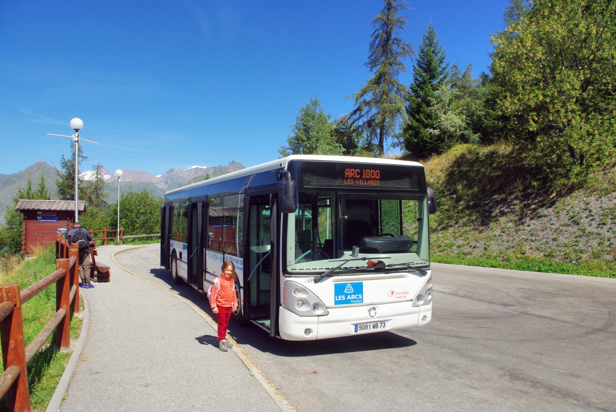
In fact, the shuttle takes you up to Arc 2000. We stopped at Arc 1950 as we wanted to explore the resort.
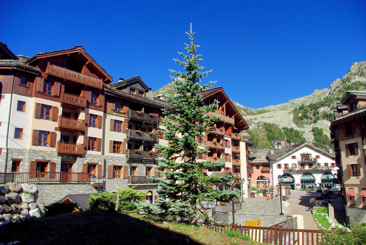
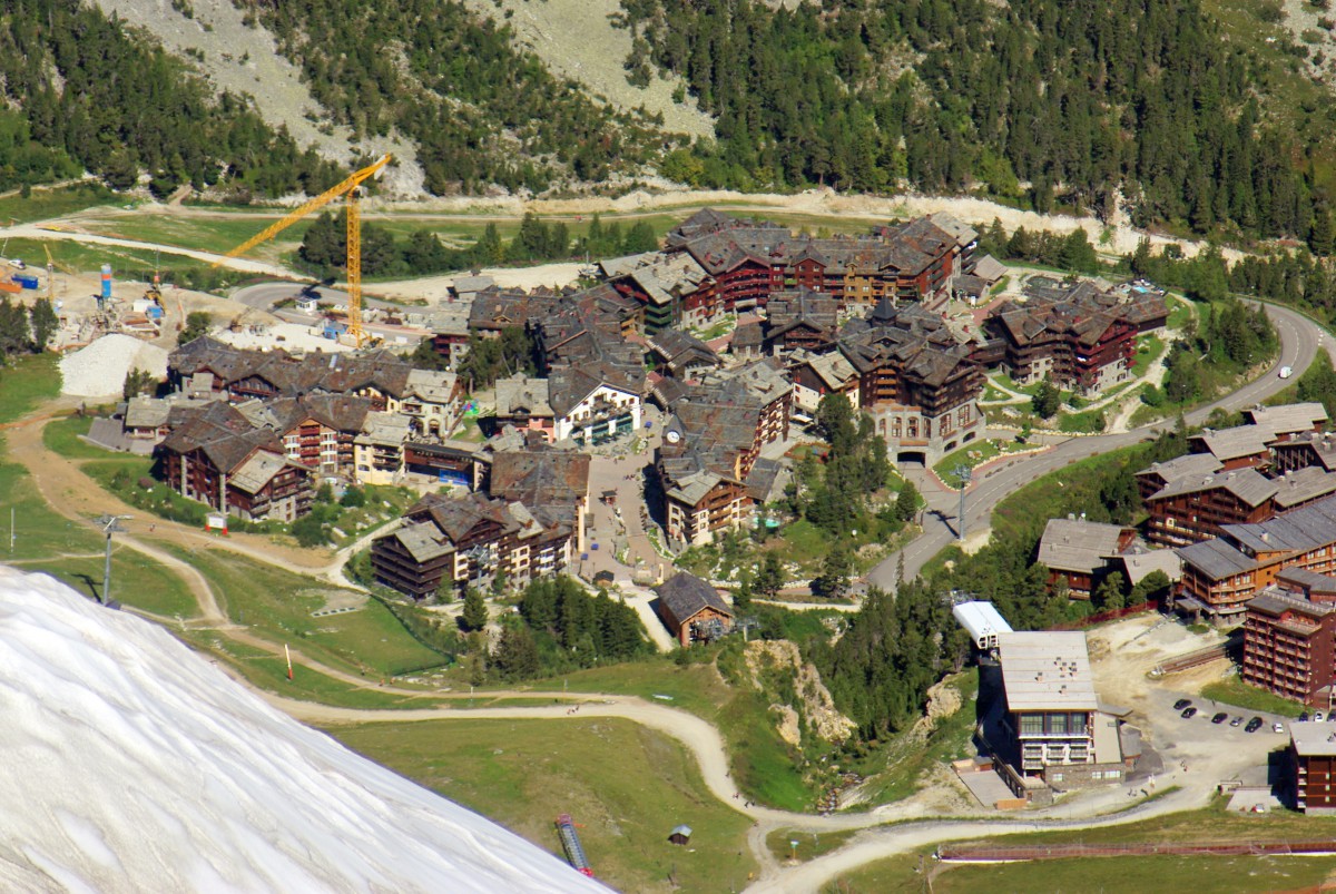
Arc 1950
We were told that Arc 1950 was different from the other resorts in its traditional architecture. It did feel nice when we wandered along the pedestrian streets of the village. The tall chalets of Arc 1950 were intentionally designed to blend with the surrounding area.
Arc 1950 is the newest addition to the resort of Les Arcs and opened in 2003, just below Arc 2000. We loved the view of Mont Blanc.

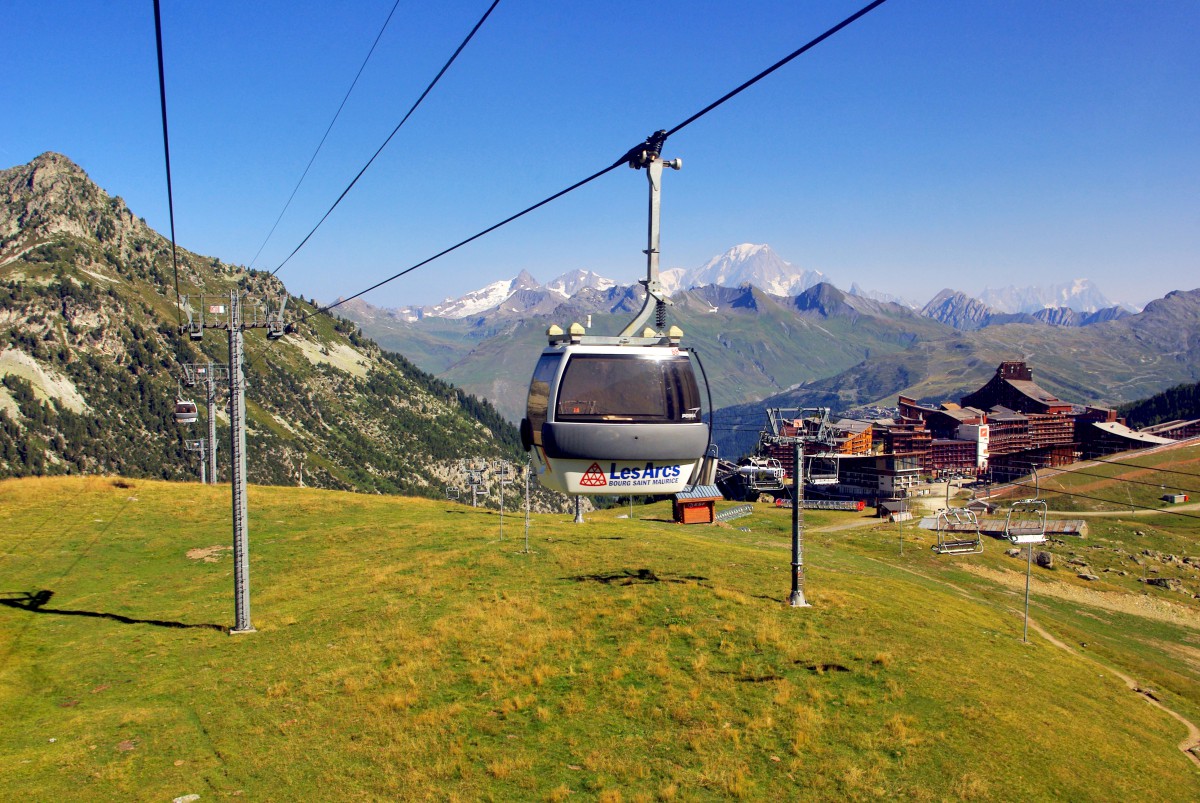
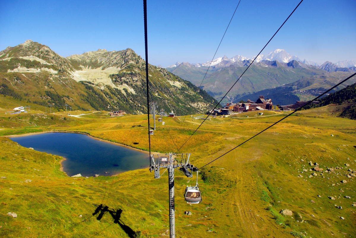
From there, we took the Cabriolet cable car that links Arc 1950 to Arc 2000 in one minute.
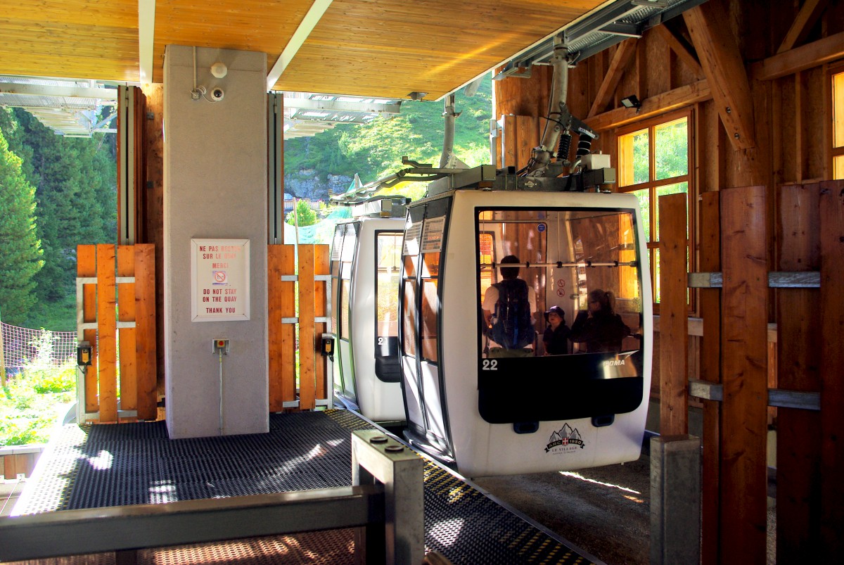
The Varet télécabine
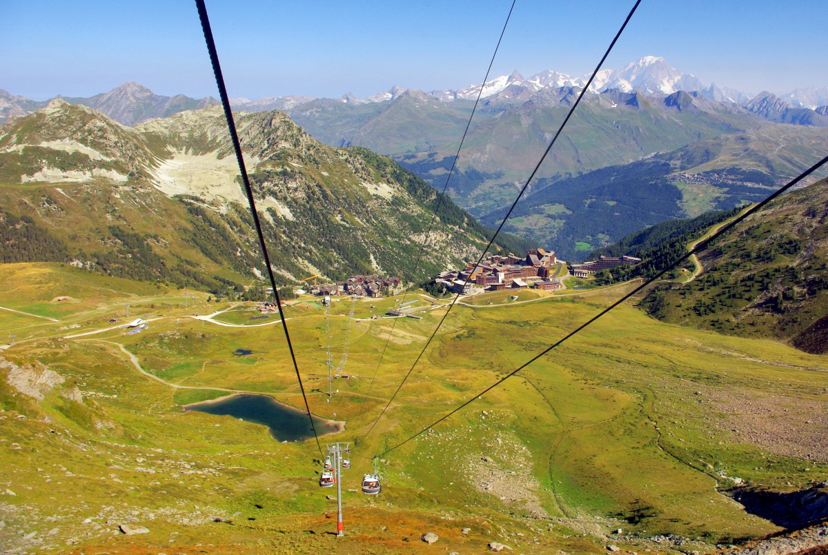
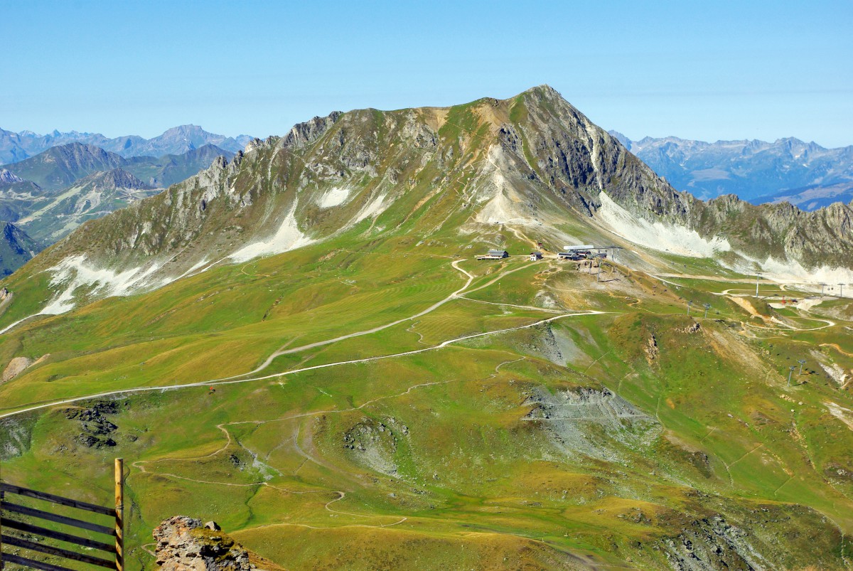
From Arc 2000, we had to walk a few hundred metres to reach the lower terminal of the Varet télécabine (2120m high).
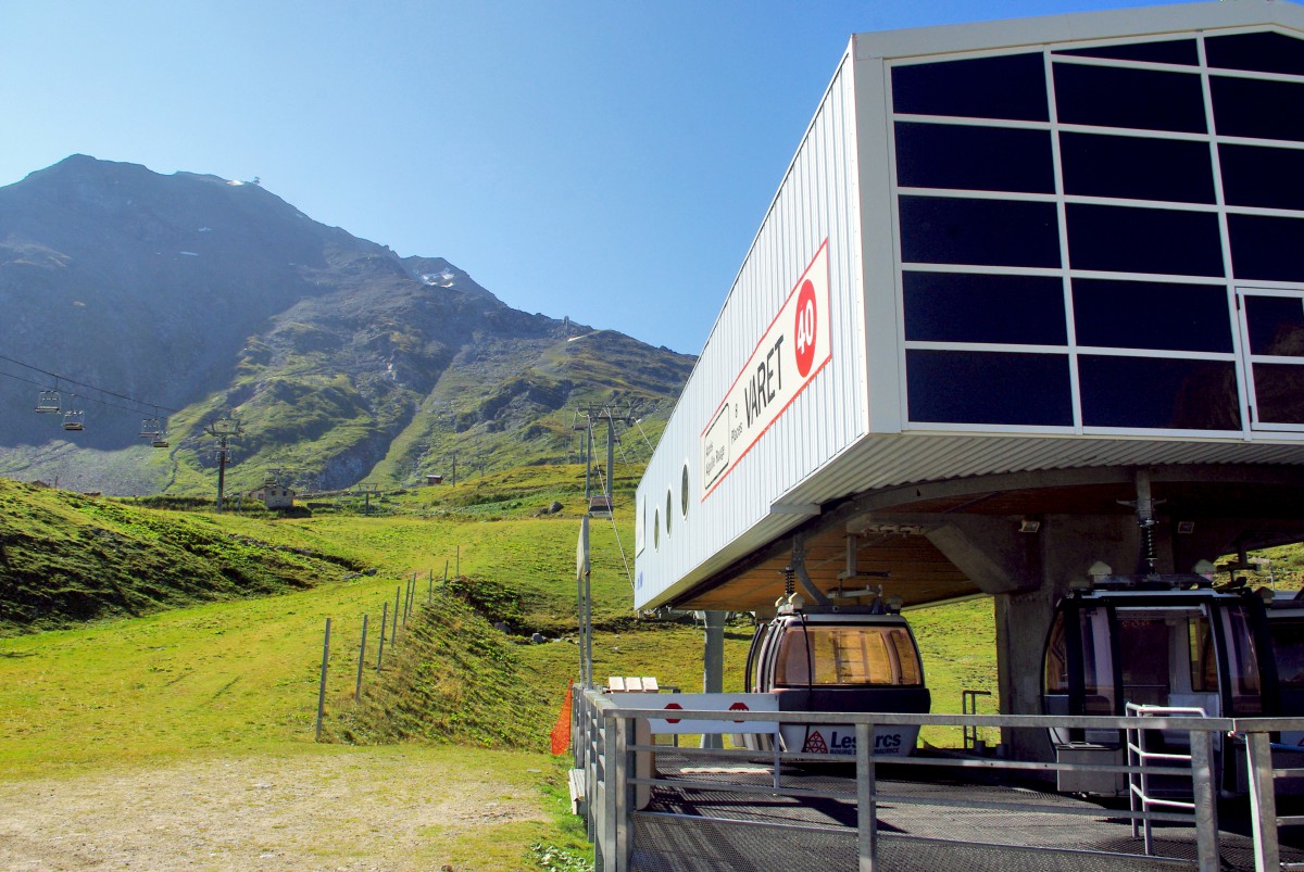
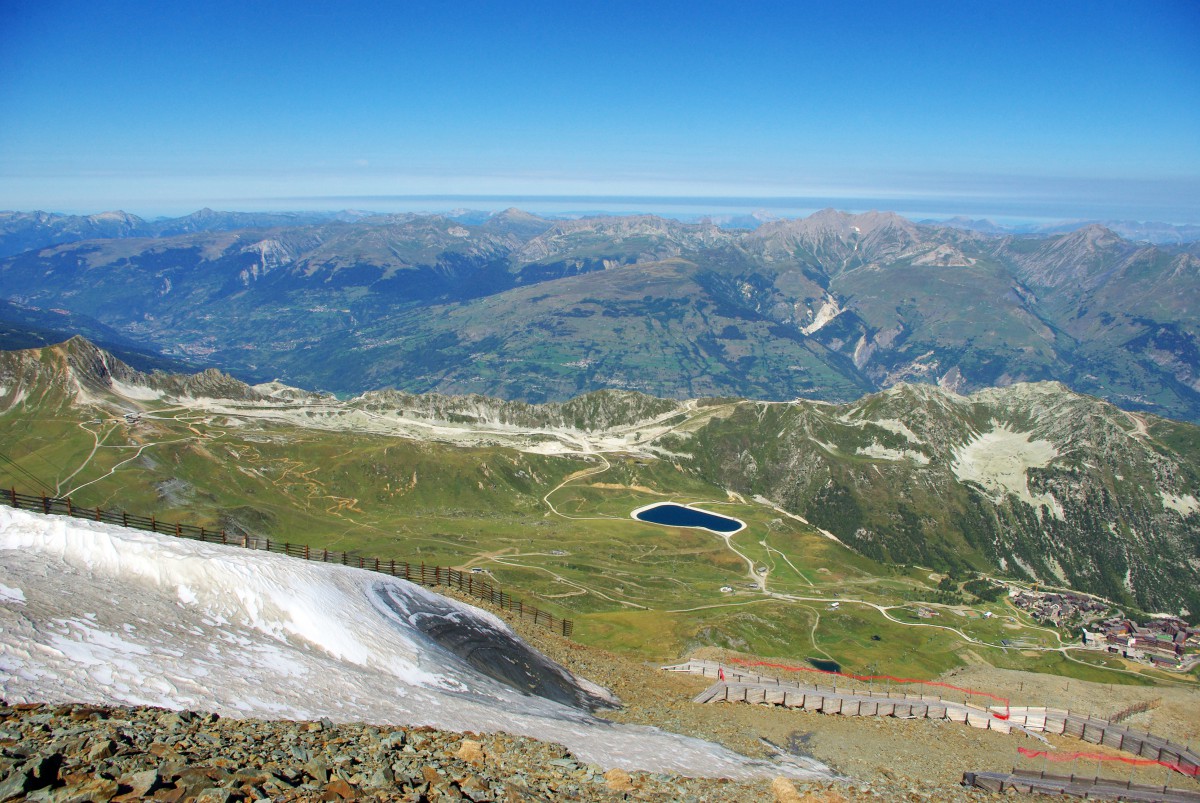
In less than 6 minutes the télécabine reached the lower terminal of the Téléphérique de l’Aiguille Rouge (2,679m). During the ride, we admired the snow-capped peaks of the Mont Blanc massif. Little by little, the vast ski domain of Arc 2000 revealed itself and the ridge line between the Aiguille Grive (2,733m) and the Pointe du Four (2,469m).
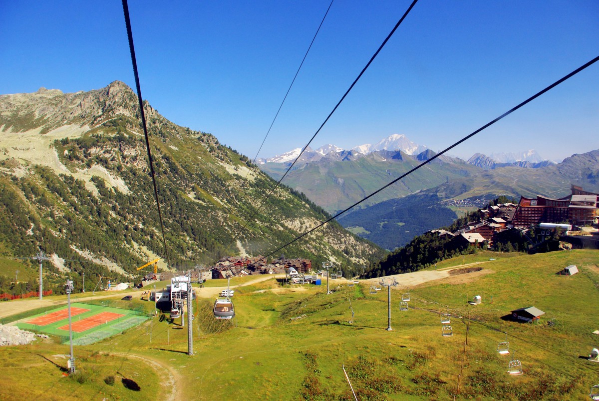
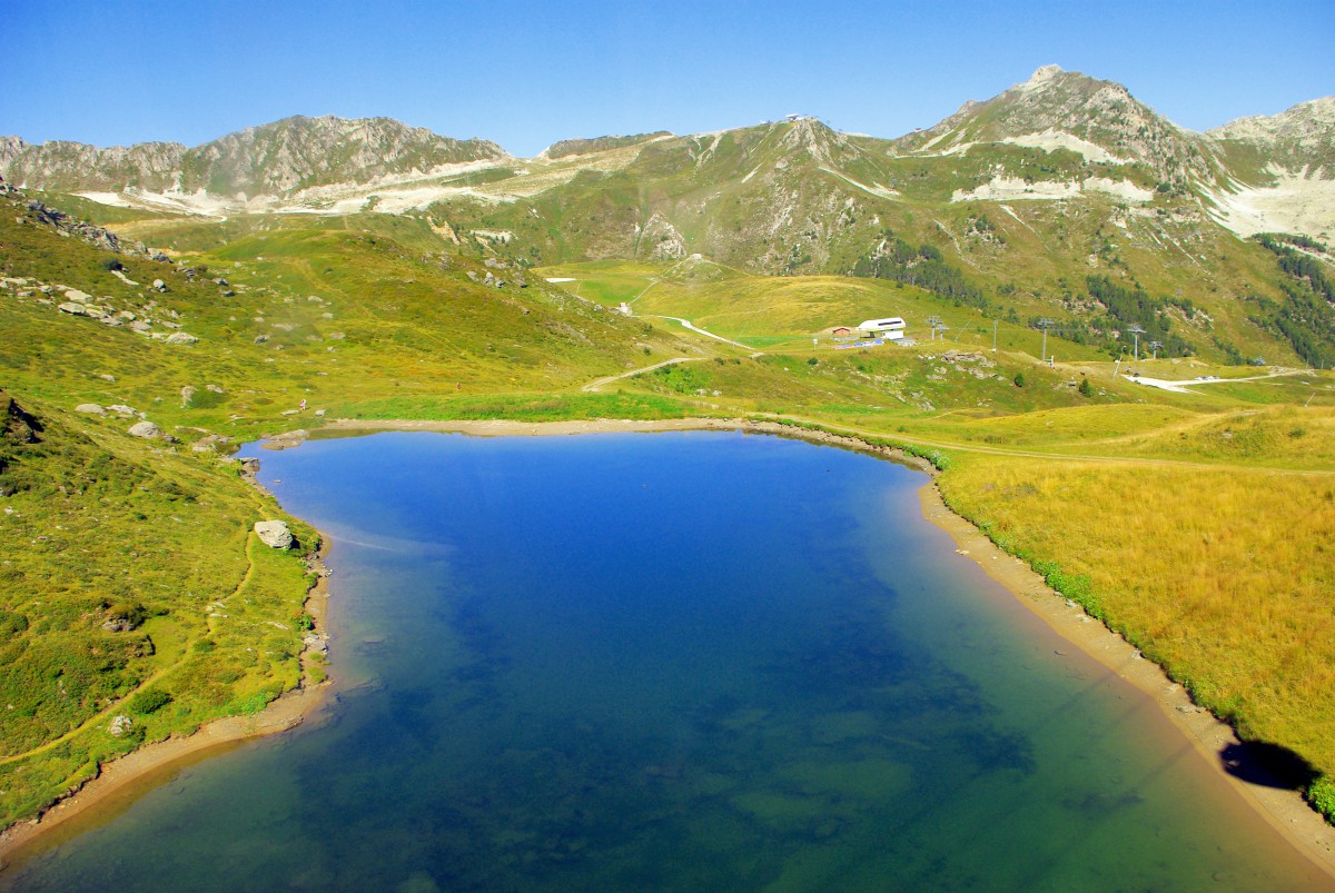
At the upper terminal of the gondolas, the view was already amazing: the Arc 2000 valley, the Aiguille Grive and the Pointe du Four. Beyond it are the mountains of the Beaufortain massif.
The view was already stunning and would be even more so from the Aiguille Rouge!
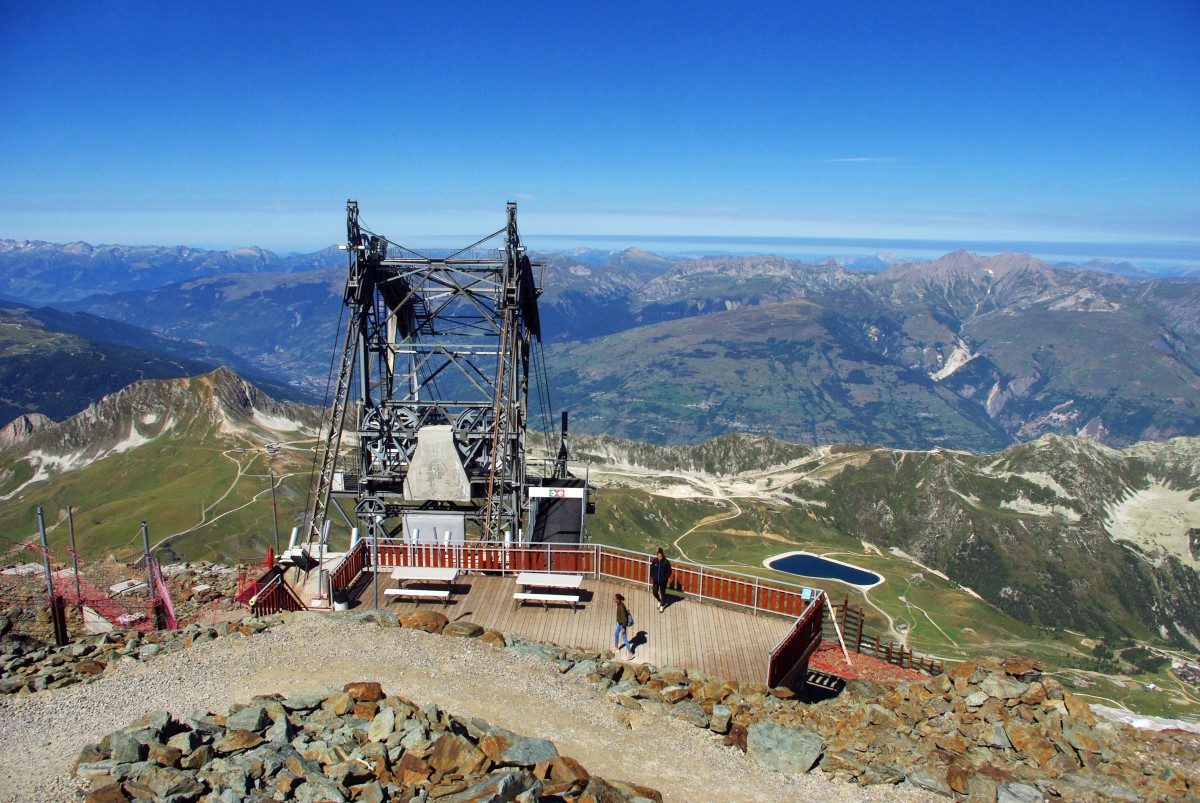
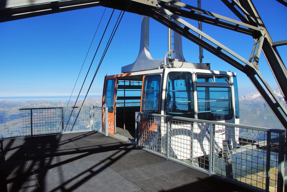
The Aiguille Rouge cable-car
We found the cable car (téléphérique) the most frightening of all the ski-lift types. This is due to the long reach of the cable between the two terminals. Unlike gondolas (télécabines), there are no intermediary pylons supporting the cable. The Aiguille Rouge cable car is 1,068m long with a height difference of 533m. It can transport 1,100 people per hour.
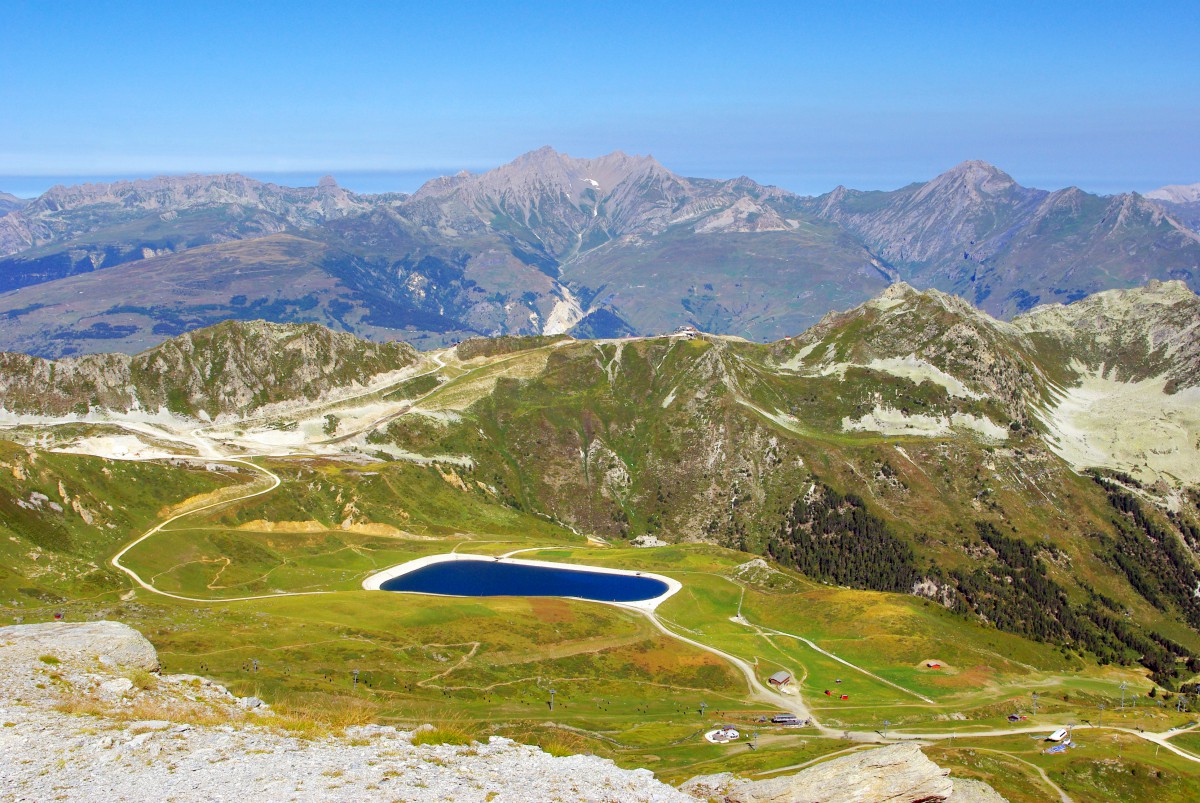
The summit of the Aiguille Rouge and the panoramic view
The arrival at the upper terminal of the Téléphérique was impressive, to say the least. We had to walk on a metallic footbridge with nothing below as we left the cabin. [Gasp!]
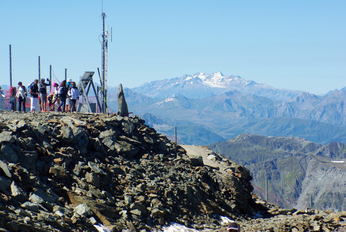
This overhang is quickly forgotten once we get to solid ground. A little pathway through the loose stones leads to the summit a few metres above.
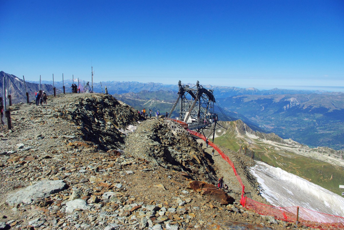
The cable car terminal is a fantastic structure. It is hung on the side of the rocky wall without cladding or roofing. Only the gantry, the cables and the rock anchors are apparent.
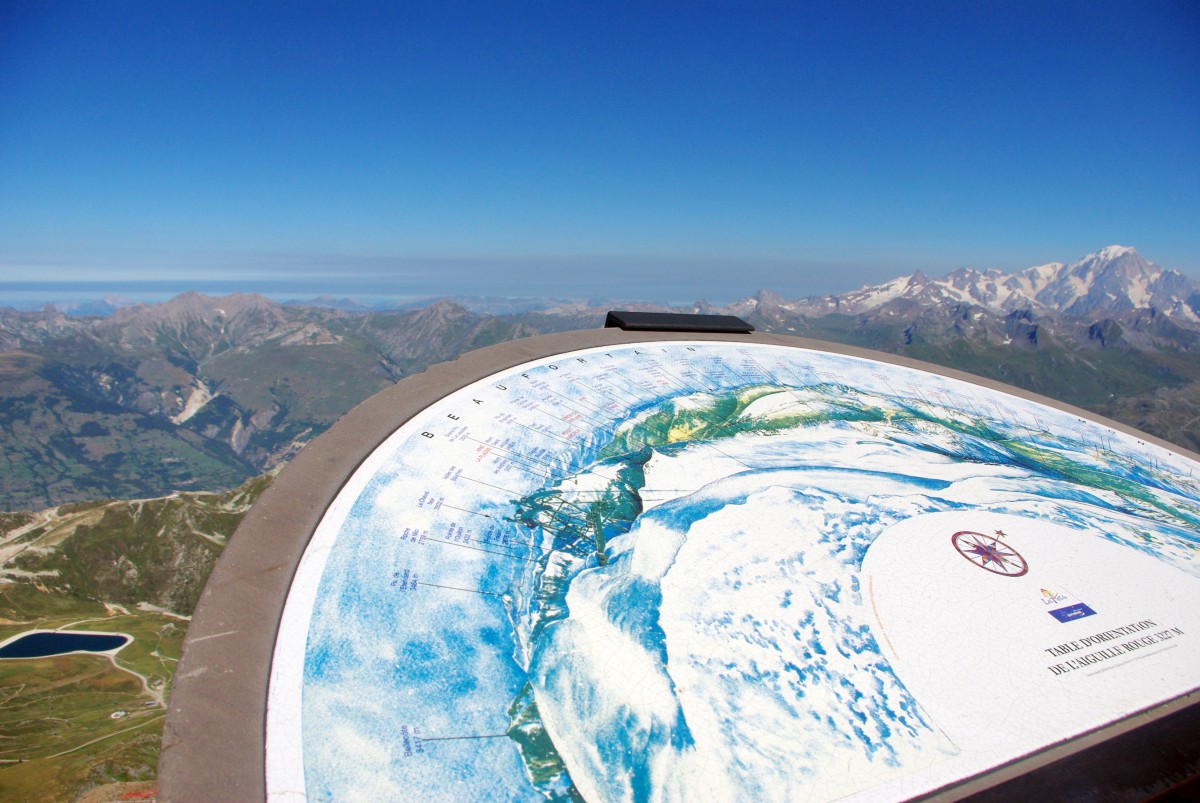
A helpful orientation table on the summit reveals the names of the highest mountains.
As well as free panoramic binoculars (that are accessible to children, as Aimée can testify!)
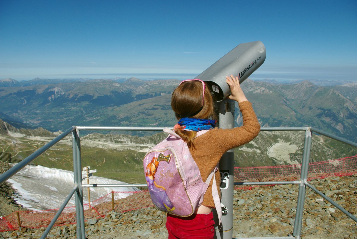
By the way, she was more interested in looking at the sky than the actual mountains!
The complete panorama
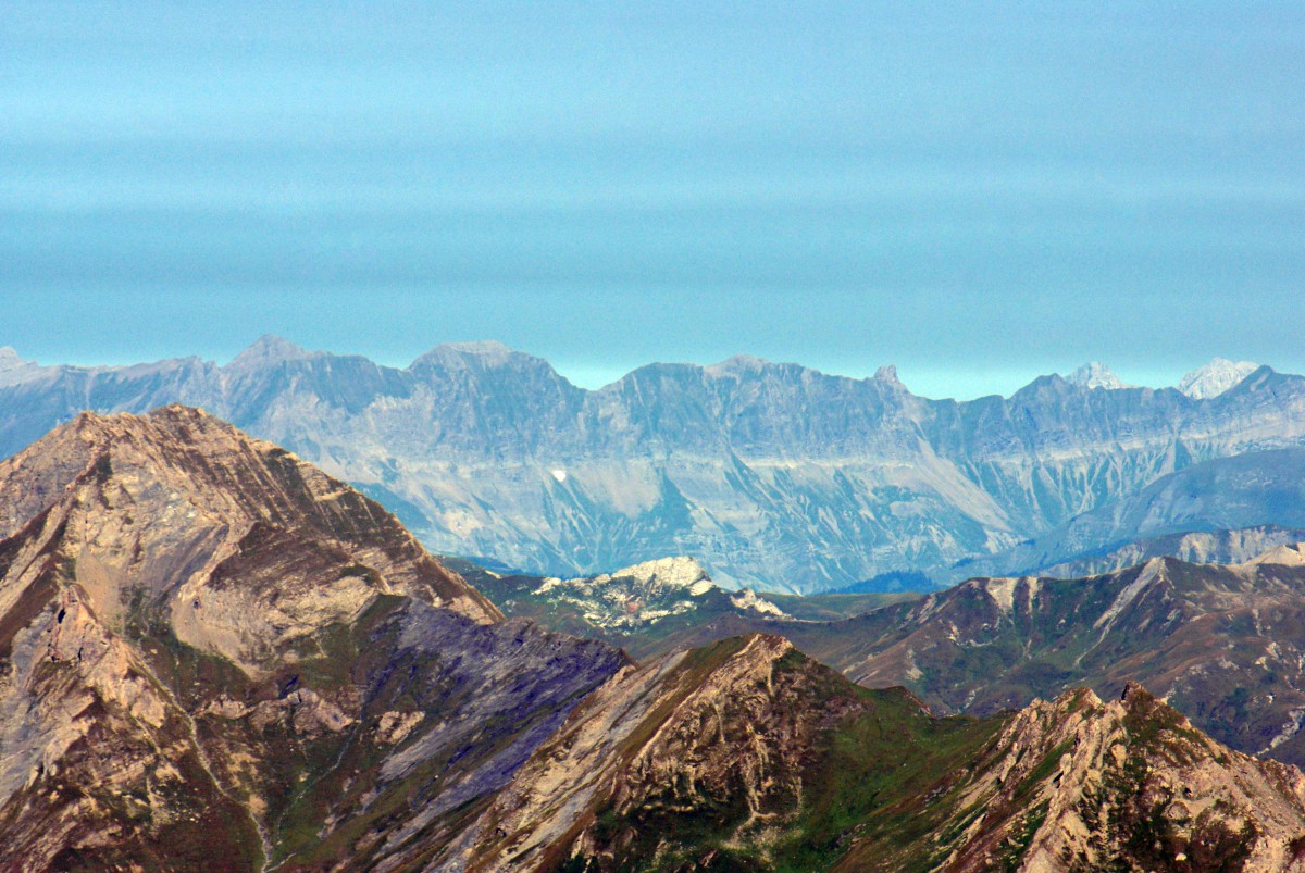
At the height of 3227m/10,587ft, the complete panoramic view is breathtaking.
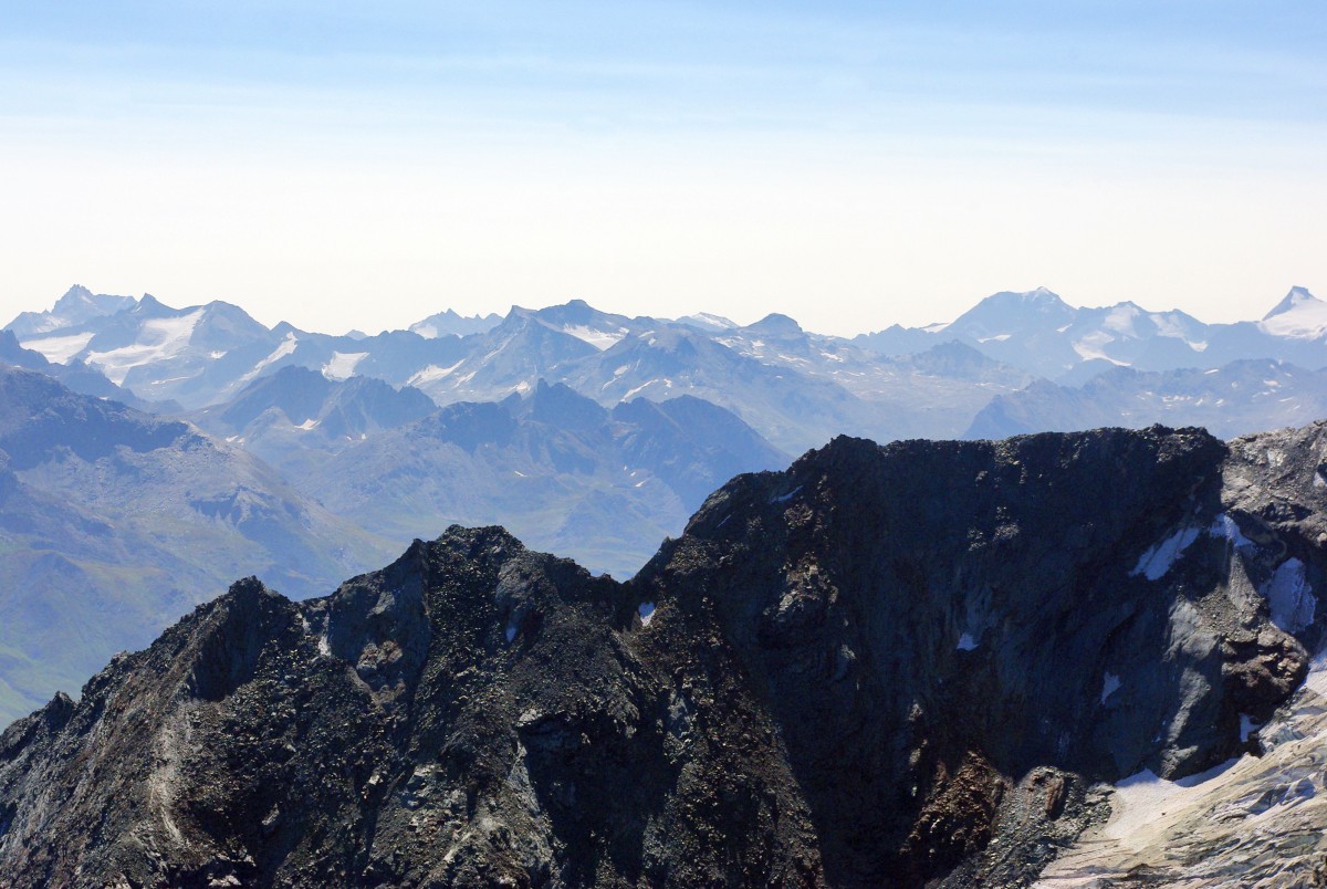
In front of us stood the French, Swiss and Italian Alps. We could see as far as the Jura mountains with favourable weather conditions.
The only obstacle to our view was the gigantic mass of Mont Pourri, which hides part of the Vanoise massif and, consequently, the Ecrins massif.
The most beautiful view of the Mont Blanc
But we can’t complain!…. The Aiguille Rouge offers its visitors the grandest panoramic view of the Mont Blanc massif. At a distance of 30 km the “Roof of Europe” does appear close to us. Its perpetual snow makes it stand out from the surrounding mountains.
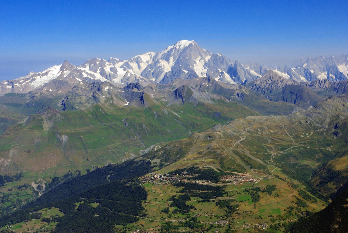
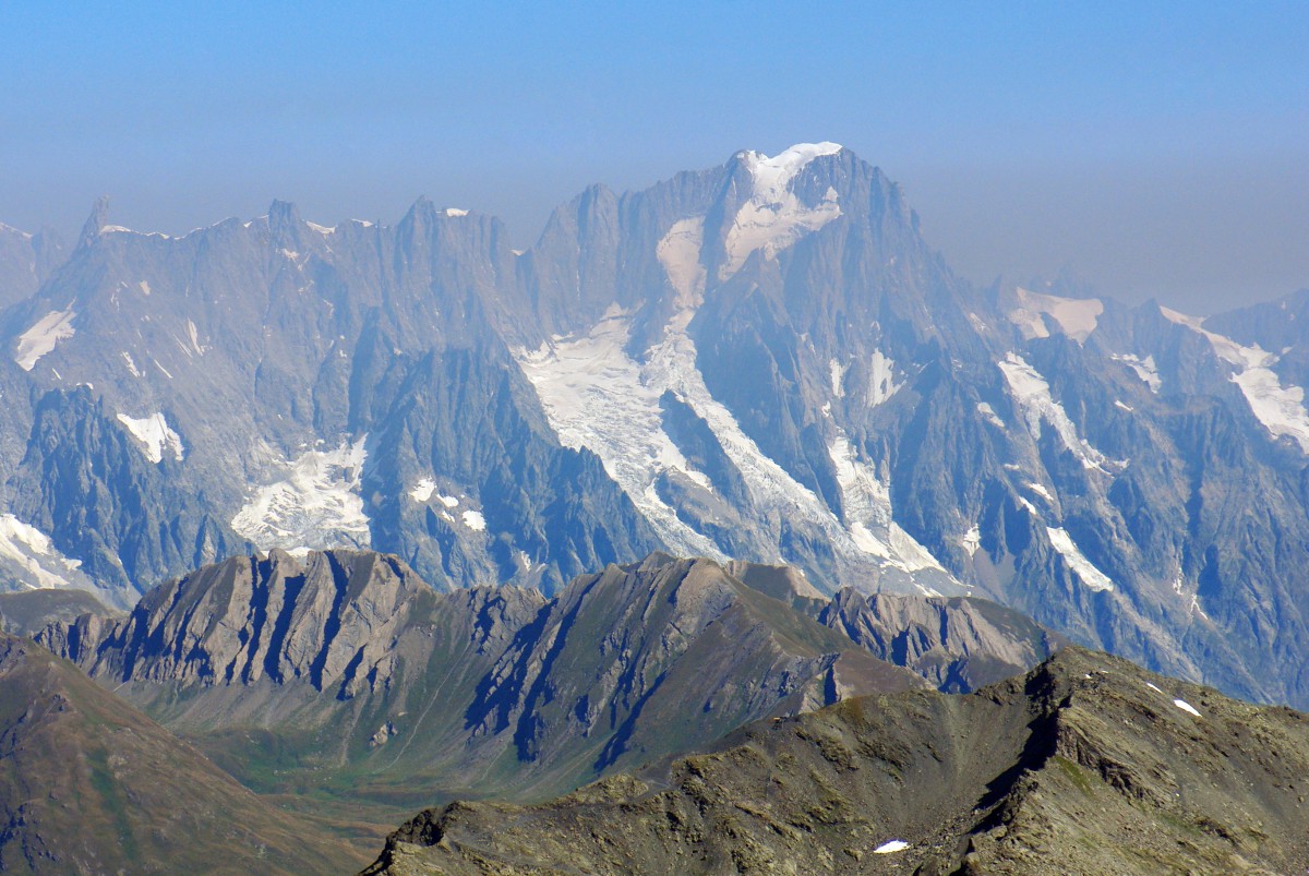
That said, the mount’s side we saw is the Italian one (as it is for all the other viewpoints from the Tarentaise Valley). This flank is definitely more abrupt than the French side seen from Mount Salève or Geneva. The view of the Mont Blanc massif also includes the Dent du Géant, the arêtes de Rochefort and the Grandes Jorasses.
Recognition of the landscape
Here is a selection of photos we took during our excursion to the Aiguille Rouges. I’ve compiled some of my best photos with the names of the main peaks and mountain chains.
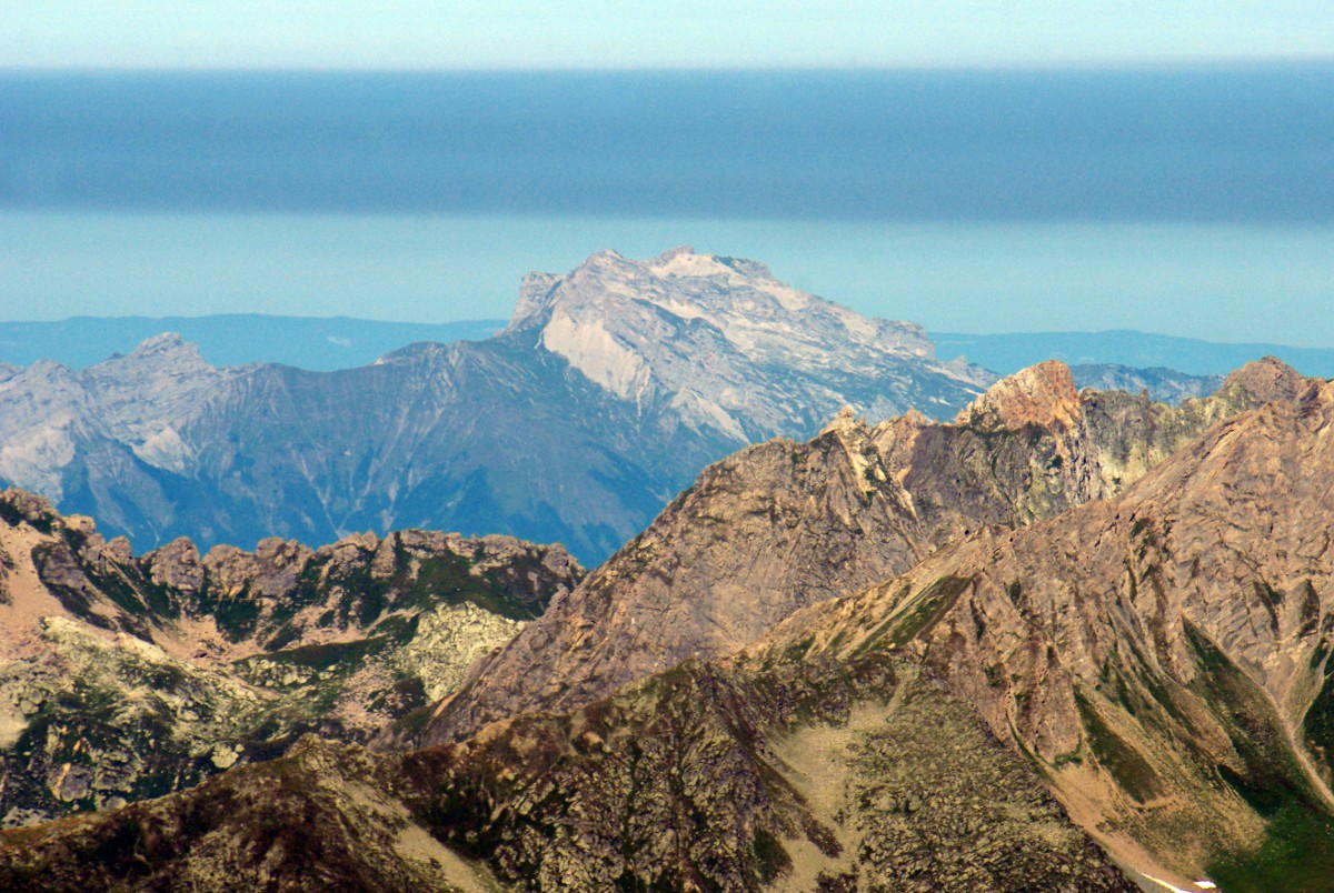
The summit of Mont Blanc, Western Europe’s highest peak (4,810m/15,780ft). It is situated some 30kms as the crow flies:
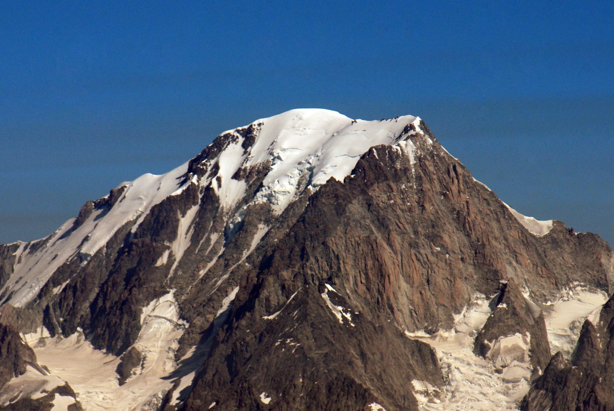
The Grandes Jorasses (4,208m/13,805ft, Mont Blanc massif):
The Bernese Alps in Switzerland, partly hidden in the mist:

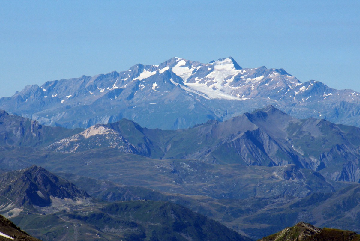
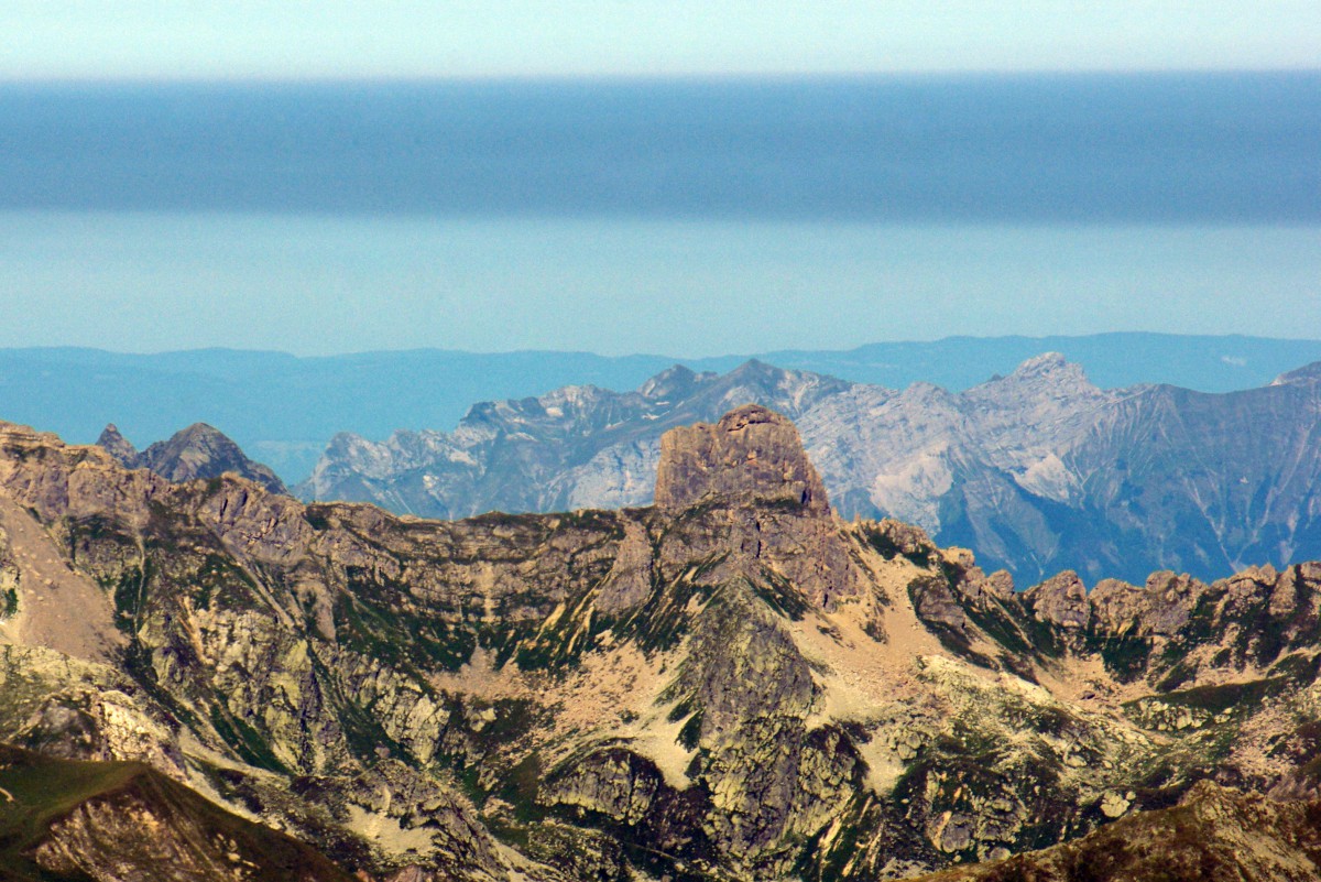
The Graian Alps and, in the distance, the Gran Paradiso massif (to the far right stands the culminating peak of Gran Paradiso at 4,061m/13,323ft) :
The Grivola (3,969m/13,021ft) in the Gran Paradiso massif, Italy, 32km away as the crow flies:
The Grande Sassière (3,747m12,293ft):
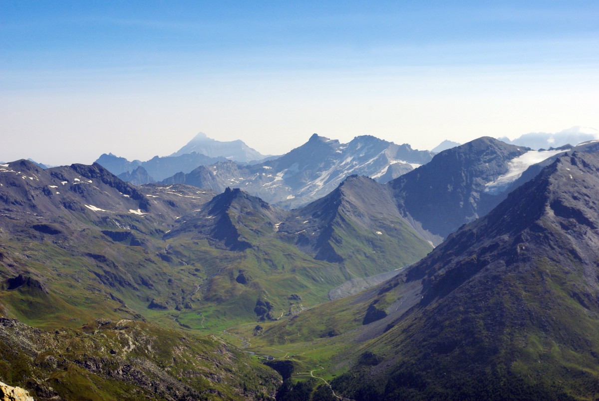
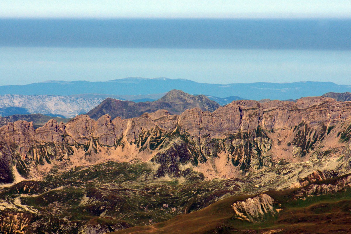
The mountains separating the Tarentaise and Maurienne valleys:
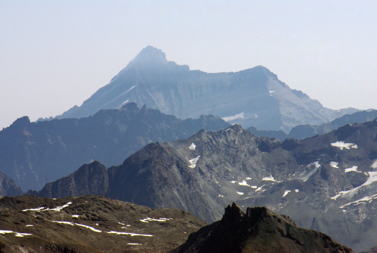
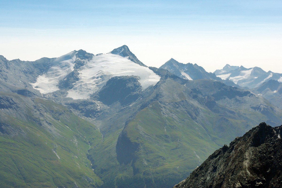
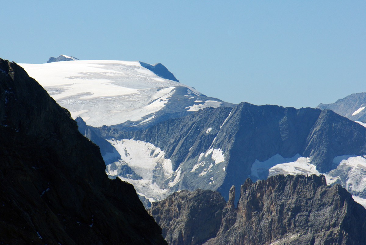
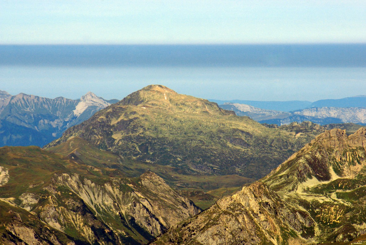
The Mont Pourri (3,779m/12,398ft):
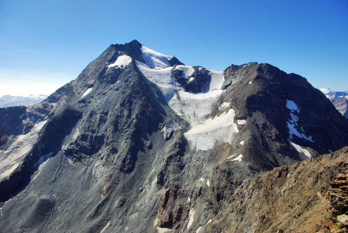
The glacier of Mont Pourri:
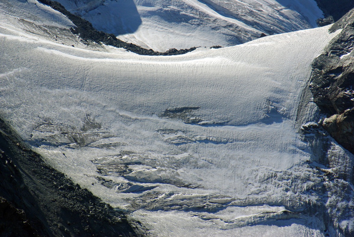
The Mont Pourri hides a significant part of the Vanoise massif. However, you can see a section of the Vanoise glaciers:
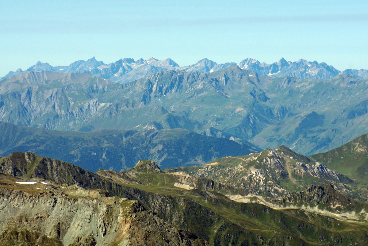
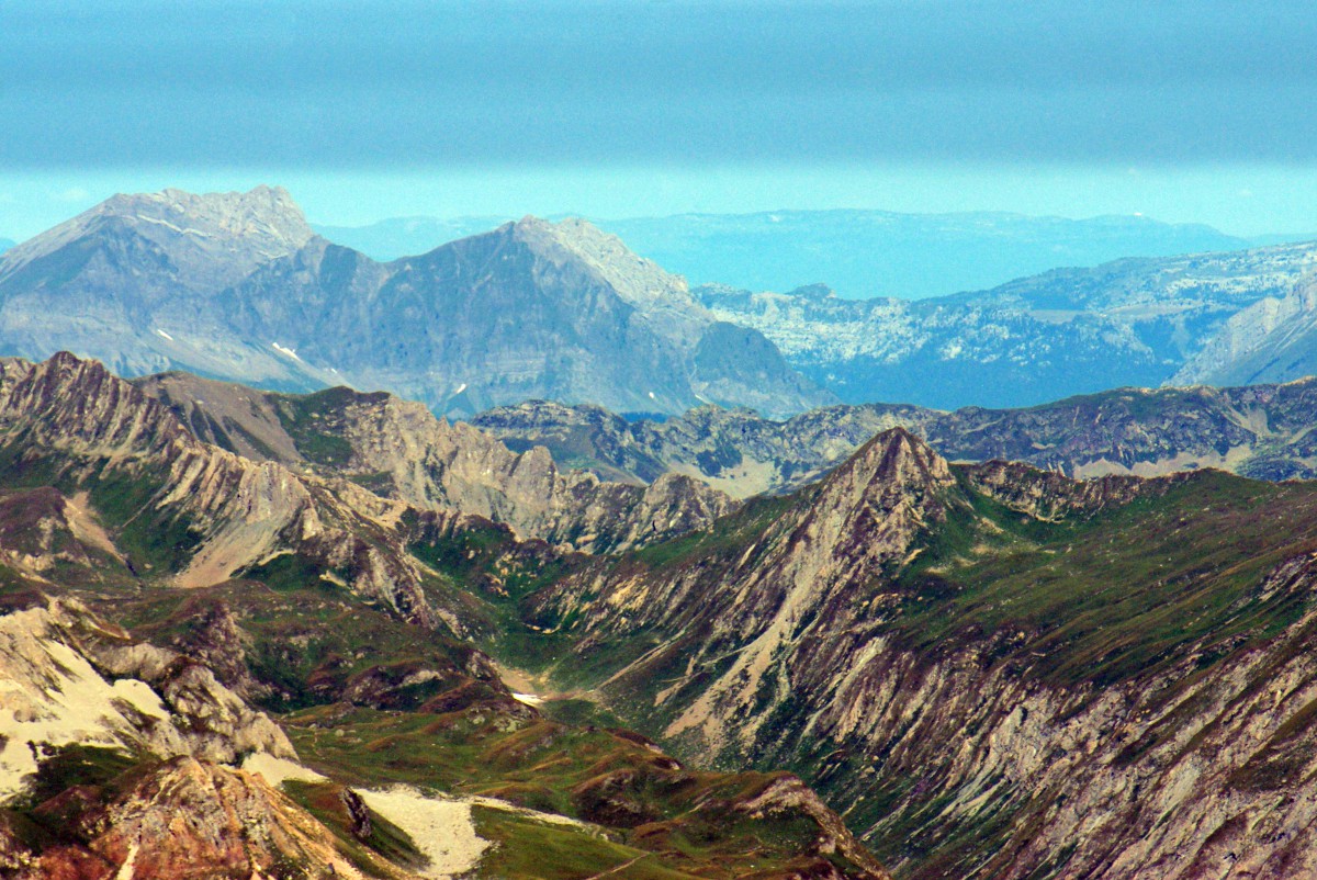
To the South-West appear the snow-capped peaks of the Grandes Rousses (3,465m/11,368ft), a distance of 70km as the crow flies. On the other side is the region of Grenoble:
As for the Ecrins, they are hidden by the Mont Pourri. Further North stands the Belledonne chain, whose peaks can be spotted in the background (max. height 2,977m/9,767ft):
Then the Lauzière massif (2,829m/9,281ft) :

Below you can see the “Liner” of Plagne Aime 2000, as well as a large part of the domain of La Plagne:
The Aiguille Grive (2,732m/8,963ft) and, in the background, the village of Longefoy with its distinctive red-tiled roofs:
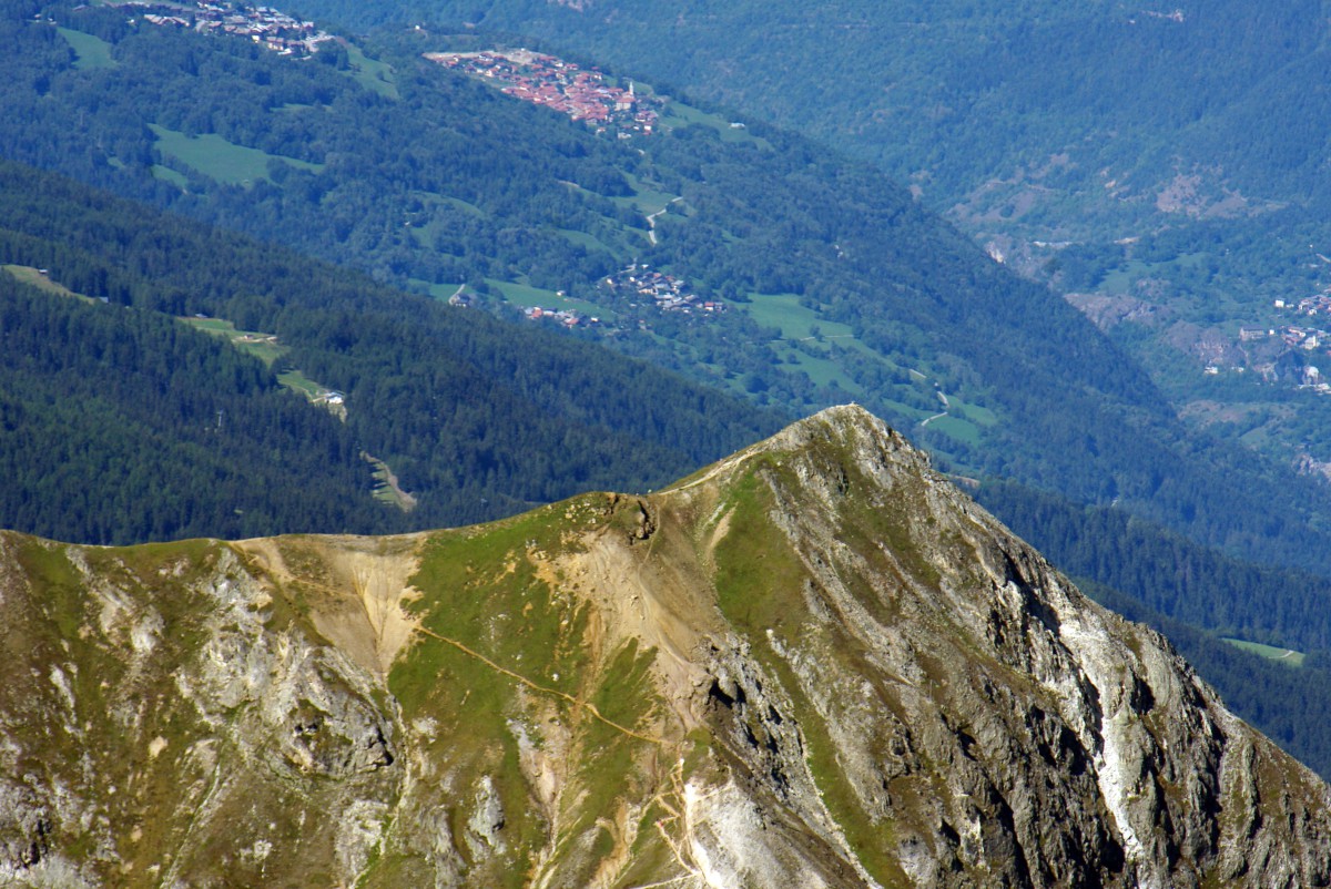
The Aiguille Grive and the village of Villette in the Tarentaise Valley. This is the site of famous quarries of grey marble (marble of Villette). The stone has been used in the region since the Roman era in the construction of several buildings, churches and monuments:
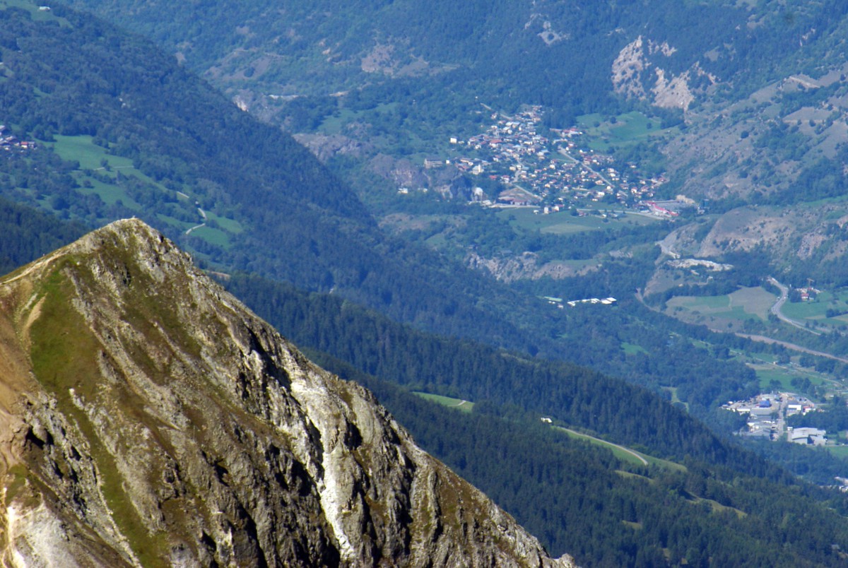
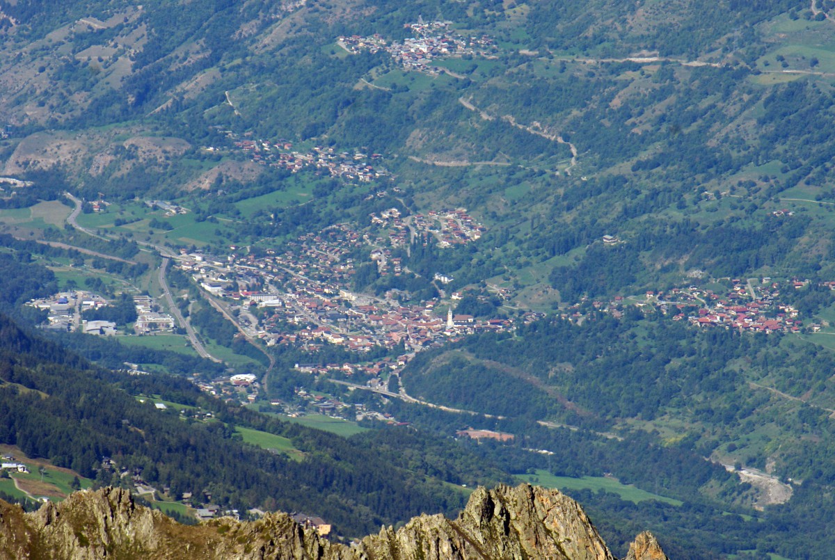
The little town of Aime (700m/2,296ft), the villages of Villaroland and Tessens (to the left) and La Côte d’Aime (to the right):
The Grand Mont d’Arêches (2,686m/8,812ft). Notice on the horizon the blue line of the Jura mountains:
At the forefront of the Portette chain in the Beaufortain, the grassy summit of the Semnoz (above Lake Annecy) and the Grand Colombier (1,534m/5,032ft) in the Jura closing the horizon:
The Pierra Menta (2,714m/8,904ft) and the mountains around Lake Annecy: Crêt des Mouches 2,033m/6,669ft and the Pointe de la Beccaz (2,041m/6,696ft). In the distance, the Jura mountains:
La Tournette (2,351m/7,713ft) is the highest peak in the region of Lake Annecy. In the distance, the blue line of the Jura:
The Aravis chain. To the left, Mont Charvin (2,409m/7903ft) dominates the town of Ugine. The Aravis Pass is located to the right of the photo. In the background, you can clearly spot the Monts Jura and the Crêt de la Neige (1,720m/5,643ft), the massif’s culminating peak. We are 106km away as the crow flies. At the foot of this mountain lies the Swiss city of Geneva:
A large part of the Aravis massif:
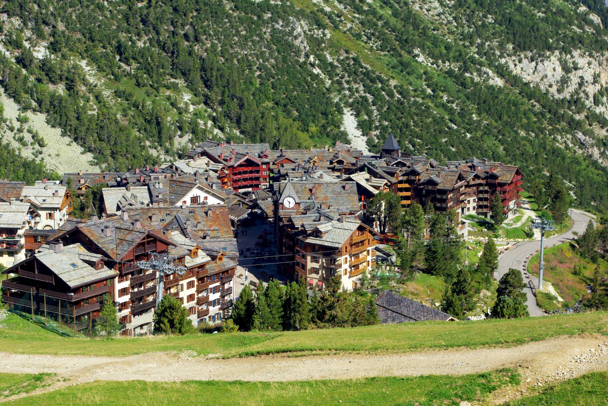
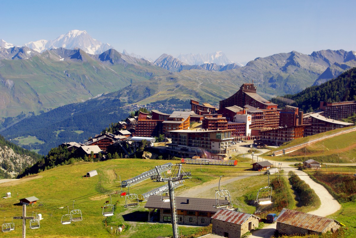
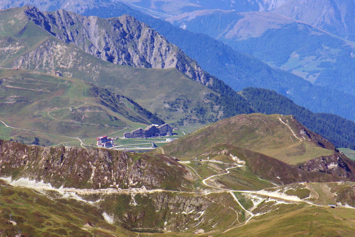
Finally, let’s have a look below us. The picturesque chalets of the beautiful resort of Arc 1950:
Then the audacious buildings of Arc 2000:
Useful tips to go to the Aiguille Rouge
- Don’t expect to walk down from the Aiguille Rouge. (Unless led by an experienced guide.) You’ll have to use the cable car again. And if you suffer from vertigo, try to avoid the cabin’s windows!
- Don’t forget to bring warm clothes (jumper, scarf) with you. Even in Summer, temperatures can be low, particularly in the morning. The summit can be a very windy place. Oh, and take with you your best sunglasses!
- Check out the weather forecast of Les Arcs before heading to the Aiguille Rouge. It would be a shame to arrive at the top entirely surrounded by clouds with zero visibility…
- The cable car operates every 20 minutes. You can stay at the summit to admire the view for as long as you want (we stayed there for 40 minutes).
- Take with you a pair of binoculars. Very handy as the free ones at the summit are very popular and there can be queues to use them! Don’t forget your camera, or grab a good selfie with your smartphone!
- The nearest public toilets from the summit are near the cable car’s lower terminal.
- If you wish to explore the domain of Les Arcs, get a Day Pass at the funicular station in Bourg-Saint-Maurice. Choose the Day Pass that includes the Varet télécabine and the Aiguille Rouge cable car (20 euros in Summer 2018). It will allow you to ride all the ski lifts open to pedestrians in Summer. More info on ski lifts open in Summer (fees, dates, and hours).
- Beware! Access to the Aiguille Rouge is impossible on Monday as the ski lifts (Varet télécabine and cable car) are closed.
Other links about Les Arcs and the Savoie region:
- The website of Les Arcs in Summer
- The dedicated page of Les Arcs on the Aiguille Rouge (times and fees)
Thank you to Les Arcs Tourist Office for making this unforgettable visit possible! Visit their tourist board offices for practical info about the domain of Les Arcs: Bourg-Saint-Maurice, Arc 1600, Arc 1800, Arc 1950 and Arc 2000.
Did you like what you read about the Aiguille Rouge? If so, please share this article on Facebook or Twitter!