

Route Joffre is one of those Vosges roads that seems peaceful at first glance. You drive along it, notice the bends, the forests and the mountain pass signs, and tell yourself that it is simply a pretty road.
Then you start looking into its history.
And suddenly, surprise: this attractive mountain road becomes a strategic road, a wartime road, a road of remembrance, and then a road for hiking, cycling and panoramic views.
Between the Doller Valley and the Thur Valley, it crosses a part of the Alsatian Vosges that is particularly familiar to me.
The Col du Hundsruck, in particular, was the starting point for many family hikes when I lived in southern Alsace as a teenager.
We would regularly park the car at the pass, then set off towards the Rossberg massif, the Thannerhubel and the high pastures. At the time, I did not yet have a camera.
A serious strategic mistake, especially when the landscapes offer you views like these. The images therefore remained more in my memory than in my archives.
Where is Route Joffre?
Route Joffre is located in the southern Alsatian Vosges, in the Haut-Rhin department.
It links the area around Masevaux, in the Doller Valley, with Bitschwiller-lès-Thann, in the Thur Valley. In other words, it connects two major Vosges valleys in southern Alsace.
It is not a very long road. It measures around 15 kilometres. But it contains a great deal: forests, mountain passes, mountain villages, viewpoints, places of remembrance and hiking trailheads.
That is often the case in the Vosges. The distances are reasonable, but the landscapes do not need endless kilometres to become interesting.
An itinerary between the Doller Valley and the Thur Valley
From Masevaux, Route Joffre climbs towards Houppach, then reaches the Col du Schirm. It continues towards Bourbach-le-Haut before arriving at the Col du Hundsruck.
From there, it drops down towards Bitschwiller-lès-Thann and the Thur Valley.
On a map, this may look simple: a road crossing from one valley to another. On the ground, it is far more evocative. You leave the atmosphere of the Doller Valley, cross a mid-mountain landscape, then descend towards the Thur, with the Grand Ballon never far away in the Vosges imagination.
Route Joffre is therefore not just a practical link. It is a road of transition between two worlds.
Route Joffre from Masevaux to Bitschwiller-lès-Thann
One of the charms of this itinerary lies in its stages:
- Houppach retains the atmosphere of the Doller Valley. Here you find the Chapelle Notre-Dame de Houppach, a Marian pilgrimage site which originally housed a Black Madonna.
- The Col du Schirm already announces the climb towards a more forested world.
- Bourbach-le-Haut, perched on the heights, gives that sense of a Vosges village set apart from the main routes.
- Then the Col du Hundsruck opens access to hiking trails, high pastures and panoramic views.
- Finally, the descent towards Bitschwiller-lès-Thann brings you back to the Thur Valley, more industrial in places, but also deeply connected to the High Vosges.
![Houppach © Espirat - licence [CC BY-SA 4.0] from Wikimedia Commons](https://frenchmoments.eu/wp-content/uploads/2026/07/Houppach-©-Espirat-licence-CC-BY-SA-4.0-from-Wikimedia-Commons.jpg "Houppach © Espirat - licence [CC BY-SA 4.0] from Wikimedia Commons")
The Chapel of Houppach © Espirat - licence [CC BY-SA 4.0] from Wikimedia Commons
In just a few kilometres, you pass through a fine variety of landscapes. And you understand why, over time, this road has become popular with motorists, cyclists and walkers.
Route Joffre, a road born from the First World War
Route Joffre owes its interest to more than its landscapes.
It was born in a very particular historical context: the First World War.
Like the Route des Crêtes, it answered a military need. In a Vosges massif that had become a front-line zone, it was necessary to move quickly, supply troops, move men, link positions and control the heights.
Today, we travel it for pleasure. But its origin reminds us that these mountain roads were not always leisure routes.
A strategic road in the Vosges
During the Great War, the Vosges occupied a sensitive position.
Alsace had been annexed by the German Empire since 1871, and the Vosges ridges became a military area of major importance. Roads were not merely routes of passage. They became strategic instruments.
Route Joffre belongs to this logic. It made it easier to move between the valleys, save time, maintain communications and reach mountain sectors.
Its name pays tribute to General Joseph Joffre, a major figure in the French army at the beginning of the conflict.
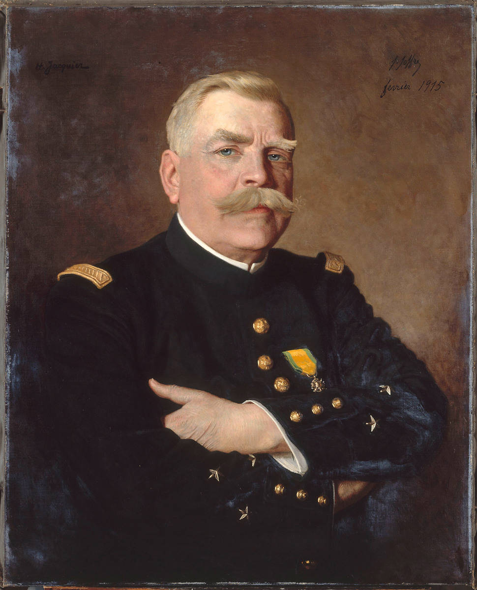
Portrait of General Joffre in 1915 by Henri Jacquier
When you drive along this peaceful road today, you therefore need to imagine a very different context: a monitored, organised, militarised massif. The forest, passes and ridges that we now associate with fresh air were also places of tension, effort and war.
The Col du Hundsruck, a key passage on Route Joffre
The Col du Hundsruck is one of the important points on Route Joffre.
It rises to around 748 metres above sea level and marks the passage between the Bourbach-le-Haut area and Bitschwiller-lès-Thann.
It does not have the altitude of the great Vosges passes such as the Col de la Schlucht, but its location makes it particularly interesting.
It is a linking pass, but also a starting point. And for many hikers, that is what matters most.
![Route Joffre - Col du Hundsruck © Rauenstein - licence [CC BY-SA 3.0] from Wikimedia Commons](https://frenchmoments.eu/wp-content/uploads/2026/07/Col-du-Hundsruck-©-Rauenstein-licence-CC-BY-SA-3.0-from-Wikimedia-Commons.jpg "Col du Hundsruck © Rauenstein - licence [CC BY-SA 3.0] from Wikimedia Commons")
Arriving at Col du Hundsruck © Rauenstein - licence [CC BY-SA 3.0] from Wikimedia Commons
A pass between Bourbach-le-Haut and Bitschwiller-lès-Thann
The Col du Hundsruck links the Doller Valley with the Thur Valley by a forested mountain route.
It lies in an environment that already announces the high pastures of the Rossberg and the Thannerhubel. You are not yet in the great open spaces, but you can feel that they are not far away.
At first glance, the site is fairly modest. A pass, a road, a few signs, and the beginning of several paths. Nothing spectacular at first sight.
But that is precisely the charm of certain Vosges places. They do not try to impress immediately. You need to know them, walk a little, leave the roadside, and suddenly the landscape takes on its full dimension.
![Route Joffre - Col du Hundsruck © Smatu - licence [CC BY-SA 4.0] from Wikimedia Commons](https://frenchmoments.eu/wp-content/uploads/2026/07/Col-du-Hundsruck-©-Smatu-licence-CC-BY-SA-4.0-from-Wikimedia-Commons.jpg "Col du Hundsruck © Smatu - licence [CC BY-SA 4.0] from Wikimedia Commons")
Col du Hundsruck © Smatu - licence [CC BY-SA 4.0] from Wikimedia Commons
The National Monument to the Shock Troops
Near the Col du Hundsruck stands the National Monument to the Shock Troops (Monument national des Troupes de Choc).
![Route Joffre - Monument National des Troupes de Choc © Smatu - licence [CC BY-SA 4.0] from Wikimedia Commons](https://frenchmoments.eu/wp-content/uploads/2026/07/Monument-National-des-Troupes-de-Choc-©-Smatu-licence-CC-BY-SA-4.0-from-Wikimedia-Commons.jpg "Monument National des Troupes de Choc © Smatu - licence [CC BY-SA 4.0] from Wikimedia Commons")
Monument National des Troupes de Choc © Smatu - licence [CC BY-SA 4.0] from Wikimedia Commons
t recalls the more recent military history of the area, particularly the battles of the Liberation and the role of these units in operations during the Second World War.
This monument adds a memorial dimension to a place that could too easily be reduced to a simple hiking trailhead. In the Vosges, the landscapes are often beautiful, but they are never entirely innocent. They carry traces, memories, names and battles.
Route Joffre tells the story of the First World War. The monument recalls another conflict. The pass therefore becomes a point where nature, passage and remembrance meet.
Hiking from the Col du Hundsruck
For me, the Col du Hundsruck first and foremost evokes hiking.
It was one of our regular starting points when we went walking as a family in the southern Vosges. We would park the car at the pass, then follow the paths towards the heights.
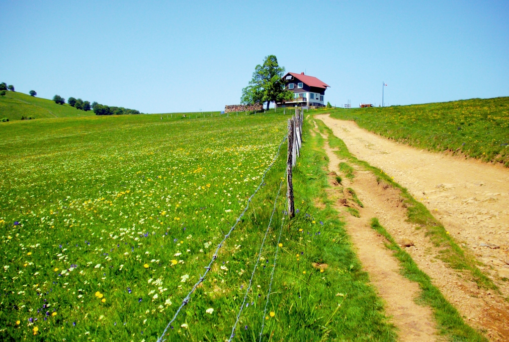
From there, the Rossberg massif gradually opens up. The forests give way to high pastures, the views clear, and you quickly understand that this sector offers some of the finest panoramas in southern Alsace.
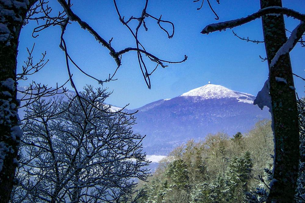
View of the Grand Ballon in winter from the Rossberg massif © French Moments
Towards the Thannerhubel and the Rossberg
The hikes towards the Thannerhubel and the Rossberg are among the finest in the area.
The Thannerhubel, at 1,183 metres, with its high pastures and farm inn, offers a magnificent balcony over the Vosges.
The Rossberg, at 1,191 metres, is broader and gives that impression of open space which I deeply associate with the Alsatian High Vosges.
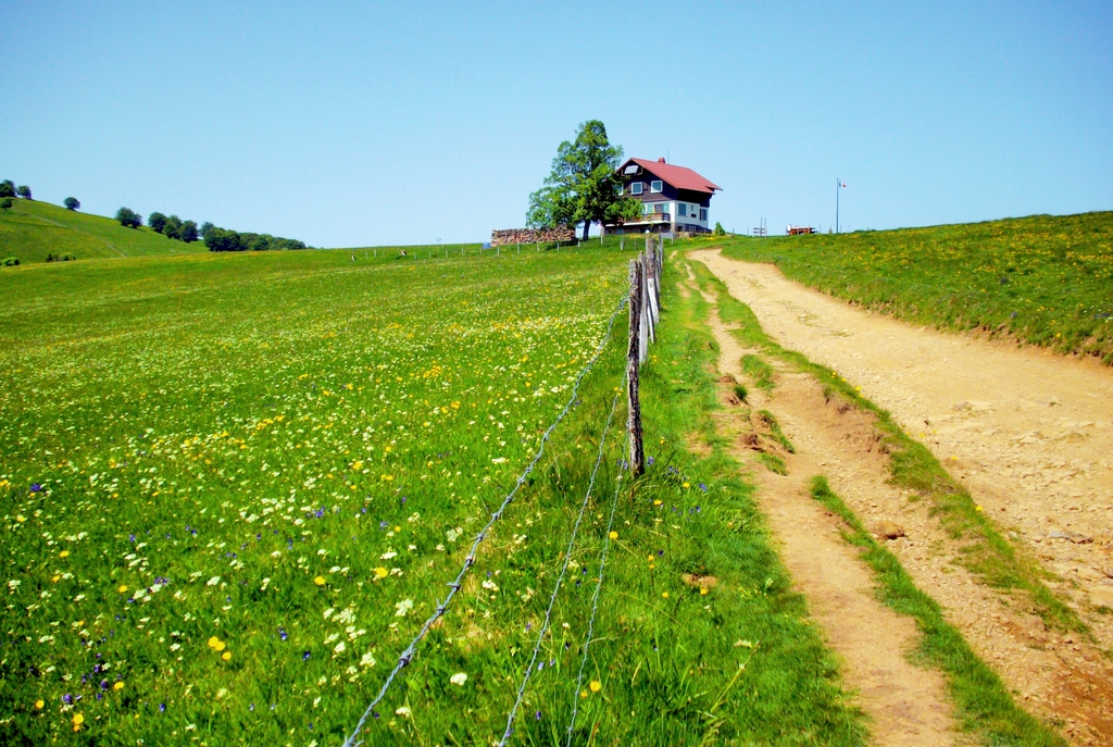
On the heights of the Rossberg massif © French Moments
You first walk through forest, then the landscape widens. The trees become fewer, the wind arrives, and the horizons open up. It is one of those moments hikers know well: after the effort of the climb, the mountain finally rewards you.
And in the Vosges, the reward is not always spectacular in the Alpine sense of the word. It is gentler, broader, more rounded. But it can be just as moving.
Farm inns and breaks on the heights
The area is also associated with farm inns.
Thanner-Hubel, Gsang, Belacker: these names are part of the Vosges experience. This is not merely about having something to eat. It is a way of experiencing the mountains.
After a walk across the high pastures, a Vosges farm inn takes on the appearance of an official reward. There is the view, the cooler air, the wooden tables, generous dishes, cheeses, tarts, potatoes, and sometimes the famous repas marcaire.
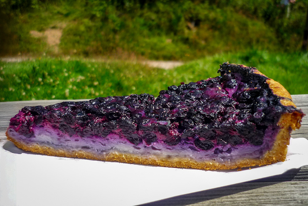
A slice of Vosges blueberry tart © French Moments
One can always pretend that the purpose of the hike was the panorama. But let us be honest: when the farm inn appears at the end of the path, motivation suddenly takes on a very practical flavour.
Panoramas over the Vosges, Alsace and the Alps
The heights of the Rossberg and the Thannerhubel offer remarkable views.
On a clear day, the eye takes in the Vosges, the Thur and Doller valleys, the Grand Ballon, the Alsace Plain, the Sundgau, the Black Forest and the Jura. And when conditions are particularly favourable, the Alps appear on the horizon.
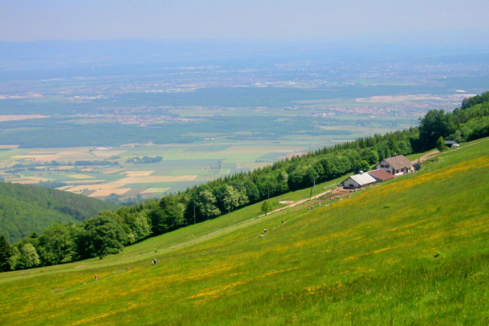
View over Thann and the Alsace Plain from the Thannerhubel © French Moments
This is the kind of panorama that gives the area all its value.
You then understand that the Col du Hundsruck is not merely a point of passage on a historic road. It is also a gateway to one of the most beautiful natural viewpoints in the southern Vosges.
The views from these heights have something very Alsatian about them: they bring together in a single glance the mountains, the plain, the valleys, the forests, and sometimes even the great distant horizons.
You walk in the Vosges, but your gaze travels much further.
Route Joffre by bike and the Tour de France
Route Joffre is also a fine terrain for cyclists.
It does not have the fame of the Ballon d’Alsace or the Grand Ballon, but it offers a serious, varied and very interesting climb.
Between Masevaux and Bitschwiller-lès-Thann, the profiles change, the slopes follow one another, the flatter sections are deceptive, and the bends remind you that the Vosges are never entirely flat, whatever some optimistic visitors may believe.
![Route Joffre - Bourbach le Haut © Michielverbeek - licence [CC BY-SA 3.0] from Wikimedia Commons](https://frenchmoments.eu/wp-content/uploads/2026/07/Bourbach-le-Haut-©-Michielverbeek-licence-CC-BY-SA-3.0-from-Wikimedia-Commons.jpg "Bourbach le Haut © Michielverbeek - licence [CC BY-SA 3.0] from Wikimedia Commons")
Bourbach le Haut © Michielverbeek - licence [CC BY-SA 3.0] from Wikimedia Commons
The Col du Hundsruck by bike
By bike, the Col du Hundsruck can be climbed from several sides.
From the Thur Valley, the ascent via Bitschwiller-lès-Thann is shorter, but fairly demanding. From Masevaux, the route is longer and passes through Houppach, the Col du Schirm and Bourbach-le-Haut before reaching the pass.
That is what makes this road interesting: it does not offer just one single climb, but a sequence. The legs do not really have time to get bored.
For cyclists who love Vosges roads, Route Joffre has that typical mixture of forest, gradient, villages, bends and sudden views. It may not be the most famous pass in the massif, but it knows how to command respect.
![Route Joffre - Col du Hundsruck © Espirat - licence [CC BY-SA 4.0] from Wikimedia Commons](https://frenchmoments.eu/wp-content/uploads/2026/07/Col-du-Hunsruck-©-Espirat-licence-CC-BY-SA-4.0-from-Wikimedia-Commons.jpg "Col du Hundsruck © Espirat - licence [CC BY-SA 4.0] from Wikimedia Commons")
The Col du Hundsruck seen from Bourbach-le-Haut © Espirat - licence [CC BY-SA 4.0] from Wikimedia Commons
The Tour de France on Route Joffre
The Col du Hundsruck also has its own small place in Tour de France history.
The Grande Boucle crossed it in 1952, 1972, 1997 and 2019, and is due to return in 2026. The first crossings were listed in the mountains classification: third category in 1952, then second category in 1972, 1997 and 2019.
In 2026, the Tour de France once again uses this area during the Mulhouse – Le Markstein Fellering stage. The Col du Hundsruck mainly serves as a transition between the Doller Valley and the Thur Valley, before the major difficulties at the end of the stage towards the heights of Le Markstein.
It may not be the most media-friendly pass in the Vosges. But it regularly reappears in the cycling history of the region. And when you know the road, you understand why: the gradient, bends, forest and sequence of nearby climbs make it a far more serious passage than it appears on a map.
My memories of Route Joffre and the Col du Hundsruck
The Col du Hundsruck holds a special place for me.
It is not merely a point on Route Joffre, nor even just a pass between two valleys. Above all, it evokes hiking departures, family Sundays, paths towards the Rossberg, climbs through the forest, high pastures, farm inns and panoramas that appeared after the effort.
At the time, I did not think about photographing these landscapes. I simply lived them. That was already a great deal. But today, I regret not having more images of those familiar places. Fortunately, a few royalty-free visuals help illustrate this article. But it is not quite the same.
During my most recent stay in Alsace, based in Turckheim, I would have loved to return to Route Joffre and the Col du Hundsruck. Time ran out. It is always the same: you think you have several days ahead of you, and then the diary collapses like a soufflé taken out of the oven too early.
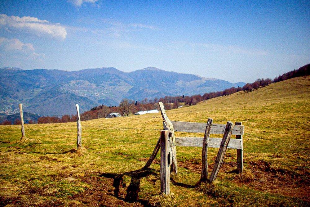
The high pastures of the Rossberg massif © French Moments
So I shall have to go back. This time, with my camera.
Because Route Joffre deserves more than a simple drive-through. It deserves that you stop, walk, look, and understand its history.
It is a military road turned tourist route, a link between the Doller and the Thur, a gateway to the high pastures of the Rossberg and the Thannerhubel, a cycling itinerary and a landscape of remembrance.
And for me, it is also one of those discreet places where the southern Vosges speak softly, but for a long time.