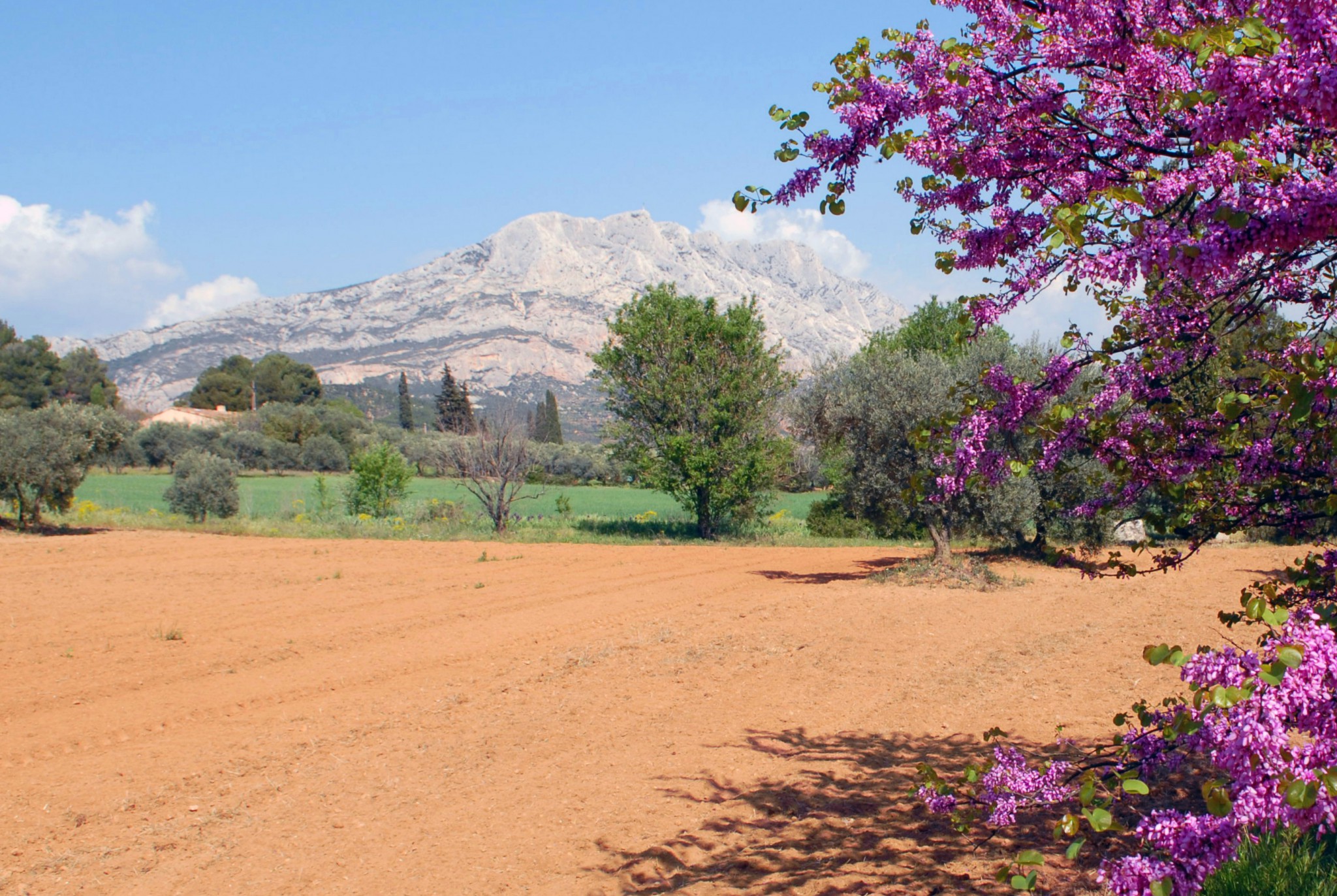

Montagne Sainte-Victoire is an iconic natural landmark in Provence, along with other famous peaks such as Mont Ventoux and Sainte-Baume. The “mountain of Aix” extends over 18 kilometres east of Aix-en-Provence. Reaching 1,011 metres / 3,317 ft at Pic des Mouches, the celebrated mountain owes its fame to painter Paul Cézanne, who could see it from his home in Aix. The peak at the “Croix de Provence” offers spectacular views of Sainte-Baume, the Luberon and the Étoile ranges, the valley of the Durance and the Provençal Alps. Follow the guide!
Geography of Montagne Sainte-Victoire
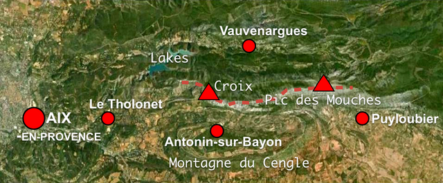
The Sainte-Victoire mountain range extends over 18 kms between the départements of Bouches-du-Rhône and Var. On average the range is 5 km wide. Eleven communes share the mountain’s territory:
- Puyloubier,
- Saint-Antonin-sur-Bayon,
- Rousset,
- Châteauneuf-le-Rouge,
- Beaurecueil,
- Le Tholonet,
- Vauvenargues,
- Saint-Marc-Jaumegarde,
- Pourrières,
- Artigues,
- and Rians.
The mountain range’s highest point is Pic des Mouches (1,011 metres / 3,317 ft). It is one of the highest peaks in the département of Bouches-du-Rhône, behind Pic de Bertagne in the Sainte-Baume range (1,042 m / 3,763 ft).
![Pic de Mouches © Anthospace - licence [CC BY-SA 4.0] from Wikimedia Commons](https://frenchmoments.eu/wp-content/uploads/2013/06/Pic-de-Mouches-©-Anthospace-licence-CC-BY-SA-4.0-from-Wikimedia-Commons-scaled.jpg)
Flora and Fauna
- On its Southern side, the mountain is steep and dominates the Arc basin with vertical limestone crags and sharp ridges. The vegetation is typically Mediterranean with bushes and contorted Aleppo pines.
- On its Northern side, the mountain falls slowly into a series of calcareous plateaux towards the Durance Valley. The vegetation on this side receives less sun and is more alpine.
![Montagne Sainte-Victoire © Georges Seguin - licence [CC BY-SA 3.0] from Wikimedia Commons](https://frenchmoments.eu/wp-content/uploads/2013/06/Montagne-Sainte-Victoire-©-Georges-Seguin-licence-CC-BY-SA-3.0-from-Wikimedia-Commons-scaled.jpg)
The site contains over 900 types of flowering plants which represent 20% of the plant species found in France.
The fauna of the region is rich and diverse comprising hares, boars, bats and hundreds of bird species.
The Lakes
To the North-West of the mountain are two dammed lakes: Lac de Bimont and Lac de Zola.
- The artificial Lac de Bimont was created by Joseph Rigaud between 1946 and 1951 to ensure manageable water resources for the local region.
- Situated downstream of Lac de Bimont, the dam of Lac de Zola takes the name of its architect: François Zola, the father of famous French writer Émile Zola. The dam operated between 1864 and 1877, supplying water to Aix-en-Provence. It still serves as a buffer in case the level of Lac de Bimont falls to emergency low levels.
![Barrage de Zola © Georges Seguin - licence [CC BY-SA 3.0] from Wikimedia Commons](https://frenchmoments.eu/wp-content/uploads/2013/06/Barrage-Zola-©-Wisi-eu-licence-CC0-from-Wikimedia-Commons-scaled.jpg)
![Barrage de Bimont © Georges Seguin - licence [CC BY-SA 3.0] from Wikimedia Commons](https://frenchmoments.eu/wp-content/uploads/2013/06/Barrage-de-Bimont-©-Georges-Seguin-licence-CC-BY-SA-3.0-from-Wikimedia-Commons-scaled.jpg)
A protected area
15,493 hectares of the Montagne Sainte-Victoire range are part of a special protection zone (Zone de Protection Spéciale), at altitudes between 246 and 1,016 metres. In 2004, Montagne Sainte-Victoire received from the Ministry of Environment the prestigious “Grand site de France” label.
![Map of Sainte-Victoire © Boldair - licence [CC BY-SA 4.0] from Wikimedia Commons](https://frenchmoments.eu/wp-content/uploads/2013/06/Map-of-Sainte-Victoire-©-Boldair-licence-CC-BY-SA-4.0-from-Wikimedia-Commons-scaled.jpg)
History of Montagne Sainte-Victoire
The unique silhouette of the mountain, rising high above the hills of Provence, has impressed mankind since time immemorial. The barren crests where the Mistral wind blows strongly and lightning often strikes have led the local inhabitants of Provence to revere the mountain as a god.
The Celto-Ligurians named Montagne Sainte-Victoire the “Vintour” in honour of the god of winds. They also named another emblematic mountain of Provence after the wind (le vent in French): Mont Ventoux.
When the Romans came into the region they originally named Aix-en-Provence ‘Aquae Sextiae’ (the waters of Sextius).
In the 13th century, a chapel dedicated to “Sainte Venture” was built near the summit.
People started to use the name “Sainte-Victoire” in the 17th century. As for its name, there are several explanations:
- Either in memory of the great victory of Marius against the Cimbres and Teutons in 102 B.C. in the vicinity of Aix.
- Or a derivation of Sainte-Venture, a local martyr who died during the Christianisation of the region.
In 1989 a huge fire devastated over 5,000 hectares of forests on the mountain range.
The Croix de Provence
The monumental Croix de Provence stands at the western peak of Montagne Sainte-Victoire at an altitude of 946 metres / 3,104 ft.
![Croix de Provence of Montagne Sainte-Victoire © Benh LIEU SONG - licence [CC BY-SA 3.0] from Wikimedia Commons](https://frenchmoments.eu/wp-content/uploads/2013/06/Croix-de-Provence-Sainte-Victoire-©-Benh-LIEU-SONG-licence-CC-BY-SA-3.0-from-Wikimedia-Commons-scaled.jpg)
Four successive crosses
The current cross is the fourth version standing on the mountain.
The first Croix de Provence was built in the 16th century by a sailor. He had vowed to put up a cross on the first mountain he saw after escaping death from a shipwreck. He made it of wood and with two anchors at its base.
In 1785, Jean Laurans replaced the first cross with a second monument.
A law student from Aix-en-Provence took the initiative to replace the second cross in 1842 as it was rapidly deteriorating. The Croix de Provence hence became a popular pilgrimage site. And so it happened that pilgrims would take away pieces of the monument out of superstition. This practice, along with the effects of the strong Mistral wind, led to its total disintegration by the 1870s!
Today’s monument dates from 1875. Abbot Meissonnier, a Catholic priest from the village of Rousset, vowed to raise the cross in an attempt to ward off two scourges which were plaguing the people of France:
- smallpox and
- the consequences of the Franco-Prussian War (1870-1871).
On 18 May 1875, the Archbishop of Aix-en-Provence, Théodore-Augustin Forcade solemnly blessed the new cross in the presence of 3,000 people.
The description of the Croix de Provence
The present-day monument is 18.25 metres tall and contains, encased inside its metallic base, the 22,000 names of its donors: people, parishes and the dioceses of Aix-en-Provence, Arles and Embrun.
On the base are engraved four inscriptions that correspond to four facing cities:
- Rome – an inscription written in Latin meaning “Great and good God, O Cross, God’s strength is our strength, Salvation! Let your soft light shine far away for the hearts of those who love Jesus and be merciful to those who unfortunately do not love Him”.
- Paris – an inscription in French: “Cross of Provence, blessed by His Grace Monseigneur Théodore-Augustin Forcade, Archbishop of Aix, Arles and Embrun on the 18 May 1875” (Croix de Provence, bénite par Monseigneur Théodore-Augustin Forcade, Archevêque d’Aix, Arles et Embrun le 18 mai 1875).
- Marseille – an inscription in Greek: “Here is to sailors your lighthouse, to traders your profit, to workers your restful place and your wealth”.
- Aix-en-Provence – an inscription in the Provençal dialect: “O salvation Cross! Source of eternal light, with the blood of a God. O written covenant, Provence was first to bow down at your feet. Protect Provence, o Cross of Jesus-Christ”.
![Croix de Provence, Montagne Sainte-Victoire © Technob105 - licence [CC BY-SA 4.0] from Wikimedia Commons](https://frenchmoments.eu/wp-content/uploads/2013/06/Croix-de-Provence-©-Technob105-licence-CC-BY-SA-4.0-from-Wikimedia-Commons.jpg)
Later restorations
Strong winds and several lightning strokes led to the first restoration of the cross in 1982.
Again in 2004, a stone-coloured reinforced concrete base replaced the original one.
The view from the Croix de Provence
The site of the Cross of Provence commands a breathtaking panoramic view.
On a clear day, you can see:
- West: the city of Aix-en-Provence and its suburbs, and the rolling hills of the Aix region.
- South: Cap Canaille (the vertical cliff just off Cassis on the Mediterranean coast), the Étoile range near Marseille, the Vitrolles range and the Crau plain.
- North: the Durance Valley, the Luberon and Mont Ventoux are easily recognisable.
- East are the Sainte-Baume ranges and far away on the horizon, the peaks of the Maritime Alps.
The Gouffre du Garagaï
To the east of the Cross of Provence, near the ridge of Sainte-Victoire lies the “gouffre du Garagaï“.
It is a cave system comprising two natural tunnels open at each end. These caves are a good example of karst phenomena in the mountain.
- The tenebrous “Petit Garagaï” is the deepest at 150 metres long. According to legend, Marius the Roman threw the Teutons through it. The first exploration of the cave took place in 1928.
- The “Grand Garagaï” runs through the mountain from its summit to the cliff. This very large tunnel, slippery and angled opens onto a 400-metre precipitous incline.
Many legends surround these mysterious caves. One can imagine how much some of them must have frightened the children of Aix! Rumour has it that its pit is bottomless and leads straight to hell…
The Sainte-Victoire Priory
![Sainte-Victoire Priory © Matthieu Gauvain - licence [CC BY-SA 3.0] from Wikimedia Commons](https://frenchmoments.eu/wp-content/uploads/2013/06/Sainte-Victoire-Priory-©-Matthieu-Gauvain-licence-CC-BY-SA-3.0-from-Wikimedia-Commons-1.jpg)
The Sainte-Victoire priory is a site of local pilgrimage at an altitude of 888 m / 2,913 ft, near the top of the mountain.
It is likely that Saint-Cassien built a small religious retreat on the site of the current building as early as the 5th century.
Over the years, the priory has received visits from kings and queens such as:
- the four daughters of Ramon Berenguer IV, Count of Provence,
- Beatrix, Queen of Naples and Sicily in the 13th century, and
- Margaret of Anjou, Queen of England in the 15th century.
In the 16th century, the mountain received fervent popular attention with the pilgrimage of the Pertuis brotherhood. People still celebrated it today on the last Sunday of April through the Roumavagi pilgrimage.
![Sainte-Victoire Priory © Maxéco - licence [CC BY-SA 4.0] from Wikimedia Commons](https://frenchmoments.eu/wp-content/uploads/2013/06/Sainte-Victoire-Priory-©-Maxéco-licence-CC-BY-SA-4.0-from-Wikimedia-Commons-scaled.jpg)
The present-day priory
In 1654, Jean Aubert, Master of Liturgical Celebrations at Aix Cathedral constructed the present-day priory. In order to host the growing number of pilgrims, he added a chapel devoted to Notre-Dame de la Victoire in 1656 as well as a convent in 1664.
After his death in 1692, the religious life of the priory declined and only a few hermits agreed to remain living at the priory. However, pilgrims from the brotherhoods of Vauvenargues, Aix-en-Provence and Pertuis continued to visit the priory regularly.
Practically abandoned in the 18th and 19th centuries, the buildings of the priory deteriorated. In 1954, the Henri Imoucha and the “Friends of Sainte-Victoire” society endeavoured to restore the buildings of the priory in order to make them “worthy of their prestigious past and their natural destination”.
![Sainte-Victoire Priory © Maxéco - licence [CC BY-SA 4.0] from Wikimedia Commons](https://frenchmoments.eu/wp-content/uploads/2013/06/Sainte-Victoire-Priory-2-©-Maxéco-licence-CC-BY-SA-4.0-from-Wikimedia-Commons-scaled.jpg)
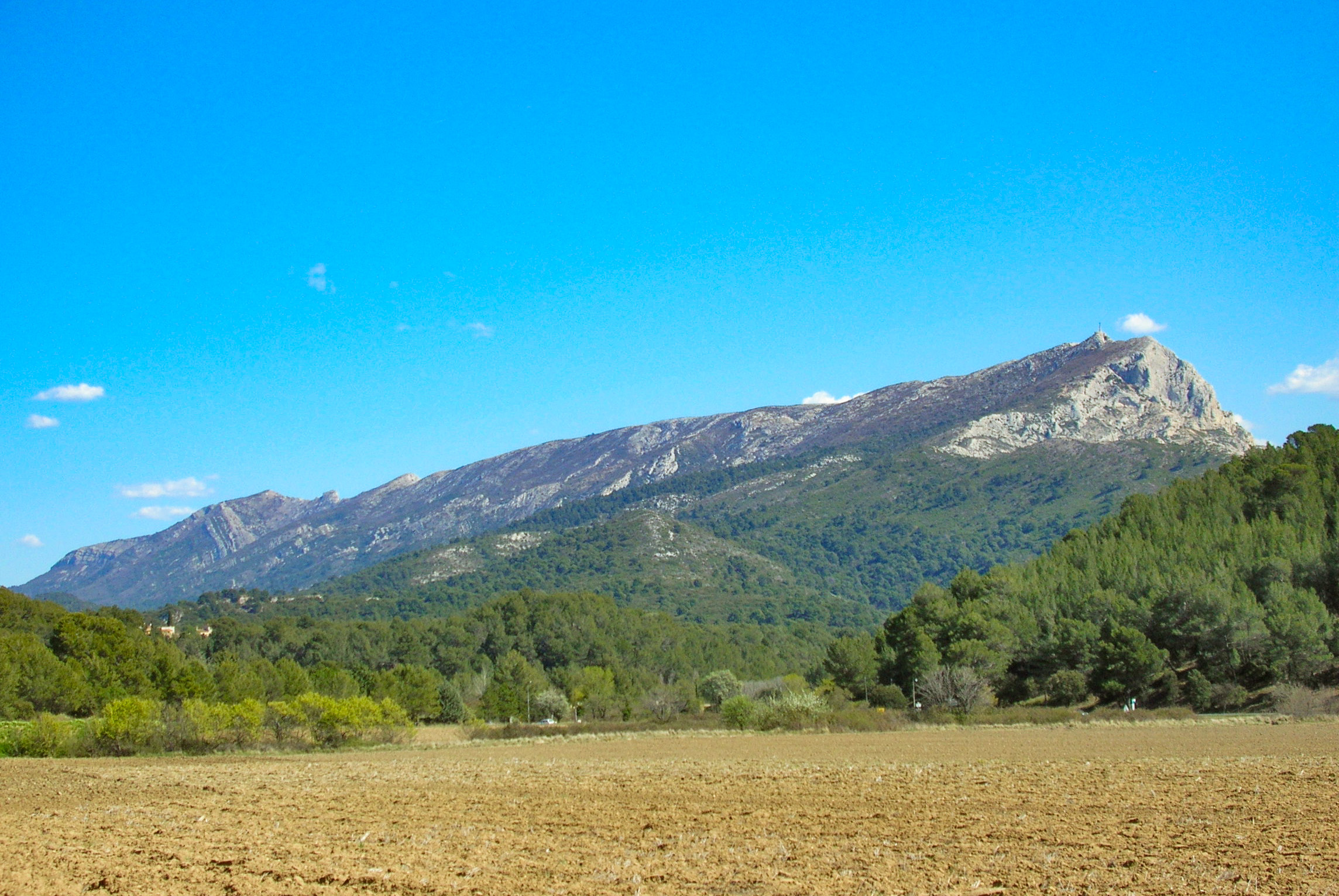
Montagne Sainte-Victoire by road
Starting at Aix-en-Provence, you can drive around the mountain range on a 60-kilometre circuit (D17, DD57D, D24, and D10 roads). The itinerary offers plenty of wonderful viewing points over Sainte-Victoire and many starting points for walks. The itinerary crosses some picturesque villages, such as Vauvenargues, dominated by the steep side of the mountain and natural sites like the wooded Infernet Gorge.
![Road leading to Sainte-Victoire © Georges Seguin - licence [CC BY-SA 3.0] from Wikimedia Commons](https://frenchmoments.eu/wp-content/uploads/2013/06/Sainte-Victoire-Road-©-Georges-Seguin-licence-CC-BY-SA-3.0-from-Wikimedia-Commons-scaled.jpg)
The Cézanne Route
Linking Aix-en-Provence to Puyloubier, the Cézanne Route (D17) runs along the whole length of Sainte-Victoire’s Southern side. The winding road evokes the painter’s memory of when he used to travel to Le Tholonet.
The D17 road offers great views of the towering cliff of Sainte-Victoire in the vicinity of Antonin-sur-Bayon, as well as a diversity of landscapes from the plain of Le Tholonet to the hilly land around Puyloubier.
![Saint-Antonin-sur-Bayon © Mathieu BROSSAIS - licence [CC BY-SA 4.0] from Wikimedia Commons](https://frenchmoments.eu/wp-content/uploads/2013/06/Montagne-Sainte-Victoire-from-Saint-Antonin-sur-Bayon-©-Mathieu-BROSSAIS-licence-CC-BY-SA-4.0-from-Wikimedia-Commons-scaled.jpg)
The little village of Antonin-sur-Bayon houses the Maison de la Sainte-Victoire. Inside is a permanent exhibition of the mountain, in particular the dinosaur eggs which were discovered on the site. It provides information and hiking maps as well as a tourist shop.
At Puyloubier, the castle of the wine domain of Capitaine Danjou houses an Institution of the Légion Étrangère for the wounded legionnaires of the French Foreign Legion. Set in the middle of a magnificent vineyard landscape, the castle has its own museum (entrance free) with a collection of uniforms and ceramics, metalwork and bookbinding workshops.
One of the finest views of Sainte-Victoire is on the D58 between Meyrieul and Beaurecueil The view from here at sunset is unforgettable.
![Montagne Sainte-Victoire from Beaurecueil © Mathieu BROSSAIS - licence [CC BY-SA 4.0] from Wikimedia Commons](https://frenchmoments.eu/wp-content/uploads/2013/06/Montagne-Sainte-Victoire-from-Beaurecueil-©-Mathieu-BROSSAIS-licence-CC-BY-SA-4.0-from-Wikimedia-Commons-scaled.jpg)
Village of Vauvenargues
In the heart of limestone Provence, the village of Vauvenargues is situated in the Infernet valley on the northern slopes of the Sainte-Victoire mountain and to the south of the Ubac mountain.
![Sunrise on Montagne Sainte-Victoire © Ddeveze - licence [CC BY-SA 4.0] from Wikimedia Commons](https://frenchmoments.eu/wp-content/uploads/2013/06/Vauvenargues-©-Mathieu-BROSSAIS-licence-CC-BY-SA-4.0-from-Wikimedia-Commons-scaled.jpg)
The peaceful village is rather small but still has a typical Provencal character with a lively open-air market on Friday morning.
Just outside the village on a rocky hillock above the narrow gorge of River Cose stands the red-shuttered castle.
Vauvenargues Castle
Vauvenargues Castle is actually a fortified bastide, a local name for a Provençal manor house. A bastide, of square or rectangular shape, was usually occupied by a wealthy farmer. With its tile roof and walls of fine ashlar stone, it was larger and therefore more elegant than a Provençal mas.
![Castle of Vauvenargues © Mathieu BROSSAIS - licence [CC BY-SA 4.0] from Wikimedia Commons](https://frenchmoments.eu/wp-content/uploads/2013/06/Château-de-Vauvenargues-©-Mathieu-BROSSAIS-licence-CC-BY-SA-4.0-from-Wikimedia-Commons-scaled.jpg)
The site of the Vauvenargues was occupied in the Roman era by a fort and became a residence for the Counts of Provence during the Middle Ages. In the 13th century, it came into the possession of the Archbishops of Aix-en-Provence before the Marquis de Vauvenargues acquired it in the 17th century.
After the French Revolution, the castle came into possession of the Isoard family. The family in turn sold the castle in 1943 to three industrialists from Marseille who removed all the furniture and a large part of the interior decoration.
In September 1958, the exiled Spanish artist Pablo Picasso acquired Vauvenargues Castle.
Picasso and his wife Jacqueline are buried in the garden of the castle under a 1933 monumental sculpture of “La Dame à l’offrande” (Woman with a Vase). The monument originally decorated the entrance of the Spanish pavilion at the 1937 International Exhibition in Paris.
The castle has since belonged to Catherine Hutin-Blay (daughter of Jacqueline, Picasso’s heir) and is not open to visitors, except in special circumstances.
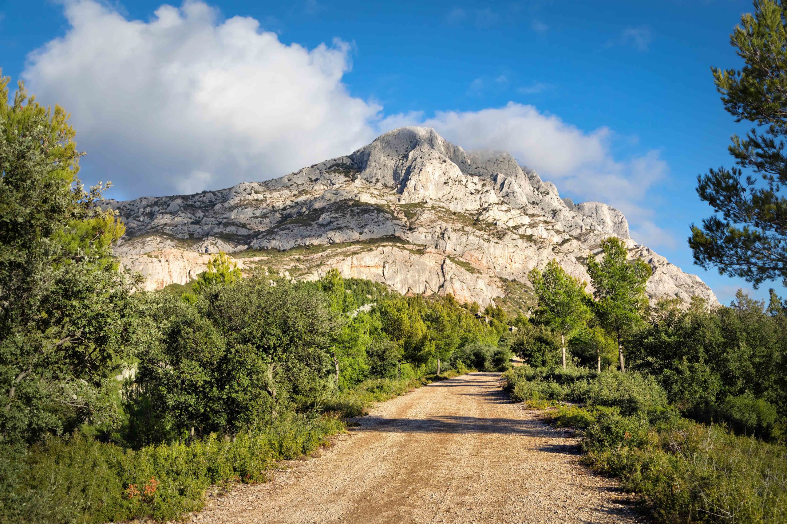
Walking and other activities in Sainte-Victoire
Each year, nearly one million people visit the mountain range and most of them come to hike in and around the mountain.
Several walking tracks lead to a 17th-century priory and to the famous Croix de Provence. The easiest tracks are those starting from the northern approach of the mountain range.
![Path leading to the Croix de Provence © Mathieu BROSSAIS - licence [CC BY-SA 4.0] from Wikimedia Commons](https://frenchmoments.eu/wp-content/uploads/2013/06/Path-leading-to-the-Croix-de-Provence-©-Mathieu-BROSSAIS-licence-CC-BY-SA-4.0-from-Wikimedia-Commons-scaled.jpg)
There is 250 km of marked footpaths, from half-day to two-day walks. The hiking trail GR 9 (Grande Randonnée) runs the full length of the 17km ridge along with some breathtakingly vertiginous cliff faces. It also involves a challenging 1-2 hour uphill walk from Vauvenargues.
As a result of the great 1989 fire when most of the hillside was deforested, access is heavily restricted and can be banned from July to September. Therefore, avoid walking under the hot summer sun between 11 am and 3 pm. Also, make sure to wear a hat and bring plenty of water and sunscreen. The shooting season runs between 13 September and 13 January. Hiking is often restricted to the main paths and hikers should wear bright clothing.
Read more about walking on Sainte-Victoire on Mostly Walking.
Apart from walking, the mountain range welcomes other sporting activities such as mountain biking, climbing, paragliding and speleology.
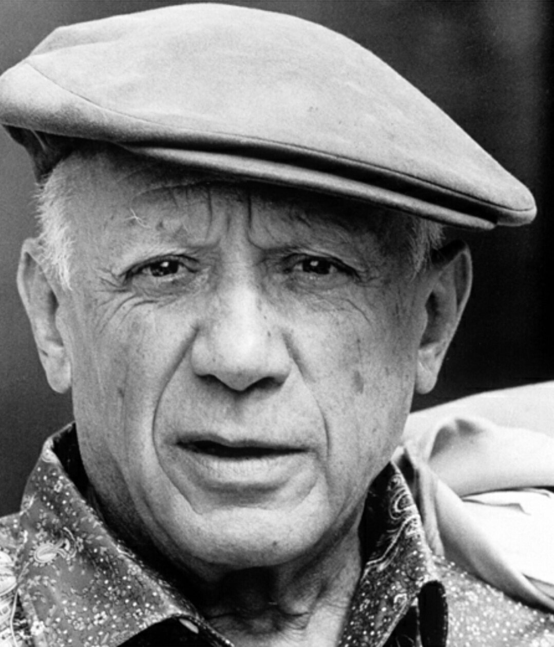
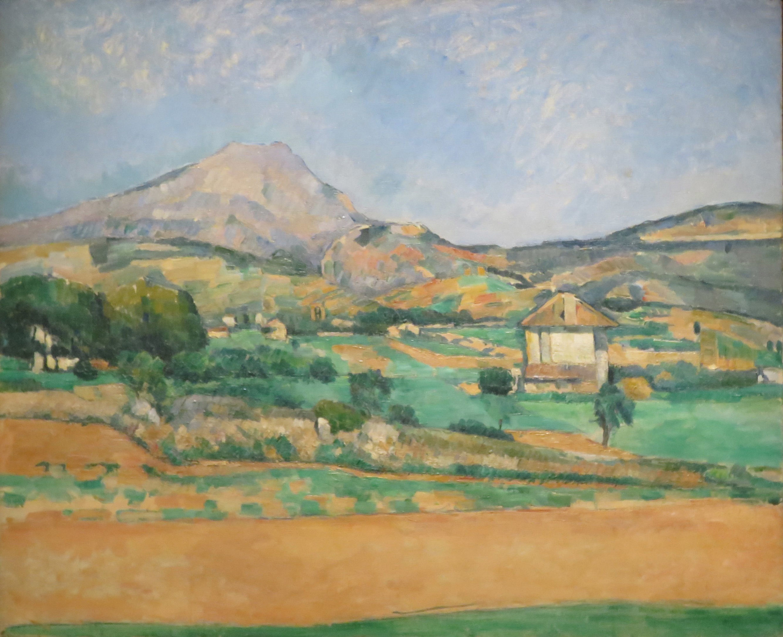
Montagne Sainte Victoire and Paul Cézanne
Paul Cézanne, the famous post-impressionnist artist native to Aix-en-Provence, immortalised the Montagne Sainte-Victoire in more than sixty paintings.

Before him, Montagne Sainte-Victoire was not as well known as Sainte-Baume. In fact, the painter contributed to its worldwide recognition, hence its nickname: “Cézanne’s Mountain”.
Today, you can admire Cézanne’s oil paintings and watercolours in private collections and in some of the world’s largest museums such as the:
- National Gallery of Art, Washington D.C.
- Musée d’Orsay, Paris
- Hermitage Museum, Saint Petersburg
- National Gallery, London
- Metropolitan Museum of Art, New York
- J. Paul Getty Museum, Los Angeles
- Tate Gallery, London
- National Gallery of Australia, Canberra
- Museum of Fine Arts, Boston
Cézanne would settle in front of the Montagne Sainte-Victoire with his easel, his canvas, his box of paints, his palette and his paintbrushes, protected from the wind, sun and indiscreet glances behind umbrellas.
Interestingly enough, the painter never featured the Cross of Provence in any of his reproductions of Sainte-Victoire. Yep, it’s a bit like erasing the Eiffel Tower from my photos of Paris because I don’t like it! 🤪
More photos of Montagne Sainte-Victoire
![The countryside of Vauvenargues © Mathieu BROSSAIS - licence [CC BY-SA 4.0] from Wikimedia Commons](https://frenchmoments.eu/wp-content/uploads/2013/06/Vauvenargues-Countryside-©-Mathieu-BROSSAIS-licence-CC-BY-SA-4.0-from-Wikimedia-Commons-scaled.jpg)
![Road near Sainte-Victoire © Spielvogel - licence [CC BY-SA 3.0] from Wikimedia Commons](https://frenchmoments.eu/wp-content/uploads/2013/06/Road-near-Sainte-Victoire-©-Spielvogel-licence-CC-BY-SA-3.0-from-Wikimedia-Commons-scaled.jpg)

![The mountain from Trets © Henri Michelon - licence [CC BY-SA 3.0] from Wikimedia Commons](https://frenchmoments.eu/wp-content/uploads/2013/06/Montagne-Sainte-Victoire-from-Trets-©-Henri-Michelon-licence-CC-BY-SA-3.0-from-Wikimedia-Commons.jpg)
![Vineyards of Plateau du Cengle © Amaya13 - licence [CC BY-SA 4.0] from Wikimedia Commons](https://frenchmoments.eu/wp-content/uploads/2013/06/Montagne-Sainte-Victoire-from-Plateau-du-Cengle-©-Amaya13-licence-CC-BY-SA-4.0-from-Wikimedia-Commons-scaled.jpg)
![Montagne Sainte-Victoire from Beaurecueil © François GOGLINS - licence [CC BY-SA 4.0] from Wikimedia Commons](https://frenchmoments.eu/wp-content/uploads/2013/06/Montagne-Sainte-Victoire-from-Beaurecueil-©-François-GOGLINS-licence-CC-BY-SA-4.0-from-Wikimedia-Commons-scaled.jpg)
![May Poppies in Sainte-Victoire © Paul Oublon - licence [CC BY-SA 4.0] from Wikimedia Commons](https://frenchmoments.eu/wp-content/uploads/2013/06/May-Poppies-in-Sainte-Victoire-©-Paul-Oublon-licence-CC-BY-SA-4.0-from-Wikimedia-Commons-scaled.jpg)
![Pic des Mouches and the crest of Montagne Sainte-Victoire © Anthospace - licence [CC BY-SA 3.0] from Wikimedia Commons](https://frenchmoments.eu/wp-content/uploads/2013/06/Crest-of-Sainte-Victoire-©-Anthospace-licence-CC-BY-SA-3.0-from-Wikimedia-Commons-scaled.jpg)
![Montagne Sainte-Victoire Aix-en-Provence © Nicolas Brignol - licence [CC BY-SA 3.0] from Wikimedia Commons](https://frenchmoments.eu/wp-content/uploads/2013/05/Montagne-Sainte-Victoire-Aix-en-Provence-©-Nicolas-Brignol-licence-CC-BY-SA-3.0-from-Wikimedia-Commons.jpg)
Aix-en-Provence: Find out more!
All our pages about Aix-en-Provence on the blog:
- Practical info for planning your visit to Aix-en-Provence
- Aix-en-Provence Old Town: A Discovery Guide
- Cours Mirabeau, Aix-en-Provence
- Aix-en-Provence Cathedral: A Discovery Guide
- Place de l’Hôtel de Ville of Aix-en-Provence
- Place d’Albertas: an elegant square in Aix-en-Provence
- The Calissons of Aix: a Specialty Candy from Provence
- Aix-en-Provence History: A Brief Account
- Around Aix-en-Provence: 10 Beautiful Places to Visit
More info about Aix-en-Provence:
- Discover the historic and cultural region of Provence on the blog
- Visit the Tourist office board of Aix-en-Provence
- Read more about Aix-en-Provence old town on Wikipedia
- Book your accommodation in Aix-en-Provence
Things to do in Aix-en-Provence
Looking for activities and things to do in Aix-en-Provence old town and its surroundings? Check out the offers from our partner Get Your Guide:
Where to stay in Aix-en-Provence?
You can choose from a great range of accommodation in Aix-en-Provence, from hotels to B&B and campings! My recommendation is to book your accommodation near the city centre. Although it’s a more pricey option, you’ll save time on transportation and can access most of the 10 things to see within walking distance.
Also, when possible, don’t wait until the last minute to book as finding hotel rooms can be a problem, especially on weekdays.
To book your accommodation in Aix, click on this affiliate link which will redirect you to our partner booking.com… or use the interactive map below:
Pin it for later!
Featured image: Montagne Sainte-Victoire courtesy of Olivier Risnes


