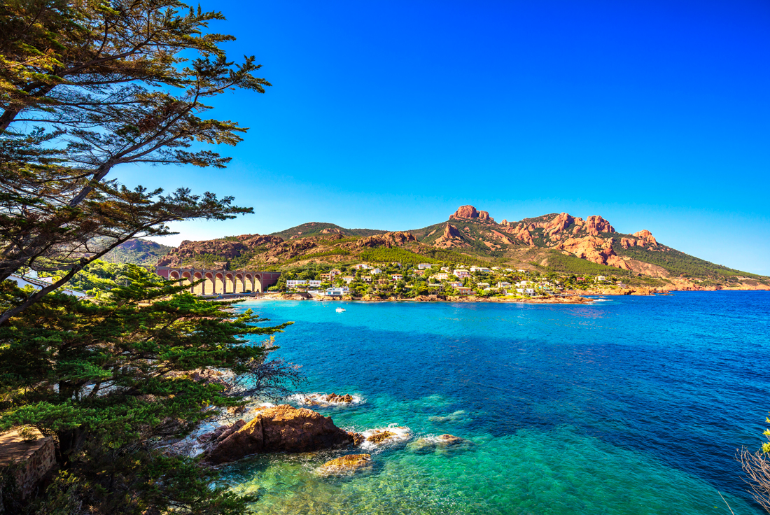
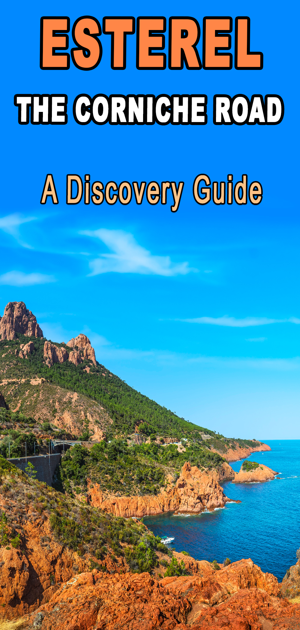
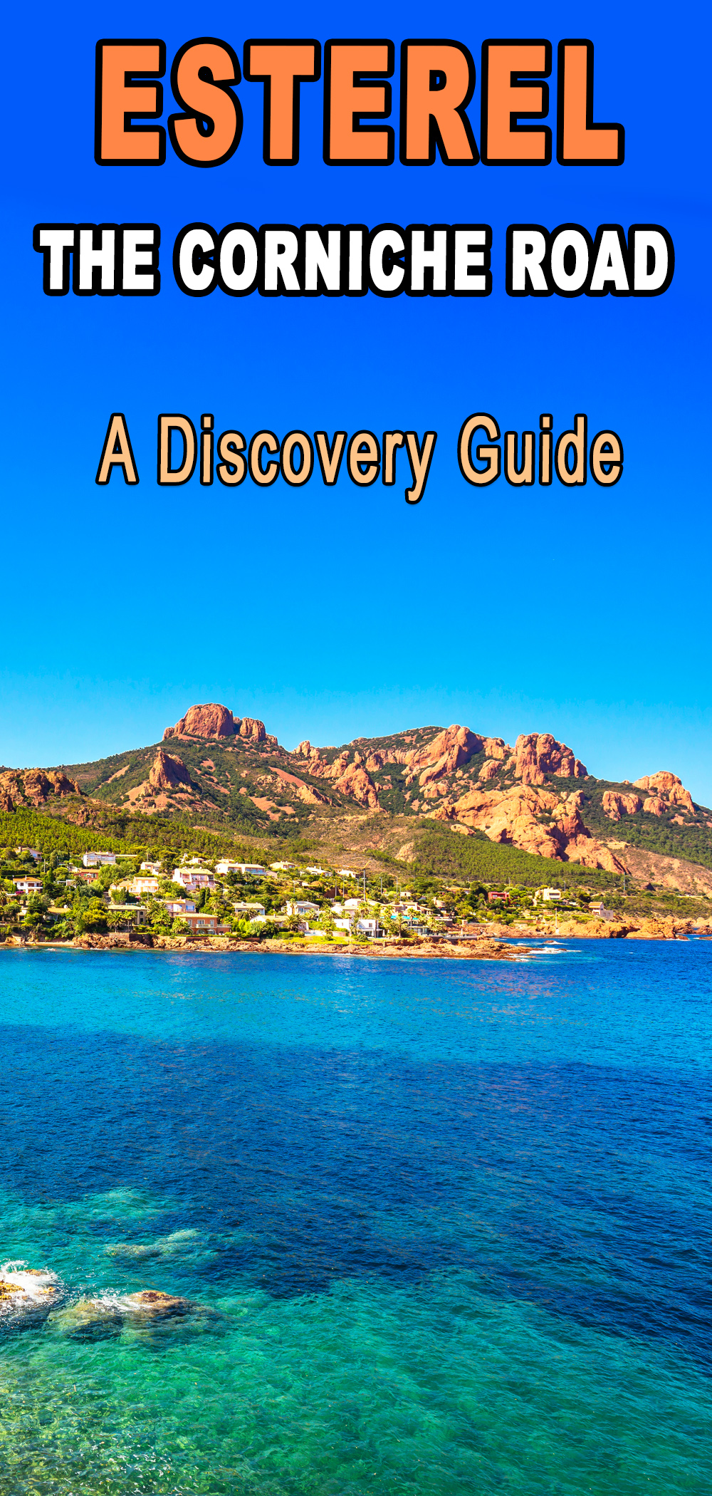
Between Saint-Raphaël and La Napoule, the Esterel massif offers natural scenery which inspires wonder. It is one of the most beautiful regions of Provence, opened to mass tourism since the creation by the Touring Club of the Esterel corniche road or Corniche d’Or (1903). The contrast between the coast’s bustling life and the hinterland’s deserted roads is extraordinary. The latter will undoubtedly please you if you are fond of scenic landscapes. Follow me along the Esterel corniche road to discover this beautiful stretch of the French Riviera.
Watch this short video of the route!
Plan your trip to the Esterel
- 🏨 Find the best accommodations along the Esterel corniche road on Booking.com
- 🙋♀️ Get the PASS CÔTE D’AZUR and take your pick from more than 100 unique experiences!
- 🛥 Take the Esterel Cruise from Saint-Raphaël: 2.5-hour sea and creeks boat excursion
- 📚 Read the DK Eyewitness Provence and the Côte d’Azur Travel Guide
- 🤩 Get familiar with these hotspots of the Côte d’Azur
- 👌 Choose from the following activities in the Esterel region:
What is the Esterel massif?
The Esterel is a Mediterranean coastal mountain range on the French Riviera that covers an area of 320 km². Most of the massif is included in the département of Var [83], and a small part belongs to the Alpes-Maritimes [06]. The Esterel separates two coastal towns: Fréjus and Cannes, and more particularly Saint-Raphaël and La Napoule.
The Esterel, separated from the Maures by the Argens valley, is of low altitude. Like its neighbour, the Maures massif, it has been levelled by erosion for a very long time. The highest point, Mount Vinaigre, reaches only 618 metres (2,027 feet). However, the deep ravines that cut into it and its jagged ridges remove any impression of hills.
![Esterel corniche road - Agay and Anthéor from above © Olivier Cleynen - licence [CC BY-SA 3.0] from Wikimedia Commons](https://frenchmoments.eu/wp-content/uploads/2022/08/Agay-and-Anthéor-from-above-©-Olivier-Cleynen-licence-CC-BY-SA-3.0-from-Wikimedia-Commons-scaled.jpg)
The Esterel consists of magmatic rocks (porphyry), giving the massif its characteristic appearance, jagged relief and bright colouring. These hard porphyries appear in all the beauty of their red colour in the Cap Roux massif. There, the fiery red colour of the rocks contrasts with the sea’s indigo blue.
In the Agay region is blue porphyry, from which the Romans made column shafts for their monuments in Provence. In some places, the colour of the stones turns green, yellow, purple or grey.
Where the mountain throws into the sea
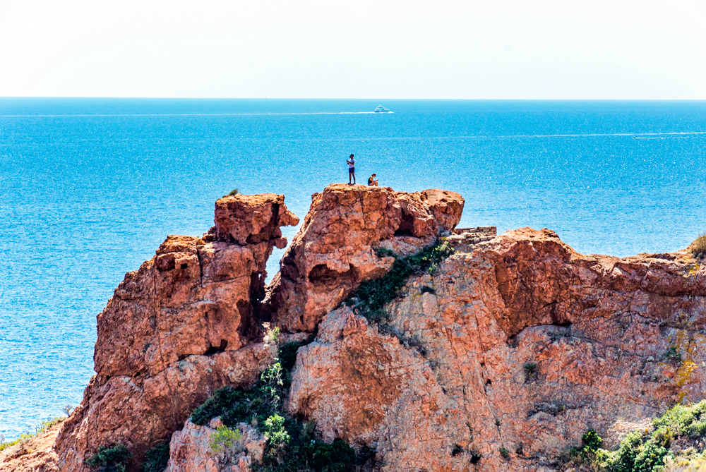
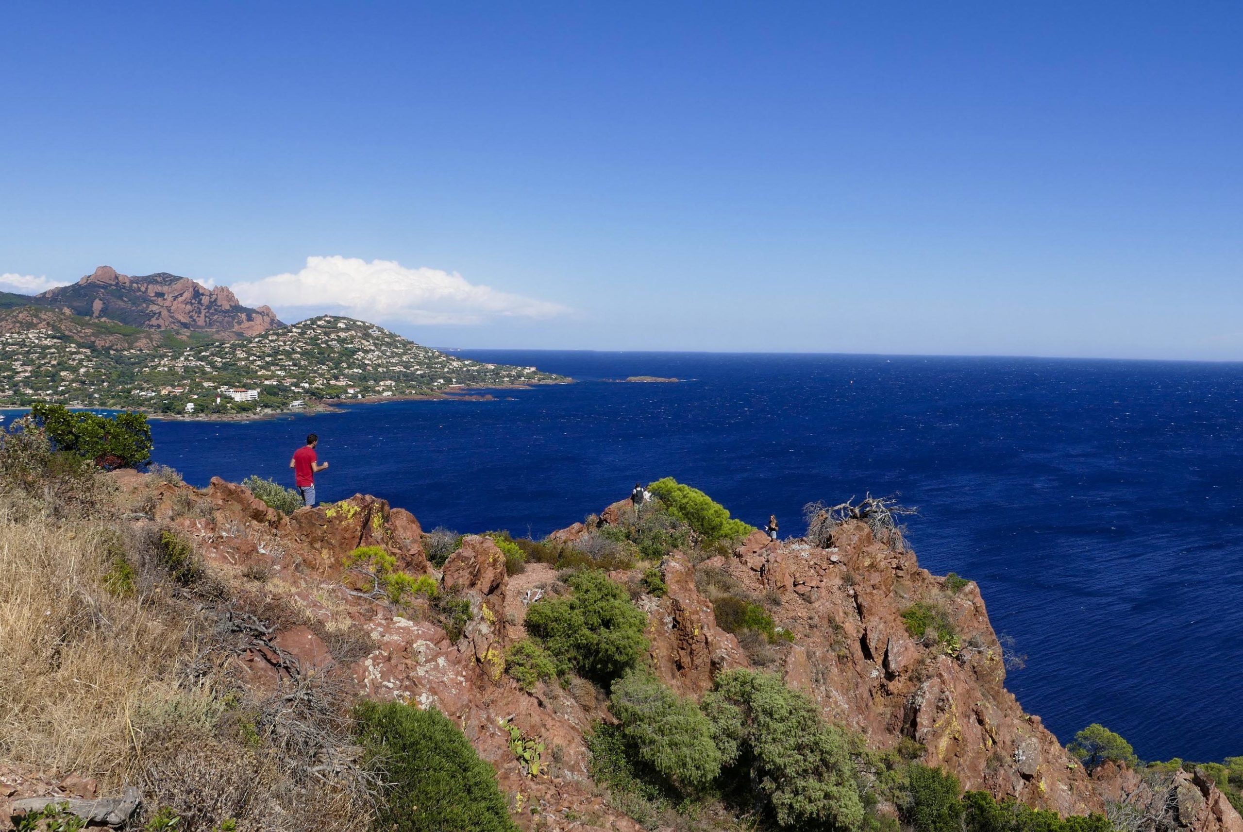
The jagged relief extends into the sea. The mountain seems to push towering promontories out to sea, giving the impression that the sea is penetrating the massif. Indeed, there are only steep points, alternating with tiny bays, narrow coves, small shady beaches or creeks with cliffs. Thousands of rocks and islets emerge in the coastal strip, coloured green by lichens, and reefs show through under the water.
![The Esterel corniche road © Tobi 1987 - licence [CC BY-SA 3.0] from Wikimedia Commons](https://frenchmoments.eu/wp-content/uploads/2019/06/Esterel-©-Tobi-1987-licence-CC-BY-SA-3.0-from-Wikimedia-Commons.jpg)
All along this fiery coastline, you will discover the resorts and viewpoints that make the Esterel corniche road universally famous.
The Esterel forest in danger
Like the Maures, the Esterel was entirely covered by pine and cork oak forests.
![Blavet Bagnols-en-Forêt © Julian Nyča - licence [CC BY-SA 4.0] from Wikimedia Commons](https://frenchmoments.eu/wp-content/uploads/2022/08/Blavet-Bagnols-en-Forêt-©-Julian-Nyča-licence-CC-BY-SA-4.0-from-Wikimedia-Commons.jpg)
Following the great fires that ravaged almost the entire massif in 1943, 1964, 1985, 1986, 2003 and 2007, the original forest remains only in places.
Its replanting requires a massive effort because the disease currently affecting the maritime pine requires reforestation with the introduction of new species (coniferous and deciduous). The Office National des Forêts has undertaken major planting work and has pruned the cork oak shoots.
Under the shelter of the trees, many shrubs and bushes cover the ground: heather, arbutus, mastic, rockrose, thorny broom, lavender, etc. In Provence, this scrubland takes the name of “le maquis“. It slows down erosion, and its flowers of all colours make a delightful spectacle, especially in spring and autumn.
The mountain massif offers hiking and mountain biking trails, including the GR 49 and GR 51.
Where does its name come from?
Linguists have put forward several hypotheses concerning the origin or meaning of the name of the massif, including from:
- the old Provençal estelell around the 14th century, which means “sun”;
- the name of an ancient Ligurian tribe called Suelteri or Suetri who lived in the region;
- the Latin word Sterilis (“barren”) because of the poor soil;
- the Spanish word Sierra Estrella or Portuguese Serra d’Estrella;
- the Provençal word Estèla/Estello (“star”).
The Roman road
The Esterel was bypassed to the north in ancient times by a section of the Aurelian Way (Via Aurelia). This great road, traced in Italy under the Republic and extended in Gaul under the Empire, went from Rome to Arles via Genoa, Cimiez, Antibes, Fréjus and Aix-en-Provence. It was one of the most important roads of the Empire. Today, the old N7 roughly follows its course.
An infamous region
For a long time, the Esterel route was the only one used for traffic with Italy. However, robbery regularly threatened travellers crossing the Esterel. The most dangerous place was near Mont Vinaigre. The stagecoaches followed the path that, starting from the N7 at the Logis-de-Paris crossroads, passed in front of the Malpey forest house (which means “bad mountain”).
The Provençal Robin Hood
The exploits of the bandit Gaspard de Besse (1757-1781) in the 18th century have remained legendary.
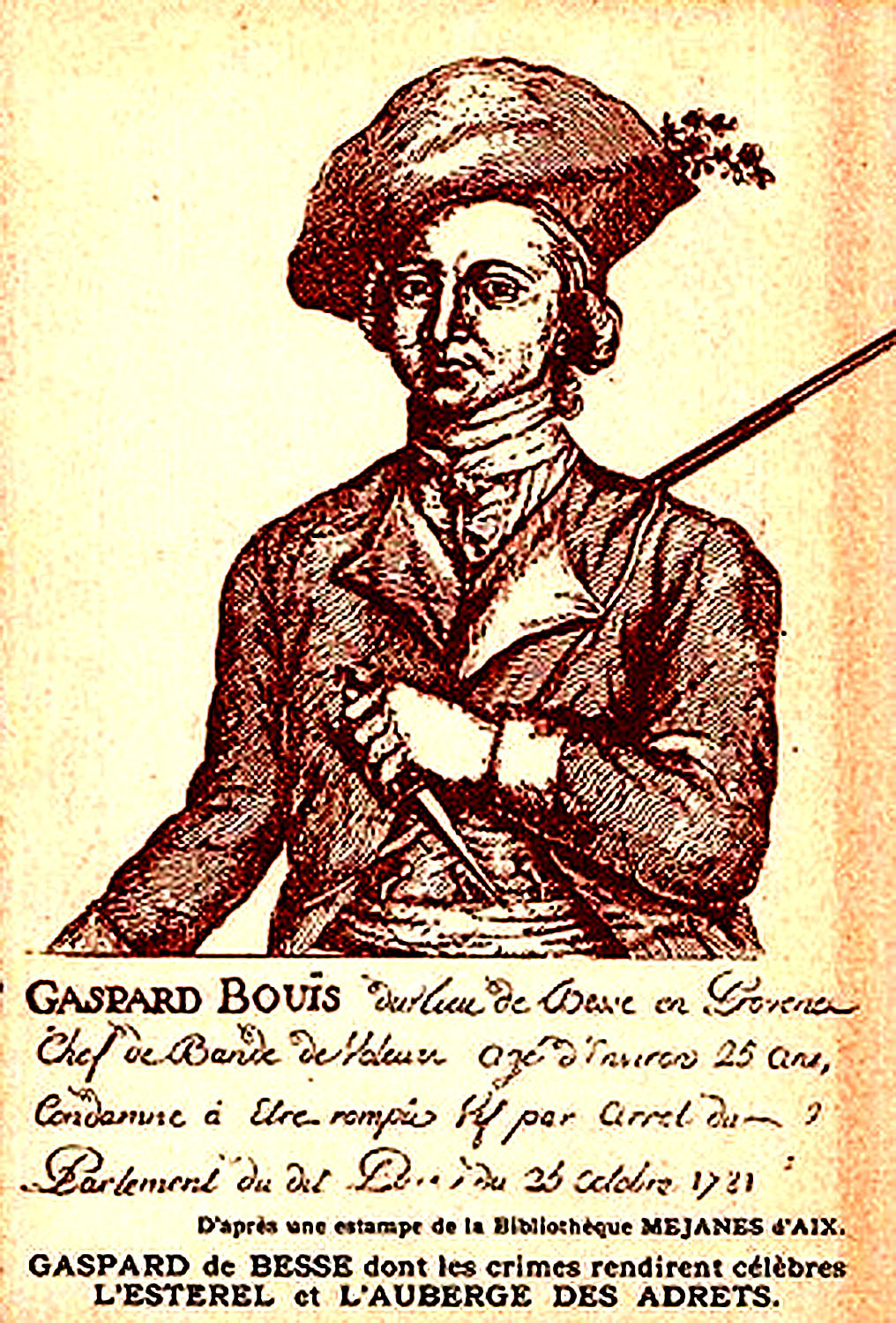
Gaspard and his gang took refuge in a cave on Mount Vinaigre after attacking and robbing stagecoaches or horse riders who passed within range.
The brigand liked elegance: he wore a beautiful red suit decorated with diamonds, buttons and silver buckles. He was a sort of a Provençal Robin Hood to the local population.
For several years, the police were on the lookout. Surprised in an inn near Toulon, the Esterel looter was judged in Aix-en-Provence and sentenced to death in 1781 at 24. His head was nailed to a tree on the main road, the scene of his guilty deeds.
Until the end of the 19th century, the massif was also a refuge for convicts escaping from the Toulon prison.
It was definitely not a good time to spend some time in this part of Provence! But everything changed at the beginning of the 20th century with the construction of the Esterel corniche road.
Operation Dragoon during WW2
Part of Operation Dragoon (Provence landings) took place on the beach of Dramont on 15 August 1944.
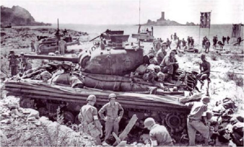
The national necropolis of Boulouris in Saint-Raphaël is the resting place of 464 soldiers. They belonged to the 1st French Army of General de Lattre de Tassigny and were killed during the fighting of the landing.
Where to stay in the Esterel
If you wish to visit the French Riviera and the Esterel, it is essential to choose the location of your base carefully so as not to travel unnecessary distances each day. After all, there is so much to see between Fréjus and Cannes, you don’t want to miss out!
As you can guess, the accommodation possibilities in this part of the Côte d’Azur are very vast.
There is bound to be an accommodation for every desire:
- Are you looking for a palace with a view of the sea?
- A charming bed and breakfast in the heart of a resort?
- A villa surrounded by greenery?
- A comfortable campsite?
- Or one of the most unusual accommodations?
Find your accommodation here or browse the map below:
Driving on the Esterel Corniche Road
The Esterel corniche road is ideal for lovers of driving and beautiful landscapes. Its name is synonymous with La Corniche d’Or (Golden corniche), which refers to the golden aspects of the overhang rocks.
The Esterel corniche road was built on the Touring Club de France initiative from 1901 to 1903 (inauguration on 11 April 1903).
The Touring Club de France (TCF), created in 1890 by a group of velocipedists, is an old association that disappeared in 1983, aiming to develop tourism.
![The Esterel corniche road from above © Olivier Cleynen - licence [CC BY-SA 3.0] from Wikimedia Commons](https://frenchmoments.eu/wp-content/uploads/2022/08/Esterel-from-above-©-Olivier-Cleynen-licence-CC-BY-SA-3.0-from-Wikimedia-Commons-scaled.jpg)
The chief engineers were Perier and Imbert. This achievement was part of a project announced by the Touring Club in 1900 to link Toulon to Genoa. Many actors financed the project: the two départements of Var and Alpes Maritimes, the municipalities, the Touring Club and private subscriptions.
The 45-kilometre-long coastal road links the towns of Saint-Raphaël and La Napoule (D559 and D6098). However, the 13 kilometres stretch between Agay and Le Trayas, carved out of red porphyry, is the most spectacular.
Click here or on the map below to see all the itineraries described in this guide on Google Maps, including the locations of landmarks along the routes.
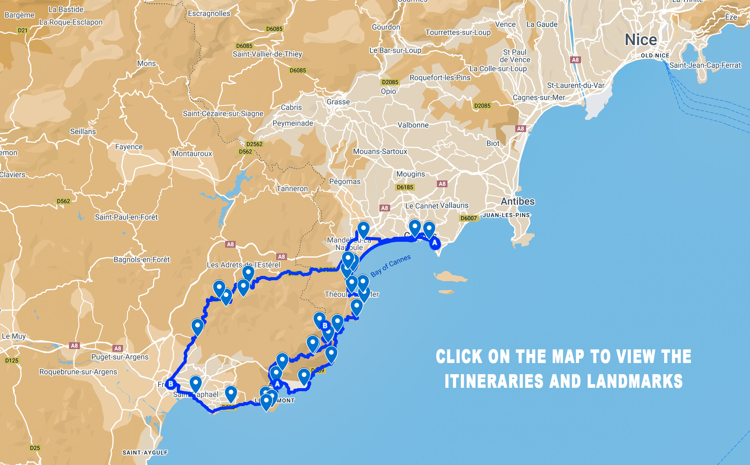
Saint-Raphaël
Saint-Raphaël is a charming resort on the Gulf of Fréjus and at the foot of the Esterel mountain. The old port is very lively with its shops and restaurants. The René-City promenade and the boulevard du Général-de-Gaulle, planted with palm trees and plane trees, offer a beautiful view of the sea and the two red rocks (the Lion de terre and the Lion de mer).
![Saint-Raphaël - Square Bonaparte © Txllxt TxllxT - licence [CC BY-SA 4.0] from Wikimedia Commons](https://frenchmoments.eu/wp-content/uploads/2022/08/Saint-Raphaël-Square-Bonaparte-©-Txllxt-TxllxT-licence-CC-BY-SA-4.0-from-Wikimedia-Commons-scaled.jpg)
Visit the church of Saint-Raphaël, a 12th-century church in the Romanesque style of Provence.
Leave the centre of Saint-Raphaël on the D559 départemental road.
The road runs alongside the marina of Saint-Raphaël. On the esplanade in front of the sea is a high stele. It commemorates the fighting of the French army in Africa during the Second World War.
Boulouris
Boulouris is a small resort with villas scattered among the pine trees. The locality has several small beaches and a marina.
Nécropole Nationale de Boulouris
On 15 August 1964, the then President of the Republic, General Charles de Gaulle, inaugurated the national necropolis. The cemetery contains the bodies of 464 fighters of all origins and confessions killed during the Provence landings in August 1944. These soldiers belonged to the 1st French army led by General Jean de Lattre de Tassigny.
Beach of Dramont
Before reaching the beach of Dramont is a commemorative stele. It is a monument in memory of the soldiers of the landing of the 36th American Division on 15 August 1944.
The beautiful beach of Dramont also takes the name “Plage du Débarquement” in remembrance of Operation Dragoon.
![Esterel Corniche Road - Dramont Beach © Txllxt TxllxT - licence [CC BY-SA 4.0] from Wikimedia Commons](https://frenchmoments.eu/wp-content/uploads/2022/08/Dramont-Beach-©-Txllxt-TxllxT-licence-CC-BY-SA-4.0-from-Wikimedia-Commons-scaled.jpg)
Ile d’Or
Opposite Dramont Beach, 200 metres away, is the Ile d’Or (Gold Island), a private island about 200 metres long. Its landmark is a square tower in the medieval style dating from the early 19th century.
![Ile d'Or © Txllxt TxllxT - licence [CC BY-SA 4.0] from Wikimedia Commons](https://frenchmoments.eu/wp-content/uploads/2022/08/Ile-dOr-©-Txllxt-TxllxT-licence-CC-BY-SA-4.0-from-Wikimedia-Commons-scaled.jpg)
In 1897, a Parisian doctor, Auguste Lutaud, bought it at auction. The eccentric doctor had a medieval-inspired four-storey tower built in red Esterel stone before proclaiming himself king of the island under Auguste I. His sumptuous receptions attracted the socialites of the French Riviera. The monarch died in 1925 and is now resting in his kingdom, which is still private and has changed ownership several times since.
The Île d’Or is said to have inspired Hergé’s 1937 album The Black Island, the seventh in his Adventures of Tintin series.
![Ile d'Or © André ALLIOT - licence [CC0] from Wikimedia Commons](https://frenchmoments.eu/wp-content/uploads/2022/08/Ile-dOr-©-André-ALLIOT-licence-CC0-from-Wikimedia-Commons-scaled.jpg)
Cap Dramont
A path climbs up to the wooded Cap Dramont to reach the Dramont semaphore. Just below is a viewpoint offering a magnificent panorama of the Maures, the gulf of Fréjus, the Ile d’Or, the bay of Agay and the Esterel (Mont Vinaigre and the Pic de l’Ours). To go back down, follow the signposted path that leads to the small port. You will have beautiful views of the creeks with transparent waters.
The quarry of Dramont
In the 1960s, there were nearly 150 quarries in the Esterel. Unprofitable, they ceased their activity. In Paris, the Latin Quarter’s cobblestones are said to have been made from the grey porphyry of a former quarry in Dramont, which has since become a freshwater lake.
Agay
Agay is a charming place to stay on the edge of a deep, circular cove, possibly the best in the Esterel.
Not surprisingly, Agay is a Mecca for scuba diving, thanks to its numerous wrecks. The Ligurians, Greeks and Romans frequented it. Indeed, Roman amphorae have been found underwater, probably from a shipwreck 2,000 years ago.
Antoine de Saint-Exupery, the author of The Little Prince, was a regular resident in Agay, and the writer Guy de Maupassant spent holidays here.
![French Riviera - Côte d'Azur © Frédéric Ducarme - licence [CC BY-SA 3.0] from Wikimedia Commons](https://frenchmoments.eu/wp-content/uploads/2021/05/Agay-from-Dramont-©-Frédéric-Ducarme-licence-CC-BY-SA-3.0-from-Wikimedia-Commons.jpg)
Le Rastel d’Agay (287 m), a mountain with splendid red porphyry slopes, dominates the resort.
The sizeable south-facing beach extends eastwards to a small jetty beyond which lies another, more shaded beach.
Anthéor
The road then passes through the resort of Anthéor. There are several beaches to discover (la Baumette, plage des Lucioles) and beautiful creeks (Calanque des Anglais, Calanque des Nissards, Calanque d’Anthéor, Calanque du Petit Caneiret).
![Esterel Corniche Road - Antheor © Tobi 87 - licence [CC BY-SA 3.0] from Wikimedia Commons](https://frenchmoments.eu/wp-content/uploads/2022/08/Antheor-©-Tobi-87-licence-CC-BY-SA-3.0-from-Wikimedia-Commons-scaled.jpg)
Shortly after leaving Anthéon, stop at a car park overlooking the sea. You can admire the view of the red rocks of Saint-Barthélémy and Cap Roux.
Pointe de l’Observatoire
The Pointe de l’Observatoire is the first of a series of breathtaking lookouts on the Esterel corniche road. Here, one begins to admire the mountains that abruptly fall into the sea through grandiose escarpments of red rock.
![Esterel corniche road - Pointe de l'Observatoire © Santiago Puig Vilado - licence [CC BY-SA 3.0] from Wikimedia Commons](https://frenchmoments.eu/wp-content/uploads/2022/08/Pointe-de-lObservatoire-©-Santiago-Puig-Vilado-licence-CC-BY-SA-3.0-from-Wikimedia-Commons-scaled.jpg)
A car park after the bridge over the railway lets you discover the area on foot. An old blockhouse forms the belvedere, which offers a dreamy view of the rocks and the red and blue sea.
![Esterel corniche road - Pointe de l'Observatoire © avu-edm - licence [CC BY 3.0] from Wikimedia Commons](https://frenchmoments.eu/wp-content/uploads/2022/08/Pointe-de-lObservatoire-©-avu-edm-licence-CC-BY-3.0-from-Wikimedia-Commons-scaled.jpg)
Le Trayas
Once you have reached Cap Roux, the Corniche de l’Esterel road continues along the seafront, offering beautiful views of a multitude of coves and inlets with tiny beaches.
![Esterel Corniche Road - Le Trayas © Lecochonbleu - licence [CC BY-SA 3.0] from Wikimedia Commons](https://frenchmoments.eu/wp-content/uploads/2022/08/Le-Trayas-©-Lecochonbleu-licence-CC-BY-SA-3.0-from-Wikimedia-Commons-scaled.jpg)
Le Trayas is the last hamlet of the commune of Saint-Raphaël before the border with the Alpes Maritimes département.

Before it became a seaside resort on wooded slopes, Le Trayas lived from tuna fishing.
Pointe de l’Esquillon
The road passes through Miramar, the first town in the Alpes Maritimes département. This seaside resort is part of the commune of La Théoule.
![Esterel corniche road - Pointe de l'Esquillon © Moreau.henri - licence [CC BY-SA 4.0] from Wikimedia Commons](https://frenchmoments.eu/wp-content/uploads/2022/08/Pointe-de-lEsquillon-©-Moreau.henri-licence-CC-BY-SA-4.0-from-Wikimedia-Commons.jpg)
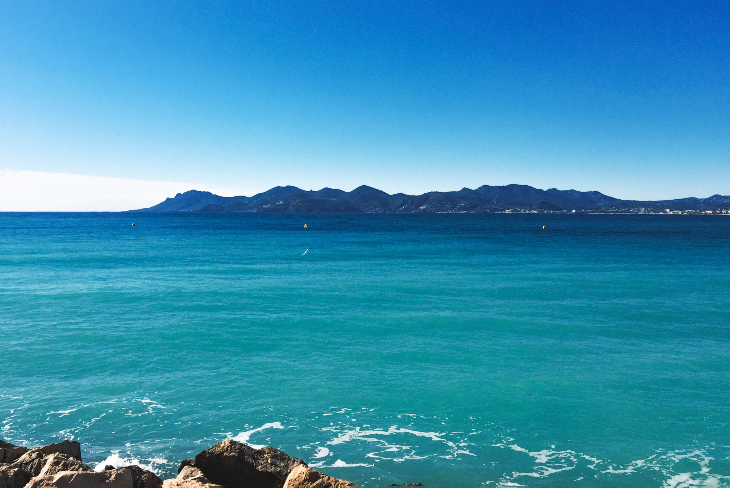
At Col de l’Esquillon (in a bend near the hotel La Tour de l’Esquillon), park the car and continue on foot along the Chemin de la Table d’Orientation. It will lead you to the Pointe de l’Esquillon, which dominates the cape of the same name. From there, there is an exceptional view of the Esterel massif and the coast from Cap Roux to Cap d’Antibes. You can clearly see Cannes and the Lérins Islands in the distance.
La Galère
From Miramar, the Esterel corniche road continues to rise, offering beautiful views of the coast and the resorts.
In the hamlet of La Galère, the streets descend to Port-la-Galère, which has buildings curiously built like honeycombs.
Pointe de l’Aiguille
A little further on, the road of the corniche de l’Esterel passes over the Pointe de l’Aiguille. It is here that we enter the territory of the Gulf of La Napoule, aka the gulf of Cannes.
![Esterel corniche road - Pointe de l'Aiguille - Théoule-sur-Mer © Florian Pépellin - licence [CC BY-SA 3.0] from Wikimedia Commons](https://frenchmoments.eu/wp-content/uploads/2022/08/Pointe-de-lAiguille-Théoule-sur-Mer-©-Florian-Pépellin-licence-CC-BY-SA-3.0-from-Wikimedia-Commons-scaled.jpg)
A car park allows you to leave your car and walk down to the Pointe de l’Aiguille and its cove. The view is magnificent over the Gulf of La Napoule, Cannes, the Lérins Islands and the Cap d’Antibes.
The cape is part of the Parc département de la Pointe de l’Aiguille, a natural park created in 1961 and covering 7 hectares on the Mediterranean Sea.
Théoule-sur-Mer
The road then descends to the port of Théoule-sur-Mer.
![Esterel corniche road - Théoule-sur-Mer © Florian Pépellin - licence [CC BY-SA 3.0] from Wikimedia Commons](https://frenchmoments.eu/wp-content/uploads/2022/08/Théoule-sur-Mer-©-Florian-Pépellin-licence-CC-BY-SA-3.0-from-Wikimedia-Commons-scaled.jpg)
Its coastline and wild beaches, more unspoilt than Cannes, make it a trendy place to stay, although relatively untouched by mass tourism in summer.
![Esterel corniche road - La Rague (Théoule-sur-Mer) © Florian Pépellin - licence [CC BY-SA 3.0] from Wikimedia Commons](https://frenchmoments.eu/wp-content/uploads/2022/08/Port-et-viaduc-de-la-Rague-Théoule-sur-Mer-©-Florian-Pépellin-licence-CC-BY-SA-3.0-from-Wikimedia-Commons.jpg)
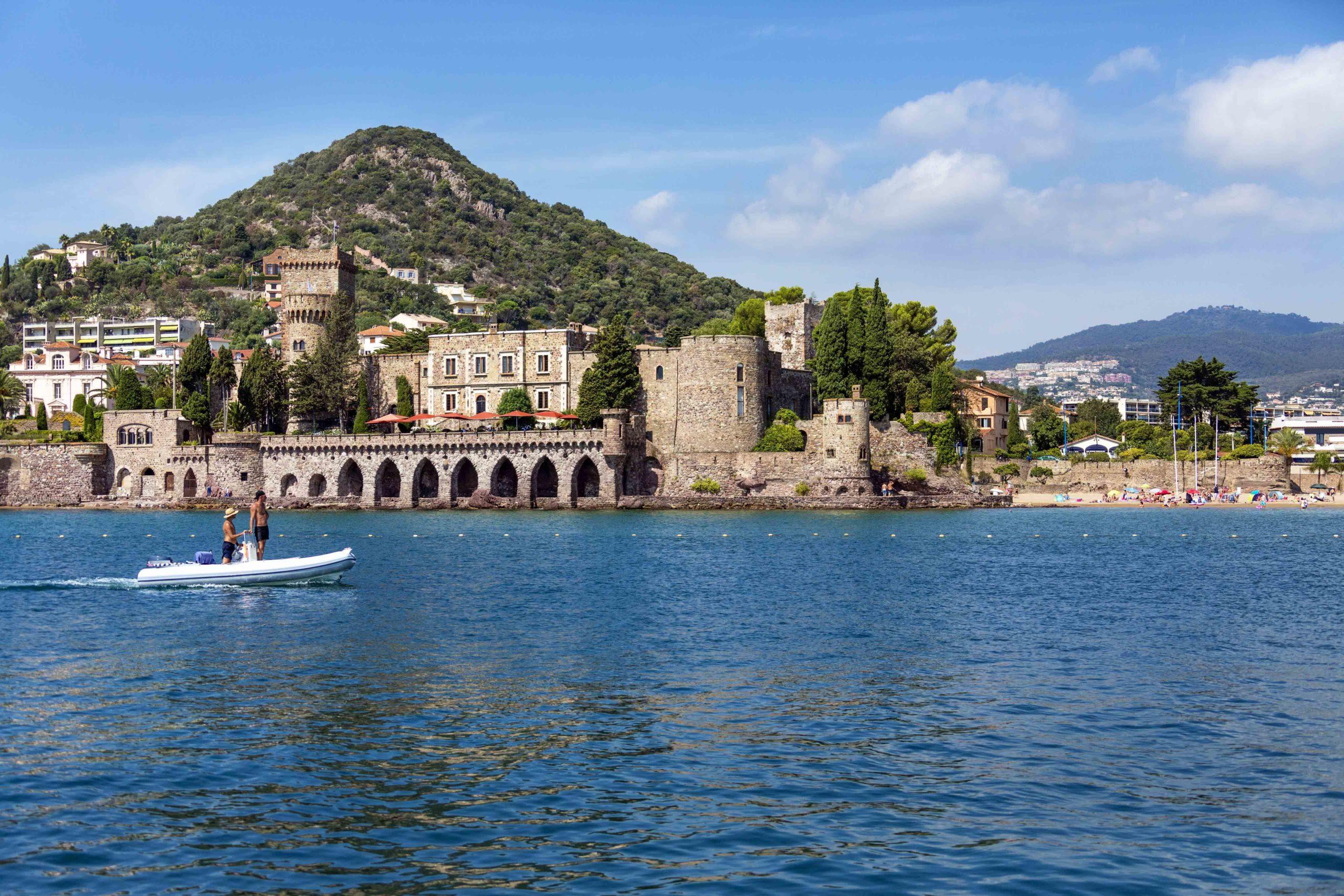
On the seafront near the marina is the former 18th-century soap factory of Théoule. It was converted into a castle in the early 20th century. In 1913, Harry Crawford Leland of Langley, a Scottish aristocrat, bought the monument and completed the work.
![Esterel Corniche road - Theoule-Sur-Mer Castle © Alistair_Cunningham - licence [CC BY 3.0] from Wikimedia Commons](https://frenchmoments.eu/wp-content/uploads/2022/08/Theoule-Sur-Mer-Castle-©-Alistair_Cunningham-licence-CC-BY-3.0-from-Wikimedia-Commons.jpg)
The mimosa, imported from Australia at the end of the 19th century, is the iconic tree of Théoule. Since the beginning of the 20th century, Théoule has been home to one of the largest mimosa plantations in Provence, with more than 4000 trees.
La Napoule
La Napoule is the seaside extension of Mandelieu. It has three sandy beaches that stretch out at the bottom of the Gulf of La Napoule. There is a large marina with a beautiful view of Cannes.
The castle of La Napoule dates from the 14th century. In the 19th century, the American sculptor Henry Clews and his wife renovated it, adding a curious mixture of architectural styles: Romanesque, Gothic and orientalist motifs.
San Peyre hill
La Napoule is dominated by the Colline de San Peyre (or St. Peter), a cone-shaped hill of volcanic origin.
The Phoenicians and then the Celtic-Ligurians watched over the gulf from this spot. The Romans then built a temple dedicated to Mercury. In 1182, the lord of Villeneuve built the Avignonnet castle and a chapel. You can still see the remains of the keep and the walls.
A 3,400 metre-long footpath runs gently through the pine trees, cork oaks, holm oaks and mimosas. This path provides easy access to the viewpoint at 131 metres above sea level and its orientation table. From the top of the hill, the view extends over the Tanneron massif, the Gulf of La Napoule, Cannes, the Cap d’Antibes and the Lérins islands.
![La Napoule San Peyre © Gilbert Bochenek - licence [CC BY-SA 3.0] from Wikimedia Commons](https://frenchmoments.eu/wp-content/uploads/2022/08/La-Napoule-San-Peyre-©-Gilbert-Bochenek-licence-CC-BY-SA-3.0-from-Wikimedia-Commons-scaled.jpg)
The road then crosses the Siagne and runs along the Gulf of La Napoule to Cannes.
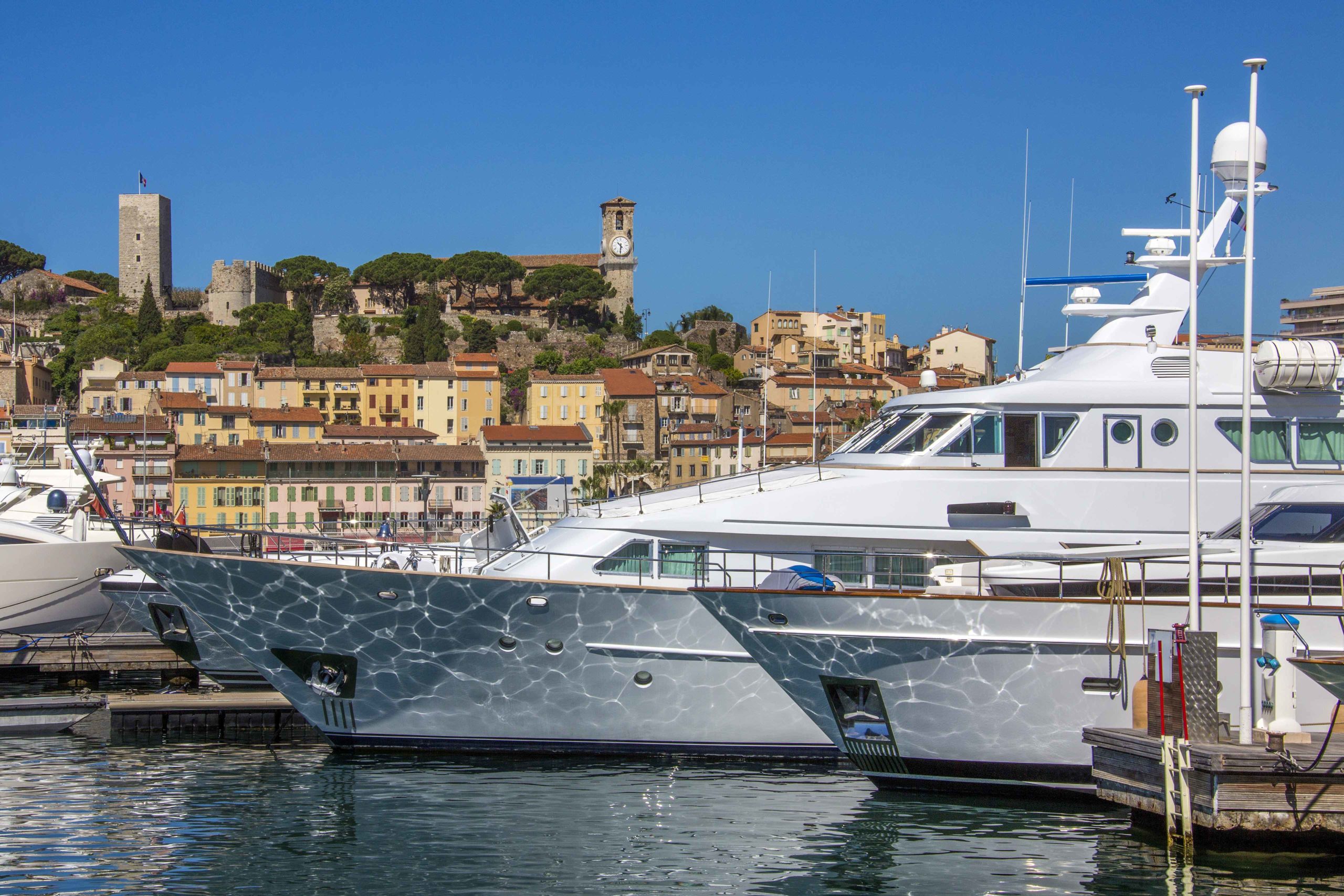
Cannes
This is the end of our journey on the Esterel corniche road. Cannes is a world-renowned summer resort thanks to the International Film Festival, which makes the city the world capital of cinema in May. Cannes also owes its success to its location on the Gulf of La Napoule and its mild climate.
Tourists discover the seafront: the boulevard de la Croisette lines up palaces and shops with luxurious facades.
They discover another atmosphere that animates the port and the old Cannes. Their streets go along the Mont Chevalier, dominated by the medieval Suquet tower.
Cannes-Fréjus on the Via Aurelia
You can plan the return to Fréjus from Cannes on a different route through the Esterel forest, along the old Aurelian road (27 km).
The road is numbered D6007 in the Alpes Maritimes and D N7 in the Var.
Saint-Cassien hermitage
The beginning of the road is not very interesting as it passes through the industrial district of La Bocca, and then bypasses the airport before crossing the alluvial plain of the Siagne. However, this part of the road sometimes holds some surprises. This is the case of the hermitage of Saint Cassien, a haven of peace surrounded by the airport and the industrial area. This 14th-century chapel stands on a small hillock, sheltered by a magnificent oak grove mixed with a few cypresses.
The Auberge des Adrets
It is from the exit of Mandelieu that the landscape changes to become mountainous. The road winds through the forest and crosses a few villages (L’Escaillon) before reaching the famous Auberge des Adrets, the former hideout of Gaspard de Besse.
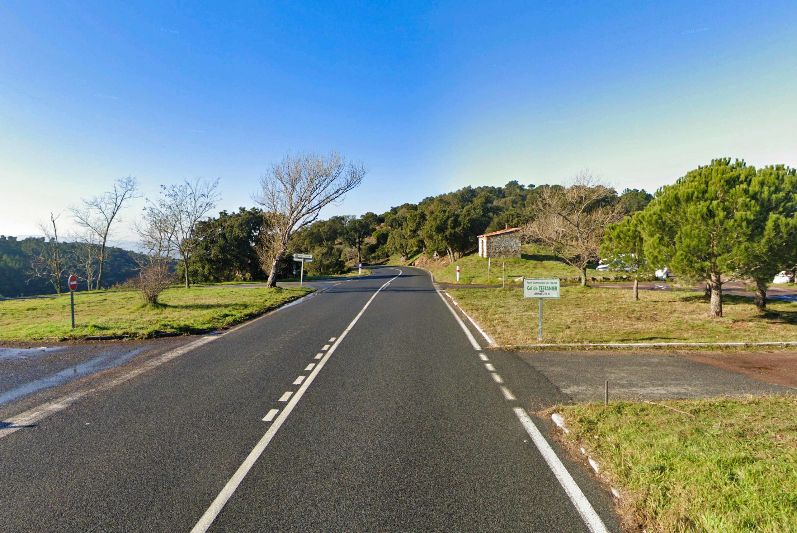
Col de Testanier and Mont Vinaigre
At the Col de Testanier, a car park allows you to park your car and enjoy the view of the Esterel massif.
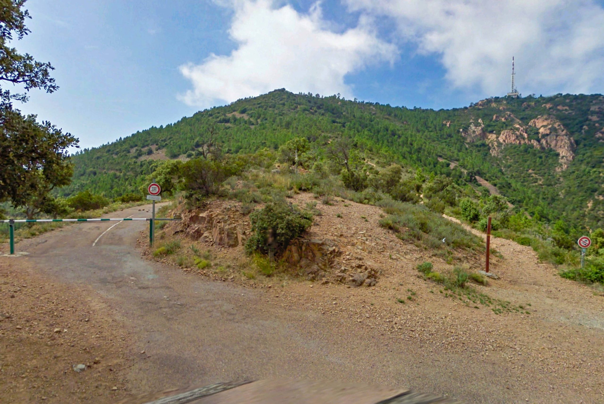
Depending on the season, it is possible to take the forest road on the left to reach the Malpey forest house.

You can walk up to Mont Vinaigre, the highest point of the Esterel massif at 618 metres (2,026 ft). The panorama is splendid.
On the land side: the Maures massif, the lower valley of the Argens, the Pre-Alps of Provence, the Sainte-Baume and the snow-covered Alps on a clear day.
On the sea side: the Gulf of Fréjus, the Pic du Cap Roux, the Pic de l’Ours, the Gulf of La Napoule and the Cap d’Antibes. It is one of the rare points where you can see both Cannes and Fréjus.
The Cocteau chapel
On the approach to Fréjus, the Notre-Dame de Jérusalem chapel (entrance fee payable) is the last work designed by Jean Cocteau before his death.
![Chapelle Cocteau Fréjus © Cyrilb 1881 - licence [CC BY-SA 3.0] from Wikimedia Commons](https://frenchmoments.eu/wp-content/uploads/2022/08/Chapelle-Cocteau-Fréjus-©-Cyrilb-1881-licence-CC-BY-SA-3.0-from-Wikimedia-Commons.jpg)
The Upper Esterel corniche road
This 25 km route from Fréjus has narrow roads, not always well maintained, especially from Agay.
Please note: because of the fire risk, vehicle and pedestrian traffic are subject to strict forest regulations. Some routes may be impracticable, depending on the level of danger. Consult the Var prefecture website. to find out if access to the Esterel massif is possible during your visit.
The road winds its way around the Saint-Pilon and Cap-Roux peaks from the north to reach the Col de l’Évêque, then the Col des Lentisques. Between these two passes, the traffic is one-way. You drive first the “outer road” to the east of the Pic d’Aurelle and then back along the “inner road”.

The road climbs through various landscapes: holm oaks, maquis, and coloured rocks. The route offers magnificent views of the Mal Infernet ravine.
Sainte-Baume
The route passes by the source of the Sainte-Baume (parking on the site). The water in the fountain is freezing even in summer and flows abundantly.
A wide path with many steps can reach the Grotto-Chapel of Saint-Honorat.
![Cave of Saint-Honorat © Opasteur - licence [CC BY-SA 3.0] from Wikimedia Commons](https://frenchmoments.eu/wp-content/uploads/2022/08/Grotte-de-Saint-Honorat-©-Opasteur-licence-CC-BY-SA-3.0-from-Wikimedia-Commons-scaled.jpg)
Saint Honorat lived there in the 4th century before leaving it to find more peace and quiet. You can see the Lérins Islands off Cannes from the cave entrance. According to legend, it was through this indentation that St Honorat planned to reach the smallest of these islands to found a monastery.
Note the font (bénitier) carved into the rock and the many ex-votos.
This troglodytic habitat of Sainte-Baume owes its name to the local inhabitants, who were jealous of the success of the Sainte Baume in the west of the Var region, which was supposedly home to Mary Magdalene. In the following centuries, the cave welcomed pilgrimages in the same way as those organised at the shrine of Mary Magdalene in the Sainte-Baume massif. Thus, in the 17th century, a monk resided here for almost 40 years.
Pic du Cap-Roux
From the Sainte-Baume car park, you can reach the summit of the Pic du Cap-Roux in just under an hour’s hike.
The ascent passes through the Col du Cap-Roux. From the summit (452 m / 1482 ft), the view is one of the most beautiful on the French Riviera. The orientation table allows you to spot the region’s landmarks, from the Saint-Tropez peninsula to Mont Agel via Fréjus, Cap Dramont, Cannes, the Gulf of La Napoule, the Lérins islands, Cap d’Antibes, and Nice. On a clear day, you can see as far as the Maritime Alps of Mercantour. Below, you can see the Esterel corniche road, which winds along the coast.
![Pic du Cap Roux © Anthospace - licence [CC BY-SA 3.0] from Wikimedia Commons](https://frenchmoments.eu/wp-content/uploads/2022/08/Pic-du-Cap-Roux-©-Anthospace-licence-CC-BY-SA-3.0-from-Wikimedia-Commons-scaled.jpg)
Pic d’Aurelle
At the Col des Lentisques, you can park the car and continue the climb on foot to the Pic d’Aurelle. The summit is one of the most important peaks of the Esterel. Culminating at 323 metres (1,059ft) above sea level, it offers an expansive view of the Pointe de l’Observatoire and Cap d’Antibes.

The Esterel corniche road between two passes
The Corniche route from the Col des Lentisques to the Col Notre-Dame is one of the most beautiful on the French Riviera. The upper Esterel corniche route offers sweeping views of the Mediterranean coast, as far as the Cap d’Antibes.
At the Col Notre-Dame, the view extends to Cannes, the Gulf of La Napoule, and the Lérins Islands.
Pic de l’Ours
Leave the car at the Col Notre-Dame car park and continue on foot to reach the summit of the Pic de l’Ours.
![Pic de l'Ours © Patrick Rouzet - licence [CC BY-SA 3.0] from Wikimedia Commons](https://frenchmoments.eu/wp-content/uploads/2022/08/Pic-de-lOurs-©-Patrick-Rouzet-licence-CC-BY-SA-3.0-from-Wikimedia-Commons-scaled.jpg)
The winding track offers beautiful views of the Esterel forest and the indentations of the coastline. It dominates the sea, where huge rocks are outcropping, by several hundred metres. A television transmitter occupies the summit (492 m); however, the view is breathtaking. The panorama extends from the Maures to the Alps, the Mont Vinaigre and the Var hinterland.
You can see 450 metres below the famous Dent de l’Ours (417 m / 1,368 ft), a rhyolite rock partly spared from erosion. On its side is a small cave: the Baume de l’Ours.
![Dent de l'Ours © Nico10310 - licence [CC BY-SA 3.0] from Wikimedia Commons](https://frenchmoments.eu/wp-content/uploads/2022/08/Dent-de-lOurs-©-Nico10310-licence-CC-BY-SA-3.0-from-Wikimedia-Commons.jpg)
In the past, the road continued to the Col de la Cadière and the Col des Trois Fermes and then descended via the Col des Suvières and the Col du Mistral. For several years, this route has been closed to traffic. It is, however, possible to follow it by mountain bike.
The Esterel in movies

The breathtaking landscapes of the Esterel, with their American Wild West look, have attracted many film directors. Indeed, many films have been partly set on the Esterel corniche road, including:
Utopia
(French title: Atoll K)
Utopia is a French-Italian film directed by Léo Joannon, released in 1951, starring the comic duo Laurel and Hardy, whose last film was made together.
Le Corniaud
(English title: The Sucker)
Le Corniaud is a French-Italian-Spanish comedy film directed by Gérard Oury and starring Bourvil and Louis de Funès. Released in 1965, it was a great success.
Ursula’s camping and midnight swim scenes are supposed to take place in Italy. In reality, they were filmed on the landing beach at Dramont with the Île d’Or as a backdrop.
Le Clan des Siciliens
(English title: The Sicilian Clan)
Le Clan des Siciliens is a French gangster film directed by Henri Verneuil, released in 1969, and starring Jean Gabin, Lino Ventura and Alain Delon.
The beach scene between Delon and Irina Demick took place east of Agay. The villa in question was a rental requested by Jean Gabin and was supposed to be in Menton (as close as possible to the Italian border). In fact, it lies in the Esterel, on the coastal road leading to Théoule-sur-Mer.
Le Coup du Parapluie
(English title: The Umbrella Coup)
Le Coup du Parapluie is a French comedy film directed by Gérard Oury in 1980, starring Pierre Richard.
The mythical scene of the out-of-control car took place on the Esterel corniche road, on the route between Nice airport and Saint-Tropez.
Planetarium
Planetarium is a 2016 French-Belgian drama film directed by Rebecca Zlotowski, starring Natalie Portman and Lily-Rose Depp.
Scenes from the film took place in Boulouris in the villa Sainte Anne on the Esterel corniche road and the Dramont beach (with the Île d’Or as a backdrop).
Johnny English Strikes Again
Johnny English Strikes Again is a 2018 action spy comedy film directed by David Kerr, and starring Rowan Atkinson.
Some of the scenes in the film were shot in the Esterel massif, near Saint-Raphaël.
Find out more about the Esterel corniche road
Here are some helpful links and websites:
- Our discovery guide to the French Riviera
- Find your accommodation in the Esterel here
- Check out the Tourist board website of the Esterel-Côte d’Azur
Pin it for later
Did you enjoy the reading? If so, please share it on Facebook and Twitter, or pin these images on Pinterest:
Featured image: photo by StevanZZ via Envato Elements


Merci Pierre, for another in-depth look at a beautiful part of France. Just one more addition to my visit-when-in-France list!
Thank you Ellen! This is definetely a must-see in the French Riviera! 🙂